2016 Global Model Runs Discussion (Out to Day 16)
Moderator: S2k Moderators
Forum rules
The posts in this forum are NOT official forecasts and should not be used as such. They are just the opinion of the poster and may or may not be backed by sound meteorological data. They are NOT endorsed by any professional institution or STORM2K. For official information, please refer to products from the National Hurricane Center and National Weather Service.
-
WeatherHoon
- Tropical Storm

- Posts: 131
- Joined: Sat Oct 01, 2016 6:12 am
Re: 2016 Global Model Runs Discussion (Out to Day 16)
Late night runs of GFS and CMC still showing the same thing, but this time the GFS develops the low pressure. CMC and GFS are split in which direction it takes. Starting to think something may actually try to develop this week. What could be the catalyst? Is it that wave out near the windward Islands or does this arise from the cold front that just moved through Florida? Also, both the GFS and CMC solutions for direction don't make sense to me.
0 likes
Re: 2016 Global Model Runs Discussion (Out to Day 16)
WeatherHoon wrote:Late night runs of GFS and CMC still showing the same thing, but this time the GFS develops the low pressure. CMC and GFS are split in which direction it takes. Starting to think something may actually try to develop this week. What could be the catalyst? Is it that wave out near the windward Islands or does this arise from the cold front that just moved through Florida? Also, both the GFS and CMC solutions for direction don't make sense to me.
Okay, sure its an outlier but the GEM (just sounds more credible than saying "CMC" right?) shows lower pressures in the S.W. Caribbean beginning around 90 hours. At 126 hours, this feature becomes the dominant forming tropical cyclone in the Atlantic (I say "dominant" because this model might have 13 different phantom storms at any given time and place). Finally, at 240 hours from this mornings 12Z run, there is a 963 hurricane drifting northward and bearing down on Central Cuba, and potentially threatening Florida or the Bahamas thereafter.
No present love for this outcome thus far, from either the GFS or EURO but interestingly there does seem to be some support from both the GEFS and GEPS ensemble members. 126 hours is not that far out, so if there were any plausibility to this verifying, I'd guess we'll see both the EURO and GFS wake up and begin to pick up on this feature pretty quickly.
0 likes
Andy D
(For official information, please refer to the NHC and NWS products.)
(For official information, please refer to the NHC and NWS products.)
Re: 2016 Global Model Runs Discussion (Out to Day 16)
Two straight runs of the GEM showing a hurricane drifting north in the N.W. Caribbean and nearing Cuba. Both it, and the NAVGEM are showing an area of low pressure in the W. Caribbean starting in about 90 hours. GFS also shows this area, but for practically the entire month of November lol
0 likes
Andy D
(For official information, please refer to the NHC and NWS products.)
(For official information, please refer to the NHC and NWS products.)
-
otowntiger
- Category 5

- Posts: 1932
- Joined: Tue Aug 31, 2004 7:06 pm
Re: 2016 Global Model Runs Discussion (Out to Day 16)
Interesting. Worth watching I suppose. What is the timing on the development in the GEM's prognostication?chaser1 wrote:Two straight runs of the GEM showing a hurricane drifting north in the N.W. Caribbean and nearing Cuba. Both it, and the NAVGEM are showing an area of low pressure in the W. Caribbean starting in about 90 hours. GFS also shows this area, but for practically the entire month of November lol
0 likes
Re: 2016 Global Model Runs Discussion (Out to Day 16)
There continues to be lots of inconsistency in the model runs. The Euro is not showing much of an MJO pulse and the model has not shown anything significant so far. I would tend to believe the Euro on this one. I just don't see things becoming too favorable for late season development in the NW Caribbean. One option could be development toward the Central or Eastern Caribbean with a NE trajectory which is possible based on climatology.
0 likes
The following post is NOT an official forecast and should not be used as such. It is just the opinion of the poster and may or may not be backed by sound meteorological data. It is NOT endorsed by any professional institution including storm2k.org For Official Information please refer to the NHC and NWS products.
-
WeatherHoon
- Tropical Storm

- Posts: 131
- Joined: Sat Oct 01, 2016 6:12 am
Re: 2016 Global Model Runs Discussion (Out to Day 16)
Looking at latest GFS 355K PV, GoM and West Carib may open up for something to develop around mid next week.
0 likes
-
WeatherEmperor
- S2K Supporter

- Posts: 4806
- Age: 42
- Joined: Thu Sep 04, 2003 2:54 pm
- Location: South Florida
Re: 2016 Global Model Runs Discussion (Out to Day 16)
18z GFS still shows something in very long range. Something to watch but it keeps pushing development later each run so maybe nothing will really happen??


Sent from my iPhone 7 using Tapatalk


Sent from my iPhone 7 using Tapatalk
0 likes
-
WeatherHoon
- Tropical Storm

- Posts: 131
- Joined: Sat Oct 01, 2016 6:12 am
Re: 2016 Global Model Runs Discussion (Out to Day 16)
WeatherEmperor wrote:18z GFS still shows something in very long range. Something to watch but it keeps pushing development later each run so maybe nothing will really happen??
Maybe. Could be what some of the models are seeing. However, I can't see how anything could really form given the current conditions out there.
0 likes
Re: 2016 Global Model Runs Discussion (Out to Day 16)
Got to give it to the CMC. I traced it back a full 7 days 12z Oct 17th so far on TT site where it shows development of the area in question in the Carribean and I think it might have started sooner. That is tremendous consistency with cyclogensis for something that does not have much consistent support from the other models. So this will likely bust at some point but if it develops would be a major coup for the inferior CMC.
IMO I think the CMC is not seeing the shear properly thus the continued development. Will be fun to watch it play out.
IMO I think the CMC is not seeing the shear properly thus the continued development. Will be fun to watch it play out.
0 likes
The following post is NOT an official forecast and should not be used as such. It is just the opinion of the poster and may or may not be backed by sound meteorological data. It is NOT endorsed by any professional institution including storm2k.org For Official Information please refer to the NHC and NWS products.
-
StormHunter72
- Tropical Storm

- Posts: 166
- Joined: Wed May 25, 2016 6:36 am
- Location: Nature Coast
Re: 2016 Global Model Runs Discussion (Out to Day 16)
Anything would move NE no threat to the CONUS at least.
0 likes
The following post is NOT an official forecast and should not be used as such. It is just the opinion of the poster and may or may not be backed by sound meteorological data. It is NOT endorsed by any professional institution including storm2k.org For Official Information please refer to the NHC and NWS products.
Re: 2016 Global Model Runs Discussion (Out to Day 16)
StormHunter72 wrote:Anything would move NE no threat to the CONUS at least.
...unless a storm were just north of Puerto Rico starting in about 160 hr's.
0 likes
Andy D
(For official information, please refer to the NHC and NWS products.)
(For official information, please refer to the NHC and NWS products.)
-
floridasun78
- Category 5

- Posts: 3755
- Joined: Sun May 17, 2009 10:16 pm
- Location: miami fl
Re: 2016 Global Model Runs Discussion (Out to Day 16)
any support by models for mess in nw Caribbean ?
0 likes
-
WeatherHoon
- Tropical Storm

- Posts: 131
- Joined: Sat Oct 01, 2016 6:12 am
Re: 2016 Global Model Runs Discussion (Out to Day 16)
floridasun78 wrote:any support by models for mess in nw Caribbean ?
Zilch. If what we have out there now was spinning around only two weeks ago, it'd probably be something worth talking about.
0 likes
-
WeatherHoon
- Tropical Storm

- Posts: 131
- Joined: Sat Oct 01, 2016 6:12 am
Re: 2016 Global Model Runs Discussion (Out to Day 16)
Question for the experts. How reliable are the TC probability maps (examples below)? This is the first year I've looked at them. Maybe I've been interpreting them incorrectly, but they don't seem to be that great. 


0 likes
-
floridasun78
- Category 5

- Posts: 3755
- Joined: Sun May 17, 2009 10:16 pm
- Location: miami fl
-
WeatherHoon
- Tropical Storm

- Posts: 131
- Joined: Sat Oct 01, 2016 6:12 am
Re: 2016 Global Model Runs Discussion (Out to Day 16)
If you guys are bored and in need for some end of season entertainment, check out the current runs of both the GEM and NAVGEM.


0 likes
- northjaxpro
- S2K Supporter

- Posts: 8900
- Joined: Mon Sep 27, 2010 11:21 am
- Location: Jacksonville, FL
Disturbance in NW Caribbean
168 hr GFS develops a 998 mb tropical or sub-tropical cyclone well to the northeast of Hispaniola for those who are out there following potential activity out there. EURO shows a bit weaker 1008 mb cyclone a bit closer to the northeast of Hispaniola out 216 hours . That area may be headed out northeast into the Central North Atlantic next week. Could have at least one more system to develop out there before we close the book on the 2016 tropical season.
There is an interesting area of convection north of Hispaniola this evening.
There is an interesting area of convection north of Hispaniola this evening.
0 likes
NEVER, EVER SAY NEVER in the tropics and weather in general, and most importantly, with life itself!!
________________________________________________________________________________________
Fay 2008 Beryl 2012 Debby 2012 Colin 2016 Hermine 2016 Julia 2016 Matthew 2016 Irma 2017 Dorian 2019
________________________________________________________________________________________
Fay 2008 Beryl 2012 Debby 2012 Colin 2016 Hermine 2016 Julia 2016 Matthew 2016 Irma 2017 Dorian 2019
-
WeatherHoon
- Tropical Storm

- Posts: 131
- Joined: Sat Oct 01, 2016 6:12 am
Re: 2016 Global Model Runs Discussion (Out to Day 16)
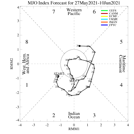
Not sure if it really means anything during the late season, but now the Euro seems to be onboard along with the GFS with an MJO pulse over the next two weeks.


0 likes
Re: 2016 Global Model Runs Discussion (Out to Day 16)
surprised nobody is mentioning the fact that all models are showing development in the Caribbean early next week
0 likes
Who is online
Users browsing this forum: Google [Bot], jconsor and 67 guests


