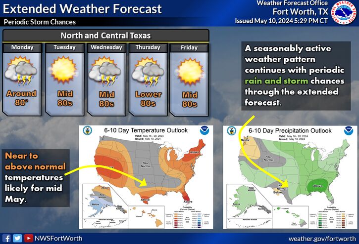
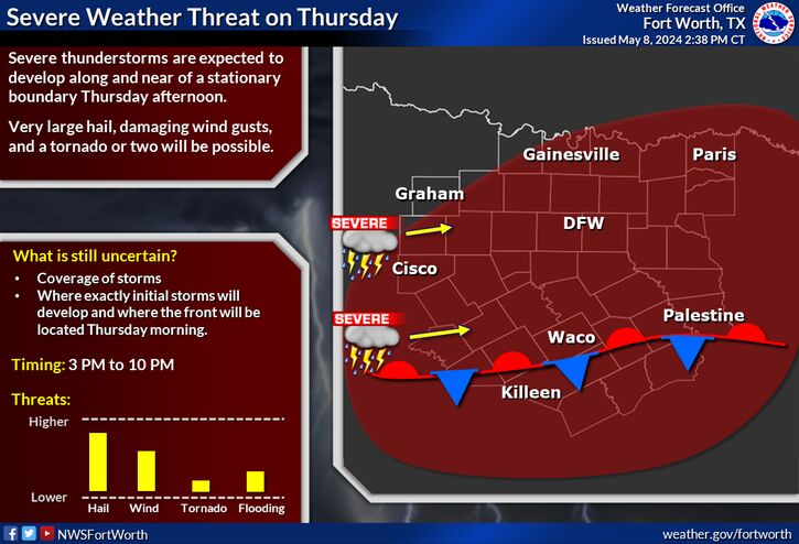
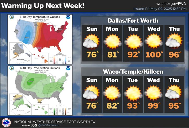
The posts in this forum are NOT official forecast and should not be used as such. They are just the opinion of the poster and may or may not be backed by sound meteorological data. They are NOT endorsed by any professional institution or


Portastorm wrote:Shocking news to report ... the models underestimated the cold.
Highs for Austin today are below freezing. That's a several degree departure from yesterday and what I would call a significant one. Patchy freezing precip being reported in Hays and Bastrop counties with some bridges icing over. Nothing much in Travis County as best as I can tell.
So far, no ice on my commute from S. Austin to Kyle via I-35. Light drizzle in Kyle, cars parked overnight with light glaze on windshield. Hope this doesn't go on all day or I will have tricky commute home this afternoon.