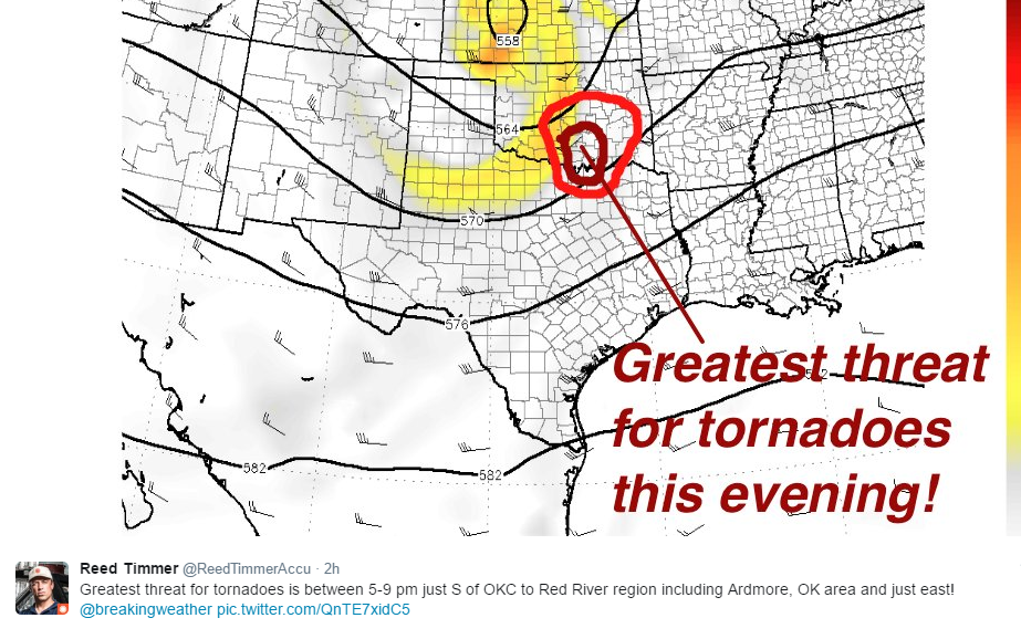
#271 Postby Texas Snowman » Sun Mar 26, 2017 2:13 pm
Steve McCauley's most recent Facebook post an hour ago:
"Latest weather data continue to support the notion of a significant severe weather event for the Southern Plains which includes most of Oklahoma and at least the northern portions of north Texas. The cap - which has protected north Texas on several occasions in recent weeks - will become paper thin over north Texas and may no longer be able to prevent severe storms locally. If the cap does indeed break - and it appears that it will - this will allow the dryline to our west to activate with the result being rapid supercell thunderstorms that will track to the east. Pocket change hail to baseball-sized hail - possibly larger - and torrential rainfall along with damaging winds will be likely in the stronger storms. The storms will also be rotating, and thus tornado potential will be moderate.
If the storms do rotate fast enough, they could move TO THE RIGHT of their initial eastward motion and thus drop more to the southeast which would put more of the Metroplex in the path of potential severe weather. But this "right-hand turn" is nearly impossible to predict this far in advance when not even the first clouds have formed.
The National Weather Service will be launching a special weather balloon to check on cap strength as well as the quality of our moisture supply that will feed the expected storms.
The cap should break FIRST after 4 PM to our west and northwest along a line from near Stephenville to Bowie to Oklahoma City. Storms will then move east and rapidly intensify moving into at least parts of the Metroplex by early evening.
This forecast radar graphic does not show any storms to our south, BUT please keep in mind that if there is any weakness in the cap that is not currently being observed, a storm could break through even to the south and southwest. Thus, even if you are in the southern half of the area, keep alert for any potential storm that manages to break through there.
This would be a good day to review severe weather safety rules with the family. It might also be a good idea to arrange shelter for vehicles against the threat of large hail this evening, especially across the northern half of north Texas.
Stay tuned for updates..."
0 likes
The above post and any post by Texas Snowman is NOT an official forecast and should not be used as such. It is just the opinion of the poster and may or may not be backed by sound meteorological data. It is NOT endorsed by any professional institution including storm2k.org. For official information, please refer to NWS products.


