#32 Postby Tireman4 » Wed Apr 05, 2017 9:38 am
From Peachtree City NWS. ( They do forecasts for Atlanta)
000
FXUS62 KFFC 051139
AFDFFC
Area Forecast Discussion
National Weather Service Peachtree City GA
739 AM EDT Wed Apr 5 2017
.PREV DISCUSSION... /Issued 348 AM EDT Wed Apr 5 2017/
SHORT TERM /Today through Thursday/...
Severe weather is expected across much of Georgia today. Be ready
to execute your severe weather plan in case a Severe Thunderstorm
Warning or Tornado Warning is issued for your location. Keep a
way to receive weather warnings nearby - such as a NOAA weather
radio or your smart phone. Please stay weather aware today, and
stay safe out there.
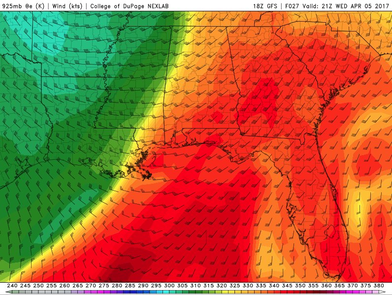
A very vigorous storm system will impact the CWFA today. There
could be several rounds of severe thunderstorms today, so don`t
let your guard down if you experience relatively quiet conditions
for a period of time. The first round of severe weather is
currently impacting portions of southern Alabama and the Florida
panhandle. This activity is associated with a northward moving
warm front. This warm front is expected to move into SW GA early
this morning and keep moving to near the I-20 corridor by
daybreak. South of the warm front, the airmass is very unstable
and lapse rates are very steep for this time of the morning.
Reports of up to half dollar sized hail have been reported across
portions of SE AL. With this first round of thunderstorms, expect
the primary modes of severe weather to be large hail (up to 2
inches possible) and damaging wind gusts in excess of 60 MPH. An
isolated tornado cannot be ruled out either, as the front will
provide an excellent source of low level shear.
The warm front may end up settling somewhere in the vicinity of
the northern `burbs of Atlanta by mid morning. This means that
most of the CWFA will be in the warm sector for the afternoon. The
atmosphere should have enough time to recuperate from the morning
storms, and become very unstable during the peak heating of the
afternoon - especially if the clouds begin to break. All the
ingredients for severe weather will be present: strong mid and
upper level forcing, strong surface instability, plenty of deep
level shear, a 40-50kt 850mb jet, etc. This will be the time that
discreet cells ahead of the front are expected to develop and
supercells will be likely. (Prime time for tornado development.)
The actual cold front isn`t expected to move through until later
in the evening and into the overnight hours. The actual front will
provide enough focus for additional storms well into the evening
and overnight. However, the atmosphere *may* be worked over enough
by the time the front moves through that the coverage and
*possibly* severity of the storms may decrease. However, not
entirely confident on this situation - so continue to stay weather
aware even after the sun sets.
There is plenty of much cooler air behind this system and
Thursday`s will be a (relatively) cold and windy day. A Wind
Advisory will likely be needed, but don`t want to over complicate
the headlines for today.
NListemaa
LONG TERM /Thursday Night through Tuesday/...
Extended period largely overshadowed by short term severe threat.
Following the aforementioned system, wrap around moisture will
linger over the northeast Georgia mountains through Friday morning,
with the potential for some mixed precip as temperatures drop into
the low to mid 30s. For now, have limited the p-type to rain or
snow, and will need to revisit this in subsequent forecast packages.
Not expecting any accumulations at this time. Will also need to
consider issuing a Freeze Warning for this area given the expected
low temperatures.
Below normal temperatures expected Friday will slowly warm through
the weekend, with highs in the 60s on Saturday and the mid to upper
70s on Sunday with sunny skies. High pressure will hold through the
weekend and into next week, with the next system approaching late
Tuesday - a tad slower than the previous model runs. GFS and ECMWF
differ in timing by 6-12 hours, with the better activity currently
timed for Wednesday. For now have limited pops to good chance.
Temperatures will generally stay in the mid 70s to near 80 through
next week.
31
HYDROLOGY...
Widespread QPF amounts of 1.5 to 2.25 inches still look to be
handled well across middle Georgia today. Flash Flood Guidance
suggests that the area can handle these rainfall amounts, even if
they were to fall in a one to three hour time frame. WPC does have
the area outlooked for a slight risk of flash flooding, and isolated
flash flooding cannot be ruled out, particularly as storms train
over the same area, or where localized rainfall amounts are higher.
Site specific headwater forecasts are largely keeping river gage
locations at or below action stage following the precipitation
today. Modeled precipitable water values remain near seasonal
maximums, and expect high rainfall rates from efficient storms. Have
opted to issue a Flash Flood Watch mainly along the Interstate 20
corridor for the heaviest QPF axis.
AVIATION... 06Z Update... Main changes to the TAF this cycle were
to tweak the timing for the early morning shra/tsra and change
the prob group to a tempo. Several rounds of shra/tsra expected
for the afternoon. Will likely have to tweak the prevailing tsra
wording at later updates.
//ATL Confidence...12Z Update...
Medium confidence all elements.
&&
.AVIATION...
12Z Update...
Made some slight timing tweaks to the TAFS for the first round of
thunderstorms this morning. Otherwise, no major changes through
the day. After the first round of storms, there could be a lull,
but do expect convective activity to develop again during the
early afternoon. This activity could linger into the early evening
hours. Winds are currently flirting with due south, but do
expected them to switch to the SW by mid morning.
//ATL Confidence...12Z Update...
Medium confidence all elements.
&&
.PRELIMINARY POINT TEMPS/POPS...
Athens 73 50 57 41 / 80 60 20 5
Atlanta 73 48 56 42 / 80 60 20 5
Blairsville 67 44 49 34 / 70 60 40 30
Cartersville 75 48 55 41 / 70 60 30 10
Columbus 78 51 63 45 / 80 60 10 0
Gainesville 71 47 53 40 / 80 60 30 10
Macon 78 51 62 43 / 80 70 10 0
Rome 77 48 56 41 / 70 60 30 5
Peachtree City 74 49 58 41 / 80 60 20 0
Vidalia 82 54 64 45 / 80 70 10 0
&&
.FFC WATCHES/WARNINGS/ADVISORIES...
Flash Flood Watch through late tonight for the following zones:
Baldwin...Barrow...Bibb...Butts...Carroll...Clarke...Clayton...
Cobb...Coweta...Crawford...DeKalb...Douglas...Fayette...
Glascock...Greene...Gwinnett...Hancock...Haralson...Harris...
Heard...Henry...Jackson...Jasper...Jones...Lamar...Madison...
Meriwether...Monroe...Morgan...Muscogee...Newton...North
Fulton...Oconee...Oglethorpe...Paulding...Pike...Polk...Putnam...
Rockdale...South Fulton...Spalding...Talbot...Taliaferro...
Troup...Upson...Walton...Warren...Wilkes.
Severe Thunderstorm Watch until 9 AM EDT this morning for the
following zones: Bibb...Butts...Carroll...Chattahoochee...
Clayton...Cobb...Coweta...Crawford...Crisp...DeKalb...Dooly...
Douglas...Fayette...Haralson...Harris...Heard...Henry...
Houston...Lamar...Macon...Marion...Meriwether...Monroe...
Muscogee...North Fulton...Paulding...Peach...Pike...Pulaski...
Rockdale...Schley...South Fulton...Spalding...Stewart...Sumter...
Talbot...Taylor...Troup...Upson...Webster...Wilcox.
&&
$$
0 likes