Pressure continues to fall down now with1008 hpa while the previous TWD mentionned pressure at 1012 hpa!
Tropical Weather Discussion
NWS National Hurricane Center Miami FL
806 PM EDT Sat Jun 17 2017
...SPECIAL FEATURES...
A tropical wave is in the central Atlantic associated with a 1008
mb low centered near 06N41W. Its axis extends from 11N41W to the
low to 00N41W, moving west at 15-20 kt within the last 24 hours.
The wave is in a region of favorable wind shear and is embedded in
a moderate moist environment at the lower levels according to
CIRA LPW imagery. However, Saharan dry air is entering to its
environment, thus limiting the convection to scattered moderate
from 05N to 08N between 40W and 45W. This convection is being
supported by upper-level diffluence. This wave has a medium
chance of becoming a tropical cyclone during the next two days.
Please see the latest NHC Tropical Weather Outlook under
AWIPS/WMO headers MIATWOAT/ABNT20 KNHC for more details.
ATL: BRET - Remnants - Discussion
Moderator: S2k Moderators
-
Gustywind

- Category 5

- Posts: 12334
- Joined: Mon Sep 03, 2007 7:29 am
- Location: Baie-Mahault, GUADELOUPE
Re: ATL: INVEST 92L - Discussion
0 likes
-
Dougiefresh
- Tropical Depression

- Posts: 55
- Age: 36
- Joined: Thu Jun 08, 2017 8:07 am
- Location: Barbados
Re: ATL: INVEST 92L - Discussion
Gustywind wrote:Pressure continues to fall down now with1008 hpa while the previous TWD mentionned pressure at 1012 hpa!
Tropical Weather Discussion
NWS National Hurricane Center Miami FL
806 PM EDT Sat Jun 17 2017
...SPECIAL FEATURES...
A tropical wave is in the central Atlantic associated with a 1008
mb low centered near 06N41W. Its axis extends from 11N41W to the
low to 00N41W, moving west at 15-20 kt within the last 24 hours.
The wave is in a region of favorable wind shear and is embedded in
a moderate moist environment at the lower levels according to
CIRA LPW imagery. However, Saharan dry air is entering to its
environment, thus limiting the convection to scattered moderate
from 05N to 08N between 40W and 45W. This convection is being
supported by upper-level diffluence. This wave has a medium
chance of becoming a tropical cyclone during the next two days.
Please see the latest NHC Tropical Weather Outlook under
AWIPS/WMO headers MIATWOAT/ABNT20 KNHC for more details.
If it can mix out that dry air for the time being, it will move into an area where there is no sahara dust and maybe then we will see a little development once sheer remains low.
1 likes

Re: ATL: INVEST 92L - Discussion
cycloneye wrote:00z Best Track.As of 00:00 UTC Jun 18, 2017:
Location: 5.8°N 43.0°W
Maximum Winds: 25 kt Gusts: N/A
Minimum Central Pressure: 1009 mb
Environmental Pressure: 1011 mb
Radius of Circulation: 150 NM
Radius of Maximum Wind: 80 NM
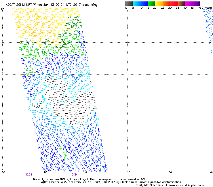
Personally I think that it is a little further N & W based on the latest ASCAT.
0 likes
-
cycloneye

- Admin

- Posts: 149283
- Age: 69
- Joined: Thu Oct 10, 2002 10:54 am
- Location: San Juan, Puerto Rico
Re: ATL: INVEST 92L - Discussion
0 likes
Visit the Caribbean-Central America Weather Thread where you can find at first post web cams,radars
and observations from Caribbean basin members Click Here
and observations from Caribbean basin members Click Here

Re: ATL: INVEST 92L - Discussion
Is this gaining latitude at all at the moment? It looks like it's going to run into S America in about 12 hours or so.
0 likes
The above post is not official and should not be used as such. It is the opinion of the poster and may or may not be backed by sound meteorological data. It is not endorsed by any professional institution or storm2k.org. For official information, please refer to the NHC and NWS products.
-
tarheelprogrammer

- S2K Supporter

- Posts: 1793
- Joined: Mon Mar 28, 2016 9:25 pm
- Location: Raleigh, NC area (Garner, NC)
Re: ATL: INVEST 92L - Models
Models are coming in weaker tonight for this. It may of missed its chance? 
0 likes
My posts are not official forecasts. They are just my opinion and may or may not be backed by sound meteorological data. They are NOT endorsed by any professional institution or storm2k.org. For official information, please refer to the NHC and NWS products.
-
Bocadude85

- Category 5
- Posts: 2991
- Age: 39
- Joined: Mon Apr 18, 2005 2:20 pm
- Location: Honolulu,Hi
Re: ATL: INVEST 92L - Discussion
Convection really exploding tonight.
http://www.ssd.noaa.gov/PS/TROP/floaters/92L/imagery/rb-animated.gif
http://www.ssd.noaa.gov/PS/TROP/floaters/92L/imagery/rb-animated.gif
0 likes
-
AutoPenalti
- Category 5
- Posts: 4091
- Age: 29
- Joined: Mon Aug 17, 2015 4:16 pm
- Location: Ft. Lauderdale, Florida
Re: ATL: INVEST 92L - Models
tarheelprogrammer wrote:Models are coming in weaker tonight for this. It may of missed its chance?
Weaker? It seems the same to be honest. Maybe a millibar or two higher or lower, but relatively the same.
Although it does look a bit ragged.
0 likes
The posts in this forum are NOT official forecasts and should not be used as such. They are just the opinion of the poster and may or may not be backed by sound meteorological data. They are NOT endorsed by any professional institution or STORM2K. For official information, please refer to products from the NHC and NWS.
Model Runs Cheat Sheet:
GFS (5:30 AM/PM, 11:30 AM/PM)
HWRF, GFDL, UKMET, NAVGEM (6:30-8:00 AM/PM, 12:30-2:00 AM/PM)
ECMWF (1:45 AM/PM)
TCVN is a weighted averaged

Re: ATL: INVEST 92L - Models
Lest no forget the ECarib in June no less is a TC destroyer. Probably why we see weaker runs coming in tonight. Hate to keep mentioning Climo but at some point it has to be mentioned. Just saying..the good doc Masters seems to agree...
1 likes
Re: ATL: INVEST 92L - Discussion
Best chance of development was probably yesterday and last night, as the shear appears that it's increasing now. NHC down to 50% as well and if anything it just looks like typical ITCZ convection over the last several hours--nothing about the appearance says development, which is probably unlikely at this point.
2 likes
The above post is not official and should not be used as such. It is the opinion of the poster and may or may not be backed by sound meteorological data. It is not endorsed by any professional institution or storm2k.org. For official information, please refer to the NHC and NWS products.
-
Yellow Evan

- Professional-Met

- Posts: 16232
- Age: 27
- Joined: Fri Jul 15, 2011 12:48 pm
- Location: Henderson, Nevada/Honolulu, HI
- Contact:

Re: ATL: INVEST 92L - Discussion
Yellow Evan wrote::uarrow: SHIPS has low shear for another 36-48 hours.
I have little confidence in the SHIPS.
0 likes
-
cycloneye
- Admin
- Posts: 149283
- Age: 69
- Joined: Thu Oct 10, 2002 10:54 am
- Location: San Juan, Puerto Rico
Re: ATL: INVEST 92L - Models
06z GFS operational has it more strong well inside the Caribbean Sea.

0 likes
Visit the Caribbean-Central America Weather Thread where you can find at first post web cams,radars
and observations from Caribbean basin members Click Here
and observations from Caribbean basin members Click Here
-
Hypercane_Kyle

- Category 5
- Posts: 3465
- Joined: Sat Mar 07, 2015 7:58 pm
- Location: Cape Canaveral, FL
Re: ATL: INVEST 92L - Discussion
Odds up to 50/50
0 likes
My posts are my own personal opinion, defer to the National Hurricane Center (NHC) and other NOAA products for decision making during hurricane season.
-
cycloneye
- Admin
- Posts: 149283
- Age: 69
- Joined: Thu Oct 10, 2002 10:54 am
- Location: San Juan, Puerto Rico
Re: ATL: INVEST 92L - Discussion
8 AM TWO: 50%-50%
Showers and thunderstorms continue to show signs of organization in
association with a tropical wave located about 1000 miles
east-southeast of the southern Windward Islands. Some development
of this system is possible during the next couple of days before
environmental conditions become less favorable for tropical cyclone
formation. This system is forecast to move to the west-northwest at
near 20 mph toward the Windward Islands and northeastern South
America during the next two days, and interests in these areas
should monitor its progress. An Air Force Reserve Hurricane Hunter
aircraft is scheduled to investigate this system on Monday, if
necessary.
* Formation chance through 48 hours...medium...50 percent.
* Formation chance through 5 days...medium...50 percent.
0 likes
Visit the Caribbean-Central America Weather Thread where you can find at first post web cams,radars
and observations from Caribbean basin members Click Here
and observations from Caribbean basin members Click Here
-
cycloneye
- Admin
- Posts: 149283
- Age: 69
- Joined: Thu Oct 10, 2002 10:54 am
- Location: San Juan, Puerto Rico
Re: ATL: INVEST 92L - Discussion
12z Best Track:
As of 12:00 UTC Jun 18, 2017:
Location: 6.3°N 47.2°W
Maximum Winds: 25 kt Gusts: N/A
Minimum Central Pressure: 1009 mb
Environmental Pressure: 1011 mb
Radius of Circulation: 150 NM
Radius of Maximum Wind: 80 NM
Location: 6.3°N 47.2°W
Maximum Winds: 25 kt Gusts: N/A
Minimum Central Pressure: 1009 mb
Environmental Pressure: 1011 mb
Radius of Circulation: 150 NM
Radius of Maximum Wind: 80 NM
0 likes
Visit the Caribbean-Central America Weather Thread where you can find at first post web cams,radars
and observations from Caribbean basin members Click Here
and observations from Caribbean basin members Click Here
-
Gustywind
- Category 5
- Posts: 12334
- Joined: Mon Sep 03, 2007 7:29 am
- Location: Baie-Mahault, GUADELOUPE
Re: ATL: INVEST 92L - Discussion
Tropical Weather Discussion
NWS National Hurricane Center Miami FL
725 AM EDT Sun Jun 18 2017
...SPECIAL FEATURE...
A tropical wave is along 45W/46W from 11N southward. The wave is
moving westward 10 to 15 knots. A 1007 mb low pressure is along
the tropical wave near 06N. Widely scattered moderate to isolated
strong rainshowers are from 04N to 10N between 43W and 50W.
The chance of formation into a tropical cyclone during the next
two days is medium. Please read the latest NHC Tropical Weather
Outlook under AWIPS/WMO headers MIATWOAT/ABNT20 KNHC for more
details.
0 likes
-
cycloneye
- Admin
- Posts: 149283
- Age: 69
- Joined: Thu Oct 10, 2002 10:54 am
- Location: San Juan, Puerto Rico
Re: ATL: INVEST 92L - Discussion
0 likes
Visit the Caribbean-Central America Weather Thread where you can find at first post web cams,radars
and observations from Caribbean basin members Click Here
and observations from Caribbean basin members Click Here
-
cycloneye
- Admin
- Posts: 149283
- Age: 69
- Joined: Thu Oct 10, 2002 10:54 am
- Location: San Juan, Puerto Rico
Re: ATL: INVEST 92L - Discussion
RL3AO,is turning like a broken record this question.Will tonight be the one 92L finnally shines?
1 likes
Visit the Caribbean-Central America Weather Thread where you can find at first post web cams,radars
and observations from Caribbean basin members Click Here
and observations from Caribbean basin members Click Here

Re: ATL: INVEST 92L - Discussion
cycloneye wrote:RL3AO,is turning like a broken record this question.Will tonight be the one 92L finnally shines?
I'm losing some hope with this one. Maybe it can prove me wrong.
0 likes
Who is online
Users browsing this forum: No registered users and 26 guests