Top hurricane sat photos of all time...
Moderator: S2k Moderators
Forum rules

The posts in this forum are NOT official forecasts and should not be used as such. They are just the opinion of the poster and may or may not be backed by sound meteorological data. They are NOT endorsed by any professional institution or STORM2K. For official information, please refer to products from the National Hurricane Center and National Weather Service.
-
1900hurricane

- Category 5

- Posts: 6063
- Age: 34
- Joined: Fri Feb 06, 2015 12:04 pm
- Location: Houston, TX
- Contact:
Re: Top hurricane sat photos of all time
Which one is that?
0 likes
Contract Meteorologist. TAMU & MSST. Fiercely authentic, one of a kind. We are all given free will, so choose a life meant to be lived. We are the Masters of our own Stories.
Opinions expressed are mine alone.
Follow me on Twitter at @1900hurricane : Read blogs at https://1900hurricane.wordpress.com/
Opinions expressed are mine alone.
Follow me on Twitter at @1900hurricane : Read blogs at https://1900hurricane.wordpress.com/
-
tatertawt24
- Category 1

- Posts: 309
- Joined: Wed Oct 24, 2012 12:57 pm
Re: Top hurricane sat photos of all time
1900hurricane wrote:Which one is that?
2000's Jelawat.
1 likes
Personal Forecast Disclaimer:
The posts in this forum are NOT official forecast and should not be used as such. They are just the opinion of the poster and may or may not be backed by sound meteorological data. They are NOT endorsed by any professional institution or storm2k.org. For official information, please refer to the NHC and NWS products.
The posts in this forum are NOT official forecast and should not be used as such. They are just the opinion of the poster and may or may not be backed by sound meteorological data. They are NOT endorsed by any professional institution or storm2k.org. For official information, please refer to the NHC and NWS products.
-
StormChaser75

- Tropical Storm

- Posts: 101
- Age: 24
- Joined: Sat Feb 06, 2016 4:23 pm
- Location: Corpus Christi TX
- Contact:
Re: Top hurricane sat photos of all time...
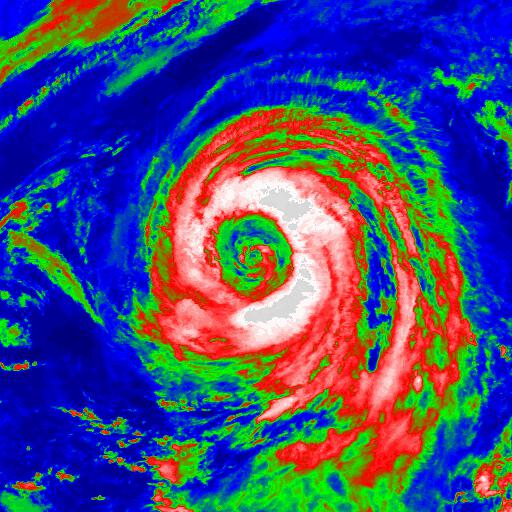
Impressive Super Typhoon Mike of 1990


sorry for all the images just thought i'd show this beauty of a storm.
sorry for all the images just thought i'd show this beauty of a storm.
1 likes
-
euro6208
Re: Top hurricane sat photos of all time...
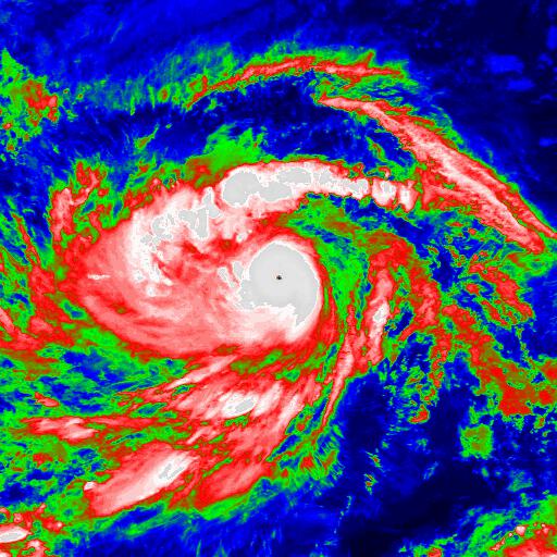
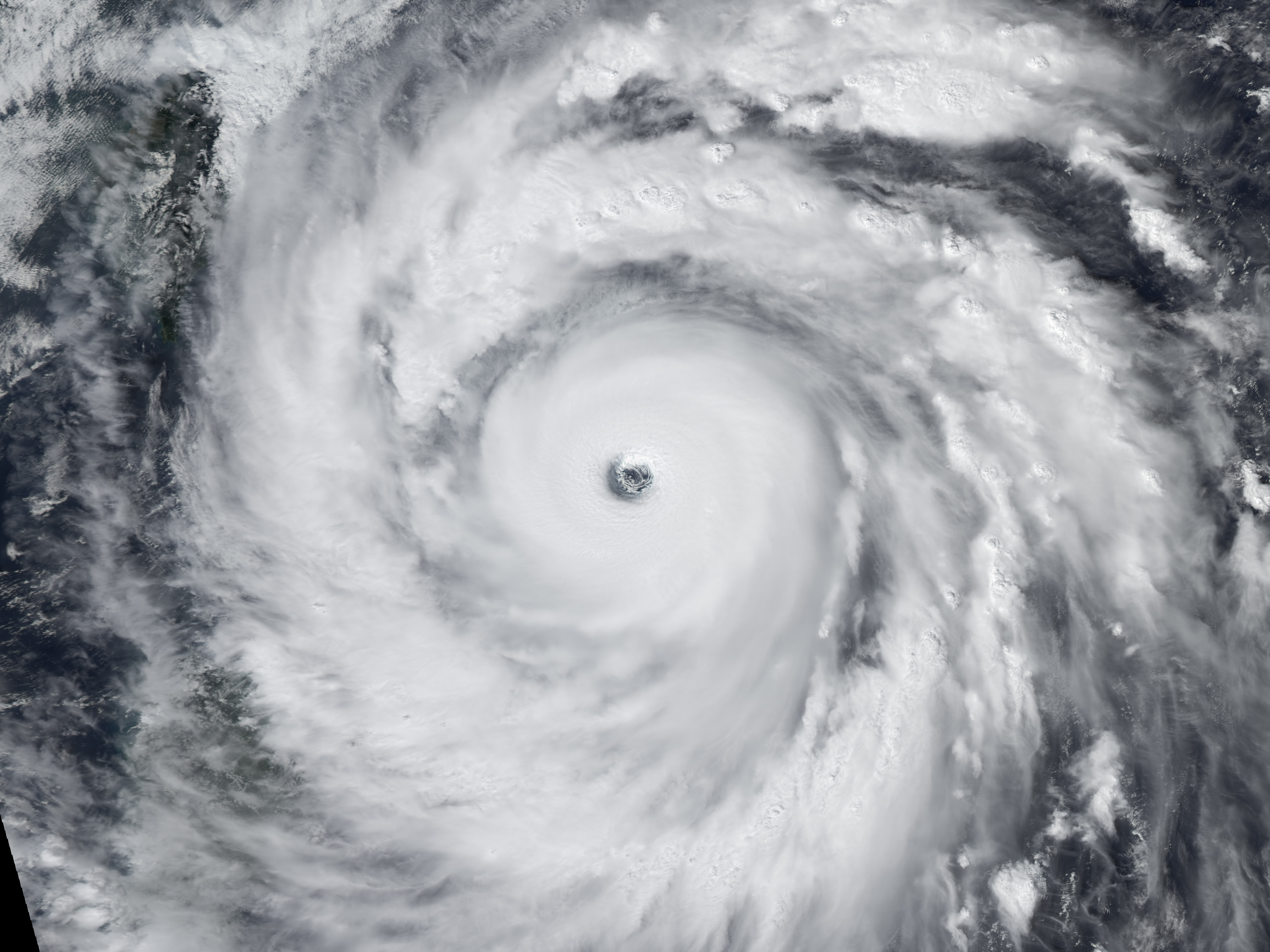
Ibayat right in the eye of 170 knot Meranti. Must have been carnage.

3 likes
-
StormChaser75
- Tropical Storm
- Posts: 101
- Age: 24
- Joined: Sat Feb 06, 2016 4:23 pm
- Location: Corpus Christi TX
- Contact:
Re: Top hurricane sat photos of all time...
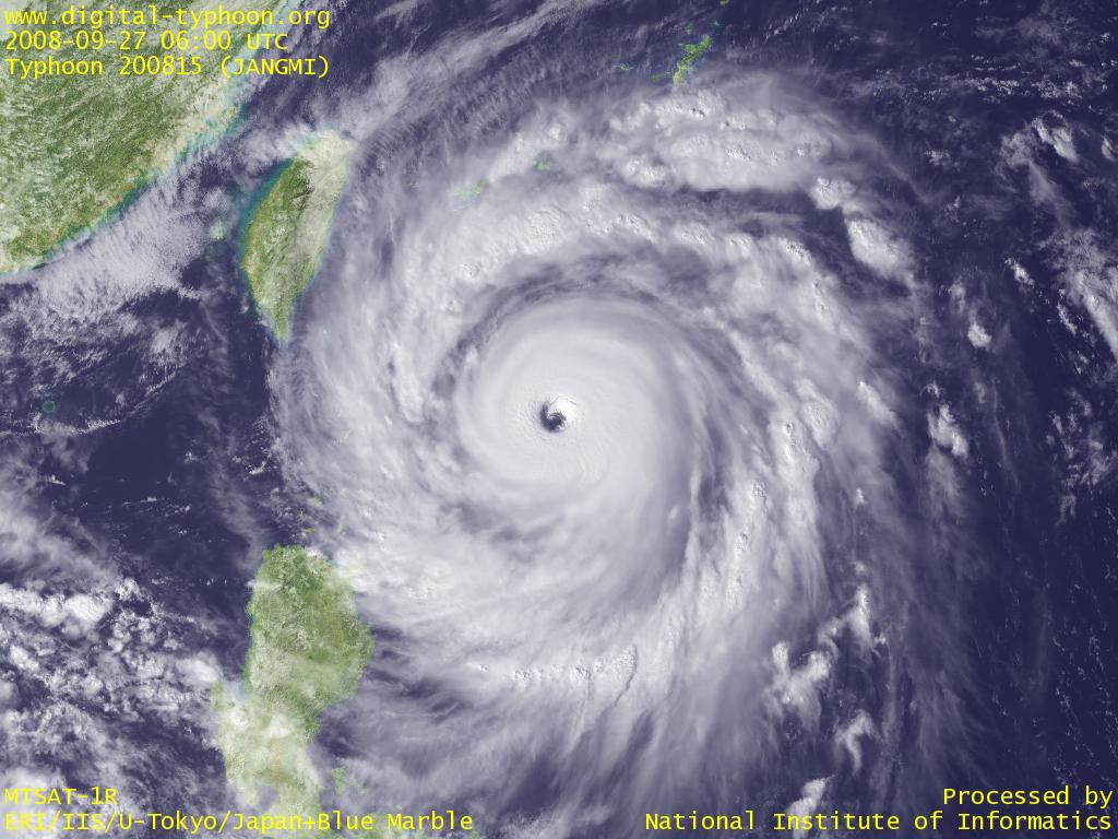
amazing Super Typhoon Nida of 2009 near peak.
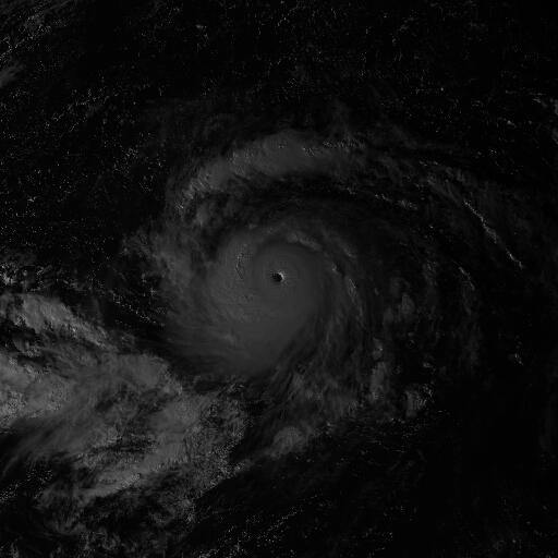


Typhoon Winnie in 1997 with its Humongous eye!


Typhoon Winnie in 1997 with its Humongous eye!
1 likes
-
1900hurricane
- Category 5
- Posts: 6063
- Age: 34
- Joined: Fri Feb 06, 2015 12:04 pm
- Location: Houston, TX
- Contact:
Re: Top hurricane sat photos of all time...
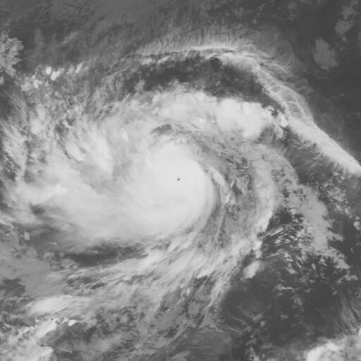
Here's a Himawari-8 visible image of Super Typhoon Meranti '16 about an hour before sunset, shortly before maximum 170 kt intensity.

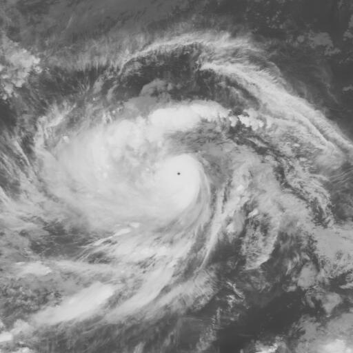
Additionally, here's a VIIRS nighttime visible pass of Meranti shortly after peak intensity, complete with a lightning strike illuminating the eyewall.

Additionally, here's a VIIRS nighttime visible pass of Meranti shortly after peak intensity, complete with a lightning strike illuminating the eyewall.
1 likes
Contract Meteorologist. TAMU & MSST. Fiercely authentic, one of a kind. We are all given free will, so choose a life meant to be lived. We are the Masters of our own Stories.
Opinions expressed are mine alone.
Follow me on Twitter at @1900hurricane : Read blogs at https://1900hurricane.wordpress.com/
Opinions expressed are mine alone.
Follow me on Twitter at @1900hurricane : Read blogs at https://1900hurricane.wordpress.com/
-
doomhaMwx

- Category 5
- Posts: 2494
- Age: 27
- Joined: Tue Apr 18, 2017 4:01 am
- Location: Baguio/Benguet, Philippines
- Contact:
Re: Top hurricane sat photos of all time...
2015's Cyclone Chapala over the Arabian Sea / Gulf of Aden... 2nd strongest TC over the Arabian sea according to the JTWC, with max 1-min sustained winds of 130kts (operational estimate was 135kts)...


0 likes
-
doomhaMwx
- Category 5
- Posts: 2494
- Age: 27
- Joined: Tue Apr 18, 2017 4:01 am
- Location: Baguio/Benguet, Philippines
- Contact:
Re: Top hurricane sat photos of all time...
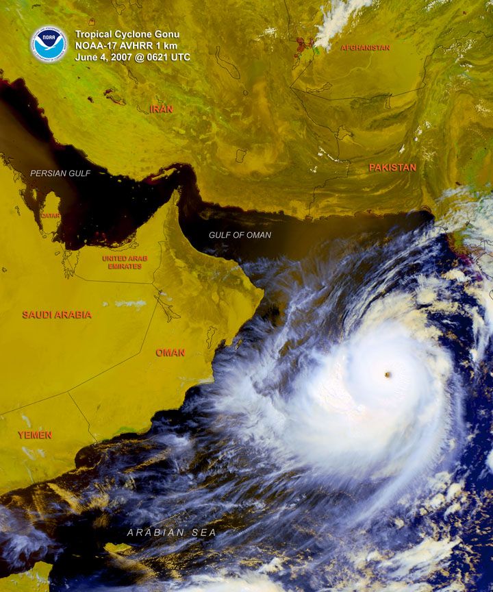
Cyclones Gonu and Sidr -- two Cat-5's of the 2007 North Indian Cyclone Season...
Gonu over the Arabian Sea
Sidr over the Bay of Bengal
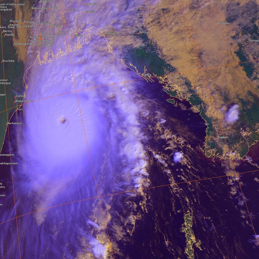
Gonu over the Arabian Sea
Sidr over the Bay of Bengal
0 likes
-
tatertawt24
- Category 1
- Posts: 309
- Joined: Wed Oct 24, 2012 12:57 pm
Re: Top hurricane sat photos of all time...
Some EPAC goodness:


0 likes
Personal Forecast Disclaimer:
The posts in this forum are NOT official forecast and should not be used as such. They are just the opinion of the poster and may or may not be backed by sound meteorological data. They are NOT endorsed by any professional institution or storm2k.org. For official information, please refer to the NHC and NWS products.
The posts in this forum are NOT official forecast and should not be used as such. They are just the opinion of the poster and may or may not be backed by sound meteorological data. They are NOT endorsed by any professional institution or storm2k.org. For official information, please refer to the NHC and NWS products.
-
1900hurricane
- Category 5
- Posts: 6063
- Age: 34
- Joined: Fri Feb 06, 2015 12:04 pm
- Location: Houston, TX
- Contact:
Re: Top hurricane sat photos of all time...
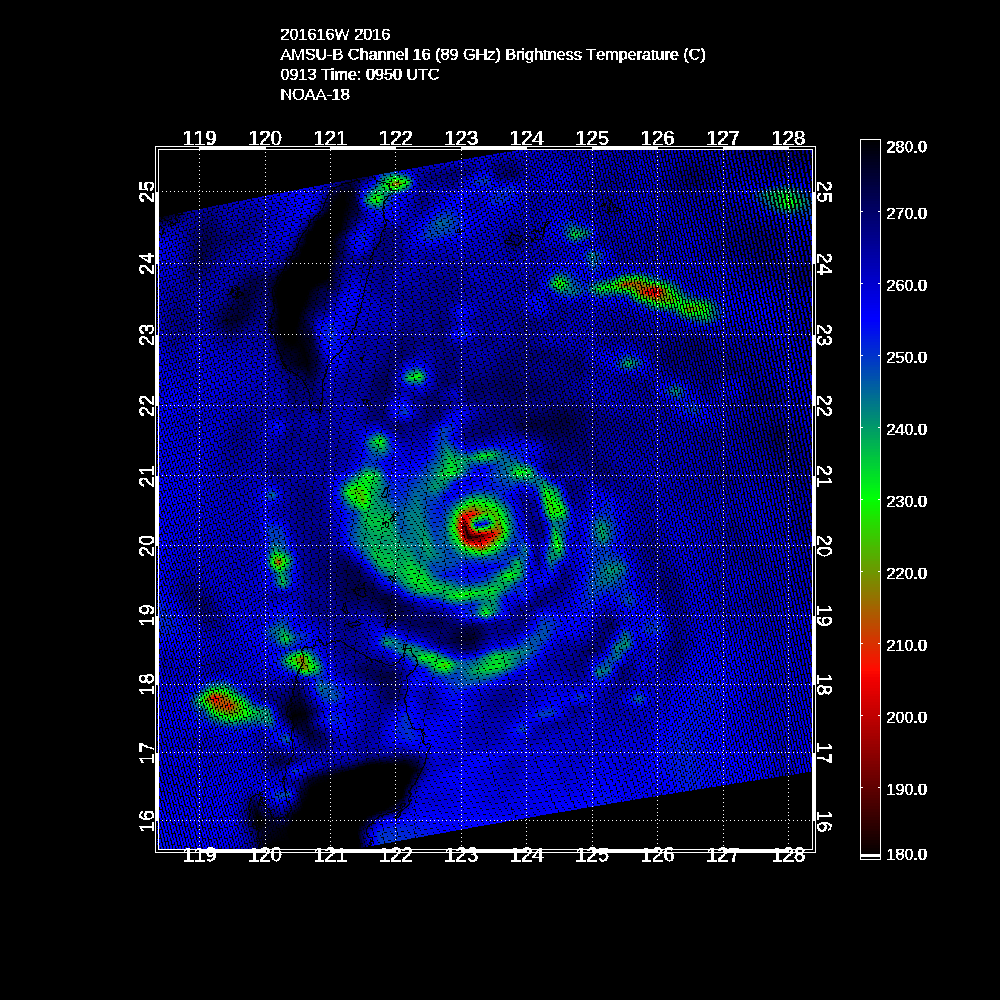
I'm going to drop a few microwave images for this thread. The first two are from Vongfong '14 and Meranti '16. The SSMIS pass and AMSU passes from the two storms, respectively are the two highest satellite derived intensity estimates that I am aware of. These estimates are a little of high outliers, even for these intense storms, so it's unlikely they were as intense as these estimates. The SSMIS pass for Vongfong yielded 182 kt/870 mb and the AMSU pass for Meranti yielded 179 kt/892 mb.

0 likes
Contract Meteorologist. TAMU & MSST. Fiercely authentic, one of a kind. We are all given free will, so choose a life meant to be lived. We are the Masters of our own Stories.
Opinions expressed are mine alone.
Follow me on Twitter at @1900hurricane : Read blogs at https://1900hurricane.wordpress.com/
Opinions expressed are mine alone.
Follow me on Twitter at @1900hurricane : Read blogs at https://1900hurricane.wordpress.com/
-
Kingarabian

- S2K Supporter

- Posts: 16377
- Joined: Sat Aug 08, 2009 3:06 am
- Location: Honolulu, Hawaii
Re: Top hurricane sat photos of all time...
Fernanda 2017 was arguably the strongest southern system in the Pacific on record.

0 likes
RIP Kobe Bryant
-
1900hurricane
- Category 5
- Posts: 6063
- Age: 34
- Joined: Fri Feb 06, 2015 12:04 pm
- Location: Houston, TX
- Contact:
Re: Top hurricane sat photos of all time...
Here's a few more microwave composite images of some pinhole tropical cyclones near peak intensity.
Nepartak '16:

Patricia '15:

Nuri '14:

Mufia '11:

Parma '09:

Wilma '05:

Dianmu '04:

Nepartak '16:
Patricia '15:
Nuri '14:
Mufia '11:
Parma '09:
Wilma '05:
Dianmu '04:
Last edited by 1900hurricane on Sat Jul 15, 2017 3:26 pm, edited 1 time in total.
0 likes
Contract Meteorologist. TAMU & MSST. Fiercely authentic, one of a kind. We are all given free will, so choose a life meant to be lived. We are the Masters of our own Stories.
Opinions expressed are mine alone.
Follow me on Twitter at @1900hurricane : Read blogs at https://1900hurricane.wordpress.com/
Opinions expressed are mine alone.
Follow me on Twitter at @1900hurricane : Read blogs at https://1900hurricane.wordpress.com/
-
mrbagyo

- Category 5
- Posts: 3996
- Age: 33
- Joined: Thu Apr 12, 2012 9:18 am
- Location: 14.13N 120.98E
- Contact:
Re: Top hurricane sat photos of all time...
1 likes
The posts in this forum are NOT official forecast and should not be used as such. They are just the opinion of the poster and may or may not be backed by sound meteorological data. They are NOT endorsed by any professional institution or storm2k.org. For official information, please refer to RSMC, NHC and NWS products.
-
tatertawt24
- Category 1
- Posts: 309
- Joined: Wed Oct 24, 2012 12:57 pm
Re: Top hurricane sat photos of all time...
1900hurricane wrote:Here's a few more microwave composite images of some pinhole tropical cyclones near peak intensity.
Nepartak '16:
Patricia '15:
Nuri '14:
Mufia '11:
Parma '09:
Wilma '05:
Dianmu '14:
Dianmu is particularly impressive imo.
0 likes
Personal Forecast Disclaimer:
The posts in this forum are NOT official forecast and should not be used as such. They are just the opinion of the poster and may or may not be backed by sound meteorological data. They are NOT endorsed by any professional institution or storm2k.org. For official information, please refer to the NHC and NWS products.
The posts in this forum are NOT official forecast and should not be used as such. They are just the opinion of the poster and may or may not be backed by sound meteorological data. They are NOT endorsed by any professional institution or storm2k.org. For official information, please refer to the NHC and NWS products.
-
euro6208
Re: Top hurricane sat photos of all time...
1900hurricane wrote:I'm going to drop a few microwave images for this thread. The first two are from Vongfong '14 and Meranti '16. The SSMIS pass and AMSU passes from the two storms, respectively are the two highest satellite derived intensity estimates that I am aware of. These estimates are a little of high outliers, even for these intense storms, so it's unlikely they were as intense as these estimates. The SSMIS pass for Vongfong yielded 182 kt/870 mb and the AMSU pass for Meranti yielded 179 kt/892 mb.
Never knew that about Vongfong! Thanks for sharing.
0 likes
-
euro6208
Re: Top hurricane sat photos of all time...
Kingarabian wrote:Fernanda 2017 was arguably the strongest southern system in the Pacific on record.
Or do you mean strongest southern system in the EPAC?
Many typhoons have peaked far stronger near the equator.
0 likes
-
euro6208
Re: Top hurricane sat photos of all time...
1900hurricane wrote:Here's a few more microwave composite images of some pinhole tropical cyclones near peak intensity.
Nepartak '16:
Patricia '15:
Nuri '14:
Mufia '11:
Parma '09:
Wilma '05:
Dianmu '04:
Like i said many times, Patricia got lucky she had recon. A bunch of Patricia's in the WPAC including more not listed and this was before Patricia. 100>1 Out from nowhere.
0 likes


Re: Top hurricane sat photos of all time...
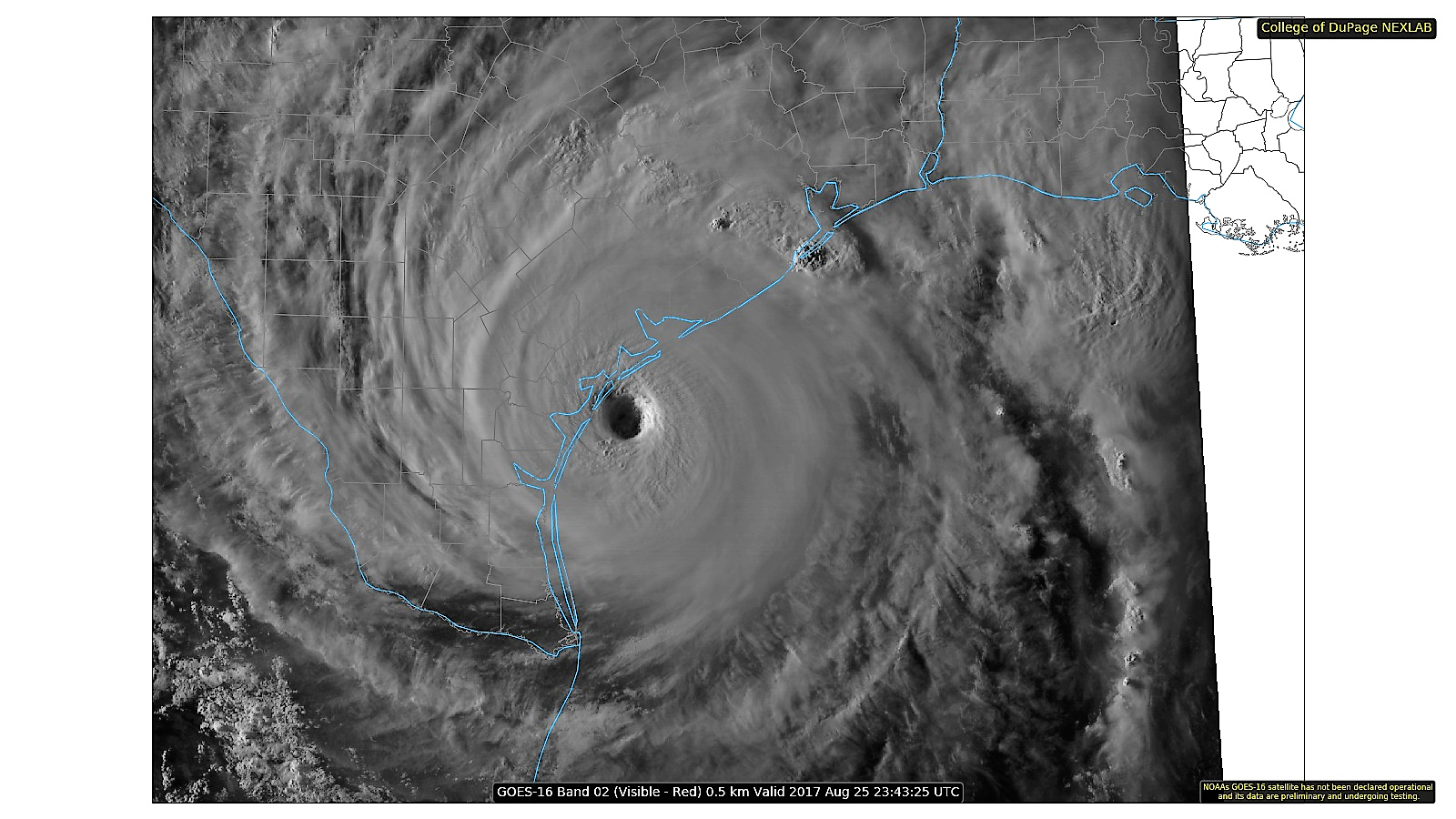
You can add Harvey 2017 to this list
6 likes
The above post and any post by Ntxw is NOT an official forecast and should not be used as such. It is just the opinion of the poster and may or may not be backed by sound meteorological data. It is NOT endorsed by any professional institution including Storm2k. For official information, please refer to NWS products.
Help support Storm2K!
Who is online
Users browsing this forum: Kingarabian and 186 guests