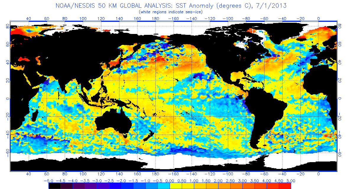
At this point, comparing 2013 to this season is just trolling. I am going to end this once and for all right now.
Lets take a look at a major indicator for hurricane activity in the Atlantic Basin since 1995, the MDR, which is relevant since we are in a multi-decadal warm AMO. Since 1995, there have been 9 hurricane seasons where the MDR was above normal (Not including this year because the results are not complete!): 1
995, 1998, 2003, 2004, 2005, 2008, 2010, 2012, and 2016. Here is what happened those years:
1995: 19/11/5
1998: 14/10/3
2003: 16/7/3
2004: 15/9/6
2005: 28/15/7
2008: 16/8/5
2010: 19/12/5
2012: 19/10/2
2016: 15/7/4Comparing warmer than normal MDR years to the 30 Year Average of 11 named storms, 6 hurricanes, and 2 major hurricanes, you get 17.8 named storms, 9.8 hurricanes, and 4.5 major hurricanes in those 9 years. This means that since 1995, if the MDR was warmer than normal, the Atlantic was significantly more active than normal, with the # of major hurricanes being TWICE as high as the 30 year average. In years like 2006 & 2013 that were busts, the MDR had cooled significantly by this point in the hurricane season.
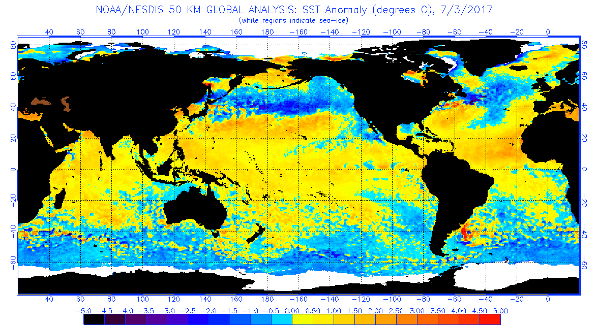
Right now, the Atlantic MDR is running approximately .55C above normal, only behind 2005 and 2010. And with the NAO forecasted to be negative for the foreseeable future, it is likely the MDR will stay anomalously warm, but get warmer too. Since we have established that the OPPOSITE of 2006/2013 is happening, I think it is completely irresponsible & lazy of posters to declare this is a repeat of 2013. The likely outcome is a burst of activity in the coming months, and with a strong Atlantic Ridge established, the threat to land in the Western Hemisphere is increased.
Current MDR Sea Surface Temperature Anomalies:  MDR Sea Surface Temperature Anomalies (1980-2016):