

Shear and 200mb PV is clearing out ahead of Franklin.
I wouldn't be suprised if Franklin maintains intensity across the Yucatan or even slightly strengthen.
ATL: FRANKLIN - Remnants - Discussion
Moderator: S2k Moderators
-
Aric Dunn
- Category 5

- Posts: 21238
- Age: 43
- Joined: Sun Sep 19, 2004 9:58 pm
- Location: Ready for the Chase.
- Contact:
Re: ATL: FRANKLIN - Tropical Storm - Discussion
GCANE wrote:Shear and 200mb PV is clearing out ahead of Franklin.
I wouldn't be suprised if Franklin maintains intensity across the Yucatan or even slightly strengthen.
Some RI is quite possible over the next 12 hours before landfall. hurricane is looking more likely every hour.
2 likes
Note: If I make a post that is brief. Please refer back to previous posts for the analysis or reasoning. I do not re-write/qoute what my initial post said each time.
If there is nothing before... then just ask
Space & Atmospheric Physicist, Embry-Riddle Aeronautical University,
I believe the sky is falling...
If there is nothing before... then just ask
Space & Atmospheric Physicist, Embry-Riddle Aeronautical University,
I believe the sky is falling...
Re: ATL: FRANKLIN - Tropical Storm - Discussion
Aric Dunn wrote:GCANE wrote:Shear and 200mb PV is clearing out ahead of Franklin.
I wouldn't be suprised if Franklin maintains intensity across the Yucatan or even slightly strengthen.
Some RI is quite possible over the next 12 hours before landfall. hurricane is looking more likely every hour.
This really looks good.
Hurricane watch issued for the Yucatan.
Going into the BOC, air column will be saturated and UL conditions ideal for intensification.
1 likes

Re: ATL: FRANKLIN - Tropical Storm - Discussion
Just watching the high cirrus clouds expanding the anticyclone in the water vapor loop.
I sure hope Franklin doesn't slow its forward motion..
I sure hope Franklin doesn't slow its forward motion..
1 likes
Re: ATL: FRANKLIN - Tropical Storm - Discussion
Nimbus wrote:Just watching the high cirrus clouds expanding the anticyclone in the water vapor loop.
I sure hope Franklin doesn't slow its forward motion..
The ULL is ventilating this really well - ideally positioned.
1 likes


Re: ATL: FRANKLIN - Tropical Storm - Discussion
GCANE wrote:Nimbus wrote:Just watching the high cirrus clouds expanding the anticyclone in the water vapor loop.
I sure hope Franklin doesn't slow its forward motion..
The ULL is ventilating this really well - ideally positioned.
That might cause the models to hasten the intensity trending.
Large anticyclones tend to squelch the upper air steering to some degree.
Hope this just means Tampico is spared but we should still watch the models if they start trending north.
1 likes
-
Thetxhurricanemaster
- Category 1

- Posts: 279
- Age: 35
- Joined: Tue Aug 01, 2017 6:53 pm
- Location: Corpus christi
Re: ATL: FRANKLIN - Tropical Storm - Discussion
Nimbus wrote:GCANE wrote:Nimbus wrote:Just watching the high cirrus clouds expanding the anticyclone in the water vapor loop.
I sure hope Franklin doesn't slow its forward motion..
The ULL is ventilating this really well - ideally positioned.
That might cause the models to hasten the intensity trending.
Large anticyclones tend to squelch the upper air steering to some degree.
Hope this just means Tampico is spared but we should still watch the models if they start trending north.
SO is there a chance this goes more North what will a stronger system do in this situation because no models bring it too far North but can you explain the Anti-Cyclone thing to me please ?
0 likes
Re: ATL: FRANKLIN - Tropical Storm - Discussion
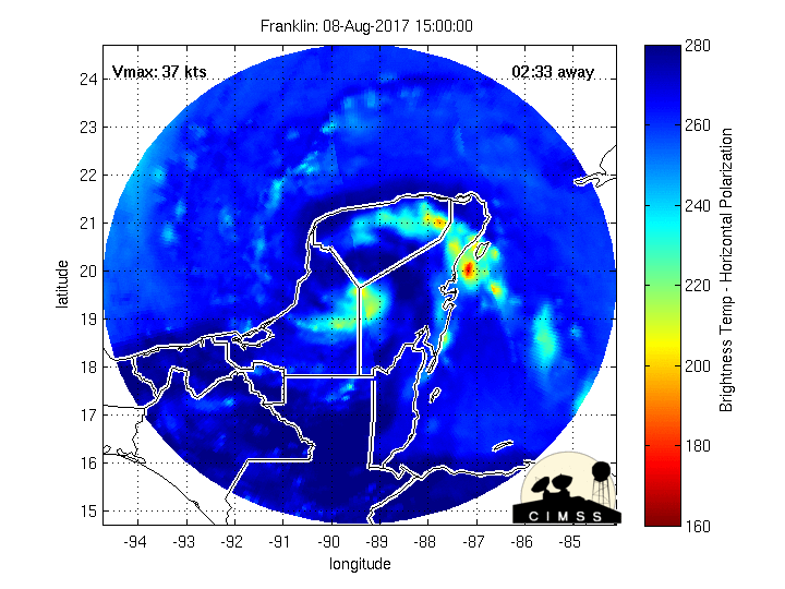
Coming up on DMAX and going off-scale on 8.4 um.
Yucatan buoy looks like its about to take a dive on surface pressure.

Yucatan buoy looks like its about to take a dive on surface pressure.
0 likes
Re: ATL: FRANKLIN - Tropical Storm - Discussion
if this builds a core before striking the Yucatan, it may be better news for the heavily populated areas down the line. This is what HWRF is showing. Shows a storm without a core when it comes off of the Yucatan. Thus, it is unable to rapidly intensify
0 likes
Re: ATL: FRANKLIN - Tropical Storm - Discussion
It's starting to show up on the long range Belize radar, (no center... yet but soon)
http://www.hydromet.gov.bz/observations ... dar-images for the radar
http://flhurricane.com/imageanimator.php?258 has a long loop going of it
http://www.hydromet.gov.bz/observations ... dar-images for the radar
http://flhurricane.com/imageanimator.php?258 has a long loop going of it
0 likes
Re: ATL: FRANKLIN - Tropical Storm - Discussion
Thetxhurricanemaster wrote:Nimbus wrote:GCANE wrote:
The ULL is ventilating this really well - ideally positioned.
That might cause the models to hasten the intensity trending.
Large anticyclones tend to squelch the upper air steering to some degree.
Hope this just means Tampico is spared but we should still watch the models if they start trending north.
SO is there a chance this goes more North what will a stronger system do in this situation because no models bring it too far North but can you explain the Anti-Cyclone thing to me please ?
Explain blister?
0 likes
Re: ATL: FRANKLIN - Tropical Storm - Discussion
Very high rain rate moving into a totally saturated air column with zero shear.
Nothing better for warm-core intensification.
IMHO, lots of room to make it to Cat 1 before the Yucatan.
If this intensifies more than the models give it, the Coriolis-Differential / Beta thing could bend this more north than currently forecasted.


Nothing better for warm-core intensification.
IMHO, lots of room to make it to Cat 1 before the Yucatan.
If this intensifies more than the models give it, the Coriolis-Differential / Beta thing could bend this more north than currently forecasted.
0 likes
-
SouthDadeFish

- Professional-Met

- Posts: 2835
- Joined: Thu Sep 23, 2010 2:54 pm
- Location: Miami, FL
- Contact:
Re: ATL: FRANKLIN - Tropical Storm - Discussion
A recent SSMIS pass suggests a mid-level core is starting to form. We need a higher resolution overpass to determine if this is also happening in the lower levels of the troposphere. Regardless, the organization of the TC has improved significantly since this time yesterday.

2 likes

Re: ATL: FRANKLIN - Tropical Storm - Discussion
This really feels like an Earl 2.0. But since it's further north, it will have more time to restrengthen over the Bay of Campeche before its second landfall. 
0 likes
Igor 2010, Sandy 2012, Fay 2014, Gonzalo 2014, Joaquin 2015, Nicole 2016, Humberto 2019, Imelda 2025
I am only a tropical weather enthusiast. My predictions are not official and may or may not be backed by sound meteorological data. For official information, please refer to the NHC and NWS products.
I am only a tropical weather enthusiast. My predictions are not official and may or may not be backed by sound meteorological data. For official information, please refer to the NHC and NWS products.
-
cycloneye

- Admin

- Posts: 149472
- Age: 69
- Joined: Thu Oct 10, 2002 10:54 am
- Location: San Juan, Puerto Rico
Re: ATL: FRANKLIN - Tropical Storm - Discussion
8 AM EDT Intermediate Advisory up to 50 mph
BULLETIN
Tropical Storm Franklin Intermediate Advisory Number 3A
NWS National Hurricane Center Miami FL AL072017
800 AM EDT Mon Aug 07 2017
...FRANKLIN GRADUALLY STRENGTHENING...
SUMMARY OF 800 AM EDT...1200 UTC...INFORMATION
----------------------------------------------
LOCATION...17.3N 84.7W
ABOUT 230 MI...370 KM E OF BELIZE CITY
ABOUT 250 MI...400 KM ESE OF CHETUMAL MEXICO
MAXIMUM SUSTAINED WINDS...50 MPH...75 KM/H
PRESENT MOVEMENT...WNW OR 300 DEGREES AT 13 MPH...20 KM/H
MINIMUM CENTRAL PRESSURE...1004 MB...29.65 INCHES
0 likes
Visit the Caribbean-Central America Weather Thread where you can find at first post web cams,radars
and observations from Caribbean basin members Click Here
and observations from Caribbean basin members Click Here


Re: ATL: FRANKLIN - Tropical Storm - Discussion
I agree with the posts above. Franklin is looking quite healthy this morning. Structurally below is sound and likely pushing for a very strong TS landfall at the minimum on the Yucatan.

0 likes
The above post and any post by Ntxw is NOT an official forecast and should not be used as such. It is just the opinion of the poster and may or may not be backed by sound meteorological data. It is NOT endorsed by any professional institution including Storm2k. For official information, please refer to NWS products.
Help support Storm2K!

-
tolakram
- Admin
- Posts: 20185
- Age: 62
- Joined: Sun Aug 27, 2006 8:23 pm
- Location: Florence, KY (name is Mark)
Re: ATL: FRANKLIN - Tropical Storm - Discussion
0 likes
M a r k
- - - - -
Join us in chat: Storm2K Chatroom Invite. Android and IOS apps also available.
The posts in this forum are NOT official forecasts and should not be used as such. Posts are NOT endorsed by any professional institution or STORM2K.org. For official information and forecasts, please refer to NHC and NWS products.
-
Aric Dunn
- Category 5
- Posts: 21238
- Age: 43
- Joined: Sun Sep 19, 2004 9:58 pm
- Location: Ready for the Chase.
- Contact:
Re: ATL: FRANKLIN - Tropical Storm - Discussion
Could this be the classic pulsing down of the convection prior to the inner core developing. Then will see indicdual towers fire off in the "eyewall" that rapidly grow and rotate around as the core builds.. always fun to watch.. will be perfect timing for recon.
0 likes
Note: If I make a post that is brief. Please refer back to previous posts for the analysis or reasoning. I do not re-write/qoute what my initial post said each time.
If there is nothing before... then just ask
Space & Atmospheric Physicist, Embry-Riddle Aeronautical University,
I believe the sky is falling...
If there is nothing before... then just ask
Space & Atmospheric Physicist, Embry-Riddle Aeronautical University,
I believe the sky is falling...
Who is online
Users browsing this forum: No registered users and 47 guests