

Alyono wrote:model ping pong continues. GFS now keeps the system alive
D did you just mention the Model that shall not be named in 2017?
Moderator: S2k Moderators
Alyono wrote:model ping pong continues. GFS now keeps the system alive
srainhoutx wrote:Alyono wrote:model ping pong continues. GFS now keeps the system alive
Look at that upper trough dropping S interacting with the TUTT. The models are clearly struggling. Need the NOAA Global Hawk missions and additional NWS Forecast Office special balloon launches next week.


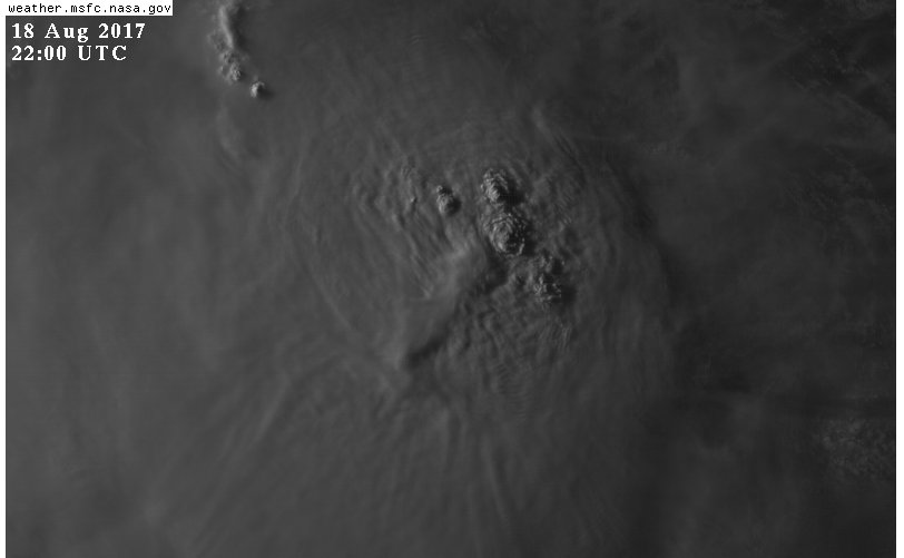
bubba hotep wrote:Getting a little feisty here at sunset
stormreader wrote:chaser1 wrote:With the latest discussion laying everything out, i'm gonna go out on a limb here. Assuming that Harvey will have at least maintained its identity as a closed system, I believe that the storm will undergo some significant strengthening at its crossing 70W and within the 24-36 hr. period. I'll further guess that Belize or Yucatan will have to brace for a Cat. 2 or 3 hurricane. As I see it, the cut-off centered over the Florida Straits will continue to not only move westward but more importantly will gain latitude as well. I think that the shear impacting Harvey now will lesson in about 24 hours as the storm moves a little further west and that we'll see a broader upper anticyclonic flow begin to bridge south and over the Central Caribbean. Obviously no models seems to think that and NHC seems to be hinting towards possibly better upper conditions but further out than that. Hmmm, maybe I wont quite bet the farm on it LOL; better I keep it to a 6-pack of beer!
Very bold. For the sake of your prediction--good luck!
Alyono wrote:looks like the shear has increased further. Think this needs to be moving in excess of 30 kts to reduce the shear
p1nheadlarry wrote:Alyono wrote:looks like the shear has increased further. Think this needs to be moving in excess of 30 kts to reduce the shear
Wouldn't that be a little troublesome for the vorticity staying alligned through the midlevels?
Alyono wrote:p1nheadlarry wrote:Alyono wrote:looks like the shear has increased further. Think this needs to be moving in excess of 30 kts to reduce the shear
Wouldn't that be a little troublesome for the vorticity staying alligned through the midlevels?
would be easier to stay aligned if it was moving at the same speed as the upper winds. That would mean the flow at all levels was the same, which would reduce the shear
Hammy wrote:I'm starting to think Harvey dissipates in about 24-36 hours and regenerates later on--starting to remind me of Chantal in 2001 (one of the years I have as possible analog) and interestingly the Euro has been hinting at a similar track.


Thetxhurricanemaster wrote:lrak wrote:Shoot, we haven't had a real threat since 1980 with Allen. I sure hope it doesn't form up like some are saying, I like my A/C and running water. I don't want to go to SA and get a hotel, my salt tank will die. Hopefully it'll just be a sheared storm with lots of beneficial rain. After reading all the posts on Storm2K of post hurricane strikes over the years has me a bit worried now, especially all the stories from Florida and Louisiana.
Hurricane Allen https://en.wikipedia.org/wiki/Hurricane_Allen#/media/File:Allen_1980_track.png
If your in Texas this definitely needs to be watched ...


chaser1 wrote:stormreader wrote:chaser1 wrote:With the latest discussion laying everything out, i'm gonna go out on a limb here. Assuming that Harvey will have at least maintained its identity as a closed system, I believe that the storm will undergo some significant strengthening at its crossing 70W and within the 24-36 hr. period. I'll further guess that Belize or Yucatan will have to brace for a Cat. 2 or 3 hurricane. As I see it, the cut-off centered over the Florida Straits will continue to not only move westward but more importantly will gain latitude as well. I think that the shear impacting Harvey now will lesson in about 24 hours as the storm moves a little further west and that we'll see a broader upper anticyclonic flow begin to bridge south and over the Central Caribbean. Obviously no models seems to think that and NHC seems to be hinting towards possibly better upper conditions but further out than that. Hmmm, maybe I wont quite bet the farm on it LOL; better I keep it to a 6-pack of beer!
Very bold. For the sake of your prediction--good luck!
LOL, thanks. Fortunately for the good folks in Texas, I'm not anticipating the need to quit my day job. Besides if I was REALLY sure about my somewhat educated hunch, I'd throw down more than a six pack of Coors Light

HURAKAN wrote:
nice microwave pass
Users browsing this forum: No registered users and 17 guests


