Texas Summer 2017

U.S. & Caribbean Weather Discussions and Severe Weather Events

Moderator: S2k Moderators

Forum rules

The posts in this forum are NOT official forecast and should not be used as such. They are just the opinion of the poster and may or may not be backed by sound meteorological data. They are NOT endorsed by any professional institution or STORM2K.

Help Support Storm2K
Message
Author
weatherdude1108
Category 5
Category 5
Posts: 4228
Joined: Tue Dec 13, 2011 1:04 pm
Location: Northwest Austin/Cedar Park, TX

Re: Texas Summer 2017

#1341 Postby weatherdude1108 » Mon Aug 21, 2017 2:29 pm

Portastorm wrote:My goodness ... the 12z Euro is showing Biblical rainfall totals for much of south central, south, and southeast Texas over the next eight days. :eek:

Largest one I saw was a 24" total for NE Waller County. Anywhere from 12-20" would fall in Harris County. My own county, Travis County, would get 4-7".

:uarrow:
:eek: :double:
Feast or famine
0 likes   
The preceding post is NOT an official forecast, and should not be used as such. It is only the opinion of the poster and may or may not be backed by sound meteorological data. It is NOT endorsed by any professional institution including storm2k.org. For Official Information please refer to the NHC and NWS products.

weatherdude1108
Category 5
Category 5
Posts: 4228
Joined: Tue Dec 13, 2011 1:04 pm
Location: Northwest Austin/Cedar Park, TX

Re: Texas Summer 2017

#1342 Postby weatherdude1108 » Mon Aug 21, 2017 2:30 pm

Got to see the eclipse, with about 50 of my cohorts. We all noticed a distinct temperature drop. Sun felt much less intense, and more bearable. Amazing natural phenomenon!
:)
2 likes   
The preceding post is NOT an official forecast, and should not be used as such. It is only the opinion of the poster and may or may not be backed by sound meteorological data. It is NOT endorsed by any professional institution including storm2k.org. For Official Information please refer to the NHC and NWS products.

User avatar
Cpv17
Category 5
Category 5
Posts: 4979
Joined: Wed Dec 07, 2016 2:24 pm
Location: Wharton/El Campo, TX

Re: Texas Summer 2017

#1343 Postby Cpv17 » Mon Aug 21, 2017 2:32 pm

weatherdude1108 wrote:Got to see the eclipse, with about 50 of my cohorts. We all noticed a distinct temperature drop. Sun felt much less intense, and more bearable. Amazing natural phenomenon!
:)

In my honest opinion it looked like someone just installed a dimmer switch on the sun lol
2 likes   

weatherdude1108
Category 5
Category 5
Posts: 4228
Joined: Tue Dec 13, 2011 1:04 pm
Location: Northwest Austin/Cedar Park, TX

Re: Texas Summer 2017

#1344 Postby weatherdude1108 » Mon Aug 21, 2017 2:35 pm

Cpv17 wrote:
weatherdude1108 wrote:Got to see the eclipse, with about 50 of my cohorts. We all noticed a distinct temperature drop. Sun felt much less intense, and more bearable. Amazing natural phenomenon!
:)

In my honest opinion it looked like someone just installed a dimmer switch on the sun lol

:uarrow:
:lol:

Yeah, I noticed it darker when I was in middle school back in the 80s in San Antonio. The temperature drop was about the extent of the spectacle down here.
0 likes   
The preceding post is NOT an official forecast, and should not be used as such. It is only the opinion of the poster and may or may not be backed by sound meteorological data. It is NOT endorsed by any professional institution including storm2k.org. For Official Information please refer to the NHC and NWS products.

weatherdude1108
Category 5
Category 5
Posts: 4228
Joined: Tue Dec 13, 2011 1:04 pm
Location: Northwest Austin/Cedar Park, TX

Re: Texas Summer 2017

#1345 Postby weatherdude1108 » Mon Aug 21, 2017 2:38 pm

This scenario would be a good test for the LCRA system of dams during a flood. Wowza!

Image
1 likes   
The preceding post is NOT an official forecast, and should not be used as such. It is only the opinion of the poster and may or may not be backed by sound meteorological data. It is NOT endorsed by any professional institution including storm2k.org. For Official Information please refer to the NHC and NWS products.

User avatar
JDawg512
Category 5
Category 5
Posts: 1076
Age: 45
Joined: Mon Aug 26, 2013 8:56 pm
Location: Austin
Contact:

Re: Texas Summer 2017

#1346 Postby JDawg512 » Mon Aug 21, 2017 2:41 pm

weatherdude1108 wrote:Got to see the eclipse, with about 50 of my cohorts. We all noticed a distinct temperature drop. Sun felt much less intense, and more bearable. Amazing natural phenomenon!
:)


Image

I managed to snap this pic as it was near the peak with my phone. Check out the visible satellite loop. Can see the shadow move across. If someone could post an animated GIF, I'd appreciate it very much. In 7 years it will be our turn to be in the path of totality.
2 likes   
Resident Rain Miser

I am a weather hobbyist living 3.5 miles south of Downtown Austin and in no way or fashion should anything I say concerning forecasts be taken seriously. Please check your local NWS for accurate weather forecasting and conditions.

User avatar
Texas Snowman
Storm2k Moderator
Storm2k Moderator
Posts: 6179
Joined: Fri Jan 25, 2008 11:29 am
Location: Denison, Texas

Re: Texas Summer 2017

#1347 Postby Texas Snowman » Mon Aug 21, 2017 3:02 pm

Yes sir, pretty cool experience here. Denison will be near the western edge of totality in 2024. Let the countdown begin for that heavenly experience!
0 likes   
The above post and any post by Texas Snowman is NOT an official forecast and should not be used as such. It is just the opinion of the poster and may or may not be backed by sound meteorological data. It is NOT endorsed by any professional institution including storm2k.org. For official information, please refer to NWS products.

User avatar
bubba hotep
S2K Supporter
S2K Supporter
Posts: 5837
Joined: Wed Dec 28, 2016 1:00 am
Location: Collin County Texas

Re: Texas Summer 2017

#1348 Postby bubba hotep » Mon Aug 21, 2017 3:06 pm

12z Euro max for Texas is 35", so both the Euro and GFS showing insane flood potential across Texas with Harvey.
1 likes   
Winter time post are almost exclusively focused on the DFW area.

weatherdude1108
Category 5
Category 5
Posts: 4228
Joined: Tue Dec 13, 2011 1:04 pm
Location: Northwest Austin/Cedar Park, TX

Re: Texas Summer 2017

#1349 Postby weatherdude1108 » Mon Aug 21, 2017 3:13 pm

JDawg512 wrote:
weatherdude1108 wrote:Got to see the eclipse, with about 50 of my cohorts. We all noticed a distinct temperature drop. Sun felt much less intense, and more bearable. Amazing natural phenomenon!
:)


Image

I managed to snap this pic as it was near the peak with my phone. Check out the visible satellite loop. Can see the shadow move across. If someone could post an animated GIF, I'd appreciate it very much. In 7 years it will be our turn to be in the path of totality.


That looks like my pic! :) I don't know how to get photos from my phone onto here though. Yeah, 7 years it will be our turn!
0 likes   
The preceding post is NOT an official forecast, and should not be used as such. It is only the opinion of the poster and may or may not be backed by sound meteorological data. It is NOT endorsed by any professional institution including storm2k.org. For Official Information please refer to the NHC and NWS products.

weatherdude1108
Category 5
Category 5
Posts: 4228
Joined: Tue Dec 13, 2011 1:04 pm
Location: Northwest Austin/Cedar Park, TX

Re: Texas Summer 2017

#1350 Postby weatherdude1108 » Mon Aug 21, 2017 3:14 pm

Our weather service is already talking about late this week.

Image
Heavy rain potential increasing for later in the work week. Stay tuned for updated weather packages for more details in the coming dates.
1 likes   
The preceding post is NOT an official forecast, and should not be used as such. It is only the opinion of the poster and may or may not be backed by sound meteorological data. It is NOT endorsed by any professional institution including storm2k.org. For Official Information please refer to the NHC and NWS products.

User avatar
Ntxw
Storm2k Moderator
Storm2k Moderator
Posts: 22785
Joined: Wed Oct 21, 2009 6:34 pm
Location: DFW, Texas

Re: Texas Summer 2017

#1351 Postby Ntxw » Mon Aug 21, 2017 3:49 pm

Trof+slow moving TC+fronts= deluge for someone. Too much of a good thing
2 likes   
The above post and any post by Ntxw is NOT an official forecast and should not be used as such. It is just the opinion of the poster and may or may not be backed by sound meteorological data. It is NOT endorsed by any professional institution including Storm2k. For official information, please refer to NWS products.

  Help support Storm2K!
Help Support Storm2K

weatherdude1108
Category 5
Category 5
Posts: 4228
Joined: Tue Dec 13, 2011 1:04 pm
Location: Northwest Austin/Cedar Park, TX

Re: Texas Summer 2017

#1352 Postby weatherdude1108 » Mon Aug 21, 2017 4:08 pm

000
FXUS64 KEWX 212054
AFDEWX

Area Forecast Discussion
National Weather Service Austin/San Antonio TX
354 PM CDT Mon Aug 21 2017

.SHORT TERM (Tonight through Tuesday Night)...

Temperatures remain near to slightly above normal this afternoon and
will do so again tomorrow with isolated thunderstorms occurring
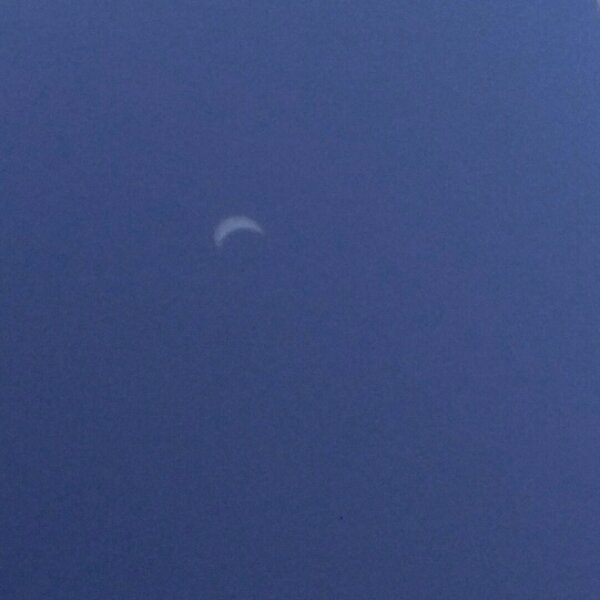
across the coastal plains. Luckily for us, temperatures did pause
briefly in their rise due to the partial eclipse that traversed
across the CONUS.


Showers and a few thunderstorms are ongoing across the coastal
plains as the influence of a large cyclonic gyre shifts towards the
Texas coast where slightly greater instability exists. This activity
will decrease after sunset as atmosphere restablizes.

Expect a near repeat of today`s weather tomorrow as the H5 ridge
slowly breaks down and the TUTT low shifts closer to the Texas coast
in western Gulf. Another round of showers and a few storms will be
likely across the coastal plains. Heat index values will reach into
the 100-104 degree range as well, minus the Hill Country.

&&

.LONG TERM (Wednesday through Monday)...

Weather pattern is becoming increasingly concerning for heavy rain
potential in portions of mid-week and especially towards late
week/weekend as model indications suggest increasing tropical
influence.
While model trends indicate this trend, more run-to-run
consistency needs to be seen before full confidence can be placed on
some of the more recent rainfall projections. None-the-less, areas of
heavy rain across the region could impact the region late week and
weekend. See below for details.

A longer wave trough axis will shift across the mid-MS Valley and
force a back-door front into north Texas. EC remains bullish on its
southern progress (likely convectively reinforced) and pivots an
axis of rain into at least north portions of the region here in
South-central Texas. Have weighted more towards the EC solution in
its handling of the previous system a few weeks ago.
GFS remains
drier with the front remaining farther north at this time. The Hill
Country looks to be the more favored region for rain Wednesday
afternoon and again Thursday. Depending on how far south the front
shifts, pockets of rain could occur as far south as SA and into the
Rio Grande Plains Thursday as well.
This does not bode well for what
can potentially occur this upcoming late week and weekend.


If soils become more saturated in the Hill Country and portions of
the area Wed-Thurs, lower absorption rates could pose a flooding and
river flooding risk for the weekend as both EC and GFS model
projections indicate the remnants of what was Harvey to shift
towards the region.
Over the past 3-4 model cycles, global models
have come into agreement that in the Day 5-7 period, Harvey could
redevelop into an organized tropical cyclone across the southern
Gulf. Both models indicate a landfall near the mouth of the Rio
Grande River as the system tracks northwest into south-central Texas.
The biggest concern (as with any tropical system here) is heavy
inland rainfall. If this track occurs, high rainfall totals could
occur quickly and result in river and flash flooding. Confidence is
slowly increasing on this possibility.
While the most recent run of
global models are suggesting extreme rainfall, we must keep in mind
how they and the system itself will evolve. The remnants of Harvey
remain a weak open wave at this time and model solutions on rainfall
amounts will shift a good amount over the next few days. Please stay
tuned through the week to solutions as extra upper-air balloon data
are ingested for refined rainfall amount potential and system
impacts.
1 likes   
The preceding post is NOT an official forecast, and should not be used as such. It is only the opinion of the poster and may or may not be backed by sound meteorological data. It is NOT endorsed by any professional institution including storm2k.org. For Official Information please refer to the NHC and NWS products.

Brent
S2K Supporter
S2K Supporter
Posts: 38090
Age: 36
Joined: Sun May 16, 2004 10:30 pm
Location: Tulsa Oklahoma
Contact:

Re: Texas Summer 2017

#1353 Postby Brent » Mon Aug 21, 2017 4:12 pm

DFW needs 2.96" of rain for wettest summer on record in the next 10 days

I'd say it's doable
1 likes   
#neversummer

User avatar
bubba hotep
S2K Supporter
S2K Supporter
Posts: 5837
Joined: Wed Dec 28, 2016 1:00 am
Location: Collin County Texas

Re: Texas Summer 2017

#1354 Postby bubba hotep » Mon Aug 21, 2017 4:22 pm

Brent wrote:DFW needs 2.96" of rain for wettest summer on record in the next 10 days

I'd say it's doable


There are certainly a number of Harvey scenarios that get DFW well beyond that.
1 likes   
Winter time post are almost exclusively focused on the DFW area.

Brent
S2K Supporter
S2K Supporter
Posts: 38090
Age: 36
Joined: Sun May 16, 2004 10:30 pm
Location: Tulsa Oklahoma
Contact:

Re: Texas Summer 2017

#1355 Postby Brent » Mon Aug 21, 2017 4:56 pm

GFS way north this run I wouldn't even rule out Harvey getting close to DFW yet

How far north could it really go?
0 likes   
#neversummer

User avatar
TeamPlayersBlue
Category 5
Category 5
Posts: 3445
Joined: Tue Feb 02, 2010 1:44 am
Location: Denver/Applewood, CO

Re: Texas Summer 2017

#1356 Postby TeamPlayersBlue » Mon Aug 21, 2017 4:57 pm

https://twitter.com/bigjoebastardi/stat ... 9895778304

This rain map is not pretty. Well, looks i'll be visiting you guys alot here over the next few days.

We do a big celebration and party for our fantasy draft every year down in Sweeny on the San Bernard river. Def need to keep an eye on this.

So the major steering currents i read this morning will be the 850MB and 300 MB level according to the NWS. Not much going on at the 500MB level. Im worried about the continued trend and the fact that no matter what, any storm in the gulf could turn into a monster.
0 likes   
Personal Forecast Disclaimer:
The posts in this forum are NOT official forecast and should not be used as such. They are just the opinion of the poster and may or may not be backed by sound meteorological data. They are NOT endorsed by any professional institution or storm2k.org. For official information, please refer to the NHC and NWS products.

User avatar
Cpv17
Category 5
Category 5
Posts: 4979
Joined: Wed Dec 07, 2016 2:24 pm
Location: Wharton/El Campo, TX

Re: Texas Summer 2017

#1357 Postby Cpv17 » Mon Aug 21, 2017 5:11 pm

Down to 987mb at landfall. It looks to be strengthening as it's making landfall probably right around Rockport.
0 likes   

User avatar
bubba hotep
S2K Supporter
S2K Supporter
Posts: 5837
Joined: Wed Dec 28, 2016 1:00 am
Location: Collin County Texas

Re: Texas Summer 2017

#1358 Postby bubba hotep » Mon Aug 21, 2017 5:12 pm

Brent wrote:GFS way north this run I wouldn't even rule out Harvey getting close to DFW yet

How far north could it really go?


Close bur makes the turn about 50 miles too soon on 18z!
0 likes   
Winter time post are almost exclusively focused on the DFW area.

User avatar
Ntxw
Storm2k Moderator
Storm2k Moderator
Posts: 22785
Joined: Wed Oct 21, 2009 6:34 pm
Location: DFW, Texas

Re: Texas Summer 2017

#1359 Postby Ntxw » Mon Aug 21, 2017 5:31 pm

What a 40" rain difference between 12Z and 18Z GFS :lol: in the hill country
0 likes   
The above post and any post by Ntxw is NOT an official forecast and should not be used as such. It is just the opinion of the poster and may or may not be backed by sound meteorological data. It is NOT endorsed by any professional institution including Storm2k. For official information, please refer to NWS products.


  Help support Storm2K!

Help Support Storm2K


User avatar
Tireman4
S2K Supporter
S2K Supporter
Posts: 5853
Age: 59
Joined: Fri Jun 30, 2006 1:08 pm
Location: Humble, Texas
Contact:

Re: Texas Summer 2017

#1360 Postby Tireman4 » Mon Aug 21, 2017 5:32 pm

Ntxw wrote:What a 40" rain difference between 12Z and 18Z GFS :lol: in the hill country


Man..if this thing gets caught in a week slow moving fromt....ugg
0 likes   


Return to “USA & Caribbean Weather”

Who is online

Users browsing this forum: No registered users and 19 guests