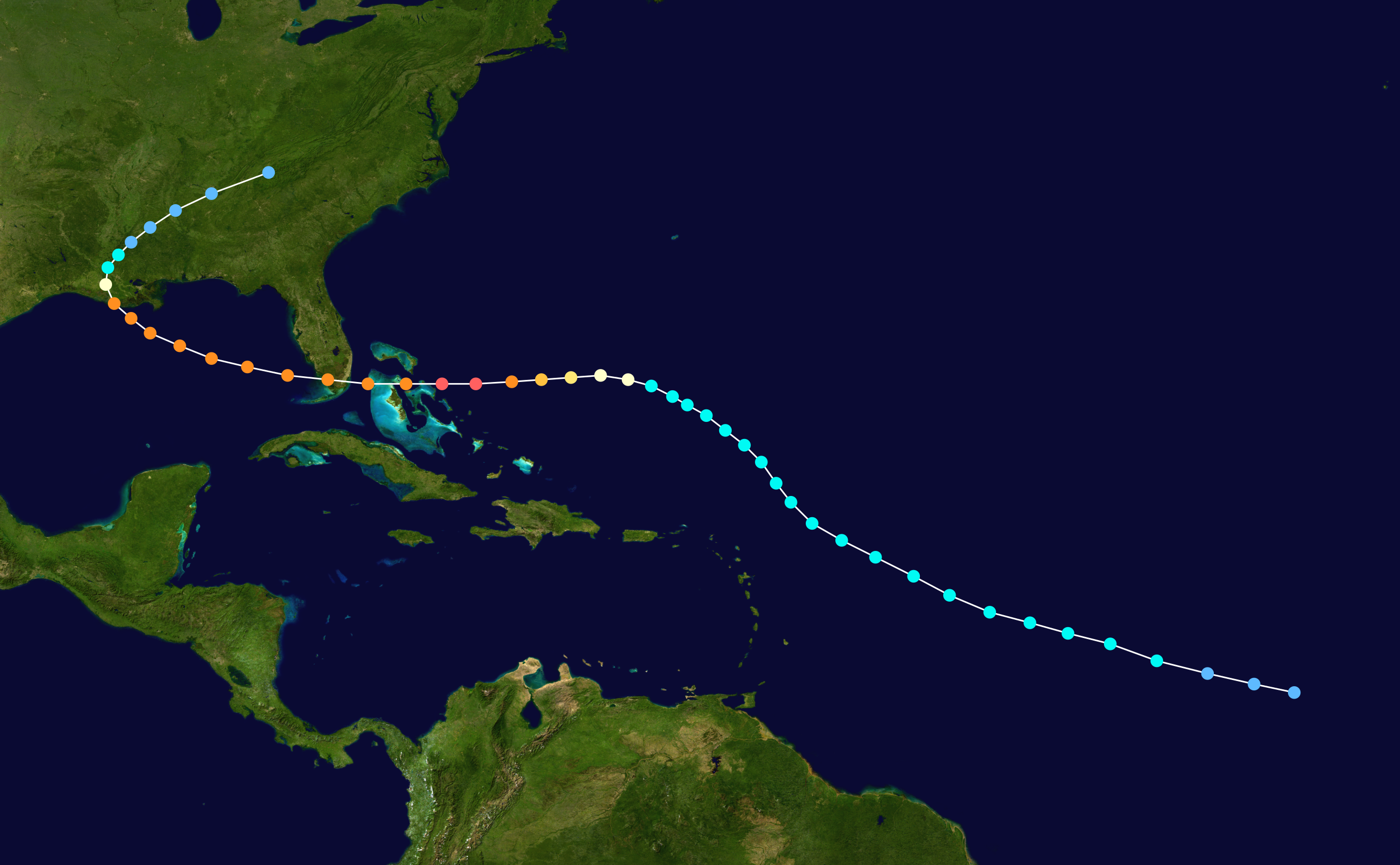
tgenius wrote:
Really not liking that Analog... though Irma is forecast to do that same WSW drop.
I think the other odd part about that track is the last half looks identical to Andrew...

Moderator: S2k Moderators

tgenius wrote:
Really not liking that Analog... though Irma is forecast to do that same WSW drop.

Michele B wrote:I've seen storms strengthen to unbelievable numbers way out to sea, and then weaken before getting close to the US mainland.
Would this one be inclined to do the same thing, I wonder?
Siker wrote:Size / intensity remind me of our last major in the MDR, Danny. Danny's small eye continued to clear out, bringing him near category 4 status. Of course, he was ripped apart by shear shortly after, which Irma should have no issues with.

KWT wrote:
The only difference is this is quite abit further north than this system, other then that the track is certainly one of the closer of the models.
Isabel and Ike both show us that even if this does end up curving to the NW like the GFS ensembles expect it could still be a threat to the states.
Aric Dunn wrote:KWT wrote:Aric Dunn wrote:Small core tiny pinhole eye well established CDO and outflow.. they are going to very likely sorely under estiamte the strength of it. They will follow their forecast irregardless.
Its got a great looking set-up, and the system is looking impressive at the moment with that small core and eye peaking through occasionally as well.
I suspect the next NHC forecast will show a peak of 115kts this time, I'm still thinking a cat-5 is possible out of this, only internal restructuring will probably stop that from happening.
Eye warming quite rapidly now. wont be long until we have a solid donut and major on our hands if this keeps up over the next 8 to 12 hours.
https://weather.msfc.nasa.gov/goes/abi/ ... Jd4tAF.jpg

RL3AO wrote:Raw ADT values jumping up very quickly now. Irma could easily be a major by tonight.
RL3AO wrote:Raw ADT values jumping up very quickly now. Irma could easily be a major by tonight.


SouthDadeFish wrote:RL3AO wrote:Raw ADT values jumping up very quickly now. Irma could easily be a major by tonight.
Irma might surpass Harvey's intensification rate if this keeps up. I just wonder how long it can keep it up with these SSTs. Raw ADT will probably shoot up to cat 4 soon though.


For later Tue into Wed, have some chc POPS, given that the
secondary cold front is to the west early, then the front may
stall out, given southwest flow aloft, as 594 heights off the
coast. Similar to 2011, with the upper level ridge off the
coast, so have to watch systems coming out of the tropics.
SouthDadeFish wrote:ADT is missing the eye. Otherwise values would likely be even higher.
SouthDadeFish wrote:The eye is clear on visible. The core of the TC is quite small at this time.
http://i.imgur.com/k2ouxZZ.gif

chris_fit wrote:FWIW no mention of Irma by Tampa, Melbourne, Miami, or Key West NWS - yet. Miami NWS expects a cold front to push through the area later next week.
KWT wrote:SouthDadeFish wrote:The eye is clear on visible. The core of the TC is quite small at this time.
http://i.imgur.com/k2ouxZZ.gif
Got a very organised core, and the eye really has cleared out rapidly, I wonder jsut how high the NHC will go in terms of intensity down the line, they've gotta go 115kts at least IMO based on current trend and organising. Nearly got a eye ringed by intense convection, something Harvey struggled with till it was a major hurricane.
Users browsing this forum: No registered users and 39 guests