ATL: IRMA - Post-Tropical - Discussion
Moderator: S2k Moderators
-
HarryPotter
- Tropical Low

- Posts: 26
- Age: 48
- Joined: Wed Aug 22, 2012 7:26 pm
- Location: Connecticut
Re: ATL: IRMA - Hurricane - Discussion
In regards to the insane GFS pressures, Ryan Maue has said a few times that since the GFS "upgrade" in July it has been way overblowing pressures. I believe he mentioned it was running around 20-40mb too low. Still....it hasn't been far enough off IMO. Beast!
0 likes
Gloria (85)
Typhoon Russ (90)
Super Typhoon Yuri (91)
Irene (11)
Sandy (12)
Disclaimer:
The posts in this forum are NOT official forecast and should not be used as such. They are just the opinion of the poster and may or may not be backed by sound meteorological data. For official information, please refer to the NHC and NWS products.
-
CrazyC83
- Professional-Met

- Posts: 34315
- Joined: Tue Mar 07, 2006 11:57 pm
- Location: Deep South, for the first time!
Re: ATL: IRMA - Hurricane - Discussion
What are the chances that Irma could go nuts and into Haiyan territory intensity-wise?
0 likes
-
FLeastcoast

- Tropical Depression

- Posts: 84
- Joined: Sun Sep 03, 2017 2:19 am
- Location: NE Florida
Re: ATL: IRMA - Hurricane - Discussion
EquusStorm wrote:Gatlinburg having been mentioned, I'm quite concerned about the potential impact at the national park in TN/NC; if the storm moves across central NC like some ensemble paths suspect, there would be a good bit of destructive wind there in the higher elevations. It is a gorgeous area. I know that Opal in 95 caused some pretty significant tree damage, knocking the top off the tallest tree east of the Rockies (was the only 200 foot tall tree on this half of the continent)
knoxville is where I am leaving to go to tomorrow. should I be safe from irma there??
2 likes

Re: ATL: IRMA - Hurricane - Discussion
Meteorcane wrote:kthmcc7319 wrote:Countrygirl911 wrote::double:
I have a bad feeling that she is not going to turn north and head straight into the GOM
I share your concern. I believe we saw it happen with Ivan and Katrina. They were forecasted to turn northward upon entering the GOM and "missed their turns."
NWP has improved leaps and bound since 2004/2005
That is true they have improved. BUT if I remember correctly, Irma was supposed to have turned to the north a few days ago and fish according to the models.,but they trended west for quite a few days. So we still have a 4 to 5 day track to watch and see if the hard right turn actually happens. I know the models have gotten kinda of an agreement but still days out. Imho
1 likes
-
Aric Dunn
- Category 5

- Posts: 21238
- Age: 43
- Joined: Sun Sep 19, 2004 9:58 pm
- Location: Ready for the Chase.
- Contact:
Re: ATL: IRMA - Hurricane - Discussion
Recon still showing pretty much the same strength... geezz.
0 likes
Note: If I make a post that is brief. Please refer back to previous posts for the analysis or reasoning. I do not re-write/qoute what my initial post said each time.
If there is nothing before... then just ask
Space & Atmospheric Physicist, Embry-Riddle Aeronautical University,
I believe the sky is falling...
If there is nothing before... then just ask
Space & Atmospheric Physicist, Embry-Riddle Aeronautical University,
I believe the sky is falling...

Re: ATL: IRMA - Hurricane - Discussion
wxmann_91 wrote:Langinbang187 wrote:RL3AO wrote:Looking at radar and recon, it appears that the inner eyewall has basically absorbed the outer eyewall. No real sign of an EWRC anymore.
Is this common? I honestly haven't heard of this ever before.
I've seen this happen in the WPAC before. I've noticed that the more favorable the environment, the more seamless the completion of the ERC will be. A long-running ERC is a symptom of something in the environment that is affecting the storm.
I have memories of Haiyan doing something similar. We saw the 2nd eyewall and thought it would weaken the storm before landfall and then all of a sudden they merged and it just kept its intensity.
0 likes
-
Aric Dunn
- Category 5
- Posts: 21238
- Age: 43
- Joined: Sun Sep 19, 2004 9:58 pm
- Location: Ready for the Chase.
- Contact:
Re: ATL: IRMA - Hurricane - Discussion
Hammy wrote:Aric Dunn wrote:if anyone is looking at radar and notice the eastern eyewall looks weak... well its just the radar ...
Mountain obstruction of the radar beam?
something.. you can see the two lines extending out to the NE
0 likes
Note: If I make a post that is brief. Please refer back to previous posts for the analysis or reasoning. I do not re-write/qoute what my initial post said each time.
If there is nothing before... then just ask
Space & Atmospheric Physicist, Embry-Riddle Aeronautical University,
I believe the sky is falling...
If there is nothing before... then just ask
Space & Atmospheric Physicist, Embry-Riddle Aeronautical University,
I believe the sky is falling...
-
CrazyC83
- Professional-Met
- Posts: 34315
- Joined: Tue Mar 07, 2006 11:57 pm
- Location: Deep South, for the first time!
Re: ATL: IRMA - Main Recon Thread (Data only)
000
URNT12 KNHC 060212
VORTEX DATA MESSAGE AL112017
A. 06/01:53:20Z
B. 17 deg 20 min N
060 deg 50 min W
C. 700 mb 2361 m
D. 143 kt
E. 206 deg 8 nm
F. 273 deg 125 kt
G. 206 deg 8 nm
H. 917 mb
I. 10 C / 3048 m
J. 22 C / 3056 m
K. 7 C / NA
L. CLOSED
M. C22
N. 12345 / 7
O. 0.02 / 1 nm
P. AF305 1111A IRMA OB 13
MAX OUTBOUND AND MAX FL WIND 163 KT 002 / 16 NM 01:59:30Z
CNTR DROPSONDE SFC WIND 175 / 17 KT
;
0 likes
-
Canelaw99

- S2K Supporter

- Posts: 2128
- Age: 49
- Joined: Tue Aug 31, 2004 8:27 am
- Location: Homestead, FL
Re: ATL: IRMA - Hurricane - Discussion
Weatherboy1 wrote:I had the opportunity to tour the NHC building at the open house they had this spring. Very cool experience, and that building is supposed to be able to handle almost anything.
I went to see it too! I was very impressed. My mom and I said tonight that's where we want to ride out the storm!
1 likes
-
Kingarabian

- S2K Supporter
- Posts: 16353
- Joined: Sat Aug 08, 2009 3:06 am
- Location: Honolulu, Hawaii
Re: ATL: IRMA - Hurricane - Discussion
Aric Dunn wrote:Recon still showing pretty much the same strength... geezz.
Interesting to know if Irma is the only system to ever maintain 185mph winds for this long.
2 likes
RIP Kobe Bryant
-
mrbagyo

- Category 5
- Posts: 3963
- Age: 33
- Joined: Thu Apr 12, 2012 9:18 am
- Location: 14.13N 120.98E
- Contact:
Re: ATL: IRMA - Hurricane - Discussion
Irma might wreck a lot of Marinas and yacht in the British Virgin Islands if it will be a direct hit. Irma will also potentially inflict huge damage in luxury cruise Tourism Industry in the Leeward Islands.
On a side note, the population center of Barbuda is inside of a lagoon on the west coast not facing the storm surge - wind and rain are the biggest threat to them.
On a side note, the population center of Barbuda is inside of a lagoon on the west coast not facing the storm surge - wind and rain are the biggest threat to them.
1 likes
The posts in this forum are NOT official forecast and should not be used as such. They are just the opinion of the poster and may or may not be backed by sound meteorological data. They are NOT endorsed by any professional institution or storm2k.org. For official information, please refer to RSMC, NHC and NWS products.
-
drewschmaltz
- S2K Supporter
- Posts: 351
- Joined: Thu Aug 27, 2015 8:19 pm
Re: ATL: IRMA - Hurricane - Discussion
CrazyC83 wrote:What are the chances that Irma could go nuts and into Haiyan territory intensity-wise?
I'm trying to understand this too, but as far as I can surmise, conditions will improve even more, especially around the time Irma turns North through the gulf (outflow, SST, shear) all improve at the same time. If there is little land interaction and Irma sustains category 5 status up until that point, I don't see why another 20mb drop and 20mph wind increase wouldn't be possible. We've seen what happens to storms in the FL straights. It ain't pretty. So, my totally novice opinion is that if there is little to no land interaction up until that north turn, we could be looking at the highest 1 min sustained winds in any basin at any time. However, I do believe that the land interaction is a big if. And, it's not a given. I just think it's in the cards. Until someone gives me a reason "why not".
0 likes
I HAVE ABSOLUTELY NO IDEA WHAT I'M TALKING ABOUT. PLEASE CONSULT SOMEONE WHO DOES. START WITH THE NHC. ALL POSTS ARE FOR ENTERTAINMENT PURPOSES ONLY.
Re: ATL: IRMA - Hurricane - Discussion
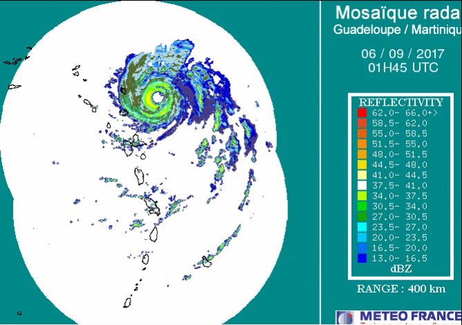
You can see the two eyewalls merging. Only the NE side shows a double wind maxima now.

3 likes

Re: ATL: IRMA - Hurricane - Discussion
FLeastcoast wrote:EquusStorm wrote:Gatlinburg having been mentioned, I'm quite concerned about the potential impact at the national park in TN/NC; if the storm moves across central NC like some ensemble paths suspect, there would be a good bit of destructive wind there in the higher elevations. It is a gorgeous area. I know that Opal in 95 caused some pretty significant tree damage, knocking the top off the tallest tree east of the Rockies (was the only 200 foot tall tree on this half of the continent)
knoxville is where I am leaving to go to tomorrow. should I be safe from irma there??
Well if you aren't we're all screwed.
8 likes
-
EquusStorm
- Category 5
- Posts: 1649
- Age: 35
- Joined: Thu Nov 07, 2013 1:04 pm
- Location: Jasper, AL
- Contact:
Re: ATL: IRMA - Hurricane - Discussion
Pretty sure Knoxville should be quite fine. Only the westernmost paths would cause any issues there, but I'm no expert.
Last edited by EquusStorm on Tue Sep 05, 2017 9:24 pm, edited 1 time in total.
1 likes
Colors of lost purpose on the canvas of irrelevance
Not a meteorologist, in fact more of an idiot than anything. You should probably check with the NHC or a local NWS office for official information.
Not a meteorologist, in fact more of an idiot than anything. You should probably check with the NHC or a local NWS office for official information.
-
johngaltfla

- Category 5
- Posts: 2073
- Joined: Sun Jul 10, 2005 9:17 pm
- Location: Sarasota County, FL
- Contact:
Re: ATL: IRMA - Hurricane - Discussion
BucMan2 wrote:If Irma comes up the spine of Fl, am I better off in Tampa or Orlando?
Looking for advice
No.
You need to get NW of both.
1 likes
-
CrazyC83
- Professional-Met
- Posts: 34315
- Joined: Tue Mar 07, 2006 11:57 pm
- Location: Deep South, for the first time!
Re: ATL: IRMA - Main Recon Thread (Data only)
000
URNT15 KNHC 060217
AF305 1111A IRMA HDOB 29 20170906
020830 1807N 06050W 6963 03076 9953 +098 +047 104101 103 072 004 00
020900 1809N 06050W 6973 03068 9963 +096 +045 104098 101 069 004 00
020930 1810N 06050W 6969 03081 9979 +089 +046 103094 097 066 004 00
021000 1812N 06050W 6961 03094 9996 +079 +049 104092 094 065 006 00
021030 1814N 06050W 6967 03093 0004 +078 +052 103087 090 062 007 00
021100 1816N 06051W 6973 03091 0005 +080 +053 105091 093 062 005 00
021130 1818N 06051W 6967 03104 0002 +089 +052 101091 092 060 004 00
021200 1820N 06051W 6967 03109 0009 +088 +052 099092 095 060 005 00
021230 1821N 06051W 6967 03114 0021 +083 +052 099081 089 057 005 00
021300 1823N 06051W 6967 03117 0019 +089 +052 098079 080 058 005 00
021330 1825N 06051W 6966 03126 0016 +095 +051 095081 082 056 004 00
021400 1827N 06051W 6967 03126 0022 +095 +051 093080 081 056 004 00
021430 1828N 06051W 6970 03124 0018 +099 +052 093076 077 055 005 00
021500 1830N 06051W 6968 03134 0027 +095 +052 095074 075 054 007 00
021530 1832N 06051W 6967 03138 0035 +091 +052 092076 077 052 007 00
021600 1834N 06051W 6969 03137 0029 +097 +051 092077 077 052 005 00
021630 1835N 06052W 6967 03142 0032 +100 +051 093078 078 053 004 00
021700 1837N 06052W 6968 03144 0035 +098 +051 093078 078 052 004 00
021730 1839N 06052W 6966 03148 0032 +101 +051 092079 079 051 003 00
021800 1841N 06052W 6968 03146 0037 +101 +051 092082 083 049 002 00
$$
;
0 likes
-
TheAustinMan

- Category 5
- Posts: 1060
- Joined: Mon Jul 08, 2013 4:26 pm
- Location: Central TX / United States
Re: ATL: IRMA - Hurricane - Discussion
A dropsonde in the northern eyewall sampled 161 kt instantaneous wind at the surface (where the pressure reading was 937 mb). At the 893 mb level, the reading was 184 knots.
3 likes
Treat my opinions with a grain of salt. For official information see your local weather service.
“It's tough to make predictions, especially about the future.”
“It's tough to make predictions, especially about the future.”
-
Aric Dunn
- Category 5
- Posts: 21238
- Age: 43
- Joined: Sun Sep 19, 2004 9:58 pm
- Location: Ready for the Chase.
- Contact:
Re: ATL: IRMA - Hurricane - Discussion
RL3AO wrote:You can see the two eyewalls merging. Only the NE side shows a double wind maxima now.
I dont think the NE outer is even there.. those radar interfernce is blocking most it.. you can see the lines going through it.
also.. better view..
http://barbadosweather.org/Composite/ki ... site=Sabre
1 likes
Note: If I make a post that is brief. Please refer back to previous posts for the analysis or reasoning. I do not re-write/qoute what my initial post said each time.
If there is nothing before... then just ask
Space & Atmospheric Physicist, Embry-Riddle Aeronautical University,
I believe the sky is falling...
If there is nothing before... then just ask
Space & Atmospheric Physicist, Embry-Riddle Aeronautical University,
I believe the sky is falling...
Re: ATL: IRMA - Hurricane - Discussion
161 kt surface winds. No reason not to keep it at 160 kts IMO.

2 likes
Who is online
Users browsing this forum: No registered users and 59 guests