

ATL: IRMA - Post-Tropical - Discussion
Moderator: S2k Moderators
-
KBBOCA
- S2K Supporter

- Posts: 1559
- Joined: Fri Sep 05, 2003 5:27 am
- Location: Formerly Boca Raton, often West Africa. Currently Charlotte NC
Re: ATL: IRMA - Hurricane - Discussion
https://twitter.com/MikeTheiss/status/906848170050818048
Mike TheissVerified account @MikeTheiss 3m
Eyewall and Storm Surge !! #HurricaneIrma #KeyWest
video
https://twitter.com/MikeTheiss/status/9 ... 0050818048
Mike TheissVerified account @MikeTheiss 3m
Eyewall and Storm Surge !! #HurricaneIrma #KeyWest
video
https://twitter.com/MikeTheiss/status/9 ... 0050818048
0 likes
-
KBBOCA
- S2K Supporter
- Posts: 1559
- Joined: Fri Sep 05, 2003 5:27 am
- Location: Formerly Boca Raton, often West Africa. Currently Charlotte NC
Re: ATL: IRMA - Hurricane - Discussion
Stu OstroVerified account @StuOstro 4m4 minutes ago
No other year in official records since 1851 http://bit.ly/1MaPQ9T w/two Cat 4 landfalls/hits in U.S. in same hurr. season #Harvey #Irma
No other year in official records since 1851 http://bit.ly/1MaPQ9T w/two Cat 4 landfalls/hits in U.S. in same hurr. season #Harvey #Irma
0 likes
Re: ATL: IRMA - Hurricane - Discussion
ZCZC MIATCPAT1 ALL
TTAA00 KNHC DDHHMM
BULLETIN
Hurricane Irma Intermediate Advisory Number 45A
NWS National Hurricane Center Miami FL AL112017
800 AM EDT Sun Sep 10 2017
...CENTER OF IRMA ABOUT TO MAKE LANDFALL IN THE LOWER FLORIDA
KEYS...
SUMMARY OF 800 AM EDT...1200 UTC...INFORMATION
----------------------------------------------
LOCATION...24.5N 81.5W
ABOUT 20 MI...30 KM ESE OF KEY WEST FLORIDA
ABOUT 110 MI...180 KM S OF NAPLES FLORIDA
MAXIMUM SUSTAINED WINDS...130 MPH...215 KM/H
PRESENT MOVEMENT...NNW OR 330 DEGREES AT 8 MPH...13 KM/H
MINIMUM CENTRAL PRESSURE...929 MB...27.43 INCHES
WATCHES AND WARNINGS
--------------------
CHANGES WITH THIS ADVISORY:
The Government of Cuba has discontinued the Hurricane Warning for
the Cuban provinces of Ciego de Avila, Sancti Spiritus, and Villa
Clara.
SUMMARY OF WATCHES AND WARNINGS IN EFFECT:
A Storm Surge Warning is in effect for...
* South Santee River southward to Jupiter Inlet
* North Miami Beach southward around the Florida peninsula to the
Ochlockonee River
* Florida Keys
* Tampa Bay
A Hurricane Warning is in effect for...
* Fernandina Beach southward around the Florida peninsula to Indian
Pass
* Florida Keys
* Lake Okeechobee
* Florida Bay
* Cuban provinces of Matanzas and La Habana
A Hurricane Watch is in effect for...
* North of Fernandina Beach to Edisto Beach
A Tropical Storm Warning is in effect for...
* West of Indian Pass to the Okaloosa/Walton County Line
* North of Fernandina Beach to South Santee River
A Tropical Storm Watch is in effect for...
* Bimini and Grand Bahama
A Storm Surge Warning means there is a danger of life-threatening
inundation, from rising water moving inland from the coastline,
during the next 36 hours in the indicated locations. For a
depiction of areas at risk, please see the National Weather
Service Storm Surge Watch/Warning Graphic, available at
hurricanes.gov. This is a life-threatening situation. Persons
located within these areas should take all necessary actions to
protect life and property from rising water and the potential for
other dangerous conditions. Promptly follow evacuation and other
instructions from local officials.
Interests elsewhere in Cuba and the southeastern United States
should monitor the progress of Irma.
For storm information specific to your area in the United
States, including possible inland watches and warnings, please
monitor products issued by your local National Weather Service
forecast office. For storm information specific to your area
outside the United States, please monitor products issued by your
national meteorological service.
DISCUSSION AND 48-HOUR OUTLOOK
------------------------------
At 800 AM EDT (1200 UTC), the center of Hurricane Irma was located
near latitude 24.5 North, longitude 81.5 West. Irma is moving toward
the north-northwest near 8 mph (13 km/h), and an increase in
forward speed is expected later today, with that motion continuing
through Monday. On the forecast track, the eye of Irma should move
over the Lower Florida Keys shortly, and then move near or over the
west coast of the Florida Peninsula later today through tonight.
Irma should then move inland over northern Florida and southwestern
Georgia Monday afternoon.
Maximum sustained winds are near 130 mph (215 km/h) with higher
gusts. Irma is a category 4 hurricane on the Saffir-Simpson
Hurricane Wind Scale. While weakening is forecast, Irma is expected
to remain a powerful hurricane while it moves through the Florida
Keys and near the west coast of Florida.
Hurricane-force winds extend outward up to 80 miles (130 km) from
the center and tropical-storm-force winds extend outward up to 220
miles (350 km). A wind gust to 89 mph (143 km/h) was recently
measured at the Key West National Weather Service Forecast Office.
Sustained winds of 46 mph (74 km/h) with a gust to 72 mph (117 km/h)
was recently reported at Tamiami Airport in West Kendall, Florida.
The estimated minimum central pressure is 929 mb (27.43 inches).
HAZARDS AFFECTING LAND
----------------------
STORM SURGE: The combination of a dangerous storm surge and the
tide will cause normally dry areas near the coast to be flooded by
rising waters moving inland from the shoreline. The water is
expected to reach the following HEIGHTS ABOVE GROUND if the peak
surge occurs at the time of high tide...
Cape Sable to Captiva...10 to 15 ft
Captiva to Ana Maria Island...6 to 10 ft
Card Sound Bridge through Cape Sable, including the Florida Keys...
5 to 10 ft
Ana Maria Island to Clearwater Beach, including Tampa Bay...
5 to 8 ft
North Miami Beach to Card Sound Bridge, including Biscayne Bay...
3 to 5 ft
South Santee River to Fernandina Beach...4 to 6 ft
Clearwater Beach to Ochlockonee River...4 to 6 ft
Fernandina Beach to Jupiter Inlet...2 to 4 ft
North of North Miami Beach to Jupiter Inlet...1 to 2 ft
The deepest water will occur along the immediate coast in areas of
onshore winds, where the surge will be accompanied by large and
destructive waves. Surge-related flooding depends on the relative
timing of the surge and the tidal cycle, and can vary greatly over
short distances. For information specific to your area, please see
products issued by your local National Weather Service forecast
office.
The combination of a life-threatening storm surge and large breaking
waves will raise water levels ABOVE NORMAL TIDE LEVELS by the
following amounts within the hurricane warning area near and to the
north of the center of Irma. Near the coast, the surge will be
accompanied by large and destructive waves.
Northern coast of Cuba in the warning area...5 to 10 ft
WIND: Hurricane conditions are expected to continue within the
hurricane warning area along the north coast of Cuba through
this morning. Hurricane conditions are spreading across portions of
the Florida Keys and southern Florida. Winds affecting the upper
floors of high-rise buildings will be significantly stronger than
those near ground level. Tropical storm and hurricane conditions
are expected to spread northward across the remainder of the warning
areas through Monday. Tropical storm conditions are possible in the
watch area in the Northwestern Bahamas today.
RAINFALL: Irma is expected to produce the following rain
accumulations through Wednesday:
Western Cuba...Additional 3 to 6 inches, isolated 10 inches.
Western Bahamas...Additional 2 to 4 inches, isolated 6 inches.
The Florida Keys...15 to 20 inches, isolated 25 inches.
The southern Florida peninsula...10 to 15 inches, isolated 20
inches.
The remainder of the Florida peninsula and southeast Georgia...8 to
12 inches, isolated 16 inches.
The rest of Georgia, eastern Florida Panhandle, southern and western
South Carolina, and western North Carolina...3 to 6 inches, isolated
10 inches.
Eastern Alabama and southern Tennessee...2 to 5 inches.
In all areas this rainfall may cause life-threatening flash floods
and, in some areas, mudslides.
TORNADOES: Tornadoes are possible through tonight, mainly across
southern, central, and eastern portions of the Florida Peninsula.
THE EYE: Do not venture outside when the calm eye of the hurricane
passes over, as dangerous winds will return very quickly when the
eye moves away.
SURF: Swells generated by Irma are affecting the southeast coast of
the United States. These swells are likely to cause life-
threatening surf and rip current conditions. Please consult
products from your local weather office.
NEXT ADVISORY
-------------
Next complete advisory at 1100 AM EDT.
$$
Forecaster Pasch
NNNN
0 likes
-
KBBOCA
- S2K Supporter
- Posts: 1559
- Joined: Fri Sep 05, 2003 5:27 am
- Location: Formerly Boca Raton, often West Africa. Currently Charlotte NC
Re: ATL: IRMA - Hurricane - Discussion
Michael VentriceVerified account @MJVentrice 3m3 minutes ago
Michael Ventrice Retweeted Philip Klotzbach
#HurricaneIrma now takes over 2nd place for the most accumulated cyclone energy in an Atlantic tropical cyclone on record.
Michael Ventrice Retweeted Philip Klotzbach
#HurricaneIrma now takes over 2nd place for the most accumulated cyclone energy in an Atlantic tropical cyclone on record.
0 likes

-
HenkL
- S2K Supporter
- Posts: 2401
- Joined: Fri Sep 10, 2004 5:33 pm
- Location: Groningen, The Netherlands
- Contact:
Re: ATL: IRMA - Main Recon Thread (Data only)
URNT12 KNHC 100920
VORTEX DATA MESSAGE AL112017
A. 10/08:56:40Z
B. 24 deg 05 min N
081 deg 24 min W
C. 700 mb 2470 m
D. 119 kt
E. 046 deg 9 nm
F. 128 deg 120 kt
G. 047 deg 13 nm
H. 929 mb
I. 11 C / 3063 m
J. 21 C / 3050 m
K. 13 C / NA
L. NA
M. C22
N. 1234 / 7
O. 0.02 / 1 nm
P. AF302 2911A IRMA OB 23
MAX FL WIND 120 KT 047 / 13 NM 08:46:00Z
CNTR DROPSONDE SFC WIND 190 / 8 KT
MAX FL TEMP 22 C 269 / 6 NM FROM FL CNTR
0 likes
-
KBBOCA
- S2K Supporter
- Posts: 1559
- Joined: Fri Sep 05, 2003 5:27 am
- Location: Formerly Boca Raton, often West Africa. Currently Charlotte NC
Re: ATL: IRMA - Hurricane - Discussion
Steve Bowen @SteveBowenWx 6m6 minutes ago
NOAA station at Virginia Key, Biscayne Bay, FL has unofficially set a new high water level (3.07'); surpassing Wilma (2.58'). #Irma
[plus surge chart]
https://twitter.com/SteveBowenWx/status/906848239114182662
NOAA station at Virginia Key, Biscayne Bay, FL has unofficially set a new high water level (3.07'); surpassing Wilma (2.58'). #Irma
[plus surge chart]
https://twitter.com/SteveBowenWx/status/906848239114182662
0 likes

Re: ATL: IRMA - Hurricane - Discussion
looks like key west may NARROWLY miss the eyewall, except maybe for the eastern quarter of the island
0 likes
-
KBBOCA
- S2K Supporter
- Posts: 1559
- Joined: Fri Sep 05, 2003 5:27 am
- Location: Formerly Boca Raton, often West Africa. Currently Charlotte NC
Re: ATL: IRMA - Hurricane - Discussion
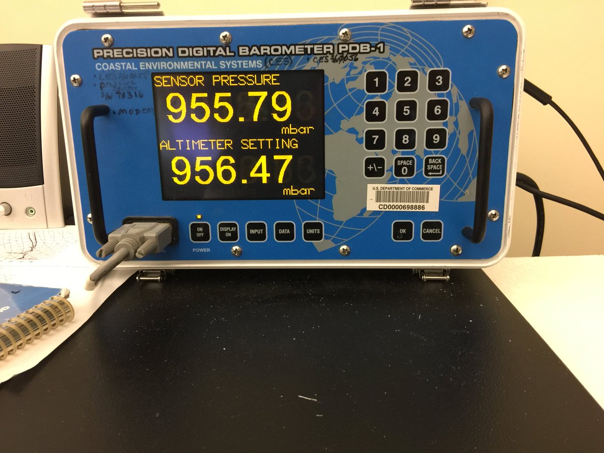
Mike TheissVerified account @MikeTheiss 4m4 minutes ago
958mb Barometric Pressure right now in #KeyWest We are getting pounded in western eyewall !!! #Irma
958mb Barometric Pressure right now in #KeyWest We are getting pounded in western eyewall !!! #Irma
0 likes
-
northjaxpro

- S2K Supporter
- Posts: 8900
- Joined: Mon Sep 27, 2010 11:21 am
- Location: Jacksonville, FL
Re: ATL: IRMA - Hurricane - Discussion
The center of the eye is moving in about 25 miles east of Key West.
0 likes
NEVER, EVER SAY NEVER in the tropics and weather in general, and most importantly, with life itself!!
________________________________________________________________________________________
Fay 2008 Beryl 2012 Debby 2012 Colin 2016 Hermine 2016 Julia 2016 Matthew 2016 Irma 2017 Dorian 2019
________________________________________________________________________________________
Fay 2008 Beryl 2012 Debby 2012 Colin 2016 Hermine 2016 Julia 2016 Matthew 2016 Irma 2017 Dorian 2019
-
johngaltfla

- Category 5

- Posts: 2073
- Joined: Sun Jul 10, 2005 9:17 pm
- Location: Sarasota County, FL
- Contact:
Re: ATL: IRMA - Hurricane - Discussion
Alyono wrote:looks like key west may NARROWLY miss the eyewall, except maybe for the eastern quarter of the island
Big Pine and Marathon didn't however. I worry about the 7 mile bridge now...
0 likes
Re: ATL: IRMA - Hurricane - Discussion
18 miles almost due east from Key West is the official coordinates for Irma at 8 AM.
0 likes
-
johngaltfla
- Category 5
- Posts: 2073
- Joined: Sun Jul 10, 2005 9:17 pm
- Location: Sarasota County, FL
- Contact:
Re: ATL: IRMA - Hurricane - Discussion
northjaxpro wrote:The center of the eye is moving in about 25 miles east of Key West.
Is it my imagination or is Irma following closer to the last GFS forecast track?
0 likes
-
KBBOCA
- S2K Supporter
- Posts: 1559
- Joined: Fri Sep 05, 2003 5:27 am
- Location: Formerly Boca Raton, often West Africa. Currently Charlotte NC
Re: ATL: IRMA - Hurricane - Discussion
NWS MiamiVerified account @NWSMiami 4m4 minutes ago
7:53 AM: Pompano Beach sustained wind 44 mph gusting to 58 mph. #HurrcaneIrma
Alex LamersVerified account @AlexJLamers 2m2 minutes ago
Alex Lamers Retweeted NWS WPC
Fort Pierce Airport 1″ rain in 10 min (3:53 to 4:03 AM). Other obs on FL east coast had 0.5″ in 5 min type rates.
7:53 AM: Pompano Beach sustained wind 44 mph gusting to 58 mph. #HurrcaneIrma
Alex LamersVerified account @AlexJLamers 2m2 minutes ago
Alex Lamers Retweeted NWS WPC
Fort Pierce Airport 1″ rain in 10 min (3:53 to 4:03 AM). Other obs on FL east coast had 0.5″ in 5 min type rates.
0 likes
-
KBBOCA
- S2K Supporter
- Posts: 1559
- Joined: Fri Sep 05, 2003 5:27 am
- Location: Formerly Boca Raton, often West Africa. Currently Charlotte NC
Re: ATL: IRMA - Hurricane - Discussion
NWS Key WestVerified account @NWSKeyWest 2m2 minutes ago
8AM: Pressure continues to drop as the eye of #Irma moves into the Lower Keys.
8AM: Pressure continues to drop as the eye of #Irma moves into the Lower Keys.
0 likes
Re: ATL: IRMA - Hurricane - Discussion
Key West Airport no longer reporting wind measurements, pressure down to 953mb.
0 likes
-
KBBOCA
- S2K Supporter
- Posts: 1559
- Joined: Fri Sep 05, 2003 5:27 am
- Location: Formerly Boca Raton, often West Africa. Currently Charlotte NC
Re: ATL: IRMA - Hurricane - Discussion
https://twitter.com/ericfisher/status/9 ... 6299457537
Eric FisherVerified account @ericfisher 2m2 minutes ago
Here's a look at how far out winds 58mph+ (yellow) and hurricane force winds 74mph+ (orange) extend from #Irma

Eric FisherVerified account @ericfisher 2m2 minutes ago
Here's a look at how far out winds 58mph+ (yellow) and hurricane force winds 74mph+ (orange) extend from #Irma
0 likes
-
tolakram
- Admin

- Posts: 20179
- Age: 62
- Joined: Sun Aug 27, 2006 8:23 pm
- Location: Florence, KY (name is Mark)
Re: ATL: IRMA - Hurricane - Discussion
Ok, twitter posts will auto post the twitter link under the post so we don't have top copy it. Why did I not do this sooner?
10 likes
M a r k
- - - - -
Join us in chat: Storm2K Chatroom Invite. Android and IOS apps also available.
The posts in this forum are NOT official forecasts and should not be used as such. Posts are NOT endorsed by any professional institution or STORM2K.org. For official information and forecasts, please refer to NHC and NWS products.
Who is online
Users browsing this forum: No registered users and 30 guests