ATL: IRMA - Post-Tropical - Discussion
Moderator: S2k Moderators
-
CaptinCrunch

- S2K Supporter

- Posts: 8747
- Age: 57
- Joined: Mon Nov 03, 2003 4:33 pm
- Location: Kennedale, TX (Tarrant Co.)
Re: ATL: IRMA - Hurricane - Discussion
Naples still looks like ground zero for next landfall
2 likes
-
Sciencerocks
- Category 5

- Posts: 10180
- Age: 39
- Joined: Thu Jul 06, 2017 1:51 am
Re: ATL: IRMA - Main Recon Thread (Data only)
000
URNT15 KNHC 101522
AF306 3011A IRMA HDOB 36 20170910
151300 2521N 08154W 6967 02857 9672 +136 +095 061069 071 052 004 00
151330 2523N 08155W 6970 02863 9692 +126 +108 062064 067 052 004 00
151400 2524N 08157W 6969 02878 9706 +124 +109 062061 063 050 005 00
151430 2525N 08158W 6967 02889 9719 +120 +113 060057 059 051 005 00
151500 2526N 08200W 6964 02901 9732 +118 +109 060054 056 050 006 00
151530 2528N 08201W 6967 02903 9743 +113 +112 062053 056 050 007 00
151600 2529N 08203W 6970 02906 9757 +108 +108 065052 054 051 007 03
151630 2530N 08204W 6967 02917 9759 +114 +113 066052 054 052 007 03
151700 2532N 08206W 6965 02923 9769 +119 +119 074051 053 053 008 03
151730 2533N 08208W 6971 02924 9790 +119 +119 079058 062 057 009 00
151800 2535N 08209W 6969 02929 9797 +121 +121 082062 065 060 011 03
151830 2536N 08211W 6962 02947 9795 +122 +122 080065 070 058 011 00
151900 2538N 08212W 6980 02933 9789 +122 +122 083065 069 060 009 00
151930 2539N 08214W 6972 02949 9797 +120 +120 080063 067 059 009 00
152000 2540N 08216W 6961 02967 9818 +118 +118 088069 077 060 008 00
152030 2542N 08217W 6971 02963 9840 +119 +119 085076 079 062 014 00
152100 2544N 08219W 6974 02969 9851 +120 +120 081072 078 062 014 03
152130 2545N 08221W 6962 02991 9859 +117 +117 078068 072 /// /// 03
152200 2546N 08222W 6966 02991 9868 +115 +115 076069 071 057 012 03
152230 2548N 08224W 6974 02991 9881 +113 //// 070071 072 060 010 05
$$
;
0 likes
-
KBBOCA
- S2K Supporter
- Posts: 1559
- Joined: Fri Sep 05, 2003 5:27 am
- Location: Formerly Boca Raton, often West Africa. Currently Charlotte NC
Re: ATL: IRMA - Hurricane - Discussion
Stu OstroVerified account @StuOstro 2m2 minutes ago
Coastal flooding in Miami area increasing as strong onshore winds continue with #Irma and astronomical high tide approaches
Coastal flooding in Miami area increasing as strong onshore winds continue with #Irma and astronomical high tide approaches
0 likes
-
ObsessedMiami

- Category 1

- Posts: 432
- Joined: Tue Aug 31, 2004 8:08 pm
- Location: West Kendall, Fl
Re: ATL: IRMA - Hurricane - Discussion
Michele B wrote:gatorcane wrote:LarryWx wrote:Indeed, she has been moving east of her projected 11PM and 5AM NHC paths. Is the further east track of the Ukmet vs the other 3 major models at 0Z or at least the somewhat more east 0Z GFS going to end up with a win? I'm now leaning toward the 0Z Euro verifying too far west and Irma making actual landfall somewhere in SW FL as opposed to the runs that had her only skirting the SW coast.This also means a harder hit on SE FL and further up FL. Anyone else's opinion about this and how she has been moving?
Yes more east. I think folks in metro SE Florida are getting quite surprised
Well, they're mostly getting surprised by the fact that this thing has pummeled them! They thought since it was west, they were going to get nothing!
This is what happens when you're not familiar with hurricanes.
Also - and I think this is going to become my PERSONAL CAMPAIGN....the "line" that shows the track of the hurricane should be waaay THICKER. The "cone" does not show people how large a storm is. It just says, "Might come in somewhere in the cone...."
But the "line" makes people complacent. They see the "line" waaay over on top of I-75, or 41, so they think that's the only place where effects will be felt. That needs to change to educate people better.
Actually the wind field projections from the NWS and NHC are what caused SEFL people to be surprised by the intensity exhibited this morning. But, please, continue your personal campaign to better us yokels.
0 likes
-
StormingB81

- S2K Supporter
- Posts: 5676
- Age: 44
- Joined: Thu Aug 27, 2009 1:45 am
- Location: Rockledge, Florida
Re: ATL: IRMA - Hurricane - Discussion
CaptinCrunch wrote:Naples still looks like ground zero for next landfall
I wouldnt doubt East of Marco Island
0 likes

Re: ATL: IRMA - Hurricane - Discussion
Product: Air Force Vortex Message (URNT12 KNHC)
A. Time of Center Fix: 10th day of the month at 15:06:20Z
B. Center Fix Coordinates: 25°03'N 81°35'W (25.05N 81.5833W)
D. Estimated (by SFMR or visually) Maximum Surface Wind Inbound: 82kts (~ 94.4mph)
E. Location of the Estimated Maximum Surface Wind Inbound: 14 nautical miles (16 statute miles) to the SE (139°) of center fix
F. Maximum Flight Level Wind Inbound: From 229° at 100kts (From the SW at ~ 115.1mph)
G. Location of Maximum Flight Level Wind Inbound: 14 nautical miles (16 statute miles) to the SE (139°) of center fix
H. Minimum Sea Level Pressure: 934mb (27.58 inHg)
I. Maximum Flight Level Temp & Pressure Altitude Outside Eye: 14°C (57°F) at a pressure alt. of 3,064m (10,052ft)
J. Maximum Flight Level Temp & Pressure Altitude Inside Eye: 19°C (66°F) at a pressure alt. of 3,048m (10,000ft)
K. Dewpoint Temp (collected at same location as temp inside eye): 13°C (55°F)
L. Eye Character: Open in the south, S
M. Eye Shape: Not Available
Remarks Section:
Maximum Flight Level Wind: 100kts (~ 115.1mph) which was observed 14 nautical miles (16 statute miles) to the SE (139°) from the flight level center at 15:02:00Z
0 likes
-
PandaCitrus
- Category 1
- Posts: 424
- Joined: Mon Sep 04, 2017 2:44 pm
Re: ATL: IRMA - Hurricane - Discussion
If the 93 mph gust reported at MIA is true, that's insane. I just googled to cheack and Hurricane Andrew which landfalled only 25 miles south gave MIA a peak 94 mph gust.
0 likes
-
GeneratorPower

- S2K Supporter
- Posts: 1648
- Age: 45
- Joined: Sun Dec 18, 2005 11:48 pm
- Location: Huntsville, AL
Re: ATL: IRMA - Hurricane - Discussion
CaptinCrunch wrote:Naples still looks like ground zero for next landfall
Here in Fort Myers we have lost a few trees so far. Power still on but flickers. This is gonna be bad for those in surge areas. We are nowhere near.
2 likes
-
KBBOCA
- S2K Supporter
- Posts: 1559
- Joined: Fri Sep 05, 2003 5:27 am
- Location: Formerly Boca Raton, often West Africa. Currently Charlotte NC
Re: ATL: IRMA - Hurricane - Discussion
Remembering all those suffering in the Islands in the wake of Irma...
CNN has drone footage from Tortola. Wow.
https://twitter.com/CNN/status/906701578777841669
CNN has drone footage from Tortola. Wow.
https://twitter.com/CNN/status/906701578777841669
0 likes
-
weathaguyry

- Category 5
- Posts: 1273
- Age: 22
- Joined: Wed Jun 15, 2016 5:16 am
- Location: Long Island, NY
Re: ATL: IRMA - Hurricane - Discussion
It's just horrible and disturbing to see the footage from this storm, my prayers are out for every single person being affected by this storm. This hurricane season is shaping up to be a brutal one, as right now we are witnessing history unfolding right before our eyes.
4 likes
My posts are only my opinions and NOT official forecasts. For official forecasts, consult the National Hurricane Center or the National Weather Service.
Irene 11', Sandy 12', Fay 20’, Isaias 20’, Elsa 21’, Henri 21’, Ida 21’
Irene 11', Sandy 12', Fay 20’, Isaias 20’, Elsa 21’, Henri 21’, Ida 21’
-
ConvergenceZone
.gif)
- Category 5
- Posts: 5241
- Joined: Fri Jul 29, 2005 1:40 am
- Location: Northern California
Re: ATL: IRMA - Hurricane - Discussion
I think this will still be around 100mph by the time it reaches the Tampa area
1 likes
Re: ATL: IRMA - Hurricane - Discussion
Michele B wrote:PandaCitrus wrote:It'll be interesting to see what Irma does as she approaches Marco Island. If the pattern of Cuba holds, she will feel the friction of land, slow down a little, and then bounce around Marco and hug the coast of Naples going NNW for a bit.
Charley also did this and bounced around Captiva.
Yeah, she doesn't like land, that's for sure!
But how long can she fight the effects of the trough trying to pull her eastward?
I'm gonna sounds NUTS here, but it's almost like she KNOWS if she goes inland, she dies. Like a survival instinct.
Yes and her buddy Jose seems to be the same way.
1 likes
-
Rail Dawg
- S2K Supporter
- Posts: 326
- Joined: Mon Aug 27, 2012 5:02 pm
- Location: Where the eye makes landfall.
Re: ATL: IRMA - Hurricane - Discussion
Reporting live from Naples!
The gusts are really starting to pick up.
I think we're going to see blue sky as the eye passes in 4-5 hours.
Power out.
Not sure how long cell coverage will last.
The gusts are really starting to pick up.
I think we're going to see blue sky as the eye passes in 4-5 hours.
Power out.
Not sure how long cell coverage will last.
5 likes
Although I have been a hurricane forecaster since 1980 that only means I've been wrong lots of times.

-
weathaguyry
- Category 5
- Posts: 1273
- Age: 22
- Joined: Wed Jun 15, 2016 5:16 am
- Location: Long Island, NY
Re: ATL: IRMA - Hurricane - Discussion
utweather wrote:Michele B wrote:PandaCitrus wrote:It'll be interesting to see what Irma does as she approaches Marco Island. If the pattern of Cuba holds, she will feel the friction of land, slow down a little, and then bounce around Marco and hug the coast of Naples going NNW for a bit.
Charley also did this and bounced around Captiva.
Yeah, she doesn't like land, that's for sure!
But how long can she fight the effects of the trough trying to pull her eastward?
I'm gonna sounds NUTS here, but it's almost like she KNOWS if she goes inland, she dies. Like a survival instinct.
Yes and her buddy Jose seems to be the same way.
I remember Matthew being like that
0 likes
My posts are only my opinions and NOT official forecasts. For official forecasts, consult the National Hurricane Center or the National Weather Service.
Irene 11', Sandy 12', Fay 20’, Isaias 20’, Elsa 21’, Henri 21’, Ida 21’
Irene 11', Sandy 12', Fay 20’, Isaias 20’, Elsa 21’, Henri 21’, Ida 21’
Re: ATL: IRMA - Hurricane - Discussion
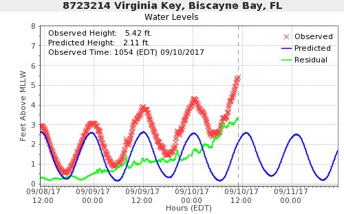
Seeing on WSVN right now Brickell Avenue is completely submerged although power is still on...water almost to the top of the steps in some of the high rises
Last edited by caneseddy on Sun Sep 10, 2017 10:32 am, edited 2 times in total.
1 likes

Re: ATL: IRMA - Hurricane - Discussion
Rail Dawg wrote:Reporting live from Naples!
The gusts are really starting to pick up.
I think we're going to see blue sky as the eye passes in 4-5 hours.
Power out.
Not sure how long cell coverage will last.
Stay safe RailDawg. Prayers from Splendora
2 likes
Alicia, Rita, Ike, Harvey and Beryl...moved to Splendora lol
-
stormreader
Re: ATL: IRMA - Hurricane - Discussion
CaptinCrunch wrote:Naples still looks like ground zero for next landfall
Yes sir! Looks like landfall coming up at Naples.
1 likes

Re: ATL: IRMA - Hurricane - Discussion
East Polk County here, just had a tornado warning, a squall line just came through. Getting windier...Power still on.
1 likes
-
KBBOCA
- S2K Supporter
- Posts: 1559
- Joined: Fri Sep 05, 2003 5:27 am
- Location: Formerly Boca Raton, often West Africa. Currently Charlotte NC
Re: ATL: IRMA - Hurricane - Discussion
wxman57 wrote:Just finished the Irma advisory. I think the NHC track is a good bit too far west. Center may move inland south of Naples this afternoon, barring any west wobble.
Any of you have a link to any live webcams that are still working? Anything from the chasers? Haven't had a chance to look around.
Mark Sudduth apparently has a stream going from Marco Island, but I'm not a subscriber / don't have link
1 likes
Who is online
Users browsing this forum: No registered users and 27 guests