Aric Dunn wrote:CrazyC83 wrote:1900hurricane wrote:I'm skeptical for now. There's a pretty big difference between the eyewall radii, so the outer would probably have to contract quite a bit, which takes time. I've been surprised before though.
Irma never weakened at all during its first big ERC as a cat 5 - all it did was knock the pressure back some and enlarge it. Doing the same here brings it down to 890 or so.
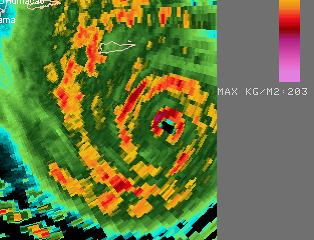
the outer eye is pretty much closed now.. lets see if it begins to contract soon.. HArvey's happened in about 4 to 6 hours. IRMA's were even faster.
Is this a better or worst scenario for PR right now?