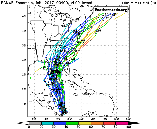
caneman wrote:Mother f'er on that Euro run. While not a landfall in Tampa Bay that run would push up lots of water and depending how strong and or close could cause power outages. Was without power with Irma for 5 days and there are still large amounts of areas that still don't have big debris piles fencing, trees, branches etc picked up. County not doing a good job.
Even if it does track closer to you as the Euro is still the eastern outlier, indications are it will still be not all that strong- t.s or weak and small cat 1. A storm that small and weak won't have catastrophic effects.