Central Subtropical Atlantic Low (is Invest 91L)
Moderator: S2k Moderators
Forum rules
The posts in this forum are NOT official forecasts and should not be used as such. They are just the opinion of the poster and may or may not be backed by sound meteorological data. They are NOT endorsed by any professional institution or STORM2K. For official information, please refer to products from the National Hurricane Center and National Weather Service.
- Blown Away
- S2K Supporter
- Posts: 9876
- Joined: Wed May 26, 2004 6:17 am
Central Subtropical Atlantic Low (is Invest 91L)
https://twitter.com/MJVentrice/status/915874008754769920
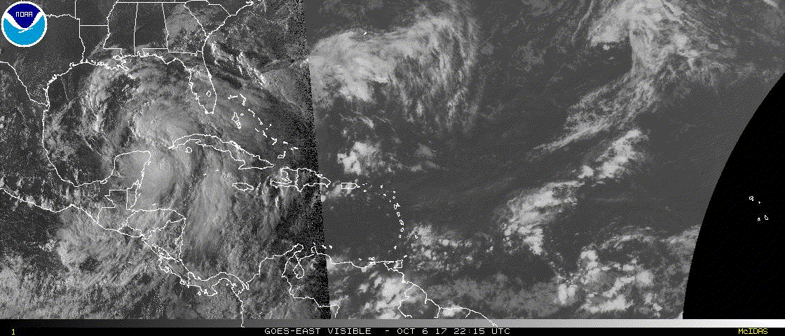
Low pressure in Central Atlantic... Just a feature to watch
0 likes
Hurricane Eye Experience: David 79, Irene 99, Frances 04, Jeanne 04, Wilma 05... EYE COMING MY WAY IN 2024…
Hurricane Brush Experience: Andrew 92, Erin 95, Floyd 99, Matthew 16, Irma 17, Ian 22, Nicole 22…
- CyclonicFury
- Category 5
- Posts: 1977
- Age: 25
- Joined: Sun Jul 02, 2017 12:32 pm
- Location: NC
- Contact:
Re: Central Subtropical Atlantic Low
00z GFS seems to develop this by Sunday.
0 likes
NCSU B.S. in Meteorology Class of 2021. Tropical weather blogger at http://www.cyclonicfury.com. My forecasts and thoughts are NOT official, for official forecasts please consult the National Hurricane Center.
-
- Admin
- Posts: 19183
- Age: 61
- Joined: Sun Aug 27, 2006 8:23 pm
- Location: Florence, KY (name is Mark)
Re: Central Subtropical Atlantic Low
ZCZC MIATWOAT ALL
TTAA00 KNHC DDHHMM
Tropical Weather Outlook
NWS National Hurricane Center Miami FL
800 AM EDT Fri Oct 6 2017
For the North Atlantic...Caribbean Sea and the Gulf of Mexico:
The National Hurricane Center is issuing advisories on Tropical
Storm Nate, located over the northwestern Caribbean Sea.
1. A non-tropical area of low pressure is forecast to form along a
frontal boundary about 800 miles southwest of the Azores on
Saturday. Environmental conditions suggest the low will then
acquire some tropical or subtropical characteristics, and a
tropical or subtropical cyclone could form early next week. The low
is forecast to drift over the northeastern Atlantic for the next
several days.
* Formation chance through 48 hours...low...10 percent.
* Formation chance through 5 days...medium...40 percent.
Forecaster Blake
1 likes
M a r k
- - - - -
Join us in chat: Storm2K Chatroom Invite. Android and IOS apps also available.
The posts in this forum are NOT official forecasts and should not be used as such. Posts are NOT endorsed by any professional institution or STORM2K.org. For official information and forecasts, please refer to NHC and NWS products.
- Vince_and_Grace_fan
- Category 1
- Posts: 315
- Joined: Thu Nov 03, 2016 9:25 am
- Location: Szombathely (Hungary)
Re: Central Subtropical Atlantic Low
The GEM now brings it very near to Spain as a transitioning cyclone, and at the end of the run shows another tropical cyclone close to Europe.
According to the GFS, the cyclone will be blocked south of the Azores and turns southwestward with fast weakening.
1 likes
Re: Central Subtropical Atlantic Low
Vince_and_Grace_fan wrote:The GEM now brings it very near to Spain as a transitioning cyclone, and at the end of the run shows another tropical cyclone close to Europe.
Neat, seems like we may have a Vince analog on our hands if it doesn't get blocked out.
0 likes
- CyclonicFury
- Category 5
- Posts: 1977
- Age: 25
- Joined: Sun Jul 02, 2017 12:32 pm
- Location: NC
- Contact:
Re: Central Subtropical Atlantic Low
Storms in this region of the Atlantic have always been my favorite. Decent chance this becomes TS/SS Ophelia by Sunday or Monday. Whether it is classified or not will depend greatly on where it can develop sustained deep convection around its center.
0 likes
NCSU B.S. in Meteorology Class of 2021. Tropical weather blogger at http://www.cyclonicfury.com. My forecasts and thoughts are NOT official, for official forecasts please consult the National Hurricane Center.
-
- Category 5
- Posts: 7314
- Age: 38
- Joined: Thu Jul 06, 2017 1:51 am
Re: Central Subtropical Atlantic Low
Convection has increased with this...Chances for development are going up.
0 likes
-
- Category 5
- Posts: 2672
- Joined: Tue Jun 29, 2010 6:46 am
Re: Central Subtropical Atlantic Low
1. A non-tropical area of low pressure is located about 700 miles
southwest of the Azores. This system is beginning to acquire
subtropical characteristics, and environmental conditions are
expected to be conducive for the development of a tropical or
subtropical cyclone during the next day or so while the low drifts
toward the southwest. Thereafter, the atmosphere is expected to
become hostile for further development.
* Formation chance through 48 hours...high...70 percent.
* Formation chance through 5 days...high...70 percent.
0 likes
-
- Admin
- Posts: 19183
- Age: 61
- Joined: Sun Aug 27, 2006 8:23 pm
- Location: Florence, KY (name is Mark)
Re: Central Subtropical Atlantic Low
Is Invest 91L viewtopic.php?f=59&t=119303
0 likes
M a r k
- - - - -
Join us in chat: Storm2K Chatroom Invite. Android and IOS apps also available.
The posts in this forum are NOT official forecasts and should not be used as such. Posts are NOT endorsed by any professional institution or STORM2K.org. For official information and forecasts, please refer to NHC and NWS products.
- - - - -
Join us in chat: Storm2K Chatroom Invite. Android and IOS apps also available.
The posts in this forum are NOT official forecasts and should not be used as such. Posts are NOT endorsed by any professional institution or STORM2K.org. For official information and forecasts, please refer to NHC and NWS products.