supercane4867 wrote:The SPAC paper mentioned in earlier posts is now freely accessible ...
Where?
Moderator: S2k Moderators


supercane4867 wrote:The SPAC paper mentioned in earlier posts is now freely accessible ...

404UserNotFound wrote:supercane4867 wrote:The SPAC paper mentioned in earlier posts is now freely accessible ...
Where?


Alyono wrote:supercane4867 wrote:I think the most important takeaway from recon observation of CAT5s in recent years is that the flight level to surface wind relationship is more complex than we thought.
It's not more complex. The Black et al paper gave a range of reduction factors from 700mb to the surface of .6 to 1.2. What we've been able to tell conclusively in the past couple of years with a relatively large dataset is that for storms in the deep tropics, or moving westward under a strong ridge in a purely barotropic environment (and not undergoing an EWRC), the surface winds are usually equal to or greater than the flight level winds.
This is why I believe Andrew was 170 kts at landfall, not the 145 that reanalysis found (the initial 25 kts failed almost any basic science test as a gradient wind analysis found winds at 140 kts)
mrbagyo wrote:Alyono wrote:supercane4867 wrote:I think the most important takeaway from recon observation of CAT5s in recent years is that the flight level to surface wind relationship is more complex than we thought.
It's not more complex. The Black et al paper gave a range of reduction factors from 700mb to the surface of .6 to 1.2. What we've been able to tell conclusively in the past couple of years with a relatively large dataset is that for storms in the deep tropics, or moving westward under a strong ridge in a purely barotropic environment (and not undergoing an EWRC), the surface winds are usually equal to or greater than the flight level winds.
This is why I believe Andrew was 170 kts at landfall, not the 145 that reanalysis found (the initial 25 kts failed almost any basic science test as a gradient wind analysis found winds at 140 kts)
I think the forgotten brother of Super Typhoon Tip 1979 would qualify based on your criteria.
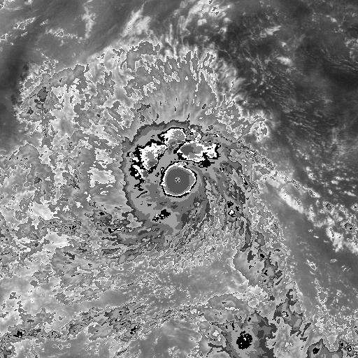
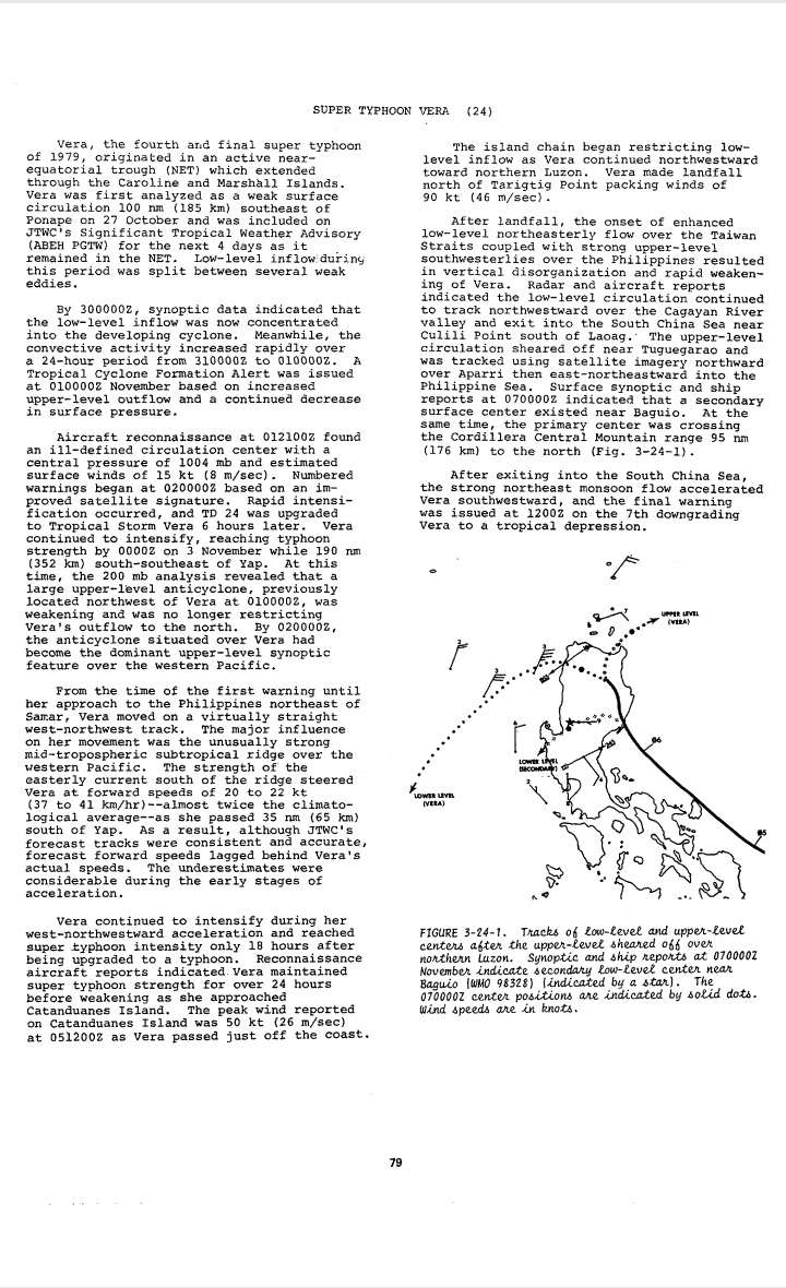
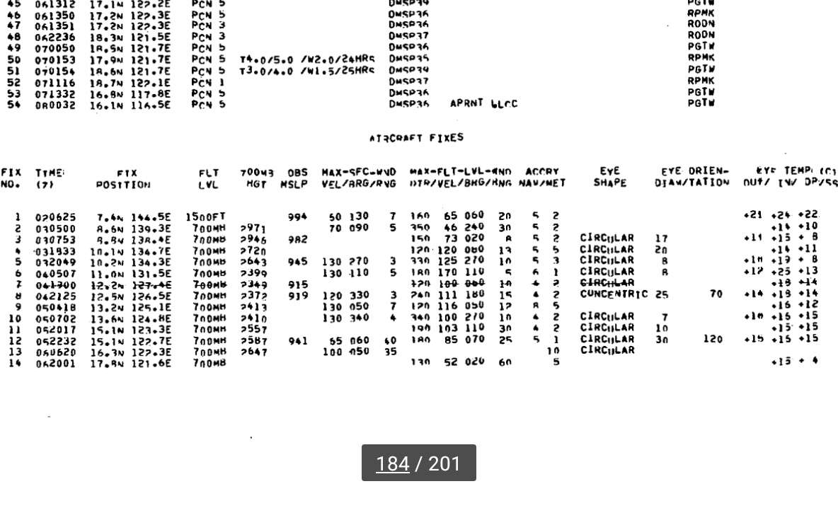
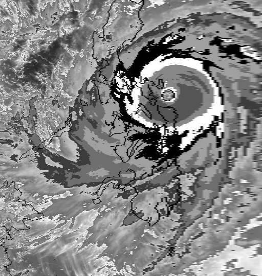
Typhoon Vera was a classic WPAC November sprinter at times moving at a forward speed between 37 to 41 kph (as noted on ATCR). Max flight level wind of 170 knots was also observed when it was undergoing RI about 1 hour before this BD enhanced ir image was taken.
Minimum pressure was quite high at 915 mb ( but still lower than Andrew and almost the same as Irma)
Official intensity per ATCR is "only" at 140 knots
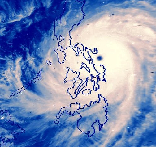
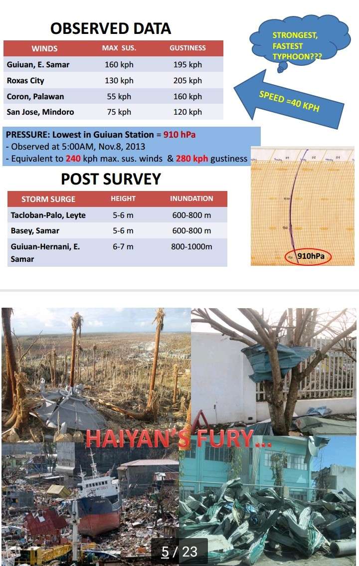

mrbagyo wrote:Just read the Kubota, Cayanan et al paper regarding Super Typhoon Haiyan (Yolanda). Whoah
[img]---[/img]
The lowest VERIFIED, observed pressure (Station pressure) in Guiuan was 910 mb. The Guiuan doppler radar measured winds in excess of 100m/s or 360kph.

mrbagyo wrote:Just read the Kubota, Cayanan et al paper regarding Super Typhoon Haiyan (Yolanda). Whoah
The lowest VERIFIED, observed pressure (Station pressure) in Guiuan was 910 mb. The Guiuan doppler radar measured winds in excess of 100m/s or 360kph.
mrbagyo wrote:Just read the Kubota, Cayanan et al paper regarding Super Typhoon Haiyan (Yolanda). Whoah
The lowest VERIFIED, observed pressure (Station pressure) in Guiuan was 910 mb. The Guiuan doppler radar measured winds in excess of 100m/s or 360kph.
xtyphooncyclonex wrote:mrbagyo wrote:Just read the Kubota, Cayanan et al paper regarding Super Typhoon Haiyan (Yolanda). Whoah
The lowest VERIFIED, observed pressure (Station pressure) in Guiuan was 910 mb. The Guiuan doppler radar measured winds in excess of 100m/s or 360kph.
Meanwhile, Joe Bastardi and Anthony Watts insist Typhoon Haiyan was just pure hype and was "just a cat 5 with 140-145 kt winds." They have probably never heard of the Japanese Koba Scale, which equates CI8.0 to 122 kts, which is the absolute limit of their scale. Wonder how tip got 140 kts, btw... One thing's for sure: RMW and pressure gradient were extremely tight in the case of Haiyan
I'm going to be extremely frank and say the following
(1) Let's not take these two seriously at all
(2) Abolish the Koba scale, or even the JMA being RSMC (maintain 10-min winds with another agency if otherwise)
(3) Propose talks among member countries and WMO to begin reconnaisance flights over the West Pacific
Alyono wrote:xtyphooncyclonex wrote:mrbagyo wrote:Just read the Kubota, Cayanan et al paper regarding Super Typhoon Haiyan (Yolanda). Whoah
The lowest VERIFIED, observed pressure (Station pressure) in Guiuan was 910 mb. The Guiuan doppler radar measured winds in excess of 100m/s or 360kph.
Meanwhile, Joe Bastardi and Anthony Watts insist Typhoon Haiyan was just pure hype and was "just a cat 5 with 140-145 kt winds." They have probably never heard of the Japanese Koba Scale, which equates CI8.0 to 122 kts, which is the absolute limit of their scale. Wonder how tip got 140 kts, btw... One thing's for sure: RMW and pressure gradient were extremely tight in the case of Haiyan
I'm going to be extremely frank and say the following
(1) Let's not take these two seriously at all
(2) Abolish the Koba scale, or even the JMA being RSMC (maintain 10-min winds with another agency if otherwise)
(3) Propose talks among member countries and WMO to begin reconnaisance flights over the West Pacific
Bastardi does not know what he's talking about in this case. No other way to put it. There is ZERO objective data to say that Haiyan was 140-145 kts. Absolutely zero. If he insists upon that, I will question his credentials as a scientist. We has Megi, which had LOWER Dvorak numbers, that had measured 175 kt surface winds from the SFMR. You're telling me that a TC with a higher Dvorak number was 30 kt weaker?
Haiyan was likely around 180-185 kts, similar to Patricia at its peak intensity
euro6208 wrote:Plain and simple. If the EPAC can produce Patricia out from nowhere after having only Linda from 1997 peaking at 905 mb and the Atlantic can produce Wilma after Gilbert more than 14 years apart, how much more can the WPAC produce? The recon era proved that this basin can produce incredibly powerful historic typhoons mostly every year which had been talked about for years. Now no recon...We have seen incredibly powerful typhoons come and go since post recon but no honorable mention of them because they are just estimated from satellite but these typhoons have the most powerful satellite presentations we have ever seen worldwide. Dvorak peaking at 7.5 or higher and a very warm eye. It's sad to think what we might have found.

xtyphooncyclonex wrote:I find this article insensitive. Here it is, containing their "proof"
Bastardi tweeted in 2013 something relating to this and questioning the "hype"
https://wattsupwiththat.com/2013/11/13/ ... n-yolanda/


tolakram wrote:xtyphooncyclonex wrote:I find this article insensitive. Here it is, containing their "proof"
Bastardi tweeted in 2013 something relating to this and questioning the "hype"
https://wattsupwiththat.com/2013/11/13/ ... n-yolanda/
Bastardi likes to see his name thrown around, so here we are throwing it around. This is why I react so negatively when I see the 'hype' word used, most of the time the person claiming hype has no clue what they are talking about or is working with subjective data. Hype is not a word that belongs in a scientific analysis, IMO.

Users browsing this forum: No registered users and 47 guests

