

Ptarmigan wrote:This Week's ENSO
Niño 4 -0.4ºC
Niño 3.4 -0.8ºC
Niño 3 -1.1ºC
Niño 1+2 -1.4ºC
http://www.cpc.noaa.gov/products/analys ... ts-web.pdf
All regions cooled.
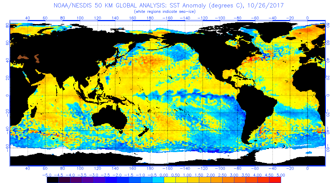
We also have the closest thing to a negative (–) PDO we have seen since 2013. It may be short-lived, but it's still significant, given how the PDO has been strongly positive for four years. You can see the trend on the latest NESDIS SST anomaly data. Note the ring of cold anomalies near western North America and Baja California, coupled with the warm pool south of the Aleutian Islands. Notably, the Pacific Meridional Mode (PMM) looks more negative than it has been in some time, with below-average anomalies supplanting previously above-average ones to the south of the Hawaiian Islands. If sustained, this pattern makes for big differences in the upcoming winter and spring seasons, both in terms of winter and severe weather. Overall, we definitely have the most "classic" La Niña configuration in some time.


