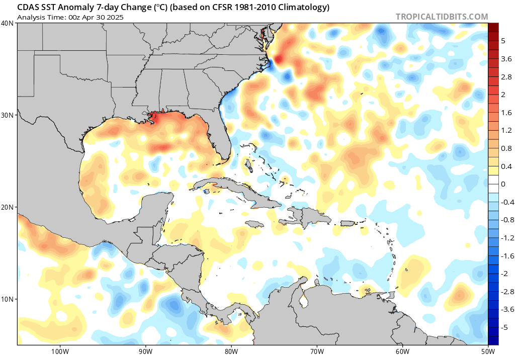
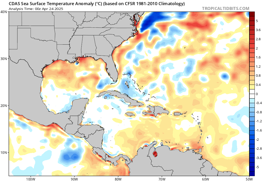
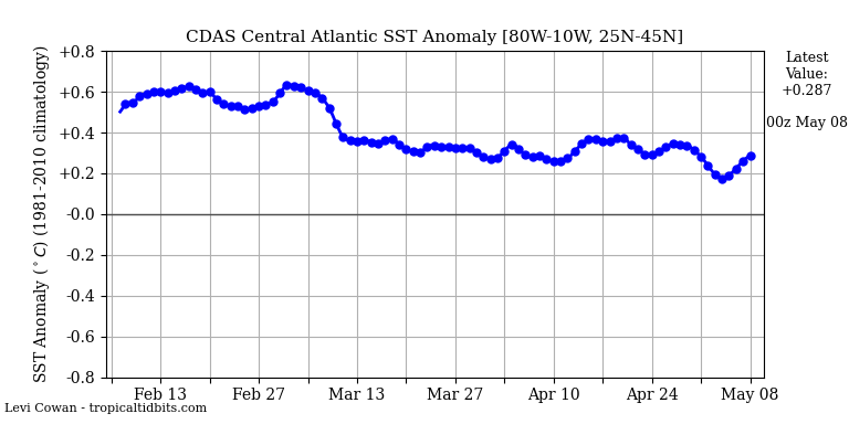
cycloneye wrote:The NAO is forecast to turn positive and if that comes thru,it will cool the waters in Central Atlantic and MDR regions but how much it will cool if it does is the question,so until it occurs is only a waiting game.

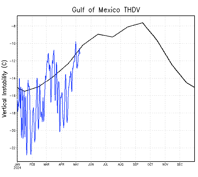
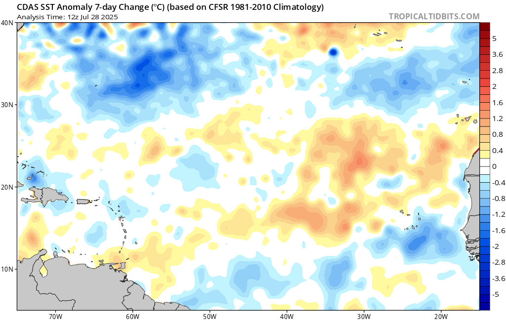
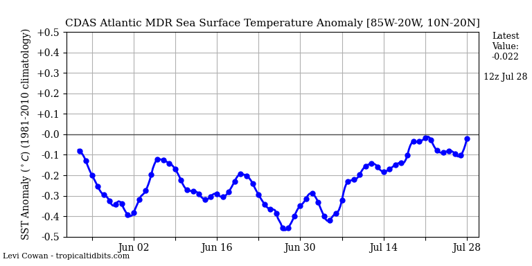
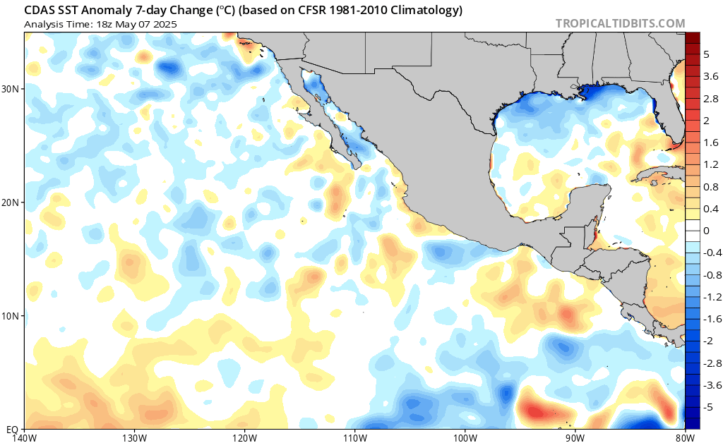
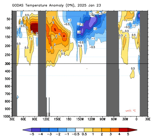
Ironically, I also noticed how the E. Atlantic MDR SST's have recently seemed to have warmed nicely. Up to recent, it seems like MDR SST anomalies have been comparatively less warm than those SST anomolies further north throughout much of the higher latitudes in the Atlantic. I wonder if a positive NAO were to continue, whether that would necessarily cool equatorial East/Central Atlantic water temps or if that could somehow translate to a cooling of Atlantic SST's limited to latitudes north of 15N-20N?
On a different note, I believe the EURO was projecting lowest surface pressures for most of the Caribbean (as well as the E. Pacific) for April. I'd be curious to see how long range forecasts evolve for May/June. This time last year, I recall firmly believing that no warm ENSO would manifest during the 2017 Spring/Summer. Here we are again with a Central Pacific area of warming that many are pondering might migrate eastward. In contrast, we're already seeing equatorial regions well east toward the East PAC which are showing distinct cooling anomalies. I'd bet bottom dollar that we'll simply continue to see weak to possibly more moderate La Nina conditions continue into the Spring. My guess is that we'll see those Nina conditions begin to wane early to mid Summer. I may be wrong but my recollection was that a weak cool to neutral ENSO was actually more indicative of an increased threat to the U.S. and Greater Antilles than those years where a Moderate to Strong Nina season was still in play. Assuming no full reversal actually occurs and regardless whether June/July/August is then exhibiting a "cool" to near neutral ENSO or more moderate NINA conditions, I believe that the two far more important factors than any of the above mentioned conditions would be
1) how much more (or less) conducive might conditions be over the Western Atlantic as compared to Eastern Atlantic MDR breeding grounds, and
2) How the W. Atlantic steering evolves as we approach June/July
Sure, 2018 could prove the Atlantic to actually be the massive "ACE-HOLE" (

) that some are beginning to suspect. That and $2.00 still wont buy you a cup of coffee at Starbucks, nor would it necessarily mean that most Cape Verde systems might ever cross W. of 50W Longitude if any big bad mid Atlantic trough loomed throughout most of the season. On the other hand, what if a positive NAO took place resulting in relative cooler Central and Eastern Atlantic SST's? Now, imagine a similarly impressive 2017 tropical wave train that was further capped from development
UNTIL reaching points even further west where both SST''s and especially overall instability was distinctly higher. Such could potentially spell a deserved respite for those E. Caribbean islands that were pounded last season, but potentially a greater threat for the U.S., or possibly an even greater threat for the Central Caribbean, Central America, and Mexico. I think those of us not anticipating El Nino to make a return anytime soon, are collectively anticipating "the Rocket" (2018 Atlantic Hurricane season) and its launch fuel being slowly wheeled and approaching the launch pad. Over the years though, my perspective and pragmatic interest has shifted from worrying a bit less about the rocket and a good deal more towards "who (actually what) will be steering the damn thing once lift-off actually occurs" lol!
For that reason and in that line of thought, I was wondering if anybody particularly recalled when it was during last Spring or early Summer, when mid to long range models began to fairly consistently forecast increasing W. Atlantic mid level ridging which broadly evolved as a significant steering dynamic during much of the 2017 Atlantic season? I'm not sure when it was that I started noticing W. Atlantic GFS 500mb forecast heights trending higher (more blocking and further West steering) but thought I recalled some beginning evidence occurring by early June (even though that still could have proven way early to assess how the overall CONUS long wave pattern might evolve). I seem to think we were already beginning to see signs of the prior Winter Season Greenland Vortex shifting further west with its attending deep E. CONUS sharp troughs seemingly digging less sharply southward and eventually tilting more and more Southwestward over time. As I sit here wondering whether these possibly evolving signals last year were something I might have observed even earlier (March, April, May??), I was curious if anyone else happened to take notice when the commonly North/South U.S. East coast troughs seemed to increasingly become more sharply positively tilted toward the Southwest?
Even now, this winter has clearly exhibited a more west and south shift with regard to cold outbreaks from Texas to Florida with our current East Coast Winter Bomb (I hate that term) seemingly tracking fairly sharply northward and along the Eastern Seaboard. With plenty of Winter left to occur, I'm still a bit surprised that Florida is once again receiving the cold outbreaks that we're seeing, rather than the projected very progressive La Nina pattern that might cause us in Florida to be limited to frontal passages followed by an immediate Northeast wind shift, with little upper air pattern support for sustained northwest/northerly arctic intrusions. Whether or not our present Winter pattern is more or less locked in place is a question hard to know. Guessing how the present long-wave pattern further evolves as we move into Spring is an even bigger question mark. Obviously, its hard to know whether we might be observing the beginning of a pattern change or trend, verses a simple blip in the present steering flow. However those changes eventually occur though, are what I think will be our first subtle tip-off regarding where that launch-pad approaching (and possibly high octane?) Rocket may be broadly aimed this '18 Hurricane Season.
I don't always drink warm liquids during Florida Winters but when I do, I prefer some REALLY hot tea over Dos Equis.

Stay Thirsty my Friends....... and Happy New Years!