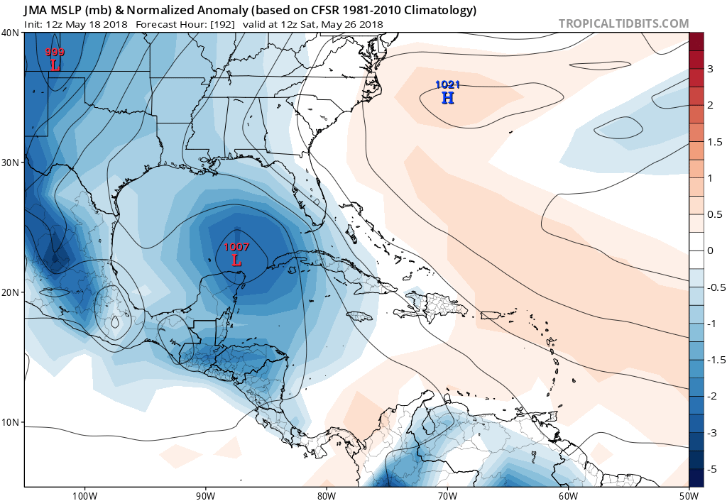
ronjon wrote:LarryWx wrote:I have yet to be in the likely to develop camp nor in the hurricane camp (both based on climo), but I did go into the "increasing threat of a TS to FL" camp yesterday when I noted the near unanimous ageement of the models for a tropical low to form in the NW Caribbean near day 7 (5/24). If anything, today that TS threat has fallen back some but there still is a low (more than minute) chance imo. I'm near 5% for a FL TS hit currently. Weak model progs along with climo and knowing that the Gulf has recently not been all that warm are keeping it down as there's a much greater chance that there will either be something weaker than TS, maybe even nothing organized, or maybe even a miss of FL.
Climo to keep in mind: There have been only 5 TS and no H on record to form in the W. Car. or GOM during 5/21-31 since 1851. So, that's only 5 in 167 years or 1 in 33 chance/3% of there even being a genesis. Only 1 of those 5 hit FL. So, only 1 in 167 years had a FL TS hit or well under 1%. So, even going with a 5% chance of a FL hit in 2018 in deference to the model consensus of a threat of something is WAY, WAY above the longterm climo based chance.
The 5 W Car/GOM 5/21-31 geneses on record since 1851:
- 5/30/2008
- 5/28/1959: hit LA at 40 knots
- 5/25/1953: hit FL at 40 knots
- 5/27/1890
- 5/29/1865
They're rare Larry no doubt but I think with this much model support - pretty much every major global model (GFS, FV-3 GFS, GEM, ECM, NAVGEM. and ICON) are on-board with low pressure development. So these globals are sniffing out an environment conducive for development. To me with this much model support in 5-7 days, something will develop and become either a TD or TS. i think Hurricane unlikely given the time of year. Track uncertain but somewhere in the SE GOM in 5-6 days and then from therefter too far away to know.
In deference to this model agreement, I'm currently near a respectable 1 in 3 chance for a TD to form next week either in the W Car. or in the GOM, which is quite high in that area for late May, but still only near a 5% chance for a subsequent FL TS hit. So, I'm saying that IF a TD forms next week, there's about a 1 in 6 chance for that TD to hit FL as a TS. That's how I get my 5% FL TS hit chance.