
here.. I know you all will see it.
The "current" main circ is about to be in the eastern BOC. not to be long winded right now. soooo
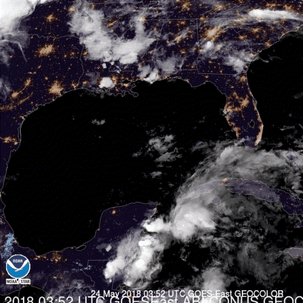
image below of a little bit ago show 3 vorts the southernmost one is the largest and most defined. if you toggle the slider back and forth you will see all 3 vorts. The northern one ( which is what I though earlier was a likely candidate) is rotating around this southern. the vort offshore os dropping south and previously passed by the station along the coast and you can see the change in wind direction as it went by. it also explains the current wind direction.
that same station is about to see another wind switch as the larger circ approaches.
SO it appears the ICON has pretty much nailed the idea of the wave/circ and the ridging being strong enough to push the energy into the BOC.. will be an interesting next 24 hours from a science point of view.
will likely see convection build with this circ as it approaches the boc ..
make sure toggle this loop and you will see.
http://weather.cod.edu/satrad/exper/?pa ... colorbars=


