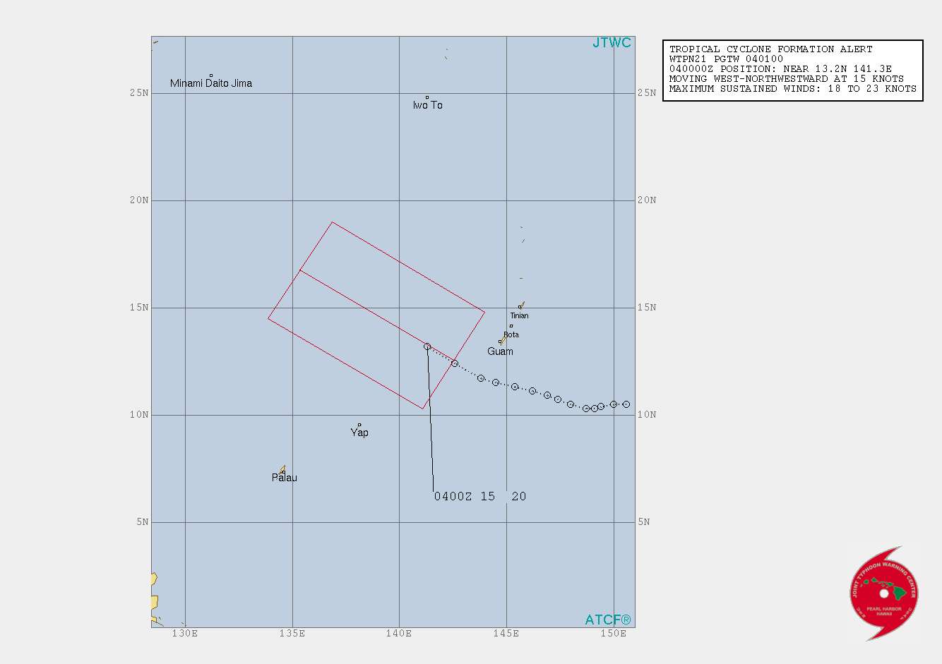
Maximum Winds: 15 kt
Minimum Central Pressure: 1009 mb


Moderator: S2k Moderators


Southwest to southerly flow associated with the upper high will
gradually stream moisture across Guam, Rota, Tinian and Saipan thru
tonight, increasing the chance of thunderstorms by later this evening.
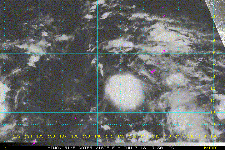
Despite widespread convection flaring up near 90W this morning, it is
showing little signs of consolidation. Therefore, expect 90W, 91W and
their associated monsoon trough to remain quasi-stationary thru
tonight. On Sunday, there will be a better chance for 90W to become
better organized and start drifting north-northwestward parallel to
the Philippines. Under this scenario, the monsoon trough and 91W will
also lift slowly northward. Aided by abundant moisture, there is a
good chance for deep convection to fire up near 91W as it moves over
our local area Sunday and Monday. Periods of heavy showers and
thunderstorms are possible during the passage of 91W, future shifts
need to monitor this situation. Once northwest of our local area,
converging southeast winds in the wake of 91W should prolong unstable
conditions into midweek. If 90W develop further over the Philippine
Sea near midweek, a surface ridge should form to its southeast over
the Marianas and introduce quieter weather for the second half of the
week.


Users browsing this forum: No registered users and 38 guests


