As of 12:00 UTC Jun 12, 2018:
Location: 13.8°N 80.8°W
Maximum Winds: 25 kt Gusts: N/A
Minimum Central Pressure: 1012 mb
Environmental Pressure: 1015 mb
Radius of Circulation: 140 NM
Radius of Maximum Wind: 90 NM
Thread that was the topic for this area at Talking Tropics forum.
viewtopic.php?f=31&t=119621
ATL: Invest 91L - Discussion
Moderator: S2k Moderators
-
NotSparta

- Professional-Met

- Posts: 1677
- Age: 24
- Joined: Fri Aug 18, 2017 8:24 am
- Location: Naples, FL
- Contact:
ATL: Invest 91L - Discussion
1 likes
This post was probably an opinion of mine, and in no way is official. Please refer to http://www.hurricanes.gov for official tropical analysis and advisories.
My website, with lots of tropical wx graphics, including satellite and recon: http://cyclonicwx.com
My website, with lots of tropical wx graphics, including satellite and recon: http://cyclonicwx.com
-
CyclonicFury

- Category 5

- Posts: 2032
- Age: 27
- Joined: Sun Jul 02, 2017 12:32 pm
- Location: NC
- Contact:
Re: ATL: Invest 91L
Looks decent this morning, but not much model support.
3 likes
NCSU B.S. in Meteorology Class of 2021. Tropical weather blogger at http://www.cyclonicfury.com. My forecasts and thoughts are NOT official, for official forecasts please consult the National Hurricane Center.


-
gatorcane

- S2K Supporter

- Posts: 23708
- Age: 48
- Joined: Sun Mar 13, 2005 3:54 pm
- Location: Boca Raton, FL
Re: ATL: Invest 91L
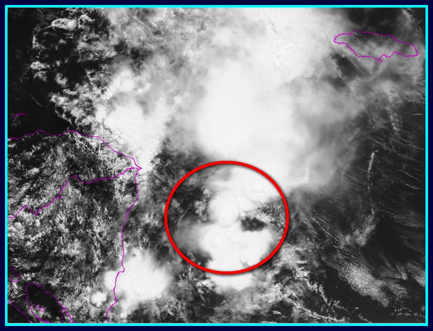
Doesn't seem invest-worthy to me especially with the lackluster model support.
Took a look at the floater and it just looks like sheared convection with nothing at the surface, nothing out of the ordinary for this time of year:
http://rammb.cira.colostate.edu/ramsdis ... display=12
Took a look at the floater and it just looks like sheared convection with nothing at the surface, nothing out of the ordinary for this time of year:
http://rammb.cira.colostate.edu/ramsdis ... display=12
0 likes
-
jaguars_22
- Category 2

- Posts: 629
- Joined: Tue Jun 20, 2017 2:26 pm
- Location: Victoria TX
Re: ATL: Invest 91L
Models starting to just dry this thing out and magically make it disappear once it comes towards texas.
0 likes
-
cycloneye

- Admin

- Posts: 149368
- Age: 69
- Joined: Thu Oct 10, 2002 10:54 am
- Location: San Juan, Puerto Rico
Re: ATL: Invest 91L - Discussion
NotSparta,I added to your first post the link to the thread that was the topic for this area at Talking Tropics forum.
2 likes
Visit the Caribbean-Central America Weather Thread where you can find at first post web cams,radars
and observations from Caribbean basin members Click Here
and observations from Caribbean basin members Click Here
Re: ATL: Invest 91L
jaguars_22 wrote:Models starting to just dry this thing out and magically make it disappear once it comes towards texas.
Remember TS Don? Hopefully you guys get some needed rain. Current WPC forecasts hold it pretty close to the coast but at least there's potential.
0 likes


Re: ATL: Invest 91L
jaguars_22 wrote:Models starting to just dry this thing out and magically make it disappear once it comes towards texas.
This would not surprise me one bit if that actually did happen.
0 likes
-
Tireman4

- S2K Supporter
- Posts: 5903
- Age: 60
- Joined: Fri Jun 30, 2006 1:08 pm
- Location: Humble, Texas
- Contact:
Re: ATL: Invest 91L
psyclone wrote:jaguars_22 wrote:Models starting to just dry this thing out and magically make it disappear once it comes towards texas.
Remember TS Don? Hopefully you guys get some needed rain. Current WPC forecasts hold it pretty close to the coast but at least there's potential.
Porta told me never to speak of Don, 2011 or High Pressure of Death again....Thank you ...LOL
1 likes
-
jaguars_22
- Category 2
- Posts: 629
- Joined: Tue Jun 20, 2017 2:26 pm
- Location: Victoria TX
Re: ATL: Invest 91L - Discussion
DON.DON.DON was DONe  This is a weird situation. Either models are missing something or this flare up will be just that...
0 likes
-
Haris

- Category 5
- Posts: 1814
- Joined: Mon Nov 27, 2017 8:19 pm
- Location: ( Bee Cave) West Austin, Texas
Re: ATL: Invest 91L - Discussion
-image removed-
From 2" we go to .3"
Love hypocrites!!!!
From 2" we go to .3"
Love hypocrites!!!!
Last edited by tolakram on Tue Jun 12, 2018 12:34 pm, edited 1 time in total.
Reason: removed image from commercial site
Reason: removed image from commercial site
0 likes
Weather geek and a storm spotter in West Austin. Not a degreed meteorologist. Big snow fan. Love rain and cold! Despise heat!
-
Tampa Bay Hurricane

- Category 5
- Posts: 5597
- Age: 38
- Joined: Fri Jul 22, 2005 7:54 pm
- Location: St. Petersburg, FL
Re: ATL: Invest 91L - Discussion
I think at most this system would be a sheared Low to medium grade tropical storm wind wise. I think it will be able to bring some periods of rain and moisture to Texas, although my confidence for heavy rain for Texas is a bit low compared to yesterday- in other words uncertainty is higher due to gfs decreased rainfall forecast for Texas.
Of note- gfs has tended to support development, then suddenly not support development, and then development does occur- so there’s a fair chance some development happens. Regardless of development, some bands of rain and moisture should make their way into Texas, where it will be a battle between moisture and the dry air over Texas which determines how much rain falls.
The shear may enhance rain bands up to hundreds of miles to the northeast of center- meaning if the system stays moist a large swath of Texas coast north and east of the low center may receive bands of rain.
0 likes
-
Clearcloudz

- Category 2
- Posts: 540
- Joined: Sun Jun 10, 2018 1:46 pm
- Location: Rosenberg TX
-
cycloneye
- Admin
- Posts: 149368
- Age: 69
- Joined: Thu Oct 10, 2002 10:54 am
- Location: San Juan, Puerto Rico
Re: ATL: Invest 91L - Discussion
Tropical Weather Outlook
NWS National Hurricane Center Miami FL
200 PM EDT Tue Jun 12 2018
For the North Atlantic...Caribbean Sea and the Gulf of Mexico:
A large area of showers and thunderstorms located over the western
Caribbean Sea just to the east of Nicaragua and northeastern
Honduras is associated with a sharp surface trough. This area of
disturbed weather is forecast to move westward to northwestward over
Central America and the Yucatan Peninsula during the next couple of
days, and little development is expected during that time due to
strong upper-level winds. However, environmental conditions could
become slightly more conducive for some development when the system
moves into the southwestern Gulf of Mexico by the end of the week.
Regardless of development, this disturbance will likely produce
locally heavy rainfall across portions of Nicaragua, Honduras,
Belize, Guatemala, and the Yucatan Peninsula through Thursday.
* Formation chance through 48 hours...low...10 percent.
* Formation chance through 5 days...low...20 percent.
Forecaster Stewart
0 likes
Visit the Caribbean-Central America Weather Thread where you can find at first post web cams,radars
and observations from Caribbean basin members Click Here
and observations from Caribbean basin members Click Here

Re: ATL: Invest 91L - Discussion
So still a sharp surface trough without low level closed circulation.
0 likes

Re: ATL: Invest 91L - Discussion
I can't remember a pre-invest/invest being followed so closely especially in June. I guess we can thank the GFS for the early season attention. While the models backed off yesterday, they're starting to show some signs of life again. Curious to see how this one plays out.
0 likes

Re: ATL: Invest 91L - Discussion
EasyTiger wrote:I can't remember a pre-invest/invest being followed so closely especially in June. I guess we can thank the GFS for the early season attention. While the models backed off yesterday, they're starting to show some signs of life again. Curious to see how this one plays out.
What's the GFS doing? It pulls a surge up toward the West Gulf funneling whatever circulation is there into Mexico and having the heaviest rains around Lafayette/Abbeville, LA. Then, "SURPRISE" it kicks a new low up toward the Western Panhandle in about the 264 hour/11 Day time frame. CMC has the highest rainfall total in the Piney Woods. ICON oddly has a ton of rain offshore of the LA Coast and then spins up a low right over Cameron, LA at the end of the run. NAVGEM is similar to the ICON with the offshore precipitation but doesn't really develop anything in its 180 hour run.
0 likes
-
wxman57

- Moderator-Pro Met

- Posts: 23172
- Age: 68
- Joined: Sat Jun 21, 2003 8:06 pm
- Location: Houston, TX (southwest)
Re: ATL: Invest 91L
gatorcane wrote:Doesn't seem invest-worthy to me especially with the lackluster model support.
Took a look at the floater and it just looks like sheared convection with nothing at the surface, nothing out of the ordinary for this time of year:
http://rammb.cira.colostate.edu/ramsdis ... display=12
The only criterion for declaring an invest is that the NHC would like to run model guidance on a disturbance. There doesn't have to be much of a chance of development, nor does the disturbance have to have a specific level of organization.
As for the disturbance, looks like the main impact may be to bring some well-needed rain to Texas (and rain to LA). Doesn't appear to be much chance of it being a strong TS or H.
6 likes
Re: ATL: Invest 91L
wxman57 wrote:gatorcane wrote:Doesn't seem invest-worthy to me especially with the lackluster model support.
Took a look at the floater and it just looks like sheared convection with nothing at the surface, nothing out of the ordinary for this time of year:
http://rammb.cira.colostate.edu/ramsdis ... display=12
The only criterion for declaring an invest is that the NHC would like to run model guidance on a disturbance. There doesn't have to be much of a chance of development, nor does the disturbance have to have a specific level of organization.
I missed that you turned 60 recently. You still look 30 in those bike photos you post every now and again though.
0 likes
-
wxman57
- Moderator-Pro Met
- Posts: 23172
- Age: 68
- Joined: Sat Jun 21, 2003 8:06 pm
- Location: Houston, TX (southwest)
Re: ATL: Invest 91L
Steve wrote:
I missed that you turned 60 recently. You still look 30 in those bike photos you post every now and again though.
I turn 61 in August. Still enjoy dropping 30 yr-old road bike riders while I'm on my dual-suspension mountain bike.
Hope to get a ride in Saturday before the showers become too numerous. I'm not too concerned about this disturbance being more than a rainmaker. Never got my numbers in for the hurricane contest here. I went with 9/5/2 in the office pool (includes Alberto).
4 likes
Who is online
Users browsing this forum: No registered users and 28 guests