ATL: Invest 91L - Discussion
Moderator: S2k Moderators
- Clearcloudz
- Category 2

- Posts: 540
- Joined: Sun Jun 10, 2018 1:46 pm
- Location: Rosenberg TX
-
jaguars_22
- Category 2

- Posts: 629
- Joined: Tue Jun 20, 2017 2:26 pm
- Location: Victoria TX
Re: ATL: Invest 91L - Discussion
it looks like the top area of thunderstorms is consolidating with the exact spot the nhc marked it at much lower latitude... frisky
1 likes
Re: ATL: Invest 91L - Discussion
EasyTiger wrote:I can't remember a pre-invest/invest being followed so closely especially in June. I guess we can thank the GFS for the early season attention. While the models backed off yesterday, they're starting to show some signs of life again. Curious to see how this one plays out.
That and Hurricane Harvey. Post-Hurricane PTSD is a real thing. Harvey really shook the people living all along the Texas coast. From Corpus Christi to Houston, to even Western Louisiana.
3 likes
Personal Forecast Disclaimer:
The posts in this forum are NOT official forecast and should not be used as such. They are just the opinion of the poster and may or may not be backed by sound meteorological data. They are NOT endorsed by any professional institution or storm2k.org. For official information, please refer to the NHC and NWS products.
The posts in this forum are NOT official forecast and should not be used as such. They are just the opinion of the poster and may or may not be backed by sound meteorological data. They are NOT endorsed by any professional institution or storm2k.org. For official information, please refer to the NHC and NWS products.
Re: ATL: Invest 91L
Steve wrote:wxman57 wrote:gatorcane wrote:Doesn't seem invest-worthy to me especially with the lackluster model support.
Took a look at the floater and it just looks like sheared convection with nothing at the surface, nothing out of the ordinary for this time of year:
http://rammb.cira.colostate.edu/ramsdis ... display=12
The only criterion for declaring an invest is that the NHC would like to run model guidance on a disturbance. There doesn't have to be much of a chance of development, nor does the disturbance have to have a specific level of organization.
I missed that you turned 60 recently. You still look 30 in those bike photos you post every now and again though.

That's from all the frigid cold weather he prevents from getting to us each winter. He's like the opposite pole of a magnet to winter storms.
3 likes
Personal Forecast Disclaimer:
The posts in this forum are NOT official forecast and should not be used as such. They are just the opinion of the poster and may or may not be backed by sound meteorological data. They are NOT endorsed by any professional institution or storm2k.org. For official information, please refer to the NHC and NWS products.
The posts in this forum are NOT official forecast and should not be used as such. They are just the opinion of the poster and may or may not be backed by sound meteorological data. They are NOT endorsed by any professional institution or storm2k.org. For official information, please refer to the NHC and NWS products.
- Haris
- Category 5

- Posts: 1814
- Joined: Mon Nov 27, 2017 8:19 pm
- Location: ( Bee Cave) West Austin, Texas
Re: ATL: Invest 91L - Discussion

well the euro is opposite of the gfs
4 likes
Weather geek and a storm spotter in West Austin. Not a degreed meteorologist. Big snow fan. Love rain and cold! Despise heat!
- NotSparta
- Professional-Met

- Posts: 1677
- Age: 24
- Joined: Fri Aug 18, 2017 8:24 am
- Location: Naples, FL
- Contact:
Re: ATL: Invest 91L - Discussion
cycloneye wrote:NotSparta,I added to your first post the link to the thread that was the topic for this area at Talking Tropics forum.
Thanks for adding that
1 likes
This post was probably an opinion of mine, and in no way is official. Please refer to http://www.hurricanes.gov for official tropical analysis and advisories.
My website, with lots of tropical wx graphics, including satellite and recon: http://cyclonicwx.com
My website, with lots of tropical wx graphics, including satellite and recon: http://cyclonicwx.com
-
stormlover2013
Re: ATL: Invest 91L - Discussion
Cmc and euro are wet, wed night runs should have a good idea or Thursday morning
1 likes
-
stormreader
Re: ATL: Invest 91L - Discussion
jaguars_22 wrote:it looks like the top area of thunderstorms is consolidating with the exact spot the nhc marked it at much lower latitude... frisky
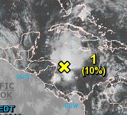
Yes the blow-up now is farther south toward the actual center of the wave axis. Might be a sign that shear is relaxing some. Still surprised that both short range and long range NHC percentages for development are as low as they are. Consolidation of storms now (off the Nicaragua coast) perhaps to near the coast for short term development??? Don't know. But there is model support for long term development. Either way I'm guessing percentages should be higher. But let's see how it pans out.
2 likes
- Clearcloudz
- Category 2

- Posts: 540
- Joined: Sun Jun 10, 2018 1:46 pm
- Location: Rosenberg TX
Re: ATL: Invest 91L - Discussion
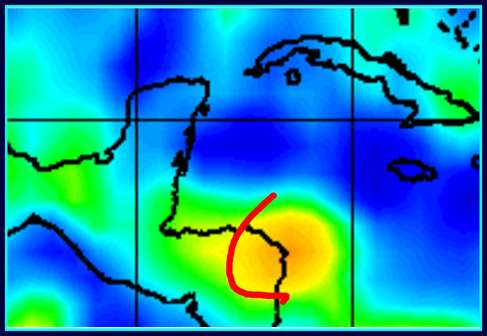
Much better definition on 850, 700, & 500mb vorts; albeit not well stacked yet.
1 likes
- Clearcloudz
- Category 2

- Posts: 540
- Joined: Sun Jun 10, 2018 1:46 pm
- Location: Rosenberg TX
Re: ATL: Invest 91L - Discussion
None of the models have been showing this convection that has been firing for much of the day.


0 likes
-
TheStormExpert
Re: ATL: Invest 91L
wxman57 wrote:I turn 61 in August. Still enjoy dropping 30 yr-old road bike riders while I'm on my dual-suspension mountain bike.
Hope to get a ride in Saturday before the showers become too numerous. I'm not too concerned about this disturbance being more than a rainmaker. Never got my numbers in for the hurricane contest here. I went with 9/5/2 in the office pool (includes Alberto).
I thought you were going with a season like 1985?
Or do you expect it to be a quieter/weaker version of that year thanks to the increasing likelihood of an El Niño during the season?
0 likes
- Clearcloudz
- Category 2

- Posts: 540
- Joined: Sun Jun 10, 2018 1:46 pm
- Location: Rosenberg TX
Re: ATL: Invest 91L - Discussion
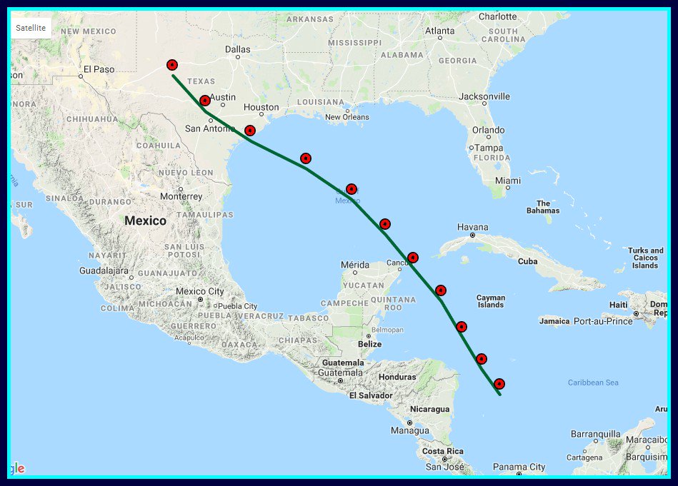
The GFS showed this track a week ago, its still possible and the EURO showed it moving over land by now and land interaction has not taken place yet.
Models are underestimating in my personal opinion.

Models are underestimating in my personal opinion.

0 likes
- Clearcloudz
- Category 2

- Posts: 540
- Joined: Sun Jun 10, 2018 1:46 pm
- Location: Rosenberg TX
-
stormreader
Re: ATL: Invest 91L - Discussion
ForexTidbits wrote:The GFS showed this track a week ago, its still possible and the EURO showed it moving over land by now and land interaction has not taken place yet.
Models are underestimating in my personal opinion.
Well, that track seems less likely now than it did a week ago. If it were to materialize then we would probably be looking at a more significant system than is presently forecast. On the other hand, I don't discount the fact that the ultimate track might swing back some to the right. I think Tex-Mex area that has been talked about much in last couple of days may be too far left and south.
1 likes
- Clearcloudz
- Category 2

- Posts: 540
- Joined: Sun Jun 10, 2018 1:46 pm
- Location: Rosenberg TX
Re: ATL: Invest 91L - Discussion
stormreader wrote:ForexTidbits wrote:The GFS showed this track a week ago, its still possible and the EURO showed it moving over land by now and land interaction has not taken place yet.
Models are underestimating in my personal opinion.
Well, that track seems less likely now than it did a week ago. If it were to materialize then we would probably be looking at a more significant system than is presently forecast. On the other hand, I don't discount the fact that the ultimate track might swing back some to the right. I think Tex-Mex area that has been talked about much in last couple of days may be too far left and south.
I agree
Once this low lifts northward around the corner of Nicaraguan Honduras border into the gulf of Honduras. Typically early seasonal the track is up or up and to the right. I'll keep watching...
0 likes
- Clearcloudz
- Category 2

- Posts: 540
- Joined: Sun Jun 10, 2018 1:46 pm
- Location: Rosenberg TX
Re: ATL: Invest 91L - Discussion
18Z GFS take the current convection and dissipates it within the next 6 to 12 hours. Need to watch that for verification.... If we wake up tomorrow morning and the convection is continuing then were in trouble.
0 likes
Re: ATL: Invest 91L - Discussion
ForexTidbits wrote:18Z GFS take the current convection and dissipates it within the next 6 to 12 hours. Need to watch that for verification.... If we wake up tomorrow morning and the convection is continuing then were in trouble.
So the GFS must see this convection as just shear enhanced lift as it interacts with the trough.
Until there is some evidence of a closed low, that is about what you would expect from the GFS.
1 likes
- Clearcloudz
- Category 2

- Posts: 540
- Joined: Sun Jun 10, 2018 1:46 pm
- Location: Rosenberg TX
Re: ATL: Invest 91L - Discussion
Nimbus wrote:ForexTidbits wrote:18Z GFS take the current convection and dissipates it within the next 6 to 12 hours. Need to watch that for verification.... If we wake up tomorrow morning and the convection is continuing then were in trouble.
So the GFS must see this convection as just shear enhanced lift as it interacts with the trough.
Until there is some evidence of a closed low, that is about what you would expect from the GFS.
Thanks, good to know.
0 likes
- Haris
- Category 5

- Posts: 1814
- Joined: Mon Nov 27, 2017 8:19 pm
- Location: ( Bee Cave) West Austin, Texas
Re: ATL: Invest 91L - Discussion
GFS IS SOOOO INCONSISTENT!!! IT LITERALLY SHOWS 10X MORE RAIN FOR TX THIS RUN! SMHHHH
1 likes
Weather geek and a storm spotter in West Austin. Not a degreed meteorologist. Big snow fan. Love rain and cold! Despise heat!
Who is online
Users browsing this forum: No registered users and 11 guests


