ATL: BERYL - Post-Tropical
Moderator: S2k Moderators
-
shiny-pebble
- Category 1

- Posts: 299
- Joined: Thu Jul 05, 2018 1:38 pm
Re: ATL: BERYL - Hurricane
Also reminds me of Lee and Ophelia. The little 'canes that could
Sent from my LG-H700 using Tapatalk
Sent from my LG-H700 using Tapatalk
0 likes
Not an meteorologist! Just someone who is interested in weather. Please refer to the NHC and local weather officials to make decisions.
-Jack
-Jack
Re: ATL: BERYL - Hurricane
I just noticed this - a very interesting feature.
TPW showing another wave cresting over the top of Beryl.

TPW showing another wave cresting over the top of Beryl.

1 likes
- NotSparta
- Professional-Met

- Posts: 1677
- Age: 24
- Joined: Fri Aug 18, 2017 8:24 am
- Location: Naples, FL
- Contact:
Re: ATL: BERYL - Hurricane
Yep. Beryl is now the earliest MDR hurricane on record, beating out 2008's Bertha by 24 hours.
3 likes
This post was probably an opinion of mine, and in no way is official. Please refer to http://www.hurricanes.gov for official tropical analysis and advisories.
My website, with lots of tropical wx graphics, including satellite and recon: http://cyclonicwx.com
My website, with lots of tropical wx graphics, including satellite and recon: http://cyclonicwx.com
- Gustywind
- Category 5

- Posts: 12334
- Joined: Mon Sep 03, 2007 7:29 am
- Location: Baie-Mahault, GUADELOUPE
Re: ATL: BERYL - Hurricane
Hi my friends!
Waouw, the latest NHC forecast is very tricky. Curious wording from the NHC as dissipation is less prononced each weather forecast. The risk of a moderate TT close or on the islands near Dominica is not off discussion now.
Now, the NHC is speaking about Hurricane... but tiny.... What a mess! Let's hope that the Leewards will not have to deal with another cane scenario like the latest one of 2017 . The predictions of intensity are very versatile if not poor. Looks like tommorow will give us a better idea because of we're entering the weekend.
Waouw, the latest NHC forecast is very tricky. Curious wording from the NHC as dissipation is less prononced each weather forecast. The risk of a moderate TT close or on the islands near Dominica is not off discussion now.
Now, the NHC is speaking about Hurricane... but tiny.... What a mess! Let's hope that the Leewards will not have to deal with another cane scenario like the latest one of 2017
3 likes
- cycloneye
- Admin

- Posts: 149372
- Age: 69
- Joined: Thu Oct 10, 2002 10:54 am
- Location: San Juan, Puerto Rico
Re: ATL: BERYL - Hurricane
TXNT26 KNES 061208
TCSNTL
A. 02L (BERYL)
B. 06/1145Z
C. 10.7N
D. 45.9W
E. ONE/GOES-E
F. T4.0/4.0/D1.0/24HRS
G. IR/EIR/SWIR
H. REMARKS...EYE PATTERN WITH OW EYE EMBEDDED IN OW AND SURROUNDED BY
MG YIELDS A DT OF 4.0. THERE WERE NO EYE ADJUSTMENTS. FT IS BASED ON DT.
I. ADDL POSITIONS
NIL
...KIM
TCSNTL
A. 02L (BERYL)
B. 06/1145Z
C. 10.7N
D. 45.9W
E. ONE/GOES-E
F. T4.0/4.0/D1.0/24HRS
G. IR/EIR/SWIR
H. REMARKS...EYE PATTERN WITH OW EYE EMBEDDED IN OW AND SURROUNDED BY
MG YIELDS A DT OF 4.0. THERE WERE NO EYE ADJUSTMENTS. FT IS BASED ON DT.
I. ADDL POSITIONS
NIL
...KIM
0 likes
Visit the Caribbean-Central America Weather Thread where you can find at first post web cams,radars
and observations from Caribbean basin members Click Here
and observations from Caribbean basin members Click Here
-
txwatcher91
- Category 5

- Posts: 1498
- Joined: Tue Aug 02, 2005 2:29 pm
Re: ATL: BERYL - Hurricane
Beryl looks very healthy today. As it nears the islands the SST's will gradually increase and the shear will also begin to increase. With how poorly shear is forecast and intensity of tropical systems, those in the islands need to be prepared for Beryl as a tropical storm looks like a possibility and it could be stronger if the shear forecast changes some the next few days.
2 likes
Re: ATL: BERYL - Models
Yep, just what I was afraid of.
GFS now curving this more north and under an anticyclone just before the islands.
Bahamas may be in play.
Latest GFS shows just south of PR with conducive 355K PV, good PW feed, and mid-level moisture entrainment from the ITCZ.
GFS now curving this more north and under an anticyclone just before the islands.
Bahamas may be in play.
Latest GFS shows just south of PR with conducive 355K PV, good PW feed, and mid-level moisture entrainment from the ITCZ.
2 likes
Re: ATL: BERYL - Models
GCANE wrote:Yep, just what I was afraid of.
GFS now curving this more north and under an anticyclone just before the islands.
Bahamas may be in play.
Latest GFS shows just south of PR with conducive 355K PV, good PW feed, and mid-level moisture entrainment from the ITCZ.
This is consistently tracking south of the guidance.
2 likes
Re: ATL: BERYL - Hurricane
Have not been following Beryl because I’m still on vacation & poor internet connection. I will not be surprised if it reaches at least cat 2 if it stays in this low latitude now that it is reaching 27C waters, GFS now shows a little better UL conditions as it reaches the islands .
0 likes
Re: ATL: BERYL - Hurricane
NotSparta wrote:Yep. Beryl is now the earliest MDR hurricane on record, beating out 2008's Bertha by 24 hours.
Incredible! Lesson learned that with despite current “cool” SSTs there’s always the possibility if a strong African wave finds the sweet spot.
2 likes
-
txwatcher91
- Category 5

- Posts: 1498
- Joined: Tue Aug 02, 2005 2:29 pm
Re: ATL: BERYL - Models
Alyono wrote:GCANE wrote:Yep, just what I was afraid of.
GFS now curving this more north and under an anticyclone just before the islands.
Bahamas may be in play.
Latest GFS shows just south of PR with conducive 355K PV, good PW feed, and mid-level moisture entrainment from the ITCZ.
This is consistently tracking south of the guidance.
Alyono, what do you feel are the chances for this to maintain into the Caribbean (assuming it tracks south of forecast). Would it have better chances or run into a wall of shear? From what I can see on models it appears they reduce the shear as Beryl approaches but its still high enough to cause dissipation when it hits the mountains of PR. IF this were to track south of there and stay over open waters would that be a bit more concerning?
0 likes
-
tolakram
- Admin

- Posts: 20184
- Age: 62
- Joined: Sun Aug 27, 2006 8:23 pm
- Location: Florence, KY (name is Mark)
Re: ATL: BERYL - Hurricane
I wonder if the SST measurements are wrong? Look at Beryl go, incredible little storm.
COD floater: http://weather.cod.edu/satrad/exper/?parms=meso-meso1-02-48-0-100-1&checked=map&colorbars=
SLIDER: http://rammb-slider.cira.colostate.edu/?sat=goes-16&sec=mesoscale_01&x=739.5&y=983&z=2&im=36&ts=1&st=0&et=0&speed=130&motion=loop&map=1&lat=0&p%5B0%5D=1&opacity%5B0%5D=1&hidden%5B0%5D=0&pause=0&slider=-1&hide_controls=0&mouse_draw=0&s=rammb-slider
2 likes
M a r k
- - - - -
Join us in chat: Storm2K Chatroom Invite. Android and IOS apps also available.
The posts in this forum are NOT official forecasts and should not be used as such. Posts are NOT endorsed by any professional institution or STORM2K.org. For official information and forecasts, please refer to NHC and NWS products.
-
txwatcher91
- Category 5

- Posts: 1498
- Joined: Tue Aug 02, 2005 2:29 pm
Re: ATL: BERYL - Hurricane
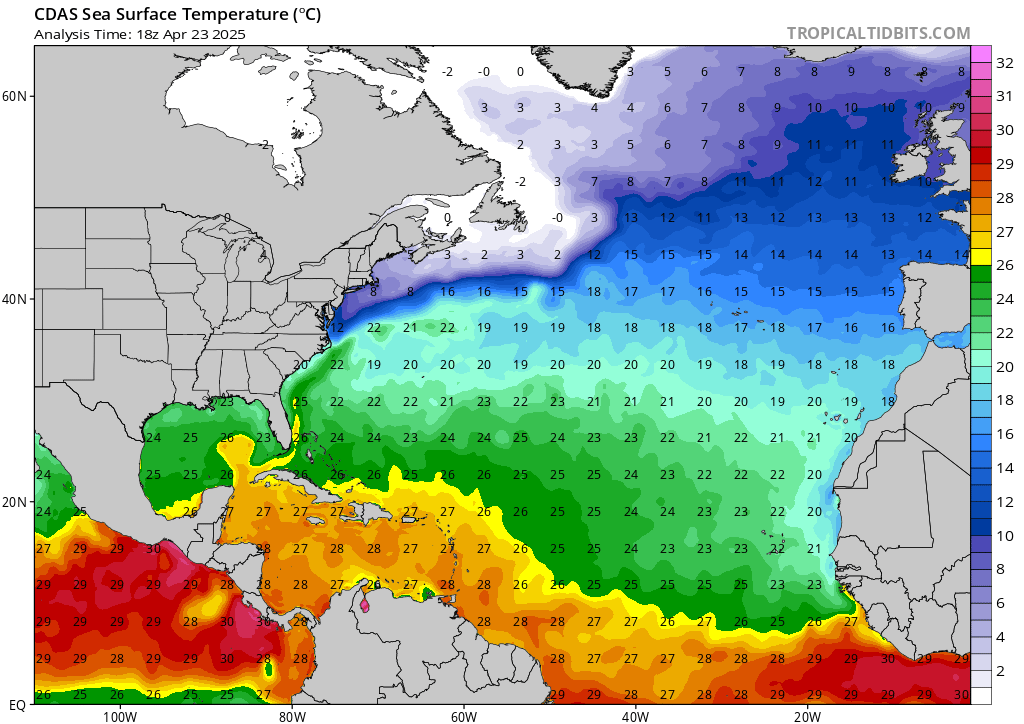
Beryl is currently in roughly 26-27C water but as he approaches the island will enter 28-29C waters. Assuming the conditions are favorable still at that time it would not be a good scenario.


0 likes
- NotSparta
- Professional-Met

- Posts: 1677
- Age: 24
- Joined: Fri Aug 18, 2017 8:24 am
- Location: Naples, FL
- Contact:
Re: ATL: BERYL - Hurricane
tolakram wrote:I wonder if the SST measurements are wrong? Look at Beryl go, incredible little storm.
COD floater: http://weather.cod.edu/satrad/exper/?parms=meso-meso1-02-48-0-100-1&checked=map&colorbars=
SLIDER: http://rammb-slider.cira.colostate.edu/?sat=goes-16&sec=mesoscale_01&x=739.5&y=983&z=2&im=36&ts=1&st=0&et=0&speed=130&motion=loop&map=1&lat=0&p%5B0%5D=1&opacity%5B0%5D=1&hidden%5B0%5D=0&pause=0&slider=-1&hide_controls=0&mouse_draw=0&s=rammb-slider
They're correct. The 200mb temperatures are cooler (-55C), which means a higher lapse rate and an ability to generate convection in cooler SSTs
2 likes
This post was probably an opinion of mine, and in no way is official. Please refer to http://www.hurricanes.gov for official tropical analysis and advisories.
My website, with lots of tropical wx graphics, including satellite and recon: http://cyclonicwx.com
My website, with lots of tropical wx graphics, including satellite and recon: http://cyclonicwx.com
Re: ATL: BERYL - Models
Alyono wrote:GCANE wrote:Yep, just what I was afraid of.
GFS now curving this more north and under an anticyclone just before the islands.
Bahamas may be in play.
Latest GFS shows just south of PR with conducive 355K PV, good PW feed, and mid-level moisture entrainment from the ITCZ.
This is consistently tracking south of the guidance.
Maybe its time for reading glasses, but it looks like the forecast line is moving somewhat north to me.
https://www.nhc.noaa.gov/archive/2018/B ... e_and_wind
0 likes
-
txwatcher91
- Category 5

- Posts: 1498
- Joined: Tue Aug 02, 2005 2:29 pm
Re: ATL: BERYL - Hurricane
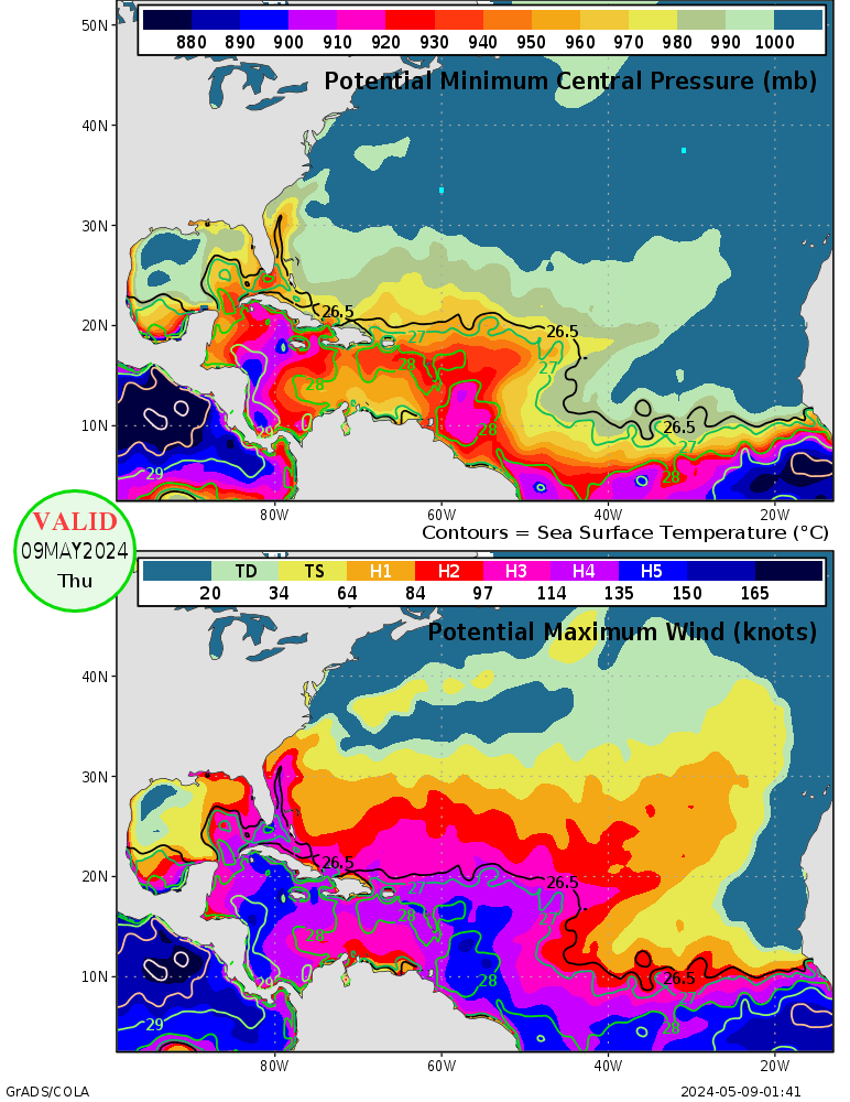
Also of note is the 26C isotherm. Beryl has been in areas where the warm water is very shallow but now is entering much deeper warm waters as well.

Also the waters in a very favorable environment would support a cat 4 (although highly unlikely).


Also the waters in a very favorable environment would support a cat 4 (although highly unlikely).

0 likes
Re: ATL: BERYL - Models
txwatcher91 wrote:Alyono wrote:GCANE wrote:Yep, just what I was afraid of.
GFS now curving this more north and under an anticyclone just before the islands.
Bahamas may be in play.
Latest GFS shows just south of PR with conducive 355K PV, good PW feed, and mid-level moisture entrainment from the ITCZ.
This is consistently tracking south of the guidance.
Alyono, what do you feel are the chances for this to maintain into the Caribbean (assuming it tracks south of forecast). Would it have better chances or run into a wall of shear? From what I can see on models it appears they reduce the shear as Beryl approaches but its still high enough to cause dissipation when it hits the mountains of PR. IF this were to track south of there and stay over open waters would that be a bit more concerning?
It's going south of PR
I was well south of the guidance yesterday. I was still too far north
1 likes
Re: ATL: BERYL - Hurricane
NotSparta wrote:tolakram wrote:I wonder if the SST measurements are wrong? Look at Beryl go, incredible little storm.
COD floater: http://weather.cod.edu/satrad/exper/?parms=meso-meso1-02-48-0-100-1&checked=map&colorbars=
SLIDER: http://rammb-slider.cira.colostate.edu/?sat=goes-16&sec=mesoscale_01&x=739.5&y=983&z=2&im=36&ts=1&st=0&et=0&speed=130&motion=loop&map=1&lat=0&p%5B0%5D=1&opacity%5B0%5D=1&hidden%5B0%5D=0&pause=0&slider=-1&hide_controls=0&mouse_draw=0&s=rammb-slider
They're correct. The 200mb temperatures are cooler (-55C), which means a higher lapse rate and an ability to generate convection in cooler SSTs
Agreed, this is the key.
This may be an indication of overall shift in the climate for upcoming waves.
Much like the 2005 season.
2004 was strong and 2005 even stronger.
Last year we saw some helacious cat 5s.
1 likes
- Hypercane_Kyle
- Category 5

- Posts: 3465
- Joined: Sat Mar 07, 2015 7:58 pm
- Location: Cape Canaveral, FL
Re: ATL: BERYL - Hurricane
GCANE wrote:NotSparta wrote:tolakram wrote:I wonder if the SST measurements are wrong? Look at Beryl go, incredible little storm.
COD floater: http://weather.cod.edu/satrad/exper/?parms=meso-meso1-02-48-0-100-1&checked=map&colorbars=
SLIDER: http://rammb-slider.cira.colostate.edu/?sat=goes-16&sec=mesoscale_01&x=739.5&y=983&z=2&im=36&ts=1&st=0&et=0&speed=130&motion=loop&map=1&lat=0&p%5B0%5D=1&opacity%5B0%5D=1&hidden%5B0%5D=0&pause=0&slider=-1&hide_controls=0&mouse_draw=0&s=rammb-slider
They're correct. The 200mb temperatures are cooler (-55C), which means a higher lapse rate and an ability to generate convection in cooler SSTs
Agreed, this is the key.
This may be an indication of overall shift in the climate for upcoming waves.
Much like the 2005 season.
2004 was strong and 2005 even stronger.
Last year we saw some helacious cat 5s.
2013 had a fairly active MDR in July and we saw naught by mid-season.
2 likes
My posts are my own personal opinion, defer to the National Hurricane Center (NHC) and other NOAA products for decision making during hurricane season.
Who is online
Users browsing this forum: No registered users and 19 guests


