ATL: BERYL - Post-Tropical
Moderator: S2k Moderators
Re: ATL: BERYL - Hurricane
Well, we all knew it was going to hit shear and weaken, so this shouldn't be a surprise. At the same time, don't write him off just yet. Patience is the key as usual. I wouldn't say all clear until he's dissipated.
1 likes
-
AnnularCane

- S2K Supporter

- Posts: 2961
- Joined: Thu Jun 08, 2006 9:18 am
- Location: Wytheville, VA
Re: ATL: BERYL - Hurricane
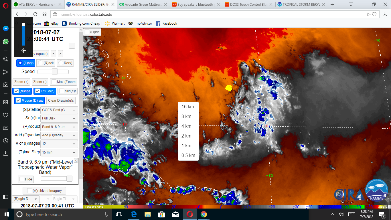
Beryl's no "him!"  Amazing how something can look so unhealthy and yet so beautiful at the same time.
1 likes
-
cycloneye

- Admin

- Posts: 149381
- Age: 69
- Joined: Thu Oct 10, 2002 10:54 am
- Location: San Juan, Puerto Rico
Re: ATL: BERYL - Advisories
BULLETIN
Tropical Storm Beryl Advisory Number 9
NWS National Hurricane Center Miami FL AL022018
1100 AM AST Sat Jul 07 2018
...BERYL WEAKENS TO A TROPICAL STORM...
SUMMARY OF 1100 AM AST...1500 UTC...INFORMATION
-----------------------------------------------
LOCATION...12.1N 51.1W
ABOUT 720 MI...1160 KM ESE OF THE LESSER ANTILLES
MAXIMUM SUSTAINED WINDS...65 MPH...100 KM/H
PRESENT MOVEMENT...WNW OR 295 DEGREES AT 14 MPH...22 KM/H
MINIMUM CENTRAL PRESSURE...999 MB...29.50 INCHES
WATCHES AND WARNINGS
--------------------
CHANGES WITH THIS ADVISORY:
The government of Barbados has issued a Tropical Storm Warning and
discontinued the Hurricane Watch for Dominica.
The government of the Netherlands has issued a Tropical Storm Watch
for Saba and St. Eustatius.
SUMMARY OF WATCHES AND WARNINGS IN EFFECT:
A Tropical Storm Warning is in effect for...
* Dominica
A Tropical Storm Watch is in effect for...
* Barbados
* St. Lucia
* Martinique, Guadeloupe, St. Martin, and St. Barthelemy
* Saba and St. Eustatius
Tropical Storm Beryl Discussion Number 9
NWS National Hurricane Center Miami FL AL022018
1100 AM AST Sat Jul 07 2018
Beryl's small size was always going to make it prone to wild and
unpredictable fluctuations in intensity, and that appears to have
come to fruition this morning. The cyclone's low-level center is
now completely exposed with all associated deep convection displaced
to the east and southeast. Dvorak estimates from TAFB and SAB have
decreased accordingly, and the initial intensity is set at 55 kt,
with Beryl being downgraded to a tropical storm.
Even though upper-level winds over the system remain light, and
upper-level cloud motions are still from east to west, strengthening
low-level flow is likely leading to an increase in the deep-layer
westerly shear. In fact, analyses from UW-CIMSS indicate that
about 15 kt of westerly shear is now over the system. The shear
and a very dry ambient environment have likely caused the small and
fragile cyclone to suddenly weaken. Since the low-level flow is
expected to increase further, and Beryl will be running into
upper-level westerlies in 36-48 hours, the shear is only expected
to become more hostile. This will make it extremely difficult for
Beryl to become more organized again, and its chances of being a
hurricane before reaching the Lesser Antilles have decreased
significantly. The updated NHC intensity forecast has been lowered
from the previous advisory, and now keeps Beryl as a tropical storm
through the forecast period. The forecast intensities could still
be a little high, and this prediction will remain low confidence
until we get a better handle on Beryl's initial intensity. Even
though a 72-hour forecast is provided, it is entirely possible that
Beryl will open up into a trough over the eastern Caribbean Sea
before that time. Regardless of whether the system has a closed
circulation, it is likely to continue producing strong gusty winds
and locally heavy rainfall over portions of the Greater Antilles
next week.
Beryl is now gaining more latitude and has an initial motion of
295/12 kt. The cyclone is still expected to accelerate toward the
west-northwest during the next several days, and the track guidance
remains tightly clustered through the forecast period. The new NHC
track forecast has been shifted slightly northward due to Beryl's
recent northwestward jog, and it lies relatively close to the HCCA
guidance.
Key Messages:
1. Beryl is no longer forecast to be near hurricane strength when it
approaches the Lesser Antilles Sunday night or Monday, but the
chance of some islands receiving direct impacts from wind and
rainfall continues. Tropical storm warnings and watches are in
effect for some of the countries in the Lesser Antilles, and
additional watches or warnings could be required for other islands
later today.
2. Due to its very small size, there is greater-than-usual
uncertainty in the analysis of Beryl's current intensity, and
confidence in the official intensity forecast is also lower than
normal. Rapid changes in intensity, both up and down, that are
difficult to predict are possible during the next couple of days.
FORECAST POSITIONS AND MAX WINDS
INIT 07/1500Z 12.1N 51.1W 55 KT 65 MPH
12H 08/0000Z 12.6N 52.9W 50 KT 60 MPH
24H 08/1200Z 13.6N 56.0W 50 KT 60 MPH
36H 09/0000Z 14.8N 59.6W 50 KT 60 MPH
48H 09/1200Z 15.9N 63.6W 45 KT 50 MPH
72H 10/1200Z 18.3N 71.7W 35 KT 40 MPH...INLAND
96H 11/1200Z...DISSIPATED
$$
Forecaster Berg
0 likes
Visit the Caribbean-Central America Weather Thread where you can find at first post web cams,radars
and observations from Caribbean basin members Click Here
and observations from Caribbean basin members Click Here
-
Kimmie.STT
- Tropical Wave

- Posts: 2
- Joined: Sat Jul 07, 2018 7:44 am
Re: ATL: BERYL - Hurricane
Steve H. wrote:Well, we all knew it was going to hit shear and weaken, so this shouldn't be a surprise. At the same time, don't write him off just yet. Patience is the key as usual. I wouldn't say all clear until he's dissipated.
This Beryl is a "she" - first storm was Alberto.
1 likes

-
wxman57

- Moderator-Pro Met

- Posts: 23173
- Age: 68
- Joined: Sat Jun 21, 2003 8:06 pm
- Location: Houston, TX (southwest)
Re: ATL: BERYL - Tropical Storm
The NHC is being quite generous with Beryl's winds with 55 kts. Objective Dvorak is down to 2.5 to 3 (40-45 kts), and 45 kts may be generous. It's very hard for a storm to produce strong surface winds with an exposed low-level swirl as a center.
3 likes
-
Ian2401
- Category 1

- Posts: 321
- Joined: Thu Sep 14, 2017 5:55 pm
- Location: Tallahassee, Florida
- Contact:
Re: ATL: BERYL - Tropical Storm
Poor Beryl - she was the little 'cane that could there for a little bit
1 likes
B.S. Meteorology from Florida State '24 // Current M.S. Meteorology student at Florida State
Research Interests: Rapid Intensification, TC Climatology, TC Modeling
Consult the NHC for official information
Research Interests: Rapid Intensification, TC Climatology, TC Modeling
Consult the NHC for official information
-
Aric Dunn
- Category 5

- Posts: 21238
- Age: 43
- Joined: Sun Sep 19, 2004 9:58 pm
- Location: Ready for the Chase.
- Contact:
Re: ATL: BERYL - Tropical Storm
Stronger north to ne shear I see has piccked up overnight.. very strange.
it has also wrapped in bunch of SAL all the way to its SW and south. but there is a huge plume of deep moisture to the east that has cut off the SAL. so if it can work out the SAL before the Islands could still see and decent TS.

it has also wrapped in bunch of SAL all the way to its SW and south. but there is a huge plume of deep moisture to the east that has cut off the SAL. so if it can work out the SAL before the Islands could still see and decent TS.
Last edited by Aric Dunn on Sat Jul 07, 2018 12:03 pm, edited 1 time in total.
1 likes
Note: If I make a post that is brief. Please refer back to previous posts for the analysis or reasoning. I do not re-write/qoute what my initial post said each time.
If there is nothing before... then just ask
Space & Atmospheric Physicist, Embry-Riddle Aeronautical University,
I believe the sky is falling...
If there is nothing before... then just ask
Space & Atmospheric Physicist, Embry-Riddle Aeronautical University,
I believe the sky is falling...
-
wxman57
- Moderator-Pro Met
- Posts: 23173
- Age: 68
- Joined: Sat Jun 21, 2003 8:06 pm
- Location: Houston, TX (southwest)
Re: ATL: BERYL - Tropical Storm
ASCAT indicates 25-30 kt winds now. There was one 35kt rain-contaminated barb at 1136Z. Of course, Beryl has weakened since then. It's a depression, and a poorly-organized one at that.
3 likes
-
cycloneye
- Admin
- Posts: 149381
- Age: 69
- Joined: Thu Oct 10, 2002 10:54 am
- Location: San Juan, Puerto Rico
Re: ATL: BERYL - Advisories
BULLETIN
Tropical Storm Beryl Intermediate Advisory Number 9A
NWS National Hurricane Center Miami FL AL022018
200 PM AST Sat Jul 07 2018
...BERYL WEAKENS FURTHER...
SUMMARY OF 200 PM AST...1800 UTC...INFORMATION
----------------------------------------------
LOCATION...12.4N 51.9W
ABOUT 665 MI...1070 KM ESE OF THE LESSER ANTILLES
MAXIMUM SUSTAINED WINDS...60 MPH...95 KM/H
PRESENT MOVEMENT...WNW OR 295 DEGREES AT 16 MPH...26 KM/H
MINIMUM CENTRAL PRESSURE...1001 MB...29.56 INCHES
WATCHES AND WARNINGS
--------------------
CHANGES WITH THIS ADVISORY:
None.
SUMMARY OF WATCHES AND WARNINGS IN EFFECT:
A Tropical Storm Warning is in effect for...
* Dominica
A Tropical Storm Watch is in effect for...
* Barbados
* St. Lucia
* Martinique, Guadeloupe, St. Martin, and St. Barthelemy
* Saba and St. Eustatius
0 likes
Visit the Caribbean-Central America Weather Thread where you can find at first post web cams,radars
and observations from Caribbean basin members Click Here
and observations from Caribbean basin members Click Here
Re: ATL: BERYL - Models
Any chance that this one can do a Harvey?
0 likes
Personal Forecast Disclaimer:
The posts in this forum are NOT official forecast and should not be used as such. They are just the opinion of the poster and may or may not be backed by sound meteorological data. They are NOT endorsed by any professional institution or storm2k.org. For official information, please refer to the NHC and NWS products.
The posts in this forum are NOT official forecast and should not be used as such. They are just the opinion of the poster and may or may not be backed by sound meteorological data. They are NOT endorsed by any professional institution or storm2k.org. For official information, please refer to the NHC and NWS products.
Re: ATL: BERYL - Recon
I see on http://tropicalatlantic.com/recon/recon ... ing=cesium there are currently 2 untasked flights in the Caribbean basin - question is are they getting into position to fly Beryl tomorrow or sampling the area inside the Caribbean island chain? AF302 - Lockheed WC-130J Hercules is currently West of Jamaica and AF301 - Lockheed WC-130J Hercules appears to be heading towards Aruba. Anyone know what they are doing?
0 likes
-
cycloneye
- Admin
- Posts: 149381
- Age: 69
- Joined: Thu Oct 10, 2002 10:54 am
- Location: San Juan, Puerto Rico
Re: ATL: BERYL - Models
12z Euro revives Beryl north of Bahamas.

1 likes
Visit the Caribbean-Central America Weather Thread where you can find at first post web cams,radars
and observations from Caribbean basin members Click Here
and observations from Caribbean basin members Click Here


Re: ATL: BERYL - Hurricane
2 likes

Re: ATL: BERYL - Models
Basically all models except GFS and NVGM redevelop Beryl.
The ICON, CMC, and Euro, and also the FV3 to a lesser extent all do.
The ICON, CMC, and Euro, and also the FV3 to a lesser extent all do.
2 likes
-
Dylan

- Professional-Met

- Posts: 338
- Age: 31
- Joined: Mon May 31, 2010 9:50 am
- Location: New Orleans, LA
Re: ATL: BERYL - Tropical Storm
2 likes
Georges('98), Allison('01), Isidore('02), Lili('02), Frances('04) Ivan('04), Cindy('05), Katrina('05), Rita('05), Gustav('08), Isaac('12), Matthew('16), Harvey('17), Irma('17), Nate ('17), Ida ('21).

Re: ATL: BERYL - Tropical Storm
Midlevels all dried up.
1 likes
The following post is NOT an official forecast and should not be used as such. It is just the opinion of the poster and may or may not be backed by sound meteorological data. It is NOT endorsed by any professional institution including storm2k.org For Official Information please refer to the NHC and NWS products.
-
cycloneye
- Admin
- Posts: 149381
- Age: 69
- Joined: Thu Oct 10, 2002 10:54 am
- Location: San Juan, Puerto Rico
Re: ATL: BERYL - Advisories
BULLETIN
Tropical Storm Beryl Advisory Number 10
NWS National Hurricane Center Miami FL AL022018
500 PM AST Sat Jul 07 2018
...BERYL WEAKENING WHILE ACCELERATING TOWARD THE LESSER ANTILLES...
SUMMARY OF 500 PM AST...2100 UTC...INFORMATION
----------------------------------------------
LOCATION...12.7N 52.7W
ABOUT 605 MI...975 KM ESE OF THE LESSER ANTILLES
MAXIMUM SUSTAINED WINDS...50 MPH...85 KM/H
PRESENT MOVEMENT...WNW OR 295 DEGREES AT 17 MPH...28 KM/H
MINIMUM CENTRAL PRESSURE...1003 MB...29.62 INCHES
WATCHES AND WARNINGS
--------------------
CHANGES WITH THIS ADVISORY:
The government of France has issued a Tropical Storm Warning for
Guadeloupe.
The government of St. Maarten has issued a Tropical Storm Watch for
St. Maarten.
SUMMARY OF WATCHES AND WARNINGS IN EFFECT:
A Tropical Storm Warning is in effect for...
* Dominica
* Guadeloupe
A Tropical Storm Watch is in effect for...
* Barbados
* St. Lucia
* Martinique, St. Martin, and St. Barthelemy
* Saba and St. Eustatius
* St. Maarten
Tropical Storm Beryl Discussion Number 10
NWS National Hurricane Center Miami FL AL022018
500 PM AST Sat Jul 07 2018
Beryl has not changed much in appearance since this morning. The
storm still has a tight low-level circulation with all of the deep
convection displaced to the east and southeast of the center.
Scatterometer data missed the circulation this morning, and we still
do not have a good handle on Beryl's maximum winds. Dvorak CI
numbers are now 3.0 from both TAFB and SAB, so the initial
intensity will be lowered to 45 kt, which could still be generous.
Beryl seems to be accelerating sooner than initially anticipated,
and the 12-hour motion is now west-northwestward, or 295/15 kt. Not
only is the cyclone moving a little faster now, but the track
guidance is also showing a faster future motion than it had been
indicating. The overall guidance envelope has also shifted
slightly northward. Therefore, the new NHC track forecast is a
little faster than the previous forecast to be closer to the
multi-model consensus aids, and it has been shifted ever-so-slightly
to the north as well.
With the low-level easterlies around Beryl increasing, and the
cyclone expected to run into upper-level westerlies in about 24
hours, the deep-layer shear is forecast to strengthen over the next
couple of days. This increased shear and nearby dry air will likely
cause Beryl to continue weakening, and the updated NHC intensity
forecast now shows the cyclone weakening to a tropical depression by
the time it reaches the eastern Caribbean Sea, if not sooner. Beryl
is then likely to open up into a trough shortly after 48 hours,
which is shown by all the global models. It should be noted that
despite the expected weakening, some of the global models show deep
convection reigniting due to upper-level divergence to the east of
a trough, and even as an open wave the system will still likely
produce gusty winds and locally heavy rainfall across the Leeward
Islands and portions of the Greater Antilles during the next several
days.
Key Messages:
1. Beryl has continued to weaken today, but there is still a chance
of some islands in the Lesser Antilles receiving direct impacts from
wind and rainfall, where tropical storm warnings and watches
remain in effect. Gusty winds and locally heavy rainfall will
also be possible across the remainder of the Leeward Islands, the
Virgin Islands, and Puerto Rico through early next week.
2. Due to its very small size, there is greater-than-usual
uncertainty in the analysis of Beryl's current intensity, and
confidence in the official intensity forecast is also lower than
normal.
FORECAST POSITIONS AND MAX WINDS
INIT 07/2100Z 12.7N 52.7W 45 KT 50 MPH
12H 08/0600Z 13.4N 55.0W 40 KT 45 MPH
24H 08/1800Z 14.6N 58.5W 35 KT 40 MPH
36H 09/0600Z 15.9N 62.4W 35 KT 40 MPH
48H 09/1800Z 17.3N 66.3W 30 KT 35 MPH
72H 10/1800Z...DISSIPATED
$$
Forecaster Berg
0 likes
Visit the Caribbean-Central America Weather Thread where you can find at first post web cams,radars
and observations from Caribbean basin members Click Here
and observations from Caribbean basin members Click Here

Re: ATL: BERYL - Tropical Storm
And Kelvin said: "Let there be convection over the naked swirl"
He saw the dry slot to the NW and it was not good for development.
So, he created convection to fill in the mid-layer with moisture.
He allowed CAPE to increase ahead of Beryl's path.
And the morning and evening were the fourth day.
He saw the dry slot to the NW and it was not good for development.
So, he created convection to fill in the mid-layer with moisture.
He allowed CAPE to increase ahead of Beryl's path.
And the morning and evening were the fourth day.
11 likes
Who is online
Users browsing this forum: No registered users and 35 guests