2018 EPAC Season
Moderator: S2k Moderators
Forum rules

The posts in this forum are NOT official forecasts and should not be used as such. They are just the opinion of the poster and may or may not be backed by sound meteorological data. They are NOT endorsed by any professional institution or STORM2K. For official information, please refer to products from the National Hurricane Center and National Weather Service.


Re: 2018 EPAC Season
Hector has crossed 40 units of ACE. That also brings the seasonal total to ~90 units.
2 likes
The above post and any post by Ntxw is NOT an official forecast and should not be used as such. It is just the opinion of the poster and may or may not be backed by sound meteorological data. It is NOT endorsed by any professional institution including Storm2k. For official information, please refer to NWS products.
Help support Storm2K!
-
Yellow Evan

- Professional-Met

- Posts: 16240
- Age: 27
- Joined: Fri Jul 15, 2011 12:48 pm
- Location: Henderson, Nevada/Honolulu, HI
- Contact:
Re: 2018 EPAC Season
cycloneye wrote:Did the burst of activity not counting Hector met the expectations the peeps had?
1- Ileana was a semi surprise as almost was a Hurricane but thanks to John it vanished.
2-John did not lived to the high expectation to be a major cane.
3- Kristy expected the way it has done.
It was a good burst but not the stronger one I was expecting.
Hector made up for John's shortcoming honestly.
3 likes
-
Kingarabian

- S2K Supporter

- Posts: 16366
- Joined: Sat Aug 08, 2009 3:06 am
- Location: Honolulu, Hawaii
Re: 2018 EPAC Season
Hector is going to go down as a classic.
John reminds me exactly of Fabio and Hilary, and just shows how tricky those type of systems have become.
Kristy has done a pretty good job.
12z Euro shows more activity soon:

John reminds me exactly of Fabio and Hilary, and just shows how tricky those type of systems have become.
Kristy has done a pretty good job.
12z Euro shows more activity soon:
2 likes
RIP Kobe Bryant
-
Kingarabian
- S2K Supporter
- Posts: 16366
- Joined: Sat Aug 08, 2009 3:06 am
- Location: Honolulu, Hawaii
Re: 2018 EPAC Season
Now the past few GFS runs show development within 120 hours. And another in the long range. Euro showing development at 96 hours. Maybe developing a different disturbance.
NHC will probably take out the yellow marker soon.
NHC will probably take out the yellow marker soon.
1 likes
RIP Kobe Bryant
Re: 2018 EPAC Season
It does look like the models are hinting at another possible long tracker
0 likes
The above post and any post by Ntxw is NOT an official forecast and should not be used as such. It is just the opinion of the poster and may or may not be backed by sound meteorological data. It is NOT endorsed by any professional institution including Storm2k. For official information, please refer to NWS products.
Help support Storm2K!
Help support Storm2K!
-
cycloneye

- Admin

- Posts: 149508
- Age: 69
- Joined: Thu Oct 10, 2002 10:54 am
- Location: San Juan, Puerto Rico
Re: 2018 EPAC Season
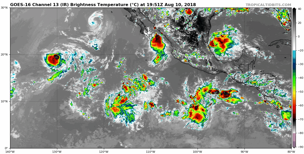
Here it is..

A tropical wave is producing disorganized showers and thunderstorms
several hundred miles south of the southern coast of Mexico. Some
development of this system is possible by the middle of next week
while it moves westward away from the coast of Mexico.
* Formation chance through 48 hours...low...near 0 percent.
* Formation chance through 5 days...low...20 percent.
1 likes
Visit the Caribbean-Central America Weather Thread where you can find at first post web cams,radars
and observations from Caribbean basin members Click Here
and observations from Caribbean basin members Click Here
Re: 2018 EPAC Season
Lane would be the next name on the list.
0 likes
The above post and any post by Ntxw is NOT an official forecast and should not be used as such. It is just the opinion of the poster and may or may not be backed by sound meteorological data. It is NOT endorsed by any professional institution including Storm2k. For official information, please refer to NWS products.
Help support Storm2K!
Help support Storm2K!

Re: 2018 EPAC Season
cycloneye wrote:Did the burst of activity not counting Hector met the expectations the peeps had?
1- Ileana was a semi surprise as almost was a Hurricane but thanks to John it vanished.
2-John did not lived to the high expectation to be a major cane.
3- Kristy expected the way it has done.
It was a good burst but not the stronger one I was expecting.
Not counting Hector, the activity was pretty much in the ball park of what I expected. I know that John underperformed for a lot of people, but he actually exceeded my expectations. He was so broad with so many convective bands that I thought he would cross the 26°C isotherm before he really got a chance to get going and consolidated. The fact he produced 130kt gusts on Socorro really impressed me.
Still plenty of time for other storms to come along and give a good show. I'm personally feeling like this season's main event storm will be in October.
1 likes
Solar Aquarian
Lunar Cancerian
 Sagittarian
Lunar Cancerian
-
cycloneye
- Admin
- Posts: 149508
- Age: 69
- Joined: Thu Oct 10, 2002 10:54 am
- Location: San Juan, Puerto Rico
Re: 2018 EPAC Season
A concentrated area of showers and thunderstorms centered a little
more than 600 miles south of Manzanillo, Mexico is associated with
a tropical wave. This activity has become a little better organized
since yesterday, and conditions appear to be favorable for some
development of this system by the middle of next week while the
disturbance moves westward away from the coast of Mexico.
* Formation chance through 48 hours...low...near 10 percent.
* Formation chance through 5 days...low...30 percent.
0 likes
Visit the Caribbean-Central America Weather Thread where you can find at first post web cams,radars
and observations from Caribbean basin members Click Here
and observations from Caribbean basin members Click Here
-
cycloneye
- Admin
- Posts: 149508
- Age: 69
- Joined: Thu Oct 10, 2002 10:54 am
- Location: San Juan, Puerto Rico
Re: 2018 EPAC Season
0 likes
Visit the Caribbean-Central America Weather Thread where you can find at first post web cams,radars
and observations from Caribbean basin members Click Here
and observations from Caribbean basin members Click Here
-
Yellow Evan
- Professional-Met
- Posts: 16240
- Age: 27
- Joined: Fri Jul 15, 2011 12:48 pm
- Location: Henderson, Nevada/Honolulu, HI
- Contact:
-
Kingarabian
- S2K Supporter
- Posts: 16366
- Joined: Sat Aug 08, 2009 3:06 am
- Location: Honolulu, Hawaii
Re: 2018 EPAC Season
Yellow Evan wrote:EPS has up to 4 systems in the next 15 days.
EPS has been CMC-ish this season
0 likes
RIP Kobe Bryant
Re: 2018 EPAC Season
Epac has crossed 100 ACE for season this morning. Normal for an entire season is ~130-135
0 likes
The above post and any post by Ntxw is NOT an official forecast and should not be used as such. It is just the opinion of the poster and may or may not be backed by sound meteorological data. It is NOT endorsed by any professional institution including Storm2k. For official information, please refer to NWS products.
Help support Storm2K!
Help support Storm2K!
-
cycloneye
- Admin
- Posts: 149508
- Age: 69
- Joined: Thu Oct 10, 2002 10:54 am
- Location: San Juan, Puerto Rico
Re: 2018 EPAC Season
Well,what happened to CSU ACE count as Hector jumped from 49.7 to 56.2 in 6 hours.And EPac as a whole jumped from 100.6 to 107.1? A glitch?
http://tropical.atmos.colostate.edu/Realtime/
http://tropical.atmos.colostate.edu/Realtime/
0 likes
Visit the Caribbean-Central America Weather Thread where you can find at first post web cams,radars
and observations from Caribbean basin members Click Here
and observations from Caribbean basin members Click Here
-
1900hurricane

- Category 5

- Posts: 6063
- Age: 34
- Joined: Fri Feb 06, 2015 12:04 pm
- Location: Houston, TX
- Contact:
Re: 2018 EPAC Season
Yeah, looks like a script isn't doing it's job or something. The 49.7(35) is the same number I ended up with for Hector while east of the International Date Line. With Hector now in the WPac, it shouldn't be contributing any more ACE to the EPac, especially not that much in the span of one best track point.
1 likes
Contract Meteorologist. TAMU & MSST. Fiercely authentic, one of a kind. We are all given free will, so choose a life meant to be lived. We are the Masters of our own Stories.
Opinions expressed are mine alone.
Follow me on Twitter at @1900hurricane : Read blogs at https://1900hurricane.wordpress.com/
Opinions expressed are mine alone.
Follow me on Twitter at @1900hurricane : Read blogs at https://1900hurricane.wordpress.com/
Re: 2018 EPAC Season
We have Lane. 11/5/3 is where the season stands and Lane should make it 11/6/4 given ideal conditions for several days. It also looks like the storm could yield 25-30 ACE at least or more depending on track. That will bring the Epac near it's normal seasonal total average.
3 likes
The above post and any post by Ntxw is NOT an official forecast and should not be used as such. It is just the opinion of the poster and may or may not be backed by sound meteorological data. It is NOT endorsed by any professional institution including Storm2k. For official information, please refer to NWS products.
Help support Storm2K!
Help support Storm2K!
-
Yellow Evan
- Professional-Met
- Posts: 16240
- Age: 27
- Joined: Fri Jul 15, 2011 12:48 pm
- Location: Henderson, Nevada/Honolulu, HI
- Contact:
Re: 2018 EPAC Season
A tropical wave, located about 1000 miles south-southwest of the
southern tip of the Baja California peninsula, continues to produce
disorganized showers and thunderstorms. Some gradual development of
this system is possible during the next several days while it moves
westward to west-northwestward at 10 to 15 mph.
* Formation chance through 48 hours...low...near 0 percent.
* Formation chance through 5 days...low...20 percent
https://twitter.com/MJVentrice/status/1030435740981882887
3 likes
-
Kingarabian
- S2K Supporter
- Posts: 16366
- Joined: Sat Aug 08, 2009 3:06 am
- Location: Honolulu, Hawaii
Re: 2018 EPAC Season
Yellow Evan wrote:A tropical wave, located about 1000 miles south-southwest of the
southern tip of the Baja California peninsula, continues to produce
disorganized showers and thunderstorms. Some gradual development of
this system is possible during the next several days while it moves
westward to west-northwestward at 10 to 15 mph.
* Formation chance through 48 hours...low...near 0 percent.
* Formation chance through 5 days...low...20 percent
[tweet]https://twitter.com/MJVentrice/status/1030435740981882887[tweet]
At this rate we' can snowball towards 200 ACE.
1 likes
RIP Kobe Bryant
-
cycloneye
- Admin
- Posts: 149508
- Age: 69
- Joined: Thu Oct 10, 2002 10:54 am
- Location: San Juan, Puerto Rico
Re: 2018 EPAC Season
Shower activity associated with a tropical wave located about 1000
miles south-southwest of the southern tip of the Baja California
peninsula has become a little better organized since yesterday.
Additional gradual development of this system is possible during the
next several days while it moves westward to west-northwestward at
10 to 15 mph.
* Formation chance through 48 hours...low...10 percent.
* Formation chance through 5 days...low...20 percent.
0 likes
Visit the Caribbean-Central America Weather Thread where you can find at first post web cams,radars
and observations from Caribbean basin members Click Here
and observations from Caribbean basin members Click Here
-
cycloneye
- Admin
- Posts: 149508
- Age: 69
- Joined: Thu Oct 10, 2002 10:54 am
- Location: San Juan, Puerto Rico
Re: 2018 EPAC Season
A tropical wave located about 900 miles south-southwest of the
southern tip of the Baja California peninsula is producing
disorganized cloudiness and showers. Environmental conditions are
forecast to be marginally conducive, and any development of this
system should be slow to occur during the next several days while
it moves westward to west-northwestward at 10 to 15 mph.
* Formation chance through 48 hours...low...10 percent.
* Formation chance through 5 days...low...20 percent.
0 likes
Visit the Caribbean-Central America Weather Thread where you can find at first post web cams,radars
and observations from Caribbean basin members Click Here
and observations from Caribbean basin members Click Here
Who is online
Users browsing this forum: ouragans and 119 guests