What an outbreak of activity in WPAC (though most of the systems are mediocre)
Moderator: S2k Moderators


The main concern in the forecast can be boiled down to two weather
features. A circulation now east of 150E and the monsoon. The
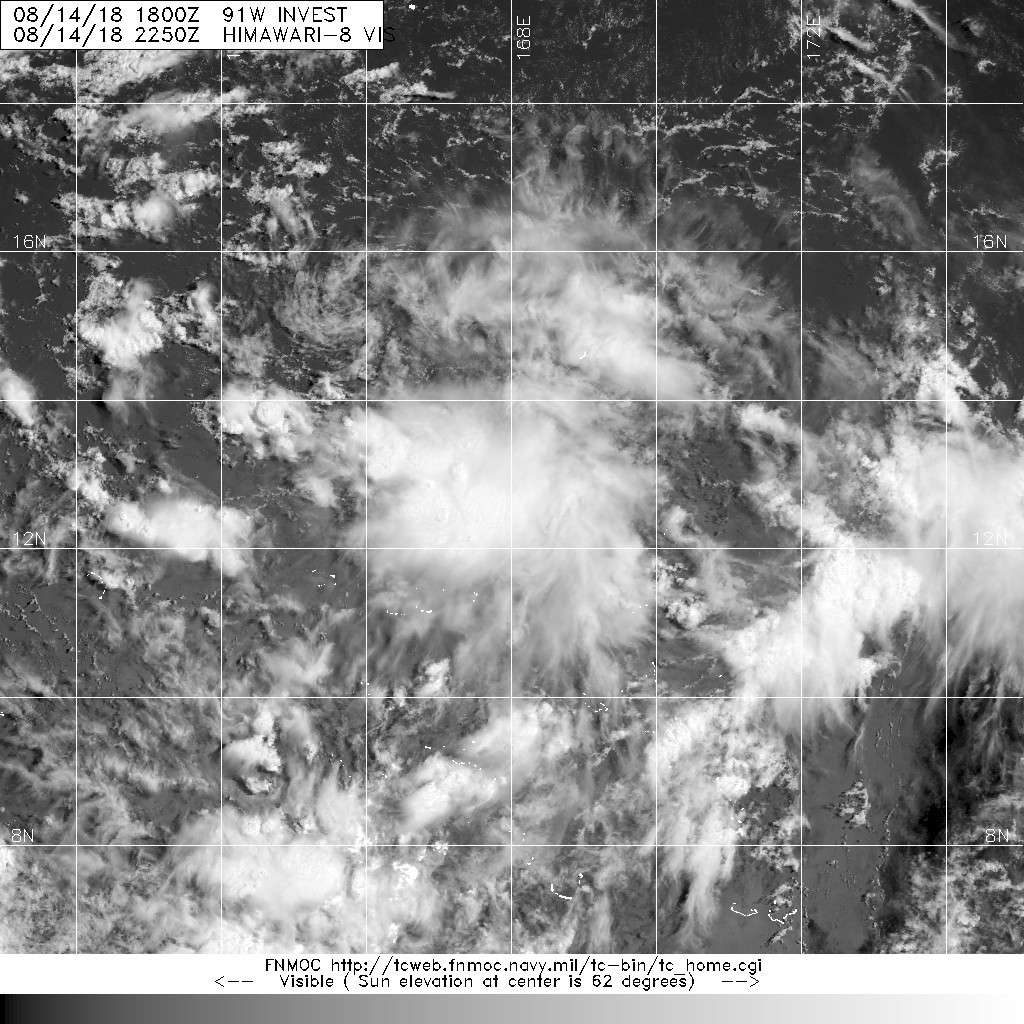
circulation in question was located near 13N158E Friday afternoon.
It is the subject of a Tropical Cyclone Formation Alert which means
that it may develop into a tropical cyclone over the next 12 to 24
hours. Current model track projections take the circulation north of
Saipan early next week. Even if the circulation follows this path
it will still have an influence on the local weather. Relatively dry
air cover the area and only expect isolated showers and thunderstorms
through Saturday night. As the circulation approaches the Marianas it
will begin enhancing the monsoon flow across the local area. This
will cause scattered showers and isolated thunderstorms over the area
starting Sunday. The scattered showers and isolated thunderstorms
will persist through Wednesday. As the circulation passes north of
Saipan showers could get heavy on Monday and Monday night. The
enhanced monsoon flow will also cause breezy wind conditions at times
Monday through Wednesday.
A circulation could be found east of Guam near 13N158E. This feature
is now the subject of a Tropical Cyclone Formation Alert, which means
it could develop into a tropical cyclone within 12 to 24 hours. The
GFS, CMC, JMA, and NAVGEM models show that it may become a tropical
storm by Monday. ECMWF keep the circulation weak. Most of the models
agree taking the circulation towards the northern Marianas by Monday.
NAVGEM has it passing east of the Marianas. As with any developing
system this is still speculative and the system should be monitored.
A Special Weather Statement has been issued to address the situation.
As mentioned above, the models suggest an enhancement in monsoon
flow across the Marianas in association with the circulation also
mentioned above. This may lead to periods of heavy rain, especially
on Monday through Wednesday. Models give varying rainfall totals.
GFS predicts from now through Wednesday morning 6 to 10 inches. The
ECMWF is lower with totals around 5 inches. CMC model indicates 8 to
9 inches possible. With the ground near saturation from recent
heavy rains in combination with the heavy rainfall predicted, brief
flooding may be possible. Will wait for a few more model runs, but if
this heavy rain pattern persist in the models a Hydrologic Outlook
may be needed.


Users browsing this forum: No registered users and 16 guests

