
2018 Tropics: Global Model Runs Discussion (Out to day 16)
Moderator: S2k Moderators
Forum rules

The posts in this forum are NOT official forecasts and should not be used as such. They are just the opinion of the poster and may or may not be backed by sound meteorological data. They are NOT endorsed by any professional institution or STORM2K. For official information, please refer to products from the National Hurricane Center and National Weather Service.
-
TheStormExpert
Re: 2018 Tropics: Global Model Runs Discussion (Out to day 16)
2 likes
-
Hurricaneman

- Category 5

- Posts: 7404
- Age: 45
- Joined: Tue Aug 31, 2004 3:24 pm
- Location: central florida
Re: 2018 Tropics: Global Model Runs Discussion (Out to day 16)
The models show another system in the Subtropical Atlantic and may need to be watched as the Euro seems to send that feature close to the Bahamas while the GFS sends it to Bermuda so let’s hope this system isn’t being underestimated as systems like this tend to be and let’s hope this doesn’t end up an east coast threat
2 likes
-
AJC3

- Admin

- Posts: 4153
- Age: 62
- Joined: Tue Aug 31, 2004 7:04 pm
- Location: Ballston Spa, New York
- Contact:
Re: 2018 Tropics: Global Model Runs Discussion (Out to day 16)
Gang,
Several of the posts in here were more suited for the seasonal thread, and as such have been moved over there...
viewtopic.php?f=31&t=&start=860
Let's try to keep the discussion here more specific to the latest global model guidance runs, and carry on the more general discussions about conditions and longer range outlooks over there.
Carry on... and thanks.
8 likes
-
CyclonicFury

- Category 5
- Posts: 2032
- Age: 27
- Joined: Sun Jul 02, 2017 12:32 pm
- Location: NC
- Contact:
Re: 2018 Tropics: Global Model Runs Discussion (Out to day 16)
00z GFS has a strong TS in the MDR in the super long range.
1 likes
NCSU B.S. in Meteorology Class of 2021. Tropical weather blogger at http://www.cyclonicfury.com. My forecasts and thoughts are NOT official, for official forecasts please consult the National Hurricane Center.
-
Hurricaneman
- Category 5
- Posts: 7404
- Age: 45
- Joined: Tue Aug 31, 2004 3:24 pm
- Location: central florida
Re: 2018 Tropics: Global Model Runs Discussion (Out to day 16)
CyclonicFury wrote:00z GFS has a strong TS in the MDR in the super long range.
Yep and that setup is not what you want to see but as we all know it could be different in a few days
0 likes
-
CyclonicFury
- Category 5
- Posts: 2032
- Age: 27
- Joined: Sun Jul 02, 2017 12:32 pm
- Location: NC
- Contact:
Re: 2018 Tropics: Global Model Runs Discussion (Out to day 16)
FWIW, the 12z ECMWF EPS was also showing some MDR activity at hour 300+. Quite far out but climatology would normally suggest that the MDR should come to life during this time period.
0 likes
NCSU B.S. in Meteorology Class of 2021. Tropical weather blogger at http://www.cyclonicfury.com. My forecasts and thoughts are NOT official, for official forecasts please consult the National Hurricane Center.

Re: 2018 Tropics: Global Model Runs Discussion (Out to day 16)
GFS spins up a CV surface low Thursday

0 likes
-
Dylan

- Professional-Met

- Posts: 338
- Age: 31
- Joined: Mon May 31, 2010 9:50 am
- Location: New Orleans, LA
Re: 2018 Tropics: Global Model Runs Discussion (Out to day 16)
Anyone that has been looking at the GEFS/EPS should be surprised that the 0z GFS shows a Cape Verde system. Also, climatology plays a factor. The Atlantic is eventually going to wake up, even if its for only a very brief period of time.
3 likes
Georges('98), Allison('01), Isidore('02), Lili('02), Frances('04) Ivan('04), Cindy('05), Katrina('05), Rita('05), Gustav('08), Isaac('12), Matthew('16), Harvey('17), Irma('17), Nate ('17), Ida ('21).
-
SFLcane

- S2K Supporter

- Posts: 10281
- Age: 48
- Joined: Sat Jun 05, 2010 1:44 pm
- Location: Lake Worth Florida
Re: 2018 Tropics: Global Model Runs Discussion (Out to day 16)
Yep and it’s also gone on the 06z gfs run... 
0 likes
-
HURRICANELONNY
- Category 5
- Posts: 1392
- Joined: Wed May 07, 2003 6:48 am
- Location: HOLLYWOOD.FL
Re: 2018 Tropics: Global Model Runs Discussion (Out to day 16)
Models are hinting by end of the month a strong wave coming off Africa. That usually is the time for more conducive factors in the tropics. The SAL should lessen as well as SST at least normal in most parts atlantic. El Nino not here yet
0 likes
hurricanelonny

Re: 2018 Tropics: Global Model Runs Discussion (Out to day 16)
Hurricaneman wrote:The models show another system in the Subtropical Atlantic and may need to be watched as the Euro seems to send that feature close to the Bahamas while the GFS sends it to Bermuda so let’s hope this system isn’t being underestimated as systems like this tend to be and let’s hope this doesn’t end up an east coast threat
Looks like this may pan out.
Last edited by tailgater on Sun Aug 19, 2018 1:38 pm, edited 1 time in total.
0 likes
The following post is NOT an official forecast and should not be used as such. It is just the opinion of the poster and may or may not be backed by sound meteorological data. It is NOT endorsed by any professional institution including storm2k.org For Official Information please refer to the NHC and NWS products.
-
CyclonicFury
- Category 5
- Posts: 2032
- Age: 27
- Joined: Sun Jul 02, 2017 12:32 pm
- Location: NC
- Contact:
Re: 2018 Tropics: Global Model Runs Discussion (Out to day 16)
The ECMWF and GFS models both indicate the potential for a non-tropical low to form west of the Azores. It's unclear whether it will be able to acquire subtropical or tropical characteristics, but we are getting into late August so we will have to watch. Both the ECMWF and GFS models meander the low over warm waters for several days, so it will be interesting to see what happens.
0 likes
NCSU B.S. in Meteorology Class of 2021. Tropical weather blogger at http://www.cyclonicfury.com. My forecasts and thoughts are NOT official, for official forecasts please consult the National Hurricane Center.

Re: 2018 Tropics: Global Model Runs Discussion (Out to day 16)
tailgater wrote:Hurricaneman wrote:The models show another system in the Subtropical Atlantic and may need to be watched as the Euro seems to send that feature close to the Bahamas while the GFS sends it to Bermuda so let’s hope this system isn’t being underestimated as systems like this tend to be and let’s hope this doesn’t end up an east coast threat
Looks like this may pan out.
This disturbance/weak vorticity is under some westerly shear and high pressure environment, very little if any development out this, IMO.

1 likes

Re: 2018 Tropics: Global Model Runs Discussion (Out to day 16)
Lets keep that shear strong over the GOM. Many people still recovering from Harvey in the Houston-Galveston areas as we approaching the 1 year anniversary next weekend.
2 likes
The following post is NOT an official forecast and should not be used as such. It is just the opinion of the poster and may or may not be backed by sound meteorological data. It is NOT endorsed by any professional institution including storm2k.org For Official Information please refer to the NHC and NWS products.

Re: 2018 Tropics: Global Model Runs Discussion (Out to day 16)
The dry wave/remnants in the Caribbean would need a long stretch of low shear environment to develop into a named storm. Shear is a constantly evolving feature but the Pacific is more interesting even if that is only high surf advisories.
0 likes
-
Dylan
- Professional-Met
- Posts: 338
- Age: 31
- Joined: Mon May 31, 2010 9:50 am
- Location: New Orleans, LA
Re: 2018 Tropics: Global Model Runs Discussion (Out to day 16)
12z EPS members continue to show a burst of activity after Day 7 in the Atlantic Basin.
2 likes
Georges('98), Allison('01), Isidore('02), Lili('02), Frances('04) Ivan('04), Cindy('05), Katrina('05), Rita('05), Gustav('08), Isaac('12), Matthew('16), Harvey('17), Irma('17), Nate ('17), Ida ('21).

Re: 2018 Tropics: Global Model Runs Discussion (Out to day 16)
Dylan wrote:12z EPS members continue to show a burst of activity after Day 7 in the Atlantic Basin.
Yep, should start showing up on the operational runs this coming week.

0 likes
The following post is NOT an official forecast and should not be used as such. It is just the opinion of the poster and may or may not be backed by sound meteorological data. It is NOT endorsed by any professional institution including storm2k.org For Official Information please refer to the NHC and NWS products.
-
wxGuy
Re: 2018 Tropics: Global Model Runs Discussion (Out to day 16)

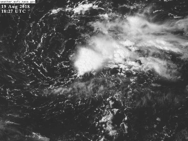
I see some rotation and t storm activity few hundred mi off east coast of FL.. could be something here
0 likes
-
CyclonicFury
- Category 5
- Posts: 2032
- Age: 27
- Joined: Sun Jul 02, 2017 12:32 pm
- Location: NC
- Contact:
Re: 2018 Tropics: Global Model Runs Discussion (Out to day 16)
12z Euro shows an impressive large wave attempting to develop over the MDR next week
0 likes
NCSU B.S. in Meteorology Class of 2021. Tropical weather blogger at http://www.cyclonicfury.com. My forecasts and thoughts are NOT official, for official forecasts please consult the National Hurricane Center.
-
gatorcane

- S2K Supporter
- Posts: 23708
- Age: 48
- Joined: Sun Mar 13, 2005 3:54 pm
- Location: Boca Raton, FL
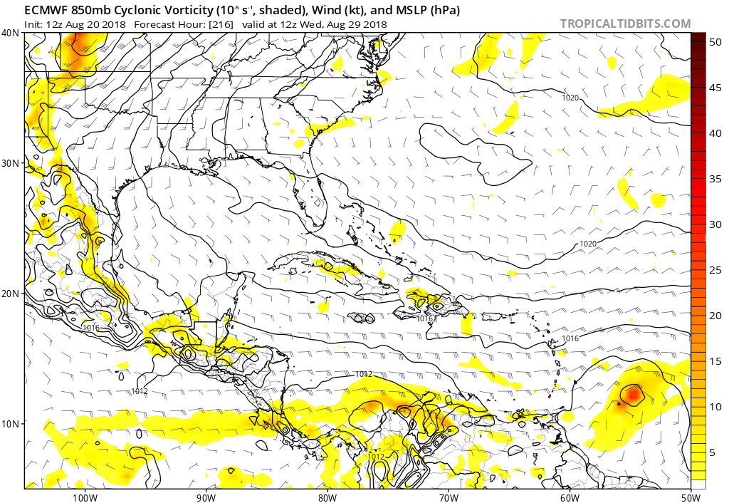
Re: 2018 Tropics: Global Model Runs Discussion (Out to day 16)
CyclonicFury wrote:12z Euro shows an impressive large wave attempting to develop over the MDR next week
Indeed the EC has woken up. It heard the “Aug 20th bell.” Heading for Caribbean at 216 hours:
0 likes
Who is online
Users browsing this forum: mixedDanilo.E and 69 guests