2018 EPAC Season
Moderator: S2k Moderators
Forum rules

The posts in this forum are NOT official forecasts and should not be used as such. They are just the opinion of the poster and may or may not be backed by sound meteorological data. They are NOT endorsed by any professional institution or STORM2K. For official information, please refer to products from the National Hurricane Center and National Weather Service.


Re: 2018 EPAC Season
Lane has definitely piled on ACE. About 26-27 units now and could easily get another 5 to pass 30. That will bring the EPAC to near it's entire seasonal average. What a ride it has been so far in August.
4 likes
The above post and any post by Ntxw is NOT an official forecast and should not be used as such. It is just the opinion of the poster and may or may not be backed by sound meteorological data. It is NOT endorsed by any professional institution including Storm2k. For official information, please refer to NWS products.
Help support Storm2K!
Re: 2018 EPAC Season
It's official, Lane is a Cat 5. With that 2018 can join 2014 and 2015 as EPAC seasons with Cat 5s of late. 2018 is going down as quite a memorable season for the EPAC+CPAC. Praying for Hawaii.
6 likes
The above post and any post by Ntxw is NOT an official forecast and should not be used as such. It is just the opinion of the poster and may or may not be backed by sound meteorological data. It is NOT endorsed by any professional institution including Storm2k. For official information, please refer to NWS products.
Help support Storm2K!
Help support Storm2K!


Re: 2018 EPAC Season
12z euro sends another longtracker west towards the CPAC
1 likes
The above post and any post by Ntxw is NOT an official forecast and should not be used as such. It is just the opinion of the poster and may or may not be backed by sound meteorological data. It is NOT endorsed by any professional institution including Storm2k. For official information, please refer to NWS products.
Help support Storm2K!
Help support Storm2K!
-
1900hurricane

- Category 5

- Posts: 6063
- Age: 34
- Joined: Fri Feb 06, 2015 12:04 pm
- Location: Houston, TX
- Contact:
Re: 2018 EPAC Season
Hector and Lane have accounted for over half the season's ACE up to this point.
4 likes
Contract Meteorologist. TAMU & MSST. Fiercely authentic, one of a kind. We are all given free will, so choose a life meant to be lived. We are the Masters of our own Stories.
Opinions expressed are mine alone.
Follow me on Twitter at @1900hurricane : Read blogs at https://1900hurricane.wordpress.com/
Opinions expressed are mine alone.
Follow me on Twitter at @1900hurricane : Read blogs at https://1900hurricane.wordpress.com/
-
cycloneye

- Admin

- Posts: 149508
- Age: 69
- Joined: Thu Oct 10, 2002 10:54 am
- Location: San Juan, Puerto Rico
Re: 2018 EPAC Season
Here comes another one.

Tropical Weather Outlook
NWS National Hurricane Center Miami FL
500 PM PDT Wed Aug 22 2018
For the eastern North Pacific...east of 140 degrees west longitude:
An area of low pressure could form in a couple of days several
hundred miles southwest of the southern tip of Baja California Sur.
Thereafter, some development of this system is possible into early
next week while the disturbance moves westward at about 10 mph.
* Formation chance through 48 hours...low...near 0 percent.
* Formation chance through 5 days...low...20 percent.
Forecaster Blake
0 likes
Visit the Caribbean-Central America Weather Thread where you can find at first post web cams,radars
and observations from Caribbean basin members Click Here
and observations from Caribbean basin members Click Here
Re: 2018 EPAC Season
cycloneye wrote:Here comes another one.Tropical Weather Outlook
NWS National Hurricane Center Miami FL
500 PM PDT Wed Aug 22 2018
For the eastern North Pacific...east of 140 degrees west longitude:
An area of low pressure could form in a couple of days several
hundred miles southwest of the southern tip of Baja California Sur.
Thereafter, some development of this system is possible into early
next week while the disturbance moves westward at about 10 mph.
* Formation chance through 48 hours...low...near 0 percent.
* Formation chance through 5 days...low...20 percent.
Forecaster Blake
https://i.imgur.com/GI4oSTi.png
Is this the one the 12z Euro sends west as another tracker?
0 likes
The above post and any post by Ntxw is NOT an official forecast and should not be used as such. It is just the opinion of the poster and may or may not be backed by sound meteorological data. It is NOT endorsed by any professional institution including Storm2k. For official information, please refer to NWS products.
Help support Storm2K!
Help support Storm2K!
-
Yellow Evan

- Professional-Met

- Posts: 16240
- Age: 27
- Joined: Fri Jul 15, 2011 12:48 pm
- Location: Henderson, Nevada/Honolulu, HI
- Contact:
Re: 2018 EPAC Season
1 likes
-
cycloneye
- Admin
- Posts: 149508
- Age: 69
- Joined: Thu Oct 10, 2002 10:54 am
- Location: San Juan, Puerto Rico
Re: 2018 EPAC Season
Ntxw wrote:cycloneye wrote:Here comes another one.Tropical Weather Outlook
NWS National Hurricane Center Miami FL
500 PM PDT Wed Aug 22 2018
For the eastern North Pacific...east of 140 degrees west longitude:
An area of low pressure could form in a couple of days several
hundred miles southwest of the southern tip of Baja California Sur.
Thereafter, some development of this system is possible into early
next week while the disturbance moves westward at about 10 mph.
* Formation chance through 48 hours...low...near 0 percent.
* Formation chance through 5 days...low...20 percent.
Forecaster Blake
https://i.imgur.com/GI4oSTi.png
Is this the one the 12z Euro sends west as another tracker?
I think this is it.
1 likes
Visit the Caribbean-Central America Weather Thread where you can find at first post web cams,radars
and observations from Caribbean basin members Click Here
and observations from Caribbean basin members Click Here
Re: 2018 EPAC Season
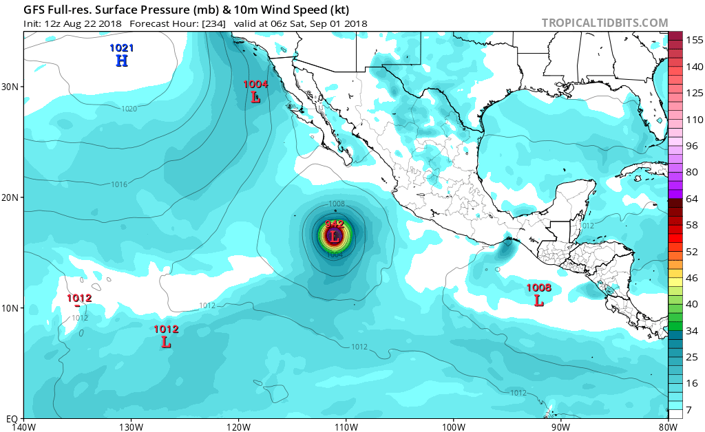
Ntxw wrote:We have Lane. 11/5/3 is where the season stands and Lane should make it 11/6/4 given ideal conditions for several days. It also looks like the storm could yield 25-30 ACE at least or more depending on track. That will bring the Epac near it's normal seasonal total average.
Lane has put down about ~35 units so far and may end up north of 40.
0 likes
The above post and any post by Ntxw is NOT an official forecast and should not be used as such. It is just the opinion of the poster and may or may not be backed by sound meteorological data. It is NOT endorsed by any professional institution including Storm2k. For official information, please refer to NWS products.
Help support Storm2K!
Help support Storm2K!
-
cycloneye
- Admin
- Posts: 149508
- Age: 69
- Joined: Thu Oct 10, 2002 10:54 am
- Location: San Juan, Puerto Rico
Re: 2018 EPAC Season
Wow Lane will surpass Maria of WPac shortly in ACE units for a TC in the Northern Hemisphere. Lane as of 03:00z had 34.2 and Maria had 35.8. It will get close to what Hector got (50.3) preliminar as changes can occur in post season report.
0 likes
Visit the Caribbean-Central America Weather Thread where you can find at first post web cams,radars
and observations from Caribbean basin members Click Here
and observations from Caribbean basin members Click Here
Re: 2018 EPAC Season
cycloneye wrote:Wow Lane will surpass Maria of WPac shortly in ACE units for a TC in the Northern Hemisphere. Lane as of 03:00z had 34.2 and Maria had 35.8. It will get close to what Hector got (50.3) preliminar as changes can occur in post season report.
Using the last public advisory forecast from the CPHC Lane would add another 10-11 units before he is done. He will join Hector in top 10 at least of EPAC ACE producers east of the IDL. That also puts the EPAC+CPAC season over 140-145 units. Another long tracker would easily tack on 25+ units.
1 likes
The above post and any post by Ntxw is NOT an official forecast and should not be used as such. It is just the opinion of the poster and may or may not be backed by sound meteorological data. It is NOT endorsed by any professional institution including Storm2k. For official information, please refer to NWS products.
Help support Storm2K!
Help support Storm2K!
Re: 2018 EPAC Season
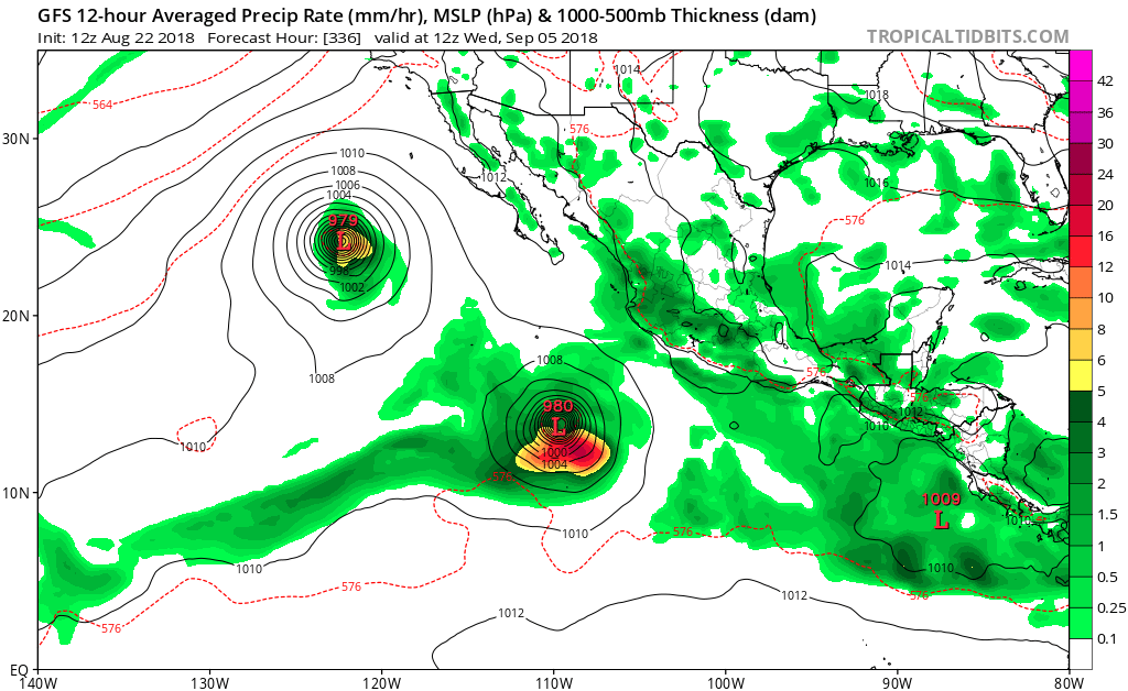
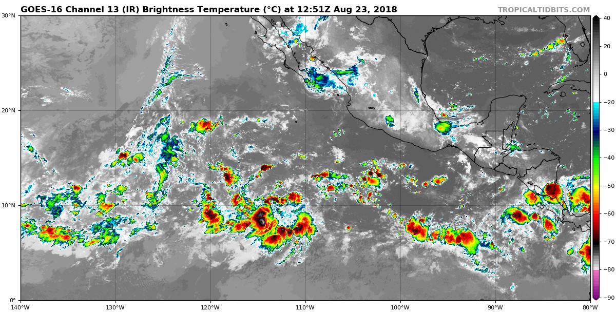
That area is starting to light up a bit this morning. It will be slow to develop but anything going west this season is worth watching for.
2 likes
The above post and any post by Ntxw is NOT an official forecast and should not be used as such. It is just the opinion of the poster and may or may not be backed by sound meteorological data. It is NOT endorsed by any professional institution including Storm2k. For official information, please refer to NWS products.
Help support Storm2K!
Help support Storm2K!
-
Yellow Evan
- Professional-Met
- Posts: 16240
- Age: 27
- Joined: Fri Jul 15, 2011 12:48 pm
- Location: Henderson, Nevada/Honolulu, HI
- Contact:
Re: 2018 EPAC Season
758
ABPZ20 KNHC 231145
TWOEP
Tropical Weather Outlook
NWS National Hurricane Center Miami FL
500 AM PDT Thu Aug 23 2018
For the eastern North Pacific...east of 140 degrees west longitude:
An area of low pressure could form this weekend several hundred
miles southwest of the southern tip of Baja California Sur.
Gradual development of this system is possible thereafter
while the disturbance moves westward at about 10 mph.
* Formation chance through 48 hours...low...near 0 percent.
* Formation chance through 5 days...low...20 percent.
A second area of low pressure could form in a few days well to
the east-southeast of the Hawaiian Islands. Some slow development
of this system is possible early next week while it moves westward
or west-northwestward at about 10 mph.
* Formation chance through 48 hours...low...near 0 percent.
* Formation chance through 5 days...low...20 percent.
$$
Forecaster Cangialosi
0 likes
-
cycloneye
- Admin
- Posts: 149508
- Age: 69
- Joined: Thu Oct 10, 2002 10:54 am
- Location: San Juan, Puerto Rico
Re: 2018 EPAC Season
Tropical Weather Outlook
NWS National Hurricane Center Miami FL
1100 AM PDT Thu Aug 23 2018
For the eastern North Pacific...east of 140 degrees west longitude:
1. An area of low pressure could form this weekend several hundred
miles southwest of the southern tip of Baja California Sur.
Gradual development of this system is possible thereafter
while the disturbance moves westward at about 10 mph.
* Formation chance through 48 hours...low...near 0 percent.
* Formation chance through 5 days...low...20 percent.
2. A second area of low pressure could form in a few days well to
the east-southeast of the Hawaiian Islands. Some slow development
of this system is possible early next week while it moves westward
or west-northwestward at about 10 mph.
* Formation chance through 48 hours...low...near 0 percent.
* Formation chance through 5 days...low...20 percent.
Forecaster Cangialosi
0 likes
Visit the Caribbean-Central America Weather Thread where you can find at first post web cams,radars
and observations from Caribbean basin members Click Here
and observations from Caribbean basin members Click Here
-
cycloneye
- Admin
- Posts: 149508
- Age: 69
- Joined: Thu Oct 10, 2002 10:54 am
- Location: San Juan, Puerto Rico
Re: 2018 EPAC Season
These are not the 2 that are being mentioned in the TWO but other 2 systems on long range. If it happens,then EPac will reach the 200 mark of ACE. As of 15:00z it was at 137.9 ACE units. 1992 was the year with the highest ACE total so far since 1971 with 295 units.

1 likes
Visit the Caribbean-Central America Weather Thread where you can find at first post web cams,radars
and observations from Caribbean basin members Click Here
and observations from Caribbean basin members Click Here
-
Yellow Evan
- Professional-Met
- Posts: 16240
- Age: 27
- Joined: Fri Jul 15, 2011 12:48 pm
- Location: Henderson, Nevada/Honolulu, HI
- Contact:
-
Yellow Evan
- Professional-Met
- Posts: 16240
- Age: 27
- Joined: Fri Jul 15, 2011 12:48 pm
- Location: Henderson, Nevada/Honolulu, HI
- Contact:
Re: 2018 EPAC Season

12z ECMWF recurves the 0/20 near 145W. Given how at least until Lane models in this area of the world had an east bias this is something to watch but still very far out.
1 likes
-
cycloneye
- Admin
- Posts: 149508
- Age: 69
- Joined: Thu Oct 10, 2002 10:54 am
- Location: San Juan, Puerto Rico
Re: 2018 EPAC Season
Tropical Weather Outlook
NWS National Hurricane Center Miami FL
500 PM PDT Thu Aug 23 2018
For the eastern North Pacific...east of 140 degrees west longitude:
1. A trough of low pressure is producing disorganized showers and
thunderstorms several hundred miles south-southwest of the southern
tip of the Baja California Peninsula. Some gradual development of
this system is possible through early next week while the
disturbance moves westward around 10 mph.
* Formation chance through 48 hours...low...near 0 percent.
* Formation chance through 5 days...low...30 percent.
2. An area of low pressure could form in a few days well to the
east-southeast of the Hawaiian Islands. Some slow development of
this system is possible early next week while it moves westward or
west-northwestward at about 10 mph.
* Formation chance through 48 hours...low...near 0 percent.
* Formation chance through 5 days...low...20 percent.
Forecaster Zelinsky
0 likes
Visit the Caribbean-Central America Weather Thread where you can find at first post web cams,radars
and observations from Caribbean basin members Click Here
and observations from Caribbean basin members Click Here
Who is online
Users browsing this forum: ouragans and 117 guests