#15 Postby Shell Mound » Sun Aug 26, 2018 10:05 am
There are a number of possible worst-case scenarios, depending on locale:
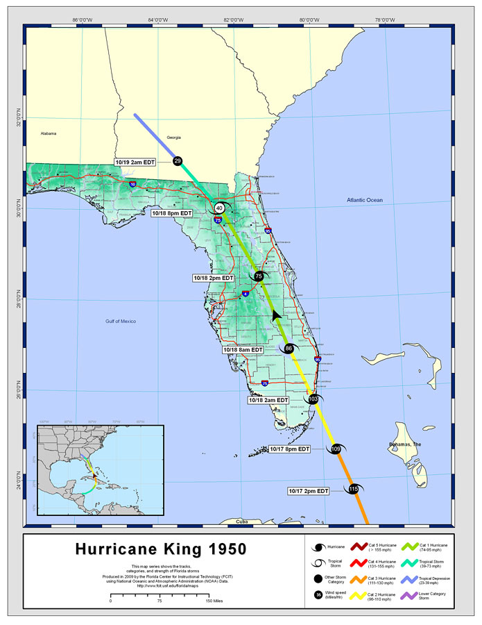
*A large, intense Cat-5 tracking from central Andros, Bahamas, to Golden Beach, FL, and thence to Egmont Key and just west of Tallahassee via St. Marks, with a path south of Lake Okeechobee. This scenario would place the eyewall over much of Miami/Fort Lauderdale, induce storm surge on Lake Okeechobee, put the strongest winds and peak surge over Tampa/St. Petersburg, and cause substantial wind- and surge-related damage to the Big Bend and the state capital. Track is a combination of 1926 and 1935: west-northwest over south-central FL, then north-northwest into the Big Bend. Landfall intensity: 150 knots / 900 mb (South FL).
*A weakening, large, post-ERC Cat-4 making landfall on Honeymoon Island, FL, with the peak winds and surge over Tampa/St. Petersburg, similar to the 1848 and 1921 major hurricanes. The system then tracks northeastward over Greater Orlando, passing just north of the city itself, and enters the Atlantic near New Smyrna Beach. Major storm surge and wind affects the west coast from Port Richey to Everglades City, while inland damage is considerable and widespread. Large southwesterly fetch generates a storm surge of 20-30’ (locally even greater) over MacDill AFB, Port of Tampa, and Boca Ciega Bay. Landfall intensity: 115 knots / 930 mb.
*A sprawling, slow-moving Cat-5 tracks north-northwestward over the lower FL Keys and up the peninsula, passing just west of Havana, Cuba, and Key West, the northeastern eyewall affecting both locations. Eye makes landfall over the Dry Tortugas and North Captiva Island, FL, before passing inland to the immediate west of Orlando and Jacksonville. Both coasts of FL experience hurricane-force gusts, storm surge devastates the Keys and SW mainland, and Orlando and Jacksonville experience severe wind- and surge-caused effects. Damage extends beyond FL, affecting coastal GA/Carolinas. Landfall intensity: 140 knots / 910 mb (Dry Tortugas).
1 likes
CVW / MiamiensisWx / Shell MoundThe posts in this forum are NOT official forecasts and should not be used as such. They are just the opinion of the poster and may or may not be backed by sound meteorological data. They are NOT endorsed by any professional institution or
STORM2K. For official information, please refer to products from the
NHC and
NWS.


