NDG wrote::uarrow: Yeah, a good half if not more of them are pointing towards the eastern US.
One of those ensembles ends with a cat 2 maybe 15 miles north of me.
Moderator: S2k Moderators
NDG wrote::uarrow: Yeah, a good half if not more of them are pointing towards the eastern US.
mlfreeman wrote:NDG wrote::uarrow: Yeah, a good half if not more of them are pointing towards the eastern US.
https://i.imgur.com/O80sA8Y.png
One of those ensembles ends with a cat 2 maybe 15 miles north of me.


TheStormExpert wrote:I hope I don't cause more west trends, but this reminds me a bit of the early days of Irma which originally was being shown by models to recurve near the U.S. East Coast or hit the Carolinas. Anyone else remember that?
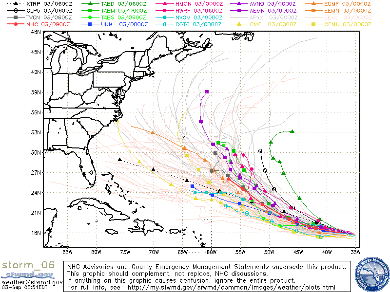


NDG wrote::uarrow: Yeah, a good half if not more of them are pointing towards the eastern US.


tolakram wrote:Keep in mind this is very long range and the odds of the models picking the correct location is slim to none.
End of the 0Z Euro run.


SFLcane wrote:Um...not liking the look of these EPS members shifting westward
[img]https://imghst.gpsfiledepot.com/1535985494.jpg/img]

toad strangler wrote:tolakram wrote:Keep in mind this is very long range and the odds of the models picking the correct location is slim to none.
End of the 0Z Euro run.
OT a bit but you are so right...... EXCEPT last year the GFS had an early 360 hour run that ended up nailing landfall location of TS Alberto lol I have an image saved of that if anybody wants a chuckle
tolakram wrote:Keep in mind this is very long range and the odds of the models picking the correct location is slim to none.
End of the 0Z Euro run.
Hypercane_Kyle wrote:toad strangler wrote:tolakram wrote:
OT a bit but you are so right...... EXCEPT last year the GFS had an early 360 hour run that ended up nailing landfall location of TS Alberto lol I have an image saved of that if anybody wants a chuckle
Wait... Alberto was last year?


Users browsing this forum: No registered users and 170 guests


