ATL: FLORENCE - Models
Moderator: S2k Moderators
Re: ATL: FLORENCE - Models
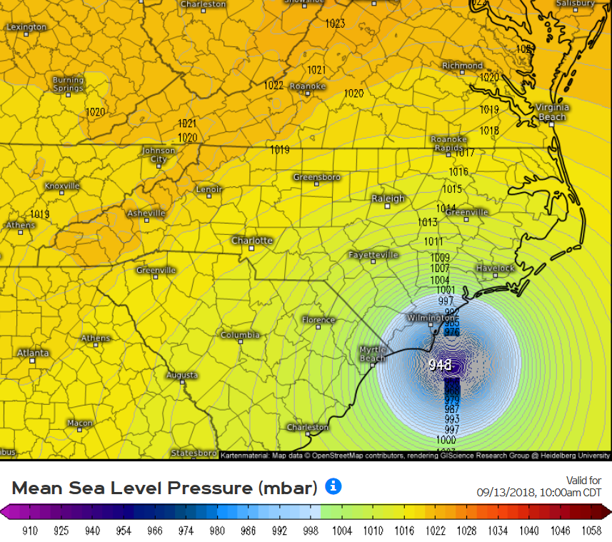
12Z Euro pounds NC Triad to Triangle with 8-12" of rain! 0Z was concentrated near Triangle and further east.
0 likes
Personal Forecast Disclaimer:
The posts in this forum are NOT official forecasts and should not be used as such. They are just the opinion of the poster and may or may not be backed by sound meteorological data. They are NOT endorsed by any professional institution or storm2k.org. For official information, please refer to the NHC and NWS products.
The posts in this forum are NOT official forecasts and should not be used as such. They are just the opinion of the poster and may or may not be backed by sound meteorological data. They are NOT endorsed by any professional institution or storm2k.org. For official information, please refer to the NHC and NWS products.
-
ScottNAtlanta

- Category 5

- Posts: 2535
- Joined: Sat May 25, 2013 3:11 pm
- Location: Atlanta, GA
Re: ATL: FLORENCE - Models
BobHarlem wrote:12Z Euro simulated IR Satellite

Thats going to have implications far inland to...people in Charlotte should be watching as well
1 likes
The posts in this forum are NOT official forecast and should not be used as such. They are just the opinion of the poster and may or may not be backed by sound meteorological data. They are NOT endorsed by any professional institution or storm2k.org. For official information, please refer to the NHC and NWS products.
-
supercane4867
- Category 5
- Posts: 4966
- Joined: Wed Nov 14, 2012 10:43 am
-
Aric Dunn
- Category 5
- Posts: 21238
- Age: 43
- Joined: Sun Sep 19, 2004 9:58 pm
- Location: Ready for the Chase.
- Contact:
Re: ATL: FLORENCE - Models
Just for fun and this is only assuming the same general ridge placement and synoptic setup. And of course if it were to continue westward longer than the models suggest there would of course be mid/end of run changes as well.
this is just to show how small variation from a wobble for 3 hours or 2 or whatever can add up and change things. we see this all the time. where the same general shape to the track from the models but it just never quite makes the turn on time.

this is just to show how small variation from a wobble for 3 hours or 2 or whatever can add up and change things. we see this all the time. where the same general shape to the track from the models but it just never quite makes the turn on time.
4 likes
Note: If I make a post that is brief. Please refer back to previous posts for the analysis or reasoning. I do not re-write/qoute what my initial post said each time.
If there is nothing before... then just ask
Space & Atmospheric Physicist, Embry-Riddle Aeronautical University,
I believe the sky is falling...
If there is nothing before... then just ask
Space & Atmospheric Physicist, Embry-Riddle Aeronautical University,
I believe the sky is falling...
-
toad strangler

- S2K Supporter

- Posts: 4546
- Joined: Sun Jul 28, 2013 3:09 pm
- Location: Earth
- Contact:
Re: ATL: FLORENCE - Models
The Euro solution is pretty much a climo Carolinas hit IMO. And if climo wins out it will be a Cat 3. Just an opinion.
Last edited by toad strangler on Sun Sep 09, 2018 1:36 pm, edited 1 time in total.
1 likes
My Weather Station
https://www.wunderground.com/dashboard/pws/KFLPORTS603
https://www.wunderground.com/dashboard/pws/KFLPORTS603
-
fox13weather
- Professional-Met

- Posts: 161
- Joined: Tue Sep 20, 2005 7:49 pm
Re: ATL: FLORENCE - Models
Yellow Evan wrote:Classic case where the ECMWF has a better handle on the system and ends up winning the model war against the GFS.
There are no "winners" until a forecast does or does not verify. Yes, the ECMWF is considered the better of the two models, but no forecast is wrong or right until proven wrong or right.
6 likes
-
tolakram
- Admin

- Posts: 20186
- Age: 62
- Joined: Sun Aug 27, 2006 8:23 pm
- Location: Florence, KY (name is Mark)
Re: ATL: FLORENCE - Models

0 likes
M a r k
- - - - -
Join us in chat: Storm2K Chatroom Invite. Android and IOS apps also available.
The posts in this forum are NOT official forecasts and should not be used as such. Posts are NOT endorsed by any professional institution or STORM2K.org. For official information and forecasts, please refer to NHC and NWS products.

Re: ATL: FLORENCE - Models
toad strangler wrote:The Euro solution is pretty much a climo Carolinas hit IMO. And if climo wins out it will be a Cat 3. Just an opinion.
I think a climo hit would be actually scrapping the OBX heading OTS afterward.
3 likes
Re: ATL: FLORENCE - Models
ronjon wrote:toad strangler wrote:The Euro solution is pretty much a climo Carolinas hit IMO. And if climo wins out it will be a Cat 3. Just an opinion.
I think a climo hit would be actually scrapping the OBX heading OTS afterward. Think its pretty rare to hit the coast moving W-NW. Last analog I can think of would be Hugo.
1 likes
-
txwatcher91
- Category 5
- Posts: 1498
- Joined: Tue Aug 02, 2005 2:29 pm
Re: ATL: FLORENCE - Models
ronjon wrote:toad strangler wrote:The Euro solution is pretty much a climo Carolinas hit IMO. And if climo wins out it will be a Cat 3. Just an opinion.
I think a climo hit would be actually scrapping the OBX heading OTS afterward.
Actually climo would have been for Florence to recurve before Bermuda and OTS. We are in uncharted territory here when it comes to climo and Florence doesn’t seem to care. Topsail Beach, NC is usually a sweet spot for storms approaching from the south or southeast.
1 likes

Re: ATL: FLORENCE - Models
If model guidance is more or less correct, then we could be looking at an Atlantic "double-landfall". Two hurricanes making landfall on the same day this Thursday (Carolina's and Lesser Antilles). Anyone know if that would be historical?
Last edited by chaser1 on Sun Sep 09, 2018 1:45 pm, edited 1 time in total.
1 likes
Andy D
(For official information, please refer to the NHC and NWS products.)
(For official information, please refer to the NHC and NWS products.)
-
MJGarrison
- Tropical Storm

- Posts: 146
- Joined: Wed Aug 30, 2017 7:26 pm
Re: ATL: FLORENCE - Models
Aric Dunn wrote:Just for fun and this is only assuming the same general ridge placement and synoptic setup. And of course if it were to continue westward longer than the models suggest there would of course be mid/end of run changes as well.
this is just to show how small variation from a wobble for 3 hours or 2 or whatever can add up and change things. we see this all the time. where the same general shape to the track from the models but it just never quite makes the turn on time.
Thanks for making this. I think it underscores how small changes now can mean very different things for landfall. It also shows why GA tends not to get hit. The coast is concave and hurricanes tend to hit where the land is sticking out.
Sent from my iPhone using Tapatalk
1 likes
-
toad strangler
- S2K Supporter
- Posts: 4546
- Joined: Sun Jul 28, 2013 3:09 pm
- Location: Earth
- Contact:
Re: ATL: FLORENCE - Models
ronjon wrote:toad strangler wrote:The Euro solution is pretty much a climo Carolinas hit IMO. And if climo wins out it will be a Cat 3. Just an opinion.
I think a climo hit would be actually scrapping the OBX heading OTS afterward.
I’m talking about a major hit. This is how it unfolds historically. And the region is due per NOAA major return rates.
1 likes
My Weather Station
https://www.wunderground.com/dashboard/pws/KFLPORTS603
https://www.wunderground.com/dashboard/pws/KFLPORTS603
-
TheStormExpert
Re: ATL: FLORENCE - Models
supercane4867 wrote:Landfall intensity on 12z EC is about borderline CAT3/4
12z Euro stronger to with landfall compared to 00z.
1 likes
-
toad strangler
- S2K Supporter
- Posts: 4546
- Joined: Sun Jul 28, 2013 3:09 pm
- Location: Earth
- Contact:
Re: ATL: FLORENCE - Models
txwatcher91 wrote:ronjon wrote:toad strangler wrote:The Euro solution is pretty much a climo Carolinas hit IMO. And if climo wins out it will be a Cat 3. Just an opinion.
I think a climo hit would be actually scrapping the OBX heading OTS afterward.
Actually climo would have been for Florence to recurve before Bermuda and OTS. We are in uncharted territory here when it comes to climo and Florence doesn’t seem to care. Topsail Beach, NC is usually a sweet spot for storms approaching from the south or southeast.
Fran, Hugo, & Isabel disagree. My context is when majors have hit this track is pretty similar regardless of the anomalies of origin.
0 likes
My Weather Station
https://www.wunderground.com/dashboard/pws/KFLPORTS603
https://www.wunderground.com/dashboard/pws/KFLPORTS603
-
terstorm1012

- S2K Supporter
- Posts: 1314
- Age: 44
- Joined: Fri Sep 10, 2004 5:36 pm
- Location: Millersburg, PA
Re: ATL: FLORENCE - Models
chaser1 wrote:If model guidance is more or less correct, then we could be looking at an Atlantic "double-landfall". Two hurricanes making landfall on the same day this Thursday (Carolina's and Lesser Antilles). Anyone know if that would be historical?
1893 I think had the Sea Islands hurricane and the New York Hurricane strike in the same day, or within the same 48 hour period.
0 likes
Re: ATL: FLORENCE - Models
BobHarlem wrote:Wait, the euro sends it back offshore at 200h?
I’d put about zero stock in any model run past ~144 hours
1 likes
Re: ATL: FLORENCE - Models
wx98 wrote:BobHarlem wrote:Wait, the euro sends it back offshore at 200h?
I’d put about zero stock in any model run past ~144 hours
Yeah I wish I grabbed it earlier, but the weathermodels plot removed the points. Either way somehow Florence's remnants end back up in Florida after all that.
2 likes
Re: ATL: FLORENCE - Models
terstorm1012 wrote:chaser1 wrote:If model guidance is more or less correct, then we could be looking at an Atlantic "double-landfall". Two hurricanes making landfall on the same day this Thursday (Carolina's and Lesser Antilles). Anyone know if that would be historical?
1893 I think had the Sea Islands hurricane and the New York Hurricane strike in the same day, or within the same 48 hour period.
Thanks, i'll have to look up 1893 out of curiosity and see if this would be a first or not. I actually just created a new thread in the Tropics section after realizing that might be a more appropriate place for that discussion?
0 likes
Andy D
(For official information, please refer to the NHC and NWS products.)
(For official information, please refer to the NHC and NWS products.)
Who is online
Users browsing this forum: No registered users and 23 guests