ATL: FLORENCE - Models
Moderator: S2k Moderators
-
Hypercane_Kyle

- Category 5

- Posts: 3465
- Joined: Sat Mar 07, 2015 7:58 pm
- Location: Cape Canaveral, FL
Re: ATL: FLORENCE - Models
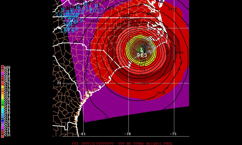
Worth pointing out the GFS isn't any more-or-less intense than the 06z through 4 days, entirely just due to modeling the position of the ridge.
4 likes
My posts are my own personal opinion, defer to the National Hurricane Center (NHC) and other NOAA products for decision making during hurricane season.
-
hurricaneCW
- Category 5
- Posts: 1799
- Joined: Wed Mar 03, 2010 6:20 am
- Location: Toms River, NJ
Re: ATL: FLORENCE - Models
I'm quite concerned about Virginia more so than SC.
I think a more northeasterly track with the Euro's timing/speed is possible.
I think a more northeasterly track with the Euro's timing/speed is possible.
3 likes

Re: ATL: FLORENCE - Models
I have sister that just moved to the Durham area could someone tell me what she might in store for power outages, flooding, both? If the forecast verifies.
1 likes
The following post is NOT an official forecast and should not be used as such. It is just the opinion of the poster and may or may not be backed by sound meteorological data. It is NOT endorsed by any professional institution including storm2k.org For Official Information please refer to the NHC and NWS products.
Re: RE: Re: ATL: FLORENCE - Models
hurricaneCW wrote: Florence is more likely to take a northerly track due to how strong it. Latest IR loop even showed a nice jump north.
I'd be shocked if the Euro didn't trend further north.
I thought Florence was still headed west currently?
0 likes
-
plasticup
Re: ATL: FLORENCE - Models
tailgater wrote:I have sister that just moved to the Durham area could someone tell me what she might in store for power outages, flooding, both? If the forecast verifies.
Could be a bit of both. Unlikely to get more than TS strength winds that far inland, but even those winds can cause power outages.
2 likes
-
ColdFusion

- S2K Supporter

- Posts: 452
- Joined: Wed Feb 13, 2008 3:46 pm
- Location: Addison, TX
ATL: FLORENCE - Models
Ken711 wrote:I thought Florence was still headed west currently?
If you are interested in current movement, you'll find a wealth of links and loops in the discussion forum.
0 likes

Re: ATL: FLORENCE - Models
plasticup wrote:tailgater wrote:I have sister that just moved to the Durham area could someone tell me what she might in store for power outages, flooding, both? If the forecast verifies.
Could be a bit of both. Unlikely to get more than TS strength winds that far inland, but even those winds can cause power outages.
Hard to say what happens in Durham. But if you look at the latest NHC track, they expect a slowdown, and Durham is on the north and East side of the track. What I'd recommend you do is run the "Total Accumulated Precipitation" on any model runs. Tropical Tidbits has most of that in the "PRECIP/MOISTURE" Tab (they don't have it for the EC or JMA). Then go to weather.us and you can plot the winds pretty easily on all models. Here's the problem up that way. Say she gets 10-15" of rain, there will already be downed trees and downed tree limbs from sustained TS winds and gusts assuming they make it up there (probably will with rotating bands). So once you get a soaked ground, trees (especially old live oaks and stuff) go over much more easily in stronger gusts. Looks messy there on the Fall Line, but it's not going to be the worst of the worst. Caveat is if it sits and stalls for a few days, obviously there is a chance for a couple of feet of rain and everything that goes along with that.
2 likes
-
tarheelprogrammer

- S2K Supporter
- Posts: 1793
- Joined: Mon Mar 28, 2016 9:25 pm
- Location: Raleigh, NC area (Garner, NC)
Re: ATL: FLORENCE - Models
12z CMC is a miss to the east and similar to the GFS it looks like. 
0 likes
My posts are not official forecasts. They are just my opinion and may or may not be backed by sound meteorological data. They are NOT endorsed by any professional institution or storm2k.org. For official information, please refer to the NHC and NWS products.

Re: ATL: FLORENCE - Models
This run has a much closer ULL to the east and farther anti-cyclone to the south.
No doubt accounting for the Cat5 forecast.

No doubt accounting for the Cat5 forecast.
0 likes
Re: ATL: FLORENCE - Models
Thanks guys, I think I’ll have her talk to the old locals and find out how flood prone they are.
0 likes
The following post is NOT an official forecast and should not be used as such. It is just the opinion of the poster and may or may not be backed by sound meteorological data. It is NOT endorsed by any professional institution including storm2k.org For Official Information please refer to the NHC and NWS products.
-
seahawkjd
- S2K Supporter
- Posts: 632
- Joined: Wed Sep 10, 2003 4:12 pm
- Location: Morehead City, NC
- Contact:
Re: ATL: FLORENCE - Models
Steve wrote:plasticup wrote:tailgater wrote:I have sister that just moved to the Durham area could someone tell me what she might in store for power outages, flooding, both? If the forecast verifies.
Could be a bit of both. Unlikely to get more than TS strength winds that far inland, but even those winds can cause power outages.
Hard to say what happens in Durham. But if you look at the latest NHC track, they expect a slowdown, and Durham is on the north and East side of the track. What I'd recommend you do is run the "Total Accumulated Precipitation" on any model runs. Tropical Tidbits has most of that in the "PRECIP/MOISTURE" Tab (they don't have it for the EC or JMA). Then go to weather.us and you can plot the winds pretty easily on all models. Here's the problem up that way. Say she gets 10-15" of rain, there will already be downed trees and downed tree limbs from sustained TS winds and gusts assuming they make it up there (probably will with rotating bands). So once you get a soaked ground, trees (especially old live oaks and stuff) go over much more easily in stronger gusts. Looks messy there on the Fall Line, but it's not going to be the worst of the worst. Caveat is if it sits and stalls for a few days, obviously there is a chance for a couple of feet of rain and everything that goes along with that.
Here is what the NWS in Raleigh says for Central NC: Thursday and Friday: Preparations for Hurricane Florence should be
complete by Wednesday evening as the latest guidance continues to be
in fairly good agreement with having the center about 300 mi
offshore Thursday morning. The other consistent trend here has been
to speed the system up as the ridge northeast of Bermuda amplifies.
The latest guidance from NHC has the track of Florence a little
further left/ westward compared to a re-curve. This track is a cause
for concern for residents of central North Carolina. Current
landfall is expected Thursday evening (per NHC) with potentially
life threatening impacts in the form of damaging winds, flooding
rains, and tornadoes. The latest guidance near and after landfall
continues to have a wide spread. The GFS has Florence making
landfall across eastern North Carolina, while the ECMWF has the
system making landfall near the SC/ NC border. Any slight
change in the track of Florence can cause big changes in the
above said impacts at a given location. Residents of central NC
are strongly encouraged to continue to closely monitor the
latest forecast and to ensure everyone has emergency kits and a
hurricane plan in place. Make preparations now! Don`t forget
about making plans for your pets too! For more tropical
information, visit our new Tropical website at
www.weather.gov/rah/tropical.
1 likes
Gloria, Hugo, Emily, Bertha, Bonnie, Dennis (twice), Fran, Floyd, Isabel, Irene, Arthur, Matthew, Florence, Dorian (and many tropical storms and nor'easters).
-
hurricaneCW
- Category 5
- Posts: 1799
- Joined: Wed Mar 03, 2010 6:20 am
- Location: Toms River, NJ
Re: RE: Re: ATL: FLORENCE - Models
ronjon wrote:hurricaneCW wrote: If it's any consolation, then Florence is more likely to take a northerly track due to how strong it. Latest IR loop even showed a nice jump north.
I'd be shocked if the Euro didn't trend further north.
Not sure what you're basing that on? That the recent GFS had a more offshore component? If you look at last 4-5 runs of the ECM, its been remarkably consistent with the landfall location near Wilmington. Now could it be consistently wrong? I suppose its possible but the FV3 GFS, HWRF, and ECM have been pretty consistent over the last 3 or 4 runs now. The latest ensemble runs of the ECM would predict a southward adjustment to track, if any since most of them are in SC. The GFS on the other hand, has been bouncing from Morehead City NC to offshore of Hatteras seemingly every 6-hour run the last couple of days. Not very consistent.
The Euro also shows a considerably weaker storm and could be the reason why it's so far south. I'm not saying the Gfs is correct but I don't think a more northerly track should be discounted especially once you consider how strong she is already.
Very curious to see if the Euro sticks to its guns.
2 likes

Re: ATL: FLORENCE - Models

Last edited by edu2703 on Mon Sep 10, 2018 12:27 pm, edited 1 time in total.
0 likes

Re: ATL: FLORENCE - Models
tarheelprogrammer wrote:12z CMC is a miss to the east and similar to the GFS it looks like.
Super close though and it just sits offshore for several days, flooding rains almost a certainty on that run.
0 likes
Personal Forecast Disclaimer:
The posts in this forum are NOT official forecast and should not be used as such. They are just the opinion of the poster and may or may not be backed by sound meteorological data. They are NOT endorsed by any professional institution or storm2k.org. For official information, please refer to the NHC and NWS products
The posts in this forum are NOT official forecast and should not be used as such. They are just the opinion of the poster and may or may not be backed by sound meteorological data. They are NOT endorsed by any professional institution or storm2k.org. For official information, please refer to the NHC and NWS products

Re: ATL: FLORENCE - Models
The fact that it’s pretty strong now lends some more credence to the cmc/unmet/gfs suite. But I think offshore ala gfs is not going to verify as a 900 mb cane on the obx is unlikely to verify. Its showing further north because it shows a stronger storm.
These east coast storms are always a pain to me. If you get a cane in the gulf it’s like, ok, who’s getting hit. But these Atlantic ones where you watch for days will build up and gnashing of teeth for a near miss...it’s just no fun. It’s like earth said Ima design this Bermuda high and coastline shape just to piss everybody off for a few million years.
These east coast storms are always a pain to me. If you get a cane in the gulf it’s like, ok, who’s getting hit. But these Atlantic ones where you watch for days will build up and gnashing of teeth for a near miss...it’s just no fun. It’s like earth said Ima design this Bermuda high and coastline shape just to piss everybody off for a few million years.
2 likes

Re: ATL: FLORENCE - Models
edu2703 wrote:12z HMON landfall near Morehead City
No change from 06z.
0 likes
-
ScottNAtlanta

- Category 5
- Posts: 2535
- Joined: Sat May 25, 2013 3:11 pm
- Location: Atlanta, GA
Re: ATL: FLORENCE - Models
tailgater wrote:I have sister that just moved to the Durham area could someone tell me what she might in store for power outages, flooding, both? If the forecast verifies.
Durham is about 110 miles as the crow flies give or take ten. If Hurricane force winds extend out 100 miles from the center, that gets pretty close and does get Raleigh.
0 likes
The posts in this forum are NOT official forecast and should not be used as such. They are just the opinion of the poster and may or may not be backed by sound meteorological data. They are NOT endorsed by any professional institution or storm2k.org. For official information, please refer to the NHC and NWS products.
Who is online
Users browsing this forum: No registered users and 206 guests