WPAC: MANGKHUT - Post-Tropical
Moderator: S2k Moderators
-
Sciencerocks
- Category 5

- Posts: 10186
- Age: 40
- Joined: Thu Jul 06, 2017 1:51 am
Re: WPAC: MANGKHUT - Typhoon
Once again, the AMSU RMW estimate is likely too small, leading to unrealistically high estimate.
0 likes
Personal Forecast Disclaimer:
The posts in this forum are NOT official forecast and should not be used as such. They are just the opinion of the poster and may or may not be backed by sound meteorological data. They are NOT endorsed by any professional institution or storm2k.org. For official information, please refer to RSMC and NWS products.
The posts in this forum are NOT official forecast and should not be used as such. They are just the opinion of the poster and may or may not be backed by sound meteorological data. They are NOT endorsed by any professional institution or storm2k.org. For official information, please refer to RSMC and NWS products.
-
xtyphooncyclonex

- Category 5
- Posts: 3891
- Age: 24
- Joined: Sat Dec 08, 2012 9:07 am
- Location: Cebu City
- Contact:
Re: WPAC: MANGKHUT - Typhoon
AMSU likely too bullish; I would go with SATCON and estimate Mangkhut to be in the neighborhood of 150-155 kts.
0 likes
REMINDER: My opinions that I, or any other NON Pro-Met in this forum, are unofficial. Please do not take my opinions as an official forecast and warning. I am NOT a meteorologist. Following my forecasts blindly may lead to false alarm, danger and risk if official forecasts from agencies are ignored.
-
1900hurricane

- Category 5
- Posts: 6063
- Age: 34
- Joined: Fri Feb 06, 2015 12:04 pm
- Location: Houston, TX
- Contact:
Re: WPAC: MANGKHUT - Typhoon
I ran KZC real quick using JTWC data from 06Z and looping the winds from 135 kt (current JTWC estimate) up to 170 kt (AMSU estimate, hard upper bound). Here's what I got:
I'm personally partial to 150 kt/909 mb or 155 kt/904 mb myself.
>>> c = 15
>>> l = 14
>>> oci = 1006
>>> r34 = 155
>>>
>>> for v in range (135, 171, 5):
p = KZC(KZCdP(v, c, r34, l), oci)
print('%d kt, %.0f mb' % (v, p))
135 kt, 925 mb
140 kt, 920 mb
145 kt, 915 mb
150 kt, 909 mb
155 kt, 904 mb
160 kt, 898 mb
165 kt, 892 mb
170 kt, 886 mb
>>> l = 14
>>> oci = 1006
>>> r34 = 155
>>>
>>> for v in range (135, 171, 5):
p = KZC(KZCdP(v, c, r34, l), oci)
print('%d kt, %.0f mb' % (v, p))
135 kt, 925 mb
140 kt, 920 mb
145 kt, 915 mb
150 kt, 909 mb
155 kt, 904 mb
160 kt, 898 mb
165 kt, 892 mb
170 kt, 886 mb
I'm personally partial to 150 kt/909 mb or 155 kt/904 mb myself.
1 likes
Contract Meteorologist. TAMU & MSST. Fiercely authentic, one of a kind. We are all given free will, so choose a life meant to be lived. We are the Masters of our own Stories.
Opinions expressed are mine alone.
Follow me on Twitter at @1900hurricane : Read blogs at https://1900hurricane.wordpress.com/
Opinions expressed are mine alone.
Follow me on Twitter at @1900hurricane : Read blogs at https://1900hurricane.wordpress.com/
-
1900hurricane
- Category 5
- Posts: 6063
- Age: 34
- Joined: Fri Feb 06, 2015 12:04 pm
- Location: Houston, TX
- Contact:
Re: WPAC: MANGKHUT - Typhoon
Heh, SSMIS just came in at 156 kt, bumping SATCON up even further.

2 likes
Contract Meteorologist. TAMU & MSST. Fiercely authentic, one of a kind. We are all given free will, so choose a life meant to be lived. We are the Masters of our own Stories.
Opinions expressed are mine alone.
Follow me on Twitter at @1900hurricane : Read blogs at https://1900hurricane.wordpress.com/
Opinions expressed are mine alone.
Follow me on Twitter at @1900hurricane : Read blogs at https://1900hurricane.wordpress.com/
-
doomhaMwx

- Category 5
- Posts: 2487
- Age: 27
- Joined: Tue Apr 18, 2017 4:01 am
- Location: Baguio/Benguet, Philippines
- Contact:
Re: WPAC: MANGKHUT - Typhoon

TY 1822 (Mangkhut)
Issued at 09:45 UTC, 11 September 2018
<Analysis at 09 UTC, 11 September>
Scale -
Intensity Violent
Center position N13°50' (13.8°)
E139°10' (139.2°)
Direction and speed of movement W 25 km/h (14 kt)
Central pressure 915 hPa
Maximum wind speed near center 55 m/s (105 kt)
Maximum wind gust speed 75 m/s (150 kt)
≥ 50 kt wind area ALL 200 km (110 NM)
≥ 30 kt wind area ALL 330 km (180 NM)
<Forecast for 21 UTC, 11 September>
Intensity Violent
Center position of probability circle N13°50' (13.8°)
E136°55' (136.9°)
Direction and speed of movement W 20 km/h (11 kt)
Central pressure 915 hPa
Maximum wind speed near center 55 m/s (105 kt)
Maximum wind gust speed 75 m/s (150 kt)
Radius of probability circle 70 km (40 NM)
Storm warning area ALL 300 km (160 NM)
<Forecast for 09 UTC, 12 September>
Intensity Violent
Center position of probability circle N14°05' (14.1°)
E134°40' (134.7°)
Direction and speed of movement W 20 km/h (11 kt)
Central pressure 915 hPa
Maximum wind speed near center 55 m/s (105 kt)
Maximum wind gust speed 75 m/s (150 kt)
Radius of probability circle 110 km (60 NM)
Storm warning area ALL 330 km (180 NM)
<Forecast for 06 UTC, 13 September>
Intensity Violent
Center position of probability circle N15°20' (15.3°)
E130°30' (130.5°)
Direction and speed of movement W 20 km/h (12 kt)
Central pressure 905 hPa
Maximum wind speed near center 55 m/s (110 kt)
Maximum wind gust speed 80 m/s (155 kt)
Radius of probability circle 200 km (110 NM)
Storm warning area ALL 440 km (240 NM)
<Forecast for 06 UTC, 14 September>
Intensity Violent
Center position of probability circle N17°05' (17.1°)
E126°05' (126.1°)
Direction and speed of movement WNW 20 km/h (11 kt)
Central pressure 900 hPa
Maximum wind speed near center 60 m/s (115 kt)
Maximum wind gust speed 85 m/s (165 kt)
Radius of probability circle 260 km (140 NM)
Storm warning area ALL 520 km (280 NM)
1 likes
-
1900hurricane
- Category 5
- Posts: 6063
- Age: 34
- Joined: Fri Feb 06, 2015 12:04 pm
- Location: Houston, TX
- Contact:
Re: WPAC: MANGKHUT - Typhoon
Here comes the eye torch.
0 likes
Contract Meteorologist. TAMU & MSST. Fiercely authentic, one of a kind. We are all given free will, so choose a life meant to be lived. We are the Masters of our own Stories.
Opinions expressed are mine alone.
Follow me on Twitter at @1900hurricane : Read blogs at https://1900hurricane.wordpress.com/
Opinions expressed are mine alone.
Follow me on Twitter at @1900hurricane : Read blogs at https://1900hurricane.wordpress.com/
-
euro6208
Re: WPAC: MANGKHUT - Typhoon
Damn oh damn. Is this what recon is missing every year in the WPAC? Shame...
0 likes
-
euro6208
Re: WPAC: MANGKHUT - Typhoon
Looking back at the most intense systems in the Atlantic, NHC most of the time led SATCON by a whole mile especially at peak. That's recon to you. What more with Mangkhut? When was the last time dvorak matched real time recon for a Cat 4 or especially 5 in the Atlantic?
CURRENT ESTIMATE
Date (mmddhhmm): 09110842
SATCON: MSLP = 920 hPa MSW = 152 knots
SATCON Member Consensus: 148.0 knots
Pressure -> Wind Using SATCON MSLP: 132 knots
Distance to Outer Closed Isobar Used is 190 nm
Eye Size Correction Used is 0.0 knots Source: IR
Member Estimates
ADT: 922 hPa 137 knots Scene: CDO Date: SEP111040
CIMSS AMSU: 903 hPa 170 knots Bias Corr: 0 (MW) Date: 09110658
ATMS: 921.8 hPa 144.1 knots Date: 09110414
SSMIS: 919.0 hPa 156.0 knots Date: 09110842
CIRA ATMS: 924 hPa 130 knots Date: 09110415
0 likes
Re: WPAC: MANGKHUT - Typhoon
euro6208 wrote:Looking back at the most intense systems in the Atlantic, NHC most of the time led SATCON by a whole mile especially at peak. That's recon to you. What more with Mangkhut? When was the last time dvorak matched real time recon for a Cat 4 or especially 5 in the Atlantic?
CURRENT ESTIMATE
Date (mmddhhmm): 09110842
SATCON: MSLP = 920 hPa MSW = 152 knots
SATCON Member Consensus: 148.0 knots
Pressure -> Wind Using SATCON MSLP: 132 knots
Distance to Outer Closed Isobar Used is 190 nm
Eye Size Correction Used is 0.0 knots Source: IR
Member Estimates
ADT: 922 hPa 137 knots Scene: CDO Date: SEP111040
CIMSS AMSU: 903 hPa 170 knots Bias Corr: 0 (MW) Date: 09110658
ATMS: 921.8 hPa 144.1 knots Date: 09110414
SSMIS: 919.0 hPa 156.0 knots Date: 09110842
CIRA ATMS: 924 hPa 130 knots Date: 09110415
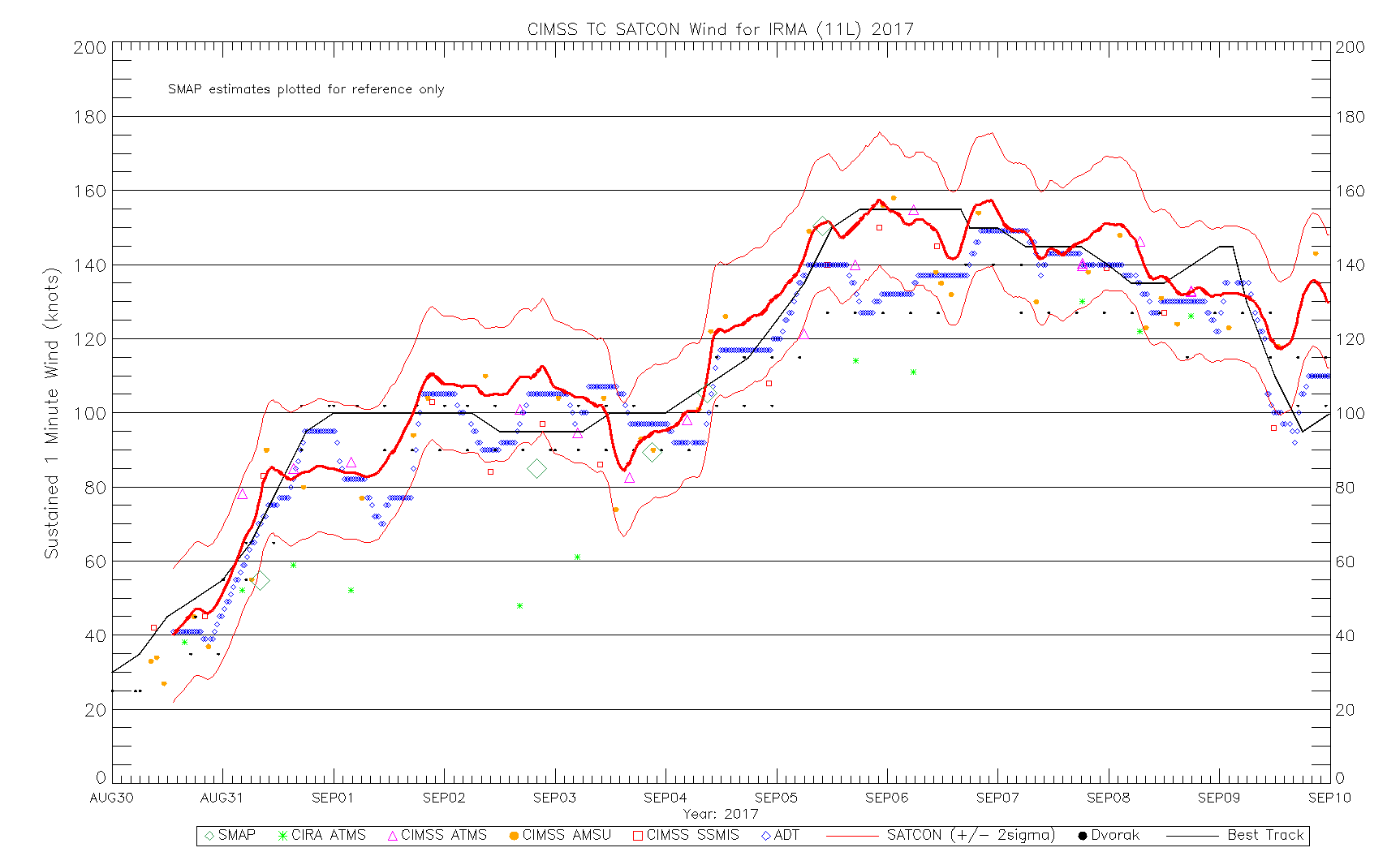
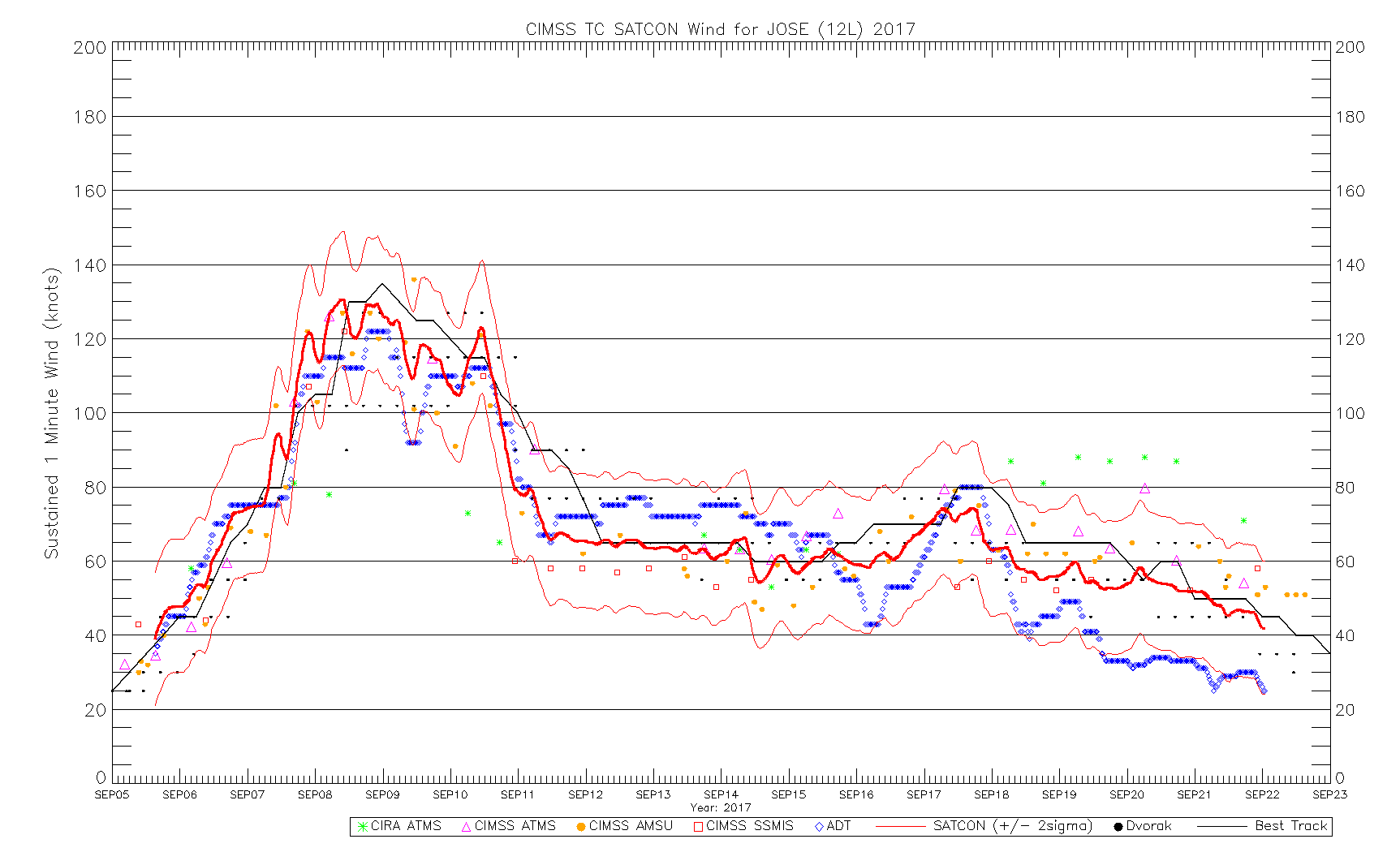
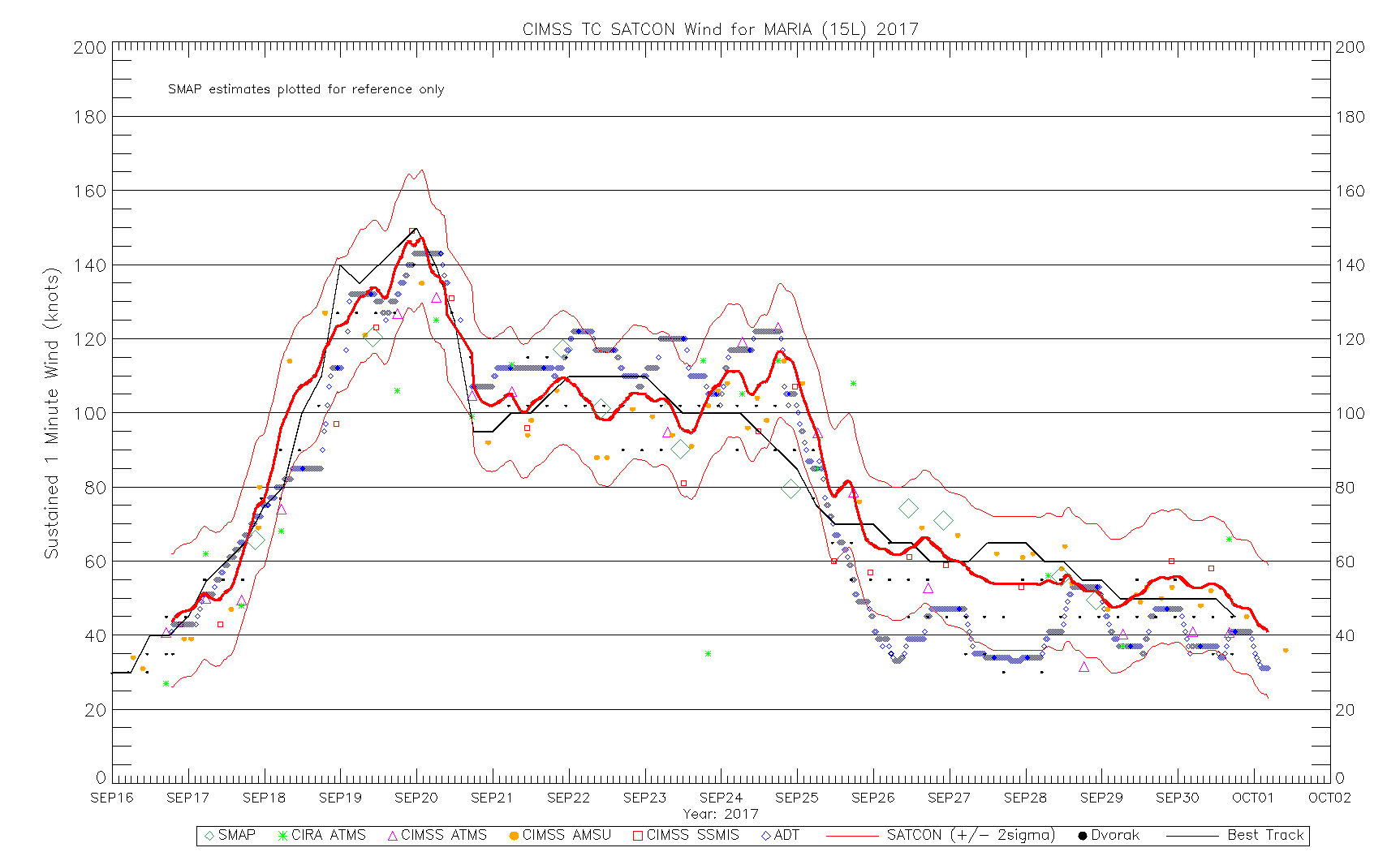
I just took a look at the SATCON estimates for the three most intense ATL systems last year, and I couldn't see any basis for the statement "NHC most of the time led SATCON by a whole mile". (Note that the peak intensity for Irma is revised to 155 knots in the best track and matches well with SATCON estimates.)
Satellite intensity estimates definitely have errors, and it is definitely desirable to have recon in order to have the ground truth, but it is very important to emphasise that satellite intensity estimates, contrary to your belief, can both under- and over-estimate intensity, and even with recon, there is still controversy over the validity of SFMR winds, flight-level to surface ratio, etc.
Back to Mangkhut, JTWC went with 140KT for 12Z, while JMA maintained the intensity at 105KT.
2 likes
Personal Forecast Disclaimer:
The posts in this forum are NOT official forecast and should not be used as such. They are just the opinion of the poster and may or may not be backed by sound meteorological data. They are NOT endorsed by any professional institution or storm2k.org. For official information, please refer to RSMC and NWS products.
The posts in this forum are NOT official forecast and should not be used as such. They are just the opinion of the poster and may or may not be backed by sound meteorological data. They are NOT endorsed by any professional institution or storm2k.org. For official information, please refer to RSMC and NWS products.

-
euro6208
Re: WPAC: MANGKHUT - Typhoon
NotoSans wrote:euro6208 wrote:Looking back at the most intense systems in the Atlantic, NHC most of the time led SATCON by a whole mile especially at peak. That's recon to you. What more with Mangkhut? When was the last time dvorak matched real time recon for a Cat 4 or especially 5 in the Atlantic?
CURRENT ESTIMATE
Date (mmddhhmm): 09110842
SATCON: MSLP = 920 hPa MSW = 152 knots
SATCON Member Consensus: 148.0 knots
Pressure -> Wind Using SATCON MSLP: 132 knots
Distance to Outer Closed Isobar Used is 190 nm
Eye Size Correction Used is 0.0 knots Source: IR
Member Estimates
ADT: 922 hPa 137 knots Scene: CDO Date: SEP111040
CIMSS AMSU: 903 hPa 170 knots Bias Corr: 0 (MW) Date: 09110658
ATMS: 921.8 hPa 144.1 knots Date: 09110414
SSMIS: 919.0 hPa 156.0 knots Date: 09110842
CIRA ATMS: 924 hPa 130 knots Date: 09110415
I just took a look at the SATCON estimates for the three most intense ATL systems last year, and I couldn't see any basis for the statement "NHC most of the time led SATCON by a whole mile". (Note that the peak intensity for Irma is revised to 155 knots in the best track and matches well with SATCON estimates.)
Satellite intensity estimates definitely have errors, and it is definitely desirable to have recon in order to have the ground truth, but it is very important to emphasise that satellite intensity estimates, contrary to your belief, can both under- and over-estimate intensity, and even with recon, there is still controversy over the validity of SFMR winds, flight-level to surface ratio, etc.
Back to Mangkhut, JTWC went with 140KT for 12Z, while JMA maintained the intensity at 105KT.
Last year only?
0 likes
-
euro6208
Re: WPAC: MANGKHUT - Typhoon
26W MANGKHUT 180911 1200 13.7N 138.6E WPAC 140 917
Following the rules. When was the last time a 7.0 atlantic hurricane got 140 knots with recon? Truth.
Following the rules.
0 likes
Re: WPAC: MANGKHUT - Typhoon
euro6208 wrote:NotoSans wrote:I just took a look at the SATCON estimates for the three most intense ATL systems last year, and I couldn't see any basis for the statement "NHC most of the time led SATCON by a whole mile". (Note that the peak intensity for Irma is revised to 155 knots in the best track and matches well with SATCON estimates.)
Satellite intensity estimates definitely have errors, and it is definitely desirable to have recon in order to have the ground truth, but it is very important to emphasise that satellite intensity estimates, contrary to your belief, can both under- and over-estimate intensity, and even with recon, there is still controversy over the validity of SFMR winds, flight-level to surface ratio, etc.
Back to Mangkhut, JTWC went with 140KT for 12Z, while JMA maintained the intensity at 105KT.
Last year only?
CIMSS has its archives for SATCON estimates here. AFAIK there is no systematic low bias for these estimates, and I would definitely be glad if you have some concrete evidence to prove the contrary.
2 likes
Personal Forecast Disclaimer:
The posts in this forum are NOT official forecast and should not be used as such. They are just the opinion of the poster and may or may not be backed by sound meteorological data. They are NOT endorsed by any professional institution or storm2k.org. For official information, please refer to RSMC and NWS products.
The posts in this forum are NOT official forecast and should not be used as such. They are just the opinion of the poster and may or may not be backed by sound meteorological data. They are NOT endorsed by any professional institution or storm2k.org. For official information, please refer to RSMC and NWS products.
-
euro6208
Re: WPAC: MANGKHUT - Typhoon
NotoSans wrote:euro6208 wrote:NotoSans wrote:I just took a look at the SATCON estimates for the three most intense ATL systems last year, and I couldn't see any basis for the statement "NHC most of the time led SATCON by a whole mile". (Note that the peak intensity for Irma is revised to 155 knots in the best track and matches well with SATCON estimates.)
Satellite intensity estimates definitely have errors, and it is definitely desirable to have recon in order to have the ground truth, but it is very important to emphasise that satellite intensity estimates, contrary to your belief, can both under- and over-estimate intensity, and even with recon, there is still controversy over the validity of SFMR winds, flight-level to surface ratio, etc.
Back to Mangkhut, JTWC went with 140KT for 12Z, while JMA maintained the intensity at 105KT.
Last year only?
CIMSS has its archives for SATCON estimates here. AFAIK there is no systematic low bias for these estimates, and I would definitely be glad if you have some concrete evidence to prove the contrary.
Past contrary? Look at dvorak vs recon...
0 likes
-
euro6208
Re: WPAC: MANGKHUT - Typhoon
WDPN31 PGTW 110900
MSGID/GENADMIN/JOINT TYPHOON WRNCEN PEARL HARBOR HI//
SUBJ/PROGNOSTIC REASONING FOR SUPER TYPHOON 26W (MANGKHUT) WARNING
NR 18//
RMKS/
1. FOR METEOROLOGISTS.
2. 6 HOUR SUMMARY AND ANALYSIS.
SUPER TYPHOON (STY) 26W (MANGKHUT), LOCATED APPROXIMATELY 286 NM
NORTH-NORTHEAST OF YAP, FSM, HAS TRACKED WESTWARD AT 15 KNOTS OVER
THE PAST SIX HOURS. ANIMATED MULTISPECTRAL SATELLITE IMAGERY SHOWS
THE SYSTEM HAS SIGNIFICANTLY COMPRESSED WITH SHORTENED FEEDER BANDS
TIGHTLY WRAPPED INTO A SHARPLY-OUTLINED 21-NM EYE. THE INITIAL
POSITION IS PLACED WITH HIGH CONFIDENCE BASED ON THE EYE FEATURE.
THE INITIAL INTENSITY OF 135 KNOTS IS BASED ON EQUIVALENT DVORAK
ESTIMATES OF T7.0 FROM PGTW AND RJTD AND REFLECTS THE RAPID
INTENSIFICATION. UPPER LEVEL ANALYSIS INDICATES STY 26W IS IN AN
AREA OF LOW VERTICAL WIND SHEAR AND
EXCELLENT RADIAL OUTFLOW WITH A STRONG EASTWARD CHANNEL INTO A TUTT
CELL. ADDITIONALLY, ALONG TRACK SEA SURFACE TEMPERATURES IN THE
PHILIPPINE SEA AT 28-30 CELSIUS ARE HIGHLY CONDUCIVE. THE CYCLONE
IS TRACKING ALONG THE SOUTHERN PERIPHERY OF A DEEP-LAYERED EAST-
WEST ORIENTED SUBTROPICAL RIDGE (STR) TO THE NORTH.
3. FORECAST REASONING.
A. THERE IS NO CHANGE TO THE FORECAST PHILOSOPHY FROM THE
PREVIOUS WARNING.
B. STY 26W WILL TRACK MORE WEST-NORTHWESTWARD AS THE STR WEAKENS
IN RESPONSE TO AN APPROACHING MIDLATITUDE TROUGH. FAVORABLE
ENVIRONMENTAL CONDITIONS WILL PERSIST AND SUPPORT CONTINUED
INTENSIFICATION TO A PEAK OF 150 KNOTS BY TAU 36. AFTERWARD,
REDUCED OUTFLOW AS THE SYSTEM MOVES AWAY FROM THE TUTT CELL AND AN
UPPER LEVEL TROUGH APPROACHES FROM THE NORTH WILL SLIGHTLY WEAKEN
THE SYSTEM TO 135 KNOTS BY TAU 72 AS IT APPROACHES NORTHERN LUZON.
CONFIDENCE IN THIS PORTION OF THE JTWC FORECAST TRACK IS HIGH BASED
ON THE TIGHT AGREEMENT IN THE NUMERICAL MODEL GUIDANCE.
C. AFTER TAU 72, STY MANGKHUT WILL CONTINUE ON A MORE
NORTHWESTWARD TRAJECTORY UNDER THE STEERING INFLUENCE OF THE STR.
THE CYCLONE WILL ENTER THE LUZON STRAIT AND PASS BETWEEN TAIWAN AND
THE PHILIPPINES INTO THE SOUTH CHINA SEA. INTERACTION WITH LAND AND
DIMINISHING OUTFLOW WILL PRIMARILY BE RESPONSIBLE FOR ITS GRADUAL
WEAKENING. HOWEVER, BY TAU 120, THE SYSTEM WILL STILL BE A STRONG
100-KNOT TYPHOON BEFORE IT MAKES LANDFALL IN THE VICINITY OF HONG
KONG. THE TRACK GUIDANCE REMAINS IN GOOD AGREEMENT WITH CTCX AS THE
LONE LEFT-OF-TRACK OUTLIER. THERE IS HIGH CONFIDENCE IN THE
EXTENDED JTWC FORECAST TRACK THAT IS LAID JUST RIGHT OF MODEL
CONSENSUS TO OFFSET THE UNLIKELY CTCX SOLUTION.//
NNNN
0 likes

Re: WPAC: MANGKHUT - Typhoon

That eye is scorching right now. Easily 155 knot storm right there.
1 likes
Very useful information on the Dvorak Technique --
https://severe.worldweather.wmo.int/TCF ... kBeven.pdf
https://severe.worldweather.wmo.int/TCF ... kBeven.pdf
-
euro6208
Re: WPAC: MANGKHUT - Typhoon

Cannot go above 150 knots unless a 7.5 is achieve. Limitation. How many 140 knots Cat 5 have we seen here? Sad
Last edited by euro6208 on Tue Sep 11, 2018 8:22 am, edited 2 times in total.
0 likes
-
mrbagyo

- Category 5
- Posts: 3963
- Age: 33
- Joined: Thu Apr 12, 2012 9:18 am
- Location: 14.13N 120.98E
- Contact:
Re: WPAC: MANGKHUT - Typhoon
2018SEP11 124000 6.9 919.8 137.4 6.9 6.9 6.9 NO LIMIT OFF OFF OFF OFF 18.28 -75.39 EYE 24 IR 86.9 13.79 -138.54 ARCHER HIM-8 16.
Currently at its record high eye temp, could possibly get even warmer.
Currently at its record high eye temp, could possibly get even warmer.
0 likes
The posts in this forum are NOT official forecast and should not be used as such. They are just the opinion of the poster and may or may not be backed by sound meteorological data. They are NOT endorsed by any professional institution or storm2k.org. For official information, please refer to RSMC, NHC and NWS products.
-
SconnieCane
- Category 5
- Posts: 1013
- Joined: Thu Aug 02, 2018 5:29 pm
- Location: Madison, WI
Who is online
Users browsing this forum: No registered users and 85 guests