
PTrackerLA wrote:Yikes, 12z Euro 963mb at 72 hours...
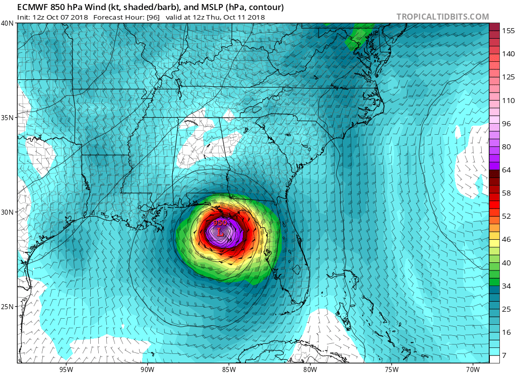
Close to Sandy's 940. Down to 950@96 hrs
Moderator: S2k Moderators
PTrackerLA wrote:Yikes, 12z Euro 963mb at 72 hours...


Kazmit wrote:Hopefully this run convinces the NHC to raise the forecast peak to at least cat 2 for 5pm.


WAcyclone wrote:I really like Maue's updating ECMWF graphic. It shows everything you need to know about this particular run:
https://i.imgur.com/s74UA51.png
Link: http://wx.graphics/models/ecmwf_michael.png

Cypresso wrote:PTrackerLA wrote:Yikes, 12z Euro 963mb at 72 hours...
Close to Sandy's 940. Down to 950@96 hrs
boca wrote:Can someone posted a graphic of the UKMET plz

ColdMiser123 wrote:Kazmit wrote:Hopefully this run convinces the NHC to raise the forecast peak to at least cat 2 for 5pm.
HWRF and HMON being way weaker at 12z makes the current NHC intensity forecast a reasonable middle ground at the moment.


gatorcane wrote:West coast of Florida on the fringe now from Tampa north:
Users browsing this forum: No registered users and 4 guests


