ATL: MICHAEL - Post-Tropical - Discussion

Moderator: S2k Moderators

Message
Author
User avatar
wxman57
Moderator-Pro Met
Moderator-Pro Met
Posts: 22979
Age: 67
Joined: Sat Jun 21, 2003 8:06 pm
Location: Houston, TX (southwest)

Re: ATL: MICHAEL - Hurricane - Discussion

#781 Postby wxman57 » Mon Oct 08, 2018 10:31 am

meriland29 wrote:How fast is he moving, he will be near shore in less than 3 days...is that enough time to really get to a M?


12 hrs (or less) is enough time to strengthen to 100 kts. Wilma went from a TS to a Cat 5 in under 24 hours. It's not moving fast now, but by the time it makes landfall it will be moving at 15+ mph and at closer to 20-25 mph across GA and the Carolinas.
4 likes   

User avatar
cycloneye
Admin
Admin
Posts: 145351
Age: 68
Joined: Thu Oct 10, 2002 10:54 am
Location: San Juan, Puerto Rico

Re: ATL: MICHAEL - Hurricane - Discussion

#782 Postby cycloneye » Mon Oct 08, 2018 10:37 am

Down to 981 mbs.

Image
1 likes   
Visit the Caribbean-Central America Weather Thread where you can find at first post web cams,radars
and observations from Caribbean basin members Click Here

User avatar
Evil Jeremy
S2K Supporter
S2K Supporter
Posts: 5463
Age: 32
Joined: Mon Apr 10, 2006 2:10 pm
Location: Los Angeles, CA

Re: ATL: MICHAEL - Hurricane - Discussion

#783 Postby Evil Jeremy » Mon Oct 08, 2018 10:43 am

cycloneye wrote:Down to 981 mbs.

https://i.imgur.com/HzK4dZh.png


And jogging back West...
0 likes   
Frances 04 / Jeanne 04 / Katrina 05 / Wilma 05 / Fay 08 / Debby 12 / Andrea 13 / Colin 16 / Hermine 16 / Matthew 16 / Irma 17

User avatar
artist
Category 5
Category 5
Posts: 9792
Joined: Mon Jun 06, 2005 3:26 pm
Location: West Palm

Re: ATL: MICHAEL - Hurricane - Discussion

#784 Postby artist » Mon Oct 08, 2018 10:48 am

Evil Jeremy wrote:
cycloneye wrote:Down to 981 mbs.

https://i.imgur.com/HzK4dZh.png


And jogging back West...

Not much

Image
0 likes   

SconnieCane
Category 4
Category 4
Posts: 998
Joined: Thu Aug 02, 2018 5:29 pm
Location: Madison, WI

Re: ATL: MICHAEL - Hurricane - Discussion

#785 Postby SconnieCane » Mon Oct 08, 2018 10:49 am

ssd.noaa.gov is back to not showing floaters for the Atlantic. It was working during Florence. :x
2 likes   

User avatar
cycloneye
Admin
Admin
Posts: 145351
Age: 68
Joined: Thu Oct 10, 2002 10:54 am
Location: San Juan, Puerto Rico

Re: ATL: MICHAEL - Hurricane - Discussion

#786 Postby cycloneye » Mon Oct 08, 2018 10:50 am

VORTEX DATA MESSAGE AL142018
A. 08/15:22:10Z
B. 21.35 deg N 085.17 deg W
C. 850 mb 1263 m
D. 981 mb
E. 300 deg 5 kt
F. OPEN S
G. C30
H. 55 kt
I. 271 deg 27 nm 14:58:30Z
J. 204 deg 65 kt
K. 126 deg 16 nm 15:17:00Z
L. 60 kt
M. 241 deg 10 nm 15:25:30Z
N. 339 deg 61 kt
O. 230 deg 33 nm 15:32:00Z
P. 17 C / 1528 m
Q. 22 C / 1523 m
R. 13 C / NA
S. 12345 / 08
T. 0.02 / 1 nm
U. AF301 0314A MICHAEL OB 23
MAX FL WIND 83 KT 295 / 26 NM 14:17:30
0 likes   
Visit the Caribbean-Central America Weather Thread where you can find at first post web cams,radars
and observations from Caribbean basin members Click Here

User avatar
Miami Storm Tracker
Category 4
Category 4
Posts: 910
Age: 67
Joined: Sun Jun 13, 2010 10:12 pm
Location: Key Largo, Fla.
Contact:

Re: ATL: MICHAEL - Hurricane - Discussion

#787 Postby Miami Storm Tracker » Mon Oct 08, 2018 10:50 am

Yea I really miss the Floaters from NOAA.
0 likes   

User avatar
StPeteMike
Category 2
Category 2
Posts: 631
Joined: Thu Jun 07, 2018 11:26 pm

Re: ATL: MICHAEL - Hurricane - Discussion

#788 Postby StPeteMike » Mon Oct 08, 2018 10:51 am

Evil Jeremy wrote:
cycloneye wrote:Down to 981 mbs.

https://i.imgur.com/HzK4dZh.png


And jogging back West...

Could easily just be a wobble to the west as well.
1 likes   
The above post is not official and should not be used as such. It is the opinion of the poster and may or may not be backed by sound meteorological data. It is not endorsed by any professional institution or storm2k.org. For official information, please refer to the NHC and NWS products.

User avatar
artist
Category 5
Category 5
Posts: 9792
Joined: Mon Jun 06, 2005 3:26 pm
Location: West Palm

Re: ATL: MICHAEL - Hurricane - Discussion

#789 Postby artist » Mon Oct 08, 2018 10:53 am

Miami Storm Tracker wrote:Yea I really miss the Floaters from NOAA.

https://www.star.nesdis.noaa.gov/GOES/f ... d=AL142018
Storm floater images: Hurricane Michael at 21.2°N - 84.9°W
Generated every 15 minutes from full disk images; click to access the latest available image for each band.
2 likes   

User avatar
artist
Category 5
Category 5
Posts: 9792
Joined: Mon Jun 06, 2005 3:26 pm
Location: West Palm

Re: ATL: MICHAEL - Hurricane - Discussion

#790 Postby artist » Mon Oct 08, 2018 10:59 am

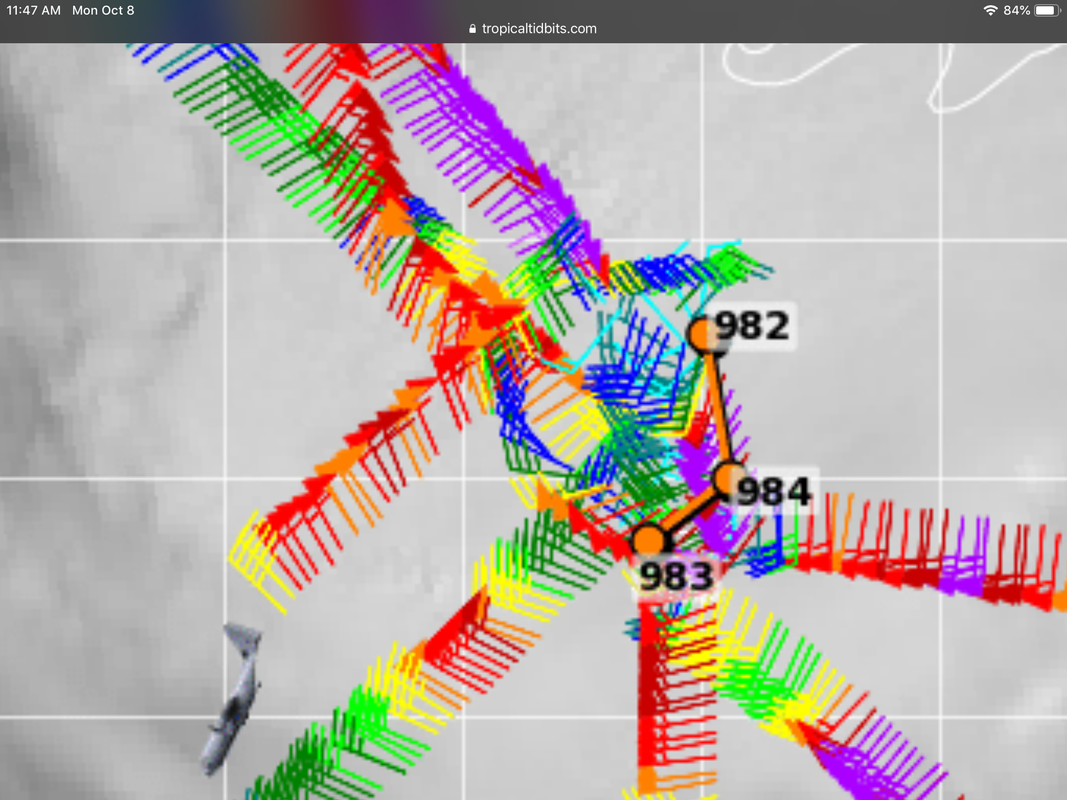
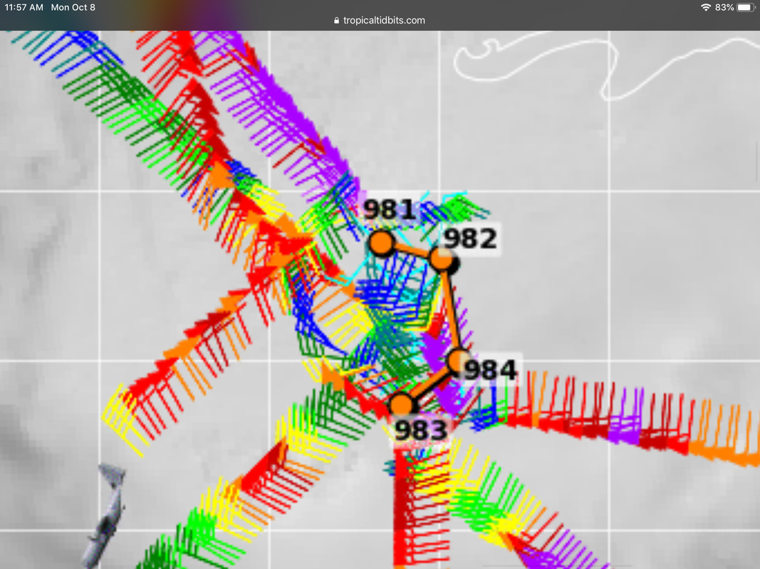
I was wrong above, evil Jeremy, here is the latest vortex image positions

Image
2 likes   

User avatar
cycloneye
Admin
Admin
Posts: 145351
Age: 68
Joined: Thu Oct 10, 2002 10:54 am
Location: San Juan, Puerto Rico

Re: ATL: MICHAEL - Hurricane - Discussion

#791 Postby cycloneye » Mon Oct 08, 2018 11:00 am

0 likes   
Visit the Caribbean-Central America Weather Thread where you can find at first post web cams,radars
and observations from Caribbean basin members Click Here

User avatar
gfsperpendicular
Category 1
Category 1
Posts: 383
Age: 21
Joined: Mon Jun 19, 2017 3:04 pm
Location: Northern Virginia

Re: ATL: MICHAEL - Hurricane - Discussion

#792 Postby gfsperpendicular » Mon Oct 08, 2018 11:04 am


What is the significance of this?
3 likes   
I'm not sleeping, I'm waiting for the 0900 UTC advisory!

#1 CMC stan

austin06
Tropical Low
Tropical Low
Posts: 15
Joined: Sat May 26, 2018 12:15 pm
Location: Dripping Springs, TX

Re: ATzL: MICHAEL - Hurricane - Discussion

#793 Postby austin06 » Mon Oct 08, 2018 11:06 am

northjaxpro wrote:Mouton, yeah I am extremely concerned about the potential of an extremely massive storm surge up into Apalachicola and all along the Big Bend region. This could really be a devastating event if we have a major hurricane bearing down on them.

They had 12 feet storm surge occur into Apalachee Bay during the March 1993 Superstorm which was absolutely devastating to Cedar Key, Steinhatchee and other areas along the Big Bend. I shudder to think what Michael could do in that region. :(


Exactly what popped into my mind if the track is to the bend. I lived in Gainesville during the Superstorm (grew up in south Fl). It was the most intense storm I have ever experienced. Worst part came in the dead of night and we were afraid the roof was going to come off - the sound was like nothing I've ever heard. Huge trees down uprooted and debris everywhere.

We drove out to Cedar Key the next afternoon and the bridges were under water and we had to turn around - you could tell things were bad. I worked at an agency that handled relief for the area and wrote about the impact to the Cedar Key area. It was devastating and took years and years for them to recover. I truly hope they don't take a direct hit as I hope it's not a bad storm for anyone.
0 likes   

User avatar
cycloneye
Admin
Admin
Posts: 145351
Age: 68
Joined: Thu Oct 10, 2002 10:54 am
Location: San Juan, Puerto Rico

Re: ATL: MICHAEL - Hurricane - Discussion

#794 Postby cycloneye » Mon Oct 08, 2018 11:09 am

Great explanation of all the players.

 https://twitter.com/pppapin/status/1049327999928029190


1 likes   
Visit the Caribbean-Central America Weather Thread where you can find at first post web cams,radars
and observations from Caribbean basin members Click Here

User avatar
Hurricaneman
Category 5
Category 5
Posts: 7351
Age: 45
Joined: Tue Aug 31, 2004 3:24 pm
Location: central florida

Re: ATL: MICHAEL - Hurricane - Discussion

#795 Postby Hurricaneman » Mon Oct 08, 2018 11:09 am

gfsperpendicular wrote:


What is the significance of this?

It means high instability which in turn causes big time convection and a possibility of rapid intensification later today
4 likes   

Abdullah
Category 1
Category 1
Posts: 379
Joined: Sat Sep 08, 2018 4:28 pm
Location: Miramar, FL

Re: ATL: MICHAEL - Tropical Storm - Discussion

#796 Postby Abdullah » Mon Oct 08, 2018 11:10 am

p1nheadlarry wrote:
Abdullah wrote:We could very well wake up to a rapidly intensifying hurricane on this, you know.

ozonepete wrote:
The 18Z GFS run still had a bad initialization point for Michael; too far west. We need to wait for the 00Z runs.


By the way, the NorthEast Gulf of Mexico is Ocean.


I don't need to be patronized like that


Sorry about that


Can anyone get into the reason it is curving Eastward? What is the cause of this?

Thanks in Advance
0 likes   

User avatar
meriland29
Category 2
Category 2
Posts: 770
Joined: Thu Aug 03, 2017 11:05 am

Re: ATL: MICHAEL - Hurricane - Discussion

#797 Postby meriland29 » Mon Oct 08, 2018 11:11 am

The thing that scares me the most about this is the very limited amount of time between genesis and landfall, giving the people in its path a very small amount of time to leave. And the fact that every advisory ups the ante in terms of strength at landfall.
1 likes   

Aric Dunn
Category 5
Category 5
Posts: 21238
Age: 42
Joined: Sun Sep 19, 2004 9:58 pm
Location: Ready for the Chase.
Contact:

Re: ATL: MICHAEL - Hurricane - Discussion

#798 Postby Aric Dunn » Mon Oct 08, 2018 11:13 am

oh goodie I woke up just in time for the RI wobbles.. :P
3 likes   
Note: If I make a post that is brief. Please refer back to previous posts for the analysis or reasoning. I do not re-write/qoute what my initial post said each time.
If there is nothing before... then just ask :)

Space & Atmospheric Physicist, Embry-Riddle Aeronautical University,
I believe the sky is falling...

txwatcher91
Category 5
Category 5
Posts: 1498
Joined: Tue Aug 02, 2005 2:29 pm

Re: ATL: MICHAEL - Hurricane - Discussion

#799 Postby txwatcher91 » Mon Oct 08, 2018 11:16 am

gfsperpendicular wrote:


What is the significance of this?


Basically a sign of a rapidly organizing hurricane with extremely powerful thunderstorms wrapping around the center to produce the gravity waves. It's not something you see very often unless a storm is a major hurricane or rapidly intensifying.
5 likes   

User avatar
ObsessedMiami
Category 1
Category 1
Posts: 431
Joined: Tue Aug 31, 2004 8:08 pm
Location: West Kendall, Fl

Re: ATL: MICHAEL - Hurricane - Discussion

#800 Postby ObsessedMiami » Mon Oct 08, 2018 11:17 am

meriland29 wrote:The thing that scares me the most about this is the very limited amount of time between genesis and landfall, giving the people in its path a very small amount of time to leave. And the fact that every advisory ups the ante in terms of strength at landfall.


And my Panhandle family are already saying "hype" and such nonsense. I am trying to talk some sense into them
0 likes   


Return to “2018”

Who is online

Users browsing this forum: No registered users and 1 guest