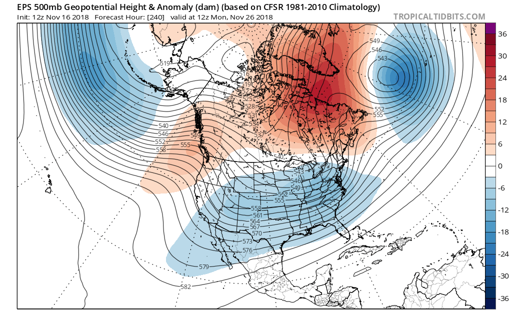
While signs are growing that the -NAO type pattern might lock in for an extended period of time we will need to wait for the Pacific to come around. Models show the EPO and WPO heading back towards the positive range but the models have, at times, been too aggressive lately with sending the EPO positive. There are also significant differences in how the GFS and Euro handle the MJO and this will also cause some issues in the longer range. By D15 the Euro EPS, and to a lesser extent the GEFS, has the coldest air still bottled up on the others side of the globe. The ensembles, even with some disagreement in the evolution of the Pacific pattern, show below normal 850s returning to Texas beyond D10. However, it may take some time for the Pacific to shuffle around and allow for really cold air to build in our source region.
Now the operational runs are different, the 00z Euro is much more aggressive than the EPS in building cold in our source region:

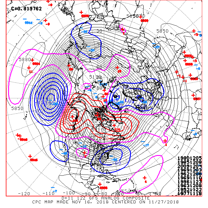
This is similar to the 00z GFS:

I suspect that the operational runs are moving too fast with the pattern shuffle and I would expect to see something like this in early December. However, the ensembles have contently been too warm in the longer range here recently.
Winter time post are almost exclusively focused on the DFW area.


