

Also, looks to be on the conservative side.
Moderator: S2k Moderators
 The posts in this forum are NOT official forecast and should not be used as such. They are just the opinion of the poster and may or may not be backed by sound meteorological data. They are NOT endorsed by any professional institution or STORM2K.


bubba hotep wrote:06z FV3 a tick south of 00z
https://www.tropicaltidbits.com/analysis/models/fv3p/2018120306/fv3p_asnow_us_40.png


gpsnowman wrote:So close to being an I-20 special. Hopefully the models continue to show a southern track as the week progresses. Would be a great surprise for DFW. My main concern is the cold air.


Ralph's Weather wrote:gpsnowman wrote:So close to being an I-20 special. Hopefully the models continue to show a southern track as the week progresses. Would be a great surprise for DFW. My main concern is the cold air.
Agreed, I do think that backside snow on Saturday is fairly likely, but if we could get the cold air down here on Friday that is when things could get wild.
spencer817 wrote:Ralph's Weather wrote:gpsnowman wrote:So close to being an I-20 special. Hopefully the models continue to show a southern track as the week progresses. Would be a great surprise for DFW. My main concern is the cold air.
Agreed, I do think that backside snow on Saturday is fairly likely, but if we could get the cold air down here on Friday that is when things could get wild.
Why do you think models are struggling to show that?
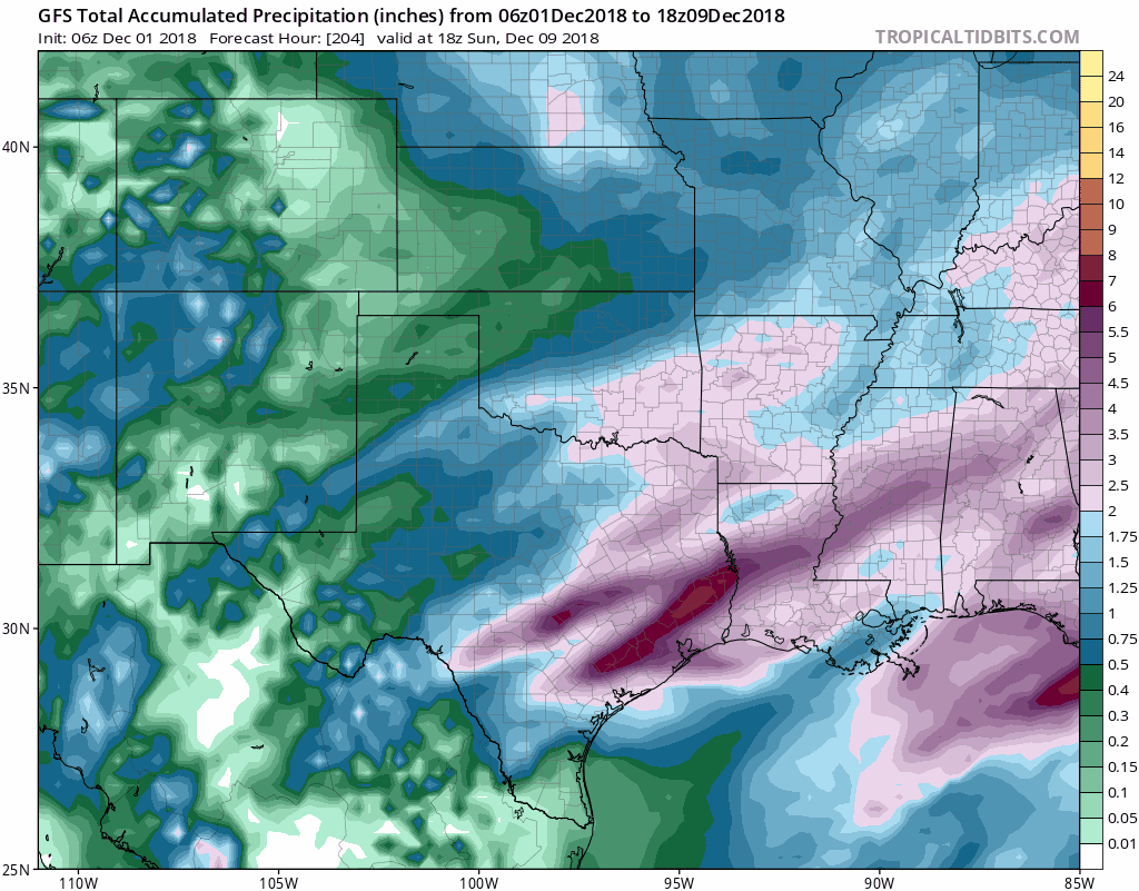
Ntxw wrote:Here is a composite of QPF trend from the GFS. Notice the shrinking of qpf in Kansas, Missouri, and Oklahoma. This is the worry for those north of the Red River. That ominous gulf low is lurking.
https://images2.imgbox.com/09/22/k8QYUm4g_o.gif
spencer817 wrote:Ntxw wrote:Here is a composite of QPF trend from the GFS. Notice the shrinking of qpf in Kansas, Missouri, and Oklahoma. This is the worry for those north of the Red River. That ominous gulf low is lurking.
https://images2.imgbox.com/09/22/k8QYUm4g_o.gif
Could a QPF shield further south allow more cold air to come quicker, or while the storm is occuring?


Brent wrote:the 12z Euro definitely doesn't look as wintry as the 0z, snow is more confined further NW through Saturday more like the GFS
starsfan65 wrote:Brent wrote:the 12z Euro definitely doesn't look as wintry as the 0z, snow is more confined further NW through Saturday more like the GFS
Has the EURO caved in to the GFS?
Users browsing this forum: No registered users and 126 guests


