Moderator: S2k Moderators


TheStormExpert wrote:Watch the Tropical Atlantic also in about a weeks time for a potential brief spin up.
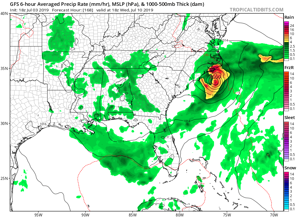
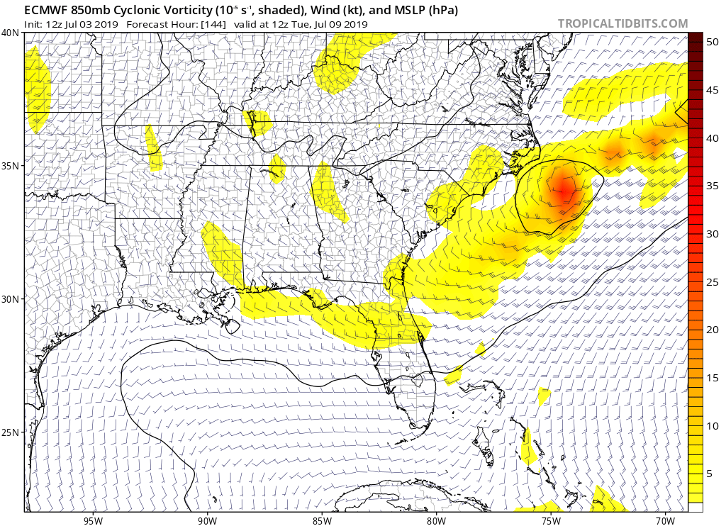
Hypercane_Kyle wrote:12z ECMWF has a TC over the GA/SC border by 240 hours.

USTropics wrote:Hypercane_Kyle wrote:12z ECMWF has a TC over the GA/SC border by 240 hours.
I believe that was last night's 00z run, still a few hours away from the 12z run for today. GFS just started running. Last night's 00z ECMWF run at 240 hrs:
https://i.imgur.com/Khu1sHb.png


jconsor wrote:https://twitter.com/yconsor/status/1146855914928037888
Users browsing this forum: No registered users and 58 guests


