ATL: ERIN - Tropical Depression - Discussion
Moderator: S2k Moderators
-
Hurricaneman

- Category 5

- Posts: 7404
- Age: 45
- Joined: Tue Aug 31, 2004 3:24 pm
- Location: central florida
Re: ATL: INVEST 98L - Discussion
This has the look of a future hurricane and fo those in Florida expect squally weather but North Carolina May have a low end hurricane on their hands and the New York/New England area need to stay vigilant as any small change in the steering could send it in that direction
4 likes
-
northjaxpro

- S2K Supporter

- Posts: 8900
- Joined: Mon Sep 27, 2010 11:21 am
- Location: Jacksonville, FL
Re: ATL: INVEST 98L - Discussion
This is setting up to be a potential major event all up and along the U.S. Eastern Seaboard for the next several days a into next week. Interesting times ahead.
3 likes
NEVER, EVER SAY NEVER in the tropics and weather in general, and most importantly, with life itself!!
________________________________________________________________________________________
Fay 2008 Beryl 2012 Debby 2012 Colin 2016 Hermine 2016 Julia 2016 Matthew 2016 Irma 2017 Dorian 2019
________________________________________________________________________________________
Fay 2008 Beryl 2012 Debby 2012 Colin 2016 Hermine 2016 Julia 2016 Matthew 2016 Irma 2017 Dorian 2019
-
Aric Dunn
- Category 5
- Posts: 21238
- Age: 43
- Joined: Sun Sep 19, 2004 9:58 pm
- Location: Ready for the Chase.
- Contact:
Re: ATL: INVEST 98L - Discussion
GCANE wrote:Aric Dunn wrote:GCANE wrote:Definitely looks like it'll pop right over Andros
Should move SW as it hits the water.
Just cant't see this taking a sharp right and skim the east FL coast.
Im not home. But if someone wants to compare the current analyzed placement of the uppper low over south georiga and where the euro has it. That is important as to track. Because as of right now the winds are west to east across the region. To get this to become lopsided with convection all to ne will take that upper low to drop south.. its current postion will not be enough to cause the necessary flow to counter the low to mid level steering and elongate this out.
And right nOw from sat loops that upper low is moving ne not south.
Don't have enough money to pay for the see-all Euro. However, can track the ULL over GA this way. Here's its current position.
https://i.imgur.com/DSHrnYn.png
So euro has it over NE florida in 12 hours. That is what thrusts this NE all of a sudden.
Looks at waver vapor its moving NE. So unles it starts moving se this will continue west.

Last edited by Aric Dunn on Thu Aug 22, 2019 2:42 pm, edited 1 time in total.
0 likes
Note: If I make a post that is brief. Please refer back to previous posts for the analysis or reasoning. I do not re-write/qoute what my initial post said each time.
If there is nothing before... then just ask
Space & Atmospheric Physicist, Embry-Riddle Aeronautical University,
I believe the sky is falling...
If there is nothing before... then just ask
Space & Atmospheric Physicist, Embry-Riddle Aeronautical University,
I believe the sky is falling...


-
jlauderdal
- S2K Supporter
- Posts: 7240
- Joined: Wed May 19, 2004 5:46 am
- Location: NE Fort Lauderdale
- Contact:
Re: RE: Re: ATL: INVEST 98L - Discussion
When is stacy stewart on shift?HurricaneAndre2008 wrote:Wonder when it will be officially designated.
Sent from my SM-G973U using Tapatalk
1 likes
-
northjaxpro
- S2K Supporter
- Posts: 8900
- Joined: Mon Sep 27, 2010 11:21 am
- Location: Jacksonville, FL
Re: ATL: INVEST 98L - Discussion
Last edited by northjaxpro on Thu Aug 22, 2019 2:45 pm, edited 1 time in total.
2 likes
NEVER, EVER SAY NEVER in the tropics and weather in general, and most importantly, with life itself!!
________________________________________________________________________________________
Fay 2008 Beryl 2012 Debby 2012 Colin 2016 Hermine 2016 Julia 2016 Matthew 2016 Irma 2017 Dorian 2019
________________________________________________________________________________________
Fay 2008 Beryl 2012 Debby 2012 Colin 2016 Hermine 2016 Julia 2016 Matthew 2016 Irma 2017 Dorian 2019
-
Aric Dunn
- Category 5
- Posts: 21238
- Age: 43
- Joined: Sun Sep 19, 2004 9:58 pm
- Location: Ready for the Chase.
- Contact:
Re: RE: Re: ATL: INVEST 98L - Discussion
jlauderdal wrote:When is stacy stewart on shift?HurricaneAndre2008 wrote:Wonder when it will be officially designated.
Sent from my SM-G973U using Tapatalk
Hopefully by morning shift lol
0 likes
Note: If I make a post that is brief. Please refer back to previous posts for the analysis or reasoning. I do not re-write/qoute what my initial post said each time.
If there is nothing before... then just ask
Space & Atmospheric Physicist, Embry-Riddle Aeronautical University,
I believe the sky is falling...
If there is nothing before... then just ask
Space & Atmospheric Physicist, Embry-Riddle Aeronautical University,
I believe the sky is falling...
-
BensonTCwatcher

- Category 5
- Posts: 1050
- Joined: Sat Aug 28, 2004 10:11 pm
- Location: Southport NC
Re: ATL: INVEST 98L - Discussion
Yep Andros circ is the winner. Continuing the convection is key and those storms off SW FL will help the western edge of the moisture envelope.
0 likes
-
Hurricaneman
- Category 5
- Posts: 7404
- Age: 45
- Joined: Tue Aug 31, 2004 3:24 pm
- Location: central florida
Re: ATL: INVEST 98L - Discussion
If thing keep organizing then if the convection persists then I wouldn’t be surprised if we have a depression sometime tomorrow but the thing that will limit strengthening the next day or so will be some fringe shear from the ULL but that shouldn’t be an issue past 24hrs
Last edited by Hurricaneman on Thu Aug 22, 2019 2:55 pm, edited 1 time in total.
0 likes
-
alienstorm

- Category 1

- Posts: 496
- Joined: Tue Jul 31, 2007 1:29 pm
- Location: Miami Fla western suburb
Re: ATL: INVEST 98L - Discussion
Right over Andros Island

0 likes
Personal Forecast Disclaimer:The posts in this forum are NOT official forecast and should not be used as such. They are just the opinion of the poster and may or may not be backed by sound meteorological data. They are NOT endorsed by any professional institution or storm2k.org. For official information, please refer to the NHC and NWS products.
-
alienstorm
- Category 1
- Posts: 496
- Joined: Tue Jul 31, 2007 1:29 pm
- Location: Miami Fla western suburb
Re: ATL: INVEST 98L - Discussion
1 likes
Personal Forecast Disclaimer:The posts in this forum are NOT official forecast and should not be used as such. They are just the opinion of the poster and may or may not be backed by sound meteorological data. They are NOT endorsed by any professional institution or storm2k.org. For official information, please refer to the NHC and NWS products.
-
Weatherboy1

- Category 5
- Posts: 1190
- Age: 50
- Joined: Mon Jul 05, 2004 1:50 pm
- Location: Jupiter/Sarasota, FL
Re: ATL: INVEST 98L - Discussion
Clearly has the look of one of those "displaced convection to the NE" lows. Agree with "just off Andros" center location. Unless/until shear eases up, don't think this amounts to much. But worth watching here in South FL ...
0 likes
-
Aric Dunn
- Category 5
- Posts: 21238
- Age: 43
- Joined: Sun Sep 19, 2004 9:58 pm
- Location: Ready for the Chase.
- Contact:
Re: ATL: INVEST 98L - Discussion
i say 50 in the next 48s from the nhc at 8... should be higher.. and shear is dropping by the hour..
low level structure and wind firld is quickly organizing despite the shear and dry air.. its now moving into the gulfstream as well.
personally, 70 percent in the next 48hours is reasonable
oddly enough we actually have some slight easterly shear taking over when it supposed to be southwesterly.
low level structure and wind firld is quickly organizing despite the shear and dry air.. its now moving into the gulfstream as well.
personally, 70 percent in the next 48hours is reasonable
oddly enough we actually have some slight easterly shear taking over when it supposed to be southwesterly.
Last edited by Aric Dunn on Thu Aug 22, 2019 3:27 pm, edited 1 time in total.
0 likes
Note: If I make a post that is brief. Please refer back to previous posts for the analysis or reasoning. I do not re-write/qoute what my initial post said each time.
If there is nothing before... then just ask
Space & Atmospheric Physicist, Embry-Riddle Aeronautical University,
I believe the sky is falling...
If there is nothing before... then just ask
Space & Atmospheric Physicist, Embry-Riddle Aeronautical University,
I believe the sky is falling...
-
TheStormExpert
Re: ATL: INVEST 98L - Discussion
Definitely been breezy here in NE Palm Beach County today thanks to 98L. It's actually felt quite pleasant in a way.
0 likes

Re: ATL: INVEST 98L - Discussion
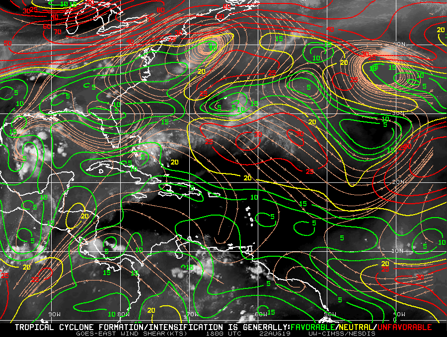
Still badly sheared by west to east 200 mb flow. Low level circulation appears to be outracing the convection being sheared off to the east.
http://rammb.cira.colostate.edu/ramsdis/online/loop.asp?data_folder=tropical/tropical_ge_4km_visir2_floater_1&width=640&height=480&number_of_images_to_display=12
http://rammb.cira.colostate.edu/ramsdis/online/loop.asp?data_folder=tropical/tropical_ge_4km_visir2_floater_1&width=640&height=480&number_of_images_to_display=12
0 likes
-
Aric Dunn
- Category 5
- Posts: 21238
- Age: 43
- Joined: Sun Sep 19, 2004 9:58 pm
- Location: Ready for the Chase.
- Contact:
Re: ATL: INVEST 98L - Discussion
ronjon wrote:Still badly sheared by west to east 200 mb flow. Low level circulation appears to be outracing the convection being sheared off to the east.
http://rammb.cira.colostate.edu/ramsdis/online/loop.asp?data_folder=tropical/tropical_ge_4km_visir2_floater_1&width=640&height=480&number_of_images_to_display=12
westerly shear is at the 300mb layer and there is actually easterly shear just above that. lol though the westerly shear is not bad and weakening presently. .. its mostly the pocket of dry air that is causing the lack of convection.
Last edited by Aric Dunn on Thu Aug 22, 2019 3:32 pm, edited 1 time in total.
1 likes
Note: If I make a post that is brief. Please refer back to previous posts for the analysis or reasoning. I do not re-write/qoute what my initial post said each time.
If there is nothing before... then just ask
Space & Atmospheric Physicist, Embry-Riddle Aeronautical University,
I believe the sky is falling...
If there is nothing before... then just ask
Space & Atmospheric Physicist, Embry-Riddle Aeronautical University,
I believe the sky is falling...

Re: ATL: INVEST 98L - Discussion
Broad low level circulation - currently devoid of any convection appears to be located at the western tip of Andros Island.
0 likes
-
MGC

- S2K Supporter
- Posts: 5940
- Joined: Sun Mar 23, 2003 9:05 pm
- Location: Pass Christian MS, or what is left.
Re: ATL: INVEST 98L - Discussion
Looks like 98L is slowly becoming better organized this afternoon. I'd speculate that odds of development are increasing. Would not be surprised if 98L eventually becomes a TC.....MGC
0 likes
Who is online
Users browsing this forum: No registered users and 41 guests