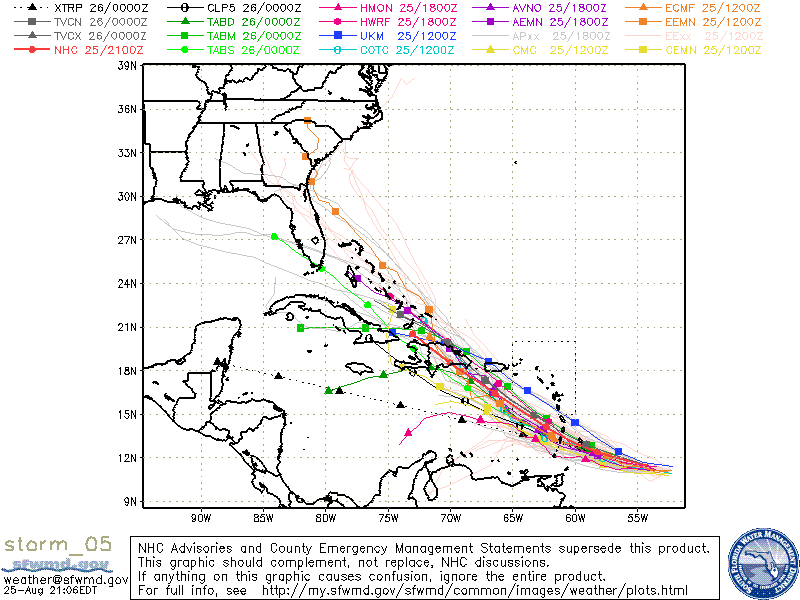
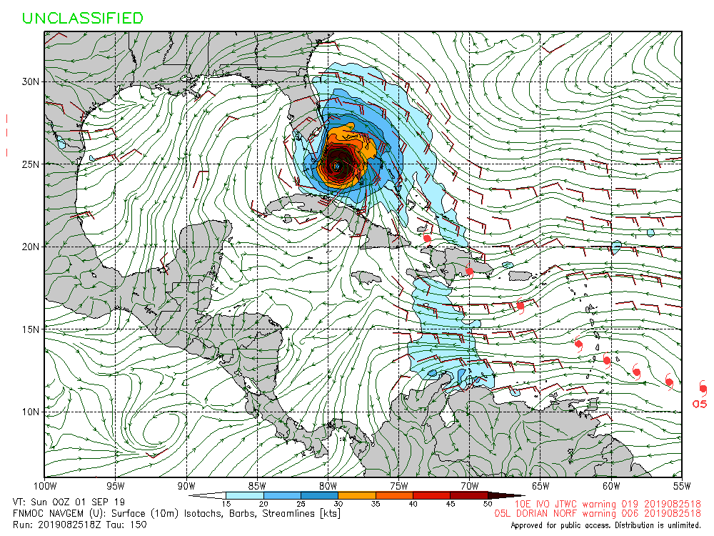
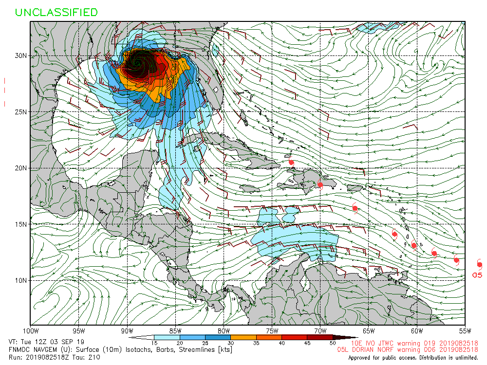
ATL: DORIAN - Models

Moderator: S2k Moderators

Message
Author
User avatar
TheProfessor
Professional-Met
Professional-Met
Posts: 3506
Age: 28
Joined: Tue Dec 03, 2013 10:56 am
Location: Wichita, Kansas

Re: ATL: DORIAN - Models

#201 Postby TheProfessor » Sun Aug 25, 2019 7:30 pm

TheStormExpert wrote:
blp wrote:The Bahamas have to have good conditions because even the Euro and GFS that dissipate the storm try to regenerate once in the Bahamas. I'm keeping my eye on this one because of the Ukmet which does not dissipate and ramps up after Hispaniola. Ukmet occasionally sniffs things out before the others follow

The same UKMET that blew up Barry in the Gulf?


The Ukmet's problems with Barry went well beyond just over intensifying him. It held on the the stronger ridge for far too long, which caused it to send the storm towards the central Texas coast. Although a stronger Barry was going to end up further west in that set up, because the UK had Barry over water longer it kind of fed into its over intensification.
2 likes   
An alumnus of The Ohio State University.

Your local National Weather Service office is your best source for weather information.

User avatar
Nimbus
Category 5
Category 5
Posts: 5300
Joined: Mon Jul 19, 2004 10:54 am

Re: ATL: DORIAN - Models

#202 Postby Nimbus » Sun Aug 25, 2019 7:37 pm

gatorcane wrote:
Nimbus wrote:
Blown Away wrote:https://i.imgur.com/OdNTIN3.gif
18z HWRF... The universe is back in balance and we can all relax, the HWRF is back where is needs to be blowing up into a Major Hurricane, j/k of course... :lol:


Headed over Nassau and will miss Miami by at least 50 miles.
Recurve before the Carolinas?


The GFS builds the Bermuda High ridge westward over the Carolinas and into the SE US days 5-7. So if the HWRF run went out further don’t think it would head towards the Carolinas. 150 hours GFS 500mb pressure anomalies below:

https://i.postimg.cc/KY6WCDqN/gfs-z500a-Norm-watl-26.png


We have had a weakness off the east coast a majority of the time but a strong hurricane might amplify the ridging so its too bad Dorian didn't stay weak a little longer.
0 likes   

Aric Dunn
Category 5
Category 5
Posts: 21238
Age: 42
Joined: Sun Sep 19, 2004 9:58 pm
Location: Ready for the Chase.
Contact:

Re: ATL: DORIAN - Models

#203 Postby Aric Dunn » Sun Aug 25, 2019 7:37 pm

little farther north and still a TS heading towards SE Hispaniola.
0 likes   
Note: If I make a post that is brief. Please refer back to previous posts for the analysis or reasoning. I do not re-write/qoute what my initial post said each time.
If there is nothing before... then just ask :)

Space & Atmospheric Physicist, Embry-Riddle Aeronautical University,
I believe the sky is falling...

User avatar
Hypercane_Kyle
Category 5
Category 5
Posts: 3352
Joined: Sat Mar 07, 2015 7:58 pm
Location: Cape Canaveral, FL

Re: ATL: DORIAN - Models

#204 Postby Hypercane_Kyle » Sun Aug 25, 2019 7:38 pm

Aric Dunn wrote:little farther north and still a TS heading towards SE Hispaniola.


Which model are you referring to?
0 likes   
My posts are my own personal opinion, defer to the National Hurricane Center (NHC) and other NOAA products for decision making during hurricane season.

User avatar
Kingarabian
S2K Supporter
S2K Supporter
Posts: 15980
Joined: Sat Aug 08, 2009 3:06 am
Location: Honolulu, Hawaii

Re: ATL: DORIAN - Models

#205 Postby Kingarabian » Sun Aug 25, 2019 7:41 pm

Hypercane_Kyle wrote:
Aric Dunn wrote:little farther north and still a TS heading towards SE Hispaniola.


Which model are you referring to?

Probably the 18z Euro, which is not too far off from the 12z Euro.
0 likes   
RIP Kobe Bryant

Aric Dunn
Category 5
Category 5
Posts: 21238
Age: 42
Joined: Sun Sep 19, 2004 9:58 pm
Location: Ready for the Chase.
Contact:

Re: ATL: DORIAN - Models

#206 Postby Aric Dunn » Sun Aug 25, 2019 7:43 pm

Kingarabian wrote:
Hypercane_Kyle wrote:
Aric Dunn wrote:little farther north and still a TS heading towards SE Hispaniola.


Which model are you referring to?

Probably the 18z Euro, which is not too far off from the 12z Euro.


position is not far off. just slightly farther NE. the big difference is it is still TS. 12z was an open wave at the same position.
1 likes   
Note: If I make a post that is brief. Please refer back to previous posts for the analysis or reasoning. I do not re-write/qoute what my initial post said each time.
If there is nothing before... then just ask :)

Space & Atmospheric Physicist, Embry-Riddle Aeronautical University,
I believe the sky is falling...

User avatar
gatorcane
S2K Supporter
S2K Supporter
Posts: 23691
Age: 47
Joined: Sun Mar 13, 2005 3:54 pm
Location: Boca Raton, FL

Re: ATL: DORIAN - Models

#207 Postby gatorcane » Sun Aug 25, 2019 7:47 pm

Slight right shift with the 00Z guidance that came in and intensity guidance has inched upward as well as a result (likely skewed by the HWRF):

Image

Image
Last edited by gatorcane on Sun Aug 25, 2019 7:58 pm, edited 1 time in total.
1 likes   

User avatar
Hypercane_Kyle
Category 5
Category 5
Posts: 3352
Joined: Sat Mar 07, 2015 7:58 pm
Location: Cape Canaveral, FL

Re: ATL: DORIAN - Models

#208 Postby Hypercane_Kyle » Sun Aug 25, 2019 7:53 pm

Aric Dunn wrote:
Kingarabian wrote:
Hypercane_Kyle wrote:
Which model are you referring to?

Probably the 18z Euro, which is not too far off from the 12z Euro.


position is not far off. just slightly farther NE. the big difference is it is still TS. 12z was an open wave at the same position.


Thanks for sharing, 00z ECMWF should show something similar then.
1 likes   
My posts are my own personal opinion, defer to the National Hurricane Center (NHC) and other NOAA products for decision making during hurricane season.

User avatar
NDG
S2K Supporter
S2K Supporter
Posts: 15446
Joined: Sun Jul 09, 2006 10:14 pm
Location: Orlando, FL

Re: ATL: DORIAN - Models

#209 Postby NDG » Sun Aug 25, 2019 8:03 pm

NHC could shift the track to the right closer to the TVCN.

Image
0 likes   

User avatar
gatorcane
S2K Supporter
S2K Supporter
Posts: 23691
Age: 47
Joined: Sun Mar 13, 2005 3:54 pm
Location: Boca Raton, FL

Re: ATL: DORIAN - Models

#210 Postby gatorcane » Sun Aug 25, 2019 8:15 pm

NHC to the left of TVCN but I think they may only slightly nudge it east and wait for 00Z guidance later to see if we really have a trend or if it just the last cycle.

Image
0 likes   

User avatar
AubreyStorm
Category 1
Category 1
Posts: 337
Age: 44
Joined: Fri Jun 16, 2017 6:21 pm
Location: Texas, USA

Re: ATL: DORIAN - Models

#211 Postby AubreyStorm » Sun Aug 25, 2019 8:18 pm

gatorcane wrote:18Z NAVY same track as the past several runs. But it has been consistently wrong before in these same situations.Takes this through Southern Florida into GOM:

First landfall:
https://i.postimg.cc/pLD5DWNL/nvg10-sfc10m-150-go-mex.gif

Second:
https://i.postimg.cc/HnyQJFQG/nvg10-sfc10m-210-go-mex.gif


Hi! Please send the link :roll:

Thanks!
1 likes   
The posts are NOT an official forecast. Please REFER to the NHC and NWS for official forecasts and products.

Frank2
Category 5
Category 5
Posts: 4061
Joined: Mon Jul 25, 2005 12:47 pm

Re: ATL: DORIAN - Models

#212 Postby Frank2 » Sun Aug 25, 2019 8:35 pm

NHC to the left of TVCN but I think they may only slightly nudge it east and wait for 00Z guidance later to see if we really have a trend or if it just the last cycle.


Let's not forget the movement of 98L and the pattern that is still there - many have Dorian on a simialr NNW track east of Florida...
0 likes   

User avatar
ronjon
Category 5
Category 5
Posts: 4822
Joined: Fri Aug 19, 2005 5:17 pm
Location: Hernando Beach, FL

Re: ATL: DORIAN - Models

#213 Postby ronjon » Sun Aug 25, 2019 8:41 pm

Nimbus wrote:
Blown Away wrote:https://i.imgur.com/OdNTIN3.gif
18z HWRF... The universe is back in balance and we can all relax, the HWRF is back where is needs to be blowing up into a Major Hurricane, j/k of course... :lol:


Headed over Nassau and will miss Miami by at least 50 miles.
Recurve before the Carolinas?


Yeah and into WPB and W-NW across Florida. I'm not liking the synoptic set up on this one with 500 mb ridging setting up in the SW Atlantic blocking any recurve.
0 likes   

User avatar
CaneCurious
Tropical Storm
Tropical Storm
Posts: 160
Joined: Wed Aug 25, 2004 1:40 pm
Location: Kenner, LA

Re: ATL: DORIAN - Models

#214 Postby CaneCurious » Sun Aug 25, 2019 8:43 pm

AubreyStorm wrote:
gatorcane wrote:18Z NAVY same track as the past several runs. But it has been consistently wrong before in these same situations.Takes this through Southern Florida into GOM:

First landfall:
https://i.postimg.cc/pLD5DWNL/nvg10-sfc10m-150-go-mex.gif

Second:
https://i.postimg.cc/HnyQJFQG/nvg10-sfc10m-210-go-mex.gif

Well isn’t that lovely. Thank goodness it’s early.
0 likes   

USTropics
Professional-Met
Professional-Met
Posts: 2650
Joined: Sun Aug 12, 2007 3:45 am
Location: Florida State University

Re: ATL: DORIAN - Models

#215 Postby USTropics » Sun Aug 25, 2019 8:44 pm

12z ensemble spaghetti plots for ECMWF, GFS, and UKMET:

Image
4 likes   

User avatar
Highteeld
Category 5
Category 5
Posts: 2139
Age: 41
Joined: Tue Jan 30, 2018 9:10 pm
Location: Chicago

Re: ATL: DORIAN - Models

#216 Postby Highteeld » Sun Aug 25, 2019 8:59 pm

....... * ATLANTIC 2019 SHIPS INTENSITY FORECAST *
* IR SAT DATA AVAILABLE, OHC AVAILABLE *
* DORIAN AL052019 08/26/19 00 UTC *

TIME (HR) 0 6 12 18 24 36 48 60 72 84 96 108 120
V (KT) NO LAND 45 50 54 60 64 70 74 76 75 73 73 73 75
V (KT) LAND 45 50 54 60 64 70 74 76 75 73 49 44 46
V (KT) LGEM 45 49 53 57 61 70 80 85 86 84 55 48 56
Storm Type TROP TROP TROP TROP TROP TROP TROP TROP TROP TROP TROP TROP TROP

SHEAR (KT) 5 0 3 6 0 6 7 12 14 15 5 3 4
SHEAR ADJ (KT) 4 4 0 0 1 0 -2 -1 -4 -5 -1 -3 -1
SHEAR DIR 174 132 29 49 56 314 255 267 242 280 235 319 47
SST (C) 28.4 28.5 28.8 28.9 28.8 29.0 29.1 28.9 29.1 29.2 29.2 29.5 29.2
POT. INT. (KT) 143 145 149 151 149 152 154 151 154 155 154 160 154
ADJ. POT. INT. 143 145 149 151 149 151 151 147 148 147 144 149 141
200 MB T (C) -54.0 -54.2 -54.4 -54.1 -54.0 -54.3 -53.9 -54.3 -54.1 -54.1 -54.1 -54.5 -54.2
200 MB VXT (C) -0.2 -0.2 -0.2 -0.2 -0.2 -0.2 -0.1 -0.2 -0.3 -0.3 -0.3 0.0 0.0
TH_E DEV (C) 11 10 10 11 11 10 12 11 12 12 12 11 12
700-500 MB RH 39 41 43 43 44 49 48 48 47 49 54 57 60
MODEL VTX (KT) 11 11 10 11 9 8 7 5 4 3 2 LOST LOST
850 MB ENV VOR 14 9 8 11 7 7 12 14 13 -1 -1 -30 -42
200 MB DIV -9 0 -7 -9 -6 25 24 21 5 -17 -3 10 15
700-850 TADV -5 -2 0 1 0 1 1 2 5 4 3 8 0
LAND (KM) 617 565 463 363 289 313 444 250 99 31 -70 21 133
LAT (DEG N) 11.6 11.9 12.2 12.5 12.8 13.6 14.7 15.8 17.1 18.1 19.0 20.0 21.2
LONG(DEG W) 54.7 55.9 57.0 58.1 59.3 61.3 63.3 65.4 67.3 69.1 70.8 72.3 73.6
STM SPEED (KT) 12 12 11 12 11 11 11 11 11 10 8 9 8
HEAT CONTENT 24 34 49 53 38 44 44 51 83 90 59 52 50

FORECAST TRACK FROM OFCI INITIAL HEADING/SPEED (DEG/KT):280/ 12 CX,CY: -11/ 2
T-12 MAX WIND: 35 PRESSURE OF STEERING LEVEL (MB): 543 (MEAN=620)
GOES IR BRIGHTNESS TEMP. STD DEV. 50-200 KM RAD: 8.6 (MEAN=14.5)
% GOES IR PIXELS WITH T < -20 C 50-200 KM RAD: 55.0 (MEAN=65.0)
PRELIM RI PROB (DV .GE. 35 KT IN 36 HR): 28.4

INDIVIDUAL CONTRIBUTIONS TO INTENSITY CHANGE
6 12 18 24 36 48 60 72 84 96 108 120
----------------------------------------------------------
SAMPLE MEAN CHANGE 1. 2. 3. 4. 6. 8. 9. 10. 11. 11. 12. 12.
SST POTENTIAL 1. 1. 2. 3. 4. 8. 12. 16. 19. 21. 23. 24.
VERTICAL SHEAR MAG 1. 2. 3. 5. 7. 9. 10. 11. 10. 11. 12. 13.
VERTICAL SHEAR ADJ 0. 0. 0. 0. 0. 0. 1. 1. 2. 2. 2. 2.
VERTICAL SHEAR DIR 0. 0. 1. 1. 2. 1. 0. -1. -2. -2. -3. -2.
PERSISTENCE 2. 2. 3. 2. 2. 1. 1. 1. 1. 1. 0. 0.
200/250 MB TEMP. 0. 0. -1. -1. 0. 0. 0. 0. 0. 1. 1. 2.
THETA_E EXCESS 0. 0. 1. 1. 1. 1. 1. 1. 1. 1. 1. 1.
700-500 MB RH 0. 0. 1. 1. 1. 2. 2. 2. 2. 2. 2. 1.
MODEL VTX TENDENCY 0. 0. 0. -2. -3. -6. -9. -12. -15. -17. -18. -19.
850 MB ENV VORTICITY 0. 0. 0. 0. 0. -1. -1. -1. -1. -1. -2. -2.
200 MB DIVERGENCE 0. 0. -1. -1. -1. -1. -1. -1. -1. 0. 1. 1.
850-700 T ADVEC 0. 0. 0. 0. 0. 0. 0. 0. 0. 0. 0. 0.
ZONAL STORM MOTION 0. 0. 0. 0. 0. 1. 1. 1. 1. 2. 2. 2.
STEERING LEVEL PRES 0. 0. 0. 0. 1. 1. 0. 1. 1. 1. 1. 1.
DAYS FROM CLIM. PEAK 0. 0. 0. 0. 0. 0. 0. 0. 0. 0. 0. 0.
GOES PREDICTORS 0. 0. 0. 0. 0. -1. -2. -2. -3. -3. -3. -3.
OCEAN HEAT CONTENT 0. 0. 0. 0. 0. 0. 0. 0. 0. 0. 0. 0.
RI POTENTIAL 1. 2. 4. 5. 7. 7. 5. 2. 1. -1. -3. -4.
----------------------------------------------------------
TOTAL CHANGE 5. 9. 15. 19. 25. 29. 31. 30. 28. 28. 28. 30.

CURRENT MAX WIND (KT): 45. LAT, LON: 11.6 54.7

** 2019 ATLANTIC RI INDEX AL052019 DORIAN 08/26/19 00 UTC **
(SHIPS-RII PREDICTOR TABLE for 30 KT OR MORE MAXIMUM WIND INCREASE IN NEXT 24-h)

Predictor Value RI Predictor Range Scaled Value(0-1) % Contribution
12 HR PERSISTENCE (KT) : 10.0 -49.5 to 33.0 0.72 14.0
850-200 MB SHEAR (KT) : 3.0 30.1 to 2.3 0.98 7.2
HEAT CONTENT (KJ/CM2) : 39.6 0.0 to 151.8 0.26 1.7
STD DEV OF IR BR TEMP : 8.6 36.6 to 2.8 0.83 6.6
MAXIMUM WIND (KT) : 45.0 22.5 to 137.5 0.60 2.6
2nd PC OF IR BR TEMP : 0.6 2.9 to -2.9 0.40 2.1
POT = MPI-VMAX (KT) : 102.2 27.5 to 139.6 0.67 3.4
D200 (10**7s-1) : -6.2 -29.7 to 185.9 0.11 0.2
%area of TPW <45 mm upshear : 12.7 100.0 to 0.0 0.87 0.0
BL DRY-AIR FLUX (W/M2) : 401.4 895.4 to -55.0 0.52 0.0

SHIPS Prob RI for 20kt/ 12hr RI threshold= 16% is 3.1 times climatological mean ( 5.2%)
SHIPS Prob RI for 25kt/ 24hr RI threshold= 50% is 4.6 times climatological mean (10.9%)
SHIPS Prob RI for 30kt/ 24hr RI threshold= 38% is 5.5 times climatological mean ( 6.9%)
SHIPS Prob RI for 35kt/ 24hr RI threshold= 32% is 8.3 times climatological mean ( 3.8%)
SHIPS Prob RI for 40kt/ 24hr RI threshold= 20% is 8.3 times climatological mean ( 2.4%)
SHIPS Prob RI for 45kt/ 36hr RI threshold= 44% is 9.8 times climatological mean ( 4.5%)
SHIPS Prob RI for 55kt/ 48hr RI threshold= 40% is 8.6 times climatological mean ( 4.6%)
SHIPS Prob RI for 65kt/ 72hr RI threshold= 37% is 6.9 times climatological mean ( 5.4%)

Matrix of RI probabilities
------------------------------------------------------------------------------
RI (kt / h) | 20/12 | 25/24 | 30/24 | 35/24 | 40/24 | 45/36 | 55/48 |65/72
------------------------------------------------------------------------------
SHIPS-RII: 15.9% 49.7% 37.9% 31.7% 19.9% 44.0% 39.7% 37.2%
Logistic: 13.3% 40.2% 40.6% 39.6% 17.4% 37.4% 22.1% 22.6%
Bayesian: 3.1% 20.9% 34.2% 2.6% 0.9% 13.3% 2.3% 0.7%
Consensus: 10.8% 36.9% 37.6% 24.6% 12.7% 31.6% 21.4% 20.2%
DTOPS: 2.0% 2.0% 0.0% 0.0% 0.0% 0.0% 3.0% 4.0%
0 likes   
Very useful information on the Dvorak Technique --

https://severe.worldweather.wmo.int/TCF ... kBeven.pdf

User avatar
northjaxpro
S2K Supporter
S2K Supporter
Posts: 8900
Joined: Mon Sep 27, 2010 11:21 am
Location: Jacksonville, FL

Re: ATL: DORIAN - Models

#217 Postby northjaxpro » Sun Aug 25, 2019 9:38 pm

The latest guidance model runs are growing.more and more concerning for Florida one week out. Ridging will likely be in place and if Dorian can skirt by or traverse north of Hispaniola that will potentially be with big implications with a potential formidable tropical cyclone approaching from the southeast.
Last edited by northjaxpro on Sun Aug 25, 2019 9:47 pm, edited 1 time in total.
1 likes   
NEVER, EVER SAY NEVER in the tropics and weather in general, and most importantly, with life itself!!

________________________________________________________________________________________

Fay 2008 Beryl 2012 Debby 2012 Colin 2016 Hermine 2016 Julia 2016 Matthew 2016 Irma 2017 Dorian 2019

User avatar
toad strangler
S2K Supporter
S2K Supporter
Posts: 4543
Joined: Sun Jul 28, 2013 3:09 pm
Location: Earth
Contact:

Re: ATL: DORIAN - Models

#218 Postby toad strangler » Sun Aug 25, 2019 9:44 pm

northjaxpro wrote:The latest guidance model runs are growing.more and more concerrning for Florida one week out. Ridging will likely be in place and if Dorian can skirt by or traverse north of Hispaniola that will potentially be with big implcations with a potential formidable tropical cyclone approaching from the southeast.


11PM disco kinda pours cold water on this plausible idea. For now. Referencing global model output of the ULL forecast to be near Hispaniola and dry air.
0 likes   

User avatar
Hypercane_Kyle
Category 5
Category 5
Posts: 3352
Joined: Sat Mar 07, 2015 7:58 pm
Location: Cape Canaveral, FL

Re: ATL: DORIAN - Models

#219 Postby Hypercane_Kyle » Sun Aug 25, 2019 9:49 pm

toad strangler wrote:
northjaxpro wrote:The latest guidance model runs are growing.more and more concerrning for Florida one week out. Ridging will likely be in place and if Dorian can skirt by or traverse north of Hispaniola that will potentially be with big implcations with a potential formidable tropical cyclone approaching from the southeast.


11PM disco kinda pours cold water on this plausible idea. For now. Referencing global model output of the ULL forecast to be near Hispaniola and dry air.


They're talking about how the ULL could potentially kill Dorian before it reaches Hispaniola as per the GFS/ECMWF, not after it reaches Hispaniola/reaches the Bahamas (if it ever does).
1 likes   
My posts are my own personal opinion, defer to the National Hurricane Center (NHC) and other NOAA products for decision making during hurricane season.

User avatar
northjaxpro
S2K Supporter
S2K Supporter
Posts: 8900
Joined: Mon Sep 27, 2010 11:21 am
Location: Jacksonville, FL

Re: ATL: DOR⁸IAN - Models

#220 Postby northjaxpro » Sun Aug 25, 2019 9:50 pm

We shall see, :uarrow:

I am not liking what I am seeing right now.with the models. I hope things changes in upcoming runs for sure.
0 likes   
NEVER, EVER SAY NEVER in the tropics and weather in general, and most importantly, with life itself!!

________________________________________________________________________________________

Fay 2008 Beryl 2012 Debby 2012 Colin 2016 Hermine 2016 Julia 2016 Matthew 2016 Irma 2017 Dorian 2019


Return to “2019”

Who is online

Users browsing this forum: No registered users and 2 guests