ATL: DORIAN - Post-Tropical - Discussion
Moderator: S2k Moderators
-
Weatherboy1

- Category 5

- Posts: 1190
- Age: 50
- Joined: Mon Jul 05, 2004 1:50 pm
- Location: Jupiter/Sarasota, FL
Re: ATL: DORIAN - Tropical Storm - Discussion
Certainly doesn’t look any stronger, but with the significant uptick in convection and decent outflow, still don’t see it dissipating altogether a la last couple days of GFS runs. In other words, think it will continue to mix off/fight off dry air and likely reach hurricane strength before too long.
4 likes
-
Weatherboy1
- Category 5
- Posts: 1190
- Age: 50
- Joined: Mon Jul 05, 2004 1:50 pm
- Location: Jupiter/Sarasota, FL
Re: ATL: DORIAN - Tropical Storm - Discussion
Longer term, models certainly do seem to be zeroing in on some kind of peninsula Florida hit. Questions as to where, how strong etc. But am definitely preparing/watching here in PBC. If - big IF - Hispaniola doesn’t cause much disruption due to a more easterly track, then NHC day 4-5 intensity guidance likely too low in my opinion
3 likes


-
Aric Dunn
- Category 5
- Posts: 21238
- Age: 43
- Joined: Sun Sep 19, 2004 9:58 pm
- Location: Ready for the Chase.
- Contact:
Re: ATL: DORIAN - Tropical Storm - Discussion
Actually looking quite healthy. Center passing/passed over northern St lucia.

1 likes
Note: If I make a post that is brief. Please refer back to previous posts for the analysis or reasoning. I do not re-write/qoute what my initial post said each time.
If there is nothing before... then just ask
Space & Atmospheric Physicist, Embry-Riddle Aeronautical University,
I believe the sky is falling...
If there is nothing before... then just ask
Space & Atmospheric Physicist, Embry-Riddle Aeronautical University,
I believe the sky is falling...
-
SFLcane

- S2K Supporter

- Posts: 10281
- Age: 48
- Joined: Sat Jun 05, 2010 1:44 pm
- Location: Lake Worth Florida
Re: ATL: DORIAN - Tropical Storm - Discussion
Aric Dunn wrote:I see it is looking alot healthier. Especially on radar with a long curved band. Shear still has not kicked up and dry air is touch and go. Looks like it will survive the carrib. Low level flow is not all that strong and will be turning out of the se.
Unfortunately I agree this will more then likely survive the Caribbean and eventually be some type of issue for FL.
1 likes
-
northjaxpro

- S2K Supporter
- Posts: 8900
- Joined: Mon Sep 27, 2010 11:21 am
- Location: Jacksonville, FL
Re: ATL: DORIAN - Tropical Storm - Discussion
Weatherboy1 wrote:Certainly doesn’t look any stronger, but with the significant uptick in convection and decent outflow, still don’t see it dissipating altogether a la last couple days of GFS runs. In other words, think it will continue to mix off/fight off dry air and likely reach hurricane strength before too long.
Yes I agree. Dorian has a very good ovetall structure and the cyclone is organized quite well. I do not see this dissipating. It should maintain itself, and once the inner core gets completely away from Hispaniola 's influences in a few days, conditions look pretty good for Dorian to become a hurrricane, possibly as early as Thursday or Thursday evening,.
1 likes
NEVER, EVER SAY NEVER in the tropics and weather in general, and most importantly, with life itself!!
________________________________________________________________________________________
Fay 2008 Beryl 2012 Debby 2012 Colin 2016 Hermine 2016 Julia 2016 Matthew 2016 Irma 2017 Dorian 2019
________________________________________________________________________________________
Fay 2008 Beryl 2012 Debby 2012 Colin 2016 Hermine 2016 Julia 2016 Matthew 2016 Irma 2017 Dorian 2019
-
toad strangler

- S2K Supporter
- Posts: 4546
- Joined: Sun Jul 28, 2013 3:09 pm
- Location: Earth
- Contact:
Re: ATL: DORIAN - Tropical Storm - Discussion
SFLcane wrote:Aric Dunn wrote:I see it is looking alot healthier. Especially on radar with a long curved band. Shear still has not kicked up and dry air is touch and go. Looks like it will survive the carrib. Low level flow is not all that strong and will be turning out of the se.
Unfortunately I agree this will more then likely survive the Caribbean and eventually be some type of issue for FL.
Looks that way but look at how far Dorian is out and all the players moving on the table. I would be quite wary anywhere from TX to the Carolinas with this kind of real estate left.
1 likes
My Weather Station
https://www.wunderground.com/dashboard/pws/KFLPORTS603
https://www.wunderground.com/dashboard/pws/KFLPORTS603
-
Tailspin
Re: ATL: DORIAN - Tropical Storm - Discussion
Kingarabian wrote:Center continues to be displayed and away from the main convection mass and appears to be on the south eastern edge.
https://i.imgur.com/fEDk2ZL.jpg
@06z 36H shows what looks too be the open core. https://imgur.com/MWanhMm
Last edited by Tailspin on Tue Aug 27, 2019 6:01 am, edited 1 time in total.
1 likes

Re: ATL: DORIAN - Tropical Storm - Discussion
Rain rate is picking up, looks like a more sustainable warm core maybe forming.

0 likes
Re: ATL: DORIAN - Tropical Storm - Discussion
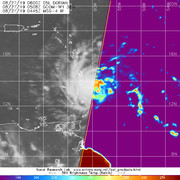
ADT is reporting a curved band
Strong towers firing east of the islands
Strong towers firing east of the islands
Last edited by GCANE on Tue Aug 27, 2019 6:04 am, edited 1 time in total.
0 likes
-
weathermimmi
- Tropical Low

- Posts: 27
- Joined: Wed Aug 24, 2016 9:16 pm
- Location: Destin/FWB Florida
Re: ATL: DORIAN - Tropical Storm - Discussion
USTropics wrote:First 40 visible frames:
https://cardse.net/i/2019/08/27/5c298e6e8f810edc71d007a60a378abc.gif
Something is brewing and not just the coffee this I see this morning, albeit small we shall see strengthening as they day progresses from Dorian. Small or not a storm is a storm to pay attention to.
1 likes
-
Aric Dunn
- Category 5
- Posts: 21238
- Age: 43
- Joined: Sun Sep 19, 2004 9:58 pm
- Location: Ready for the Chase.
- Contact:
Re: ATL: DORIAN - Tropical Storm - Discussion
GCANE wrote:ADT is reporting a curved band
Yeah radar signature continues to improve.
Once the center get away from the island and assuming it does not pull in dry air before it develops a decent core. Then we could see it ramp up.
4 likes
Note: If I make a post that is brief. Please refer back to previous posts for the analysis or reasoning. I do not re-write/qoute what my initial post said each time.
If there is nothing before... then just ask
Space & Atmospheric Physicist, Embry-Riddle Aeronautical University,
I believe the sky is falling...
If there is nothing before... then just ask
Space & Atmospheric Physicist, Embry-Riddle Aeronautical University,
I believe the sky is falling...
Re: ATL: DORIAN - Tropical Storm - Discussion
HurricaneIrma wrote:GCANE wrote:Currently Dorian is under some slightly divergent and strong UL winds due to an UL High to the NE.
However, could see some significant improvement in outflow later this afternoon as Dorian tracks NW.
https://i.imgur.com/CojjVRu.png
Who said its will go NW this afternoon

0 likes
-
Chris_in_Tampa
- Category 5
- Posts: 5101
- Age: 42
- Joined: Thu Jun 21, 2007 11:06 pm
- Location: Tampa, Florida, USA
- Contact:
Re: ATL: DORIAN - Tropical Storm - Discussion
Longer Martinique and Guadeloupe radar loops by Brian McNoldy:
http://bmcnoldy.rsmas.miami.edu/tropics/radar/
He combines all the images so far of the storm on those radars, in real time.
You can get the original imagery on these sites:
Martinique and Guadeloupe:
http://www.meteofrance.gp/previsions-me ... r/antilles
http://www.barbadosweather.org/Composit ... 700&MAPP=1
Martinique:
http://www.meteo.fr/temps/domtom/antill ... f_com.html
Guadeloupe:
http://www.meteo.fr/temps/domtom/antill ... f_com.html
4 likes
-
Aric Dunn
- Category 5
- Posts: 21238
- Age: 43
- Joined: Sun Sep 19, 2004 9:58 pm
- Location: Ready for the Chase.
- Contact:
Re: ATL: DORIAN - Tropical Storm - Discussion
By far the best satellite appearance as well with very noticable mid to upper level rotation for the first time.
The long curved band is very distinct on visible.. vs yesterday when it was just a large ball of convection.
The long curved band is very distinct on visible.. vs yesterday when it was just a large ball of convection.
0 likes
Note: If I make a post that is brief. Please refer back to previous posts for the analysis or reasoning. I do not re-write/qoute what my initial post said each time.
If there is nothing before... then just ask
Space & Atmospheric Physicist, Embry-Riddle Aeronautical University,
I believe the sky is falling...
If there is nothing before... then just ask
Space & Atmospheric Physicist, Embry-Riddle Aeronautical University,
I believe the sky is falling...
-
Aric Dunn
- Category 5
- Posts: 21238
- Age: 43
- Joined: Sun Sep 19, 2004 9:58 pm
- Location: Ready for the Chase.
- Contact:
Re: ATL: DORIAN - Tropical Storm - Discussion
Chris_in_Tampa wrote:Longer Martinique and Guadeloupe radar loops by Brian McNoldy:
http://bmcnoldy.rsmas.miami.edu/tropics/radar/
He combines all the images so far of the storm on those radars, in real time.
You can get the original imagery on these sites:
Martinique and Guadeloupe:
http://www.meteofrance.gp/previsions-me ... r/antilles
http://www.barbadosweather.org/Composit ... 700&MAPP=1
Martinique:
http://www.meteo.fr/temps/domtom/antill ... f_com.html
Guadeloupe:
http://www.meteo.fr/temps/domtom/antill ... f_com.html
THANK YOU! Totally forgot about his site. And the single view site radar loops..
And the best thing is the last frame is held.. i think i might tear up a little..
5 likes
Note: If I make a post that is brief. Please refer back to previous posts for the analysis or reasoning. I do not re-write/qoute what my initial post said each time.
If there is nothing before... then just ask
Space & Atmospheric Physicist, Embry-Riddle Aeronautical University,
I believe the sky is falling...
If there is nothing before... then just ask
Space & Atmospheric Physicist, Embry-Riddle Aeronautical University,
I believe the sky is falling...
-
p1nheadlarry

- Category 2

- Posts: 672
- Age: 34
- Joined: Wed Jan 29, 2014 2:42 pm
- Location: SR County FL
Re: ATL: DORIAN - Tropical Storm - Discussion
The streaky cirrus outflow - that is due to the storm dealing with drier than desired air right?
0 likes
--;->#GoNoles--;->.

Re: ATL: DORIAN - Tropical Storm - Discussion
Aric Dunn wrote:By far the best satellite appearance as well with very noticable mid to upper level rotation for the first time.
The long curved band is very distinct on visible.. vs yesterday when it was just a large ball of convection.
Persistance rather than pulsation overnight.
THE 06Z GFS finally acknowledges Dorian and tracks him over the high terrain of Hispaniola.
Despite better conditions in the Bahamas, the GFS tracks just a 1000 mb tropical storm into the Cape.
Good hedge that conveys some of the steering elements being considered.
0 likes

Re: ATL: DORIAN - Tropical Storm - Discussion
Levi Cowan just said no strengthening is happening at this time, he said if there were, there would be more curved banding wrapping into the center and radar showing ragged edges indicating weak rotation. he says it is following expectations at this time. per tweet.
0 likes
Robbielyn McCrary
I know just about enough to sound like I know what I'm talking about sometimes. But for your safety please follow the nhc for truly professional forecasting.
I know just about enough to sound like I know what I'm talking about sometimes. But for your safety please follow the nhc for truly professional forecasting.
Who is online
Users browsing this forum: No registered users and 14 guests