
ATL: DORIAN - Models
Moderator: S2k Moderators
-
beachman80
Re: ATL: DORIAN - Models
By the way, if that ridge builds in, wouldn’t it move more westerly rather than WNW? Always seems like models overcompensate the north movement with a ridge over it. Even Andrew and Irma moved WSW with a ridge over it in the Atlantic. That’s assuming it makes it out of the Caribbean alive, which I have my doubts on.
0 likes
-
Evil Jeremy

- S2K Supporter

- Posts: 5463
- Age: 32
- Joined: Mon Apr 10, 2006 2:10 pm
- Location: Los Angeles, CA
Re: ATL: DORIAN - Models
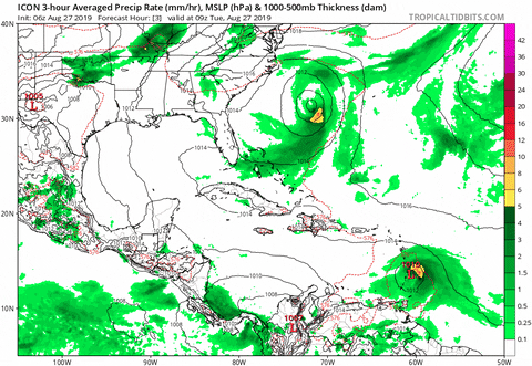
I'm not really a fan of ICON, don't know too much about it, but it's been consistant with being a northern outlier early in it's run, followed by a hard cut to the West, or even WSW. In fact, the ICON run from 84 hours onward reminds me a lot of Hurricane Ike's WSW decent, with the cone dropping from SFL into Cuba.
2 likes
Frances 04 / Jeanne 04 / Katrina 05 / Wilma 05 / Fay 08 / Debby 12 / Andrea 13 / Colin 16 / Hermine 16 / Matthew 16 / Irma 17
-
Miami Storm Tracker

- Category 4

- Posts: 916
- Age: 68
- Joined: Sun Jun 13, 2010 10:12 pm
- Location: Key Largo, Fla.
- Contact:
-
Evil Jeremy
- S2K Supporter
- Posts: 5463
- Age: 32
- Joined: Mon Apr 10, 2006 2:10 pm
- Location: Los Angeles, CA
Re: ATL: DORIAN - Models
Miami Storm Tracker wrote:At work here anyone have a most recent run of the UKMET.
I don't have the intensity forecast, but looking at the 00z run plotted on SFWMD, it takes Dorian into somewhere around the Broward/Palm Beach county line
https://apps.sfwmd.gov/sfwmd/common/ima ... orm_05.gif
0 likes
Frances 04 / Jeanne 04 / Katrina 05 / Wilma 05 / Fay 08 / Debby 12 / Andrea 13 / Colin 16 / Hermine 16 / Matthew 16 / Irma 17
-
WeatherEmperor
- S2K Supporter
- Posts: 4806
- Age: 42
- Joined: Thu Sep 04, 2003 2:54 pm
- Location: South Florida
Re: ATL: DORIAN - Models
Miami Storm Tracker wrote:At work here anyone have a most recent run of the UKMET.
This is the most recent run (blue line). The next run is around noon today

Sent from my iPhone using Tapatalk
0 likes
-
jlauderdal
- S2K Supporter
- Posts: 7240
- Joined: Wed May 19, 2004 5:46 am
- Location: NE Fort Lauderdale
- Contact:
Re: ATL: DORIAN - Models
katrina moved wsw as it was heading towards south floridabeachman80 wrote:By the way, if that ridge builds in, wouldn’t it move more westerly rather than WNW? Always seems like models overcompensate the north movement with a ridge over it. Even Andrew and Irma moved WSW with a ridge over it in the Atlantic. That’s assuming it makes it out of the Caribbean alive, which I have my doubts on.
0 likes
-
chris_fit

- Category 5

- Posts: 3261
- Age: 43
- Joined: Wed Sep 10, 2003 11:58 pm
- Location: Tampa Bay Area, FL
Re: ATL: DORIAN - Models
Ensemble recap before the 12Z... worth noting that both the EURO and GFS ensemble means seem to be south of the operational runs.
GFS:

EURO:

GFS:
EURO:
0 likes

-
p1nheadlarry

- Category 2

- Posts: 672
- Age: 34
- Joined: Wed Jan 29, 2014 2:42 pm
- Location: SR County FL
Re: ATL: DORIAN - Models
I’m late to the party but I see the HWRF is pretty close to the NHC forecast track/intensity wise.
0 likes
--;->#GoNoles--;->.

Re: ATL: DORIAN - Models
WeatherEmperor wrote:Aric Dunn wrote:Lets see how this slight north reform affects the models and interacting with hispaniola. I say we see a slight east shift again.
The Ukmet had this more northerly component in its forecast for a few days now. Maybe it was onto something? In addition to that, it is also showing a landfall closer to South Florida.
If I recall correctly, it was the ukmet that got Irma right. Looking at the model path it looks like it came close on hurricane Michael as well.
1 likes
-
beachman80
Re: ATL: DORIAN - Models
jlauderdal wrote:katrina moved wsw as it was heading towards south floridabeachman80 wrote:By the way, if that ridge builds in, wouldn’t it move more westerly rather than WNW? Always seems like models overcompensate the north movement with a ridge over it. Even Andrew and Irma moved WSW with a ridge over it in the Atlantic. That’s assuming it makes it out of the Caribbean alive, which I have my doubts on.
You’re right. This is why I’m a bit concerned for the Gulf. Seems to be the forgotten story. If HP gets a hold of this, it could bend it more west and WSW and all of a sudden this becomes a Katrina-like track where it sneaks into the eastern Gulf with 90 degree water temps and less shear.
0 likes
-
TheStormExpert
Re: ATL: DORIAN - Models
artist wrote:WeatherEmperor wrote:Aric Dunn wrote:Lets see how this slight north reform affects the models and interacting with hispaniola. I say we see a slight east shift again.
The Ukmet had this more northerly component in its forecast for a few days now. Maybe it was onto something? In addition to that, it is also showing a landfall closer to South Florida.
If I recall correctly, it was the ukmet that got Irma right. Looking at the model path it looks like it came close on hurricane Michael as well.
A lot of times though the UKMET is left biased.
1 likes
-
tolakram
- Admin

- Posts: 20186
- Age: 62
- Joined: Sun Aug 27, 2006 8:23 pm
- Location: Florence, KY (name is Mark)
Re: ATL: DORIAN - Models
The use of weathermodels.com euro data is prohibited by their license terms, which specifically includes forbidding any cropping of the output. Follow Ryan Maue on twitter and if he posts a map then post the tweet here.
1 likes
M a r k
- - - - -
Join us in chat: Storm2K Chatroom Invite. Android and IOS apps also available.
The posts in this forum are NOT official forecasts and should not be used as such. Posts are NOT endorsed by any professional institution or STORM2K.org. For official information and forecasts, please refer to NHC and NWS products.

Re: ATL: DORIAN - Models
Looks like South Florida is looking better than yesterday with the landfall moving up to the cape but it’s still too early but feeling better about it now.
0 likes
Re: ATL: DORIAN - Models
boca wrote:Looks like South Florida is looking better than yesterday with the landfall moving up to the cape but it’s still too early but feeling better about it now.
Wind speed probabilities for the 2 highest at this point-
FT PIERCE FL 34 X X( X) X( X) X( X) X( X) 6( 6) 35(41)
FT PIERCE FL 50 X X( X) X( X) X( X) X( X) 1( 1) 12(13)
FT PIERCE FL 64 X X( X) X( X) X( X) X( X) X( X) 3( 3)
W PALM BEACH 34 X X( X) X( X) X( X) X( X) 7( 7) 34(41)
W PALM BEACH 50 X X( X) X( X) X( X) X( X) 1( 1) 12(13)
W PALM BEACH 64 X X( X) X( X) X( X) X( X) X( X) 3( 3)
0 likes
-
chris_fit
- Category 5
- Posts: 3261
- Age: 43
- Joined: Wed Sep 10, 2003 11:58 pm
- Location: Tampa Bay Area, FL
Re: ATL: DORIAN - Models
boca wrote:Looks like South Florida is looking better than yesterday with the landfall moving up to the cape but it’s still too early but feeling better about it now.
I don't think this is accurate. Look at the ensembles I posted earlier. New ones coming out in next few hours, but the means are south and west of where the operational runs strike FL.
0 likes
-
beachman80
Re: ATL: DORIAN - Models
So curious as to why models are moving this more WNW and NW if HP is going to be over it and the system will be weak.
Doesn’t HP equate to more westerly movement and doesn’t a weaker system equate to more westerly movement? Not understanding the WNW move to Fla. it’s why I actually believe the ICOn although a weaker storm than it has.
Doesn’t HP equate to more westerly movement and doesn’t a weaker system equate to more westerly movement? Not understanding the WNW move to Fla. it’s why I actually believe the ICOn although a weaker storm than it has.
0 likes
-
eastcoastFL

- Category 5
- Posts: 3996
- Age: 44
- Joined: Thu Apr 12, 2007 12:29 pm
- Location: Palm City, FL
Re: ATL: DORIAN - Models
artist wrote:boca wrote:Looks like South Florida is looking better than yesterday with the landfall moving up to the cape but it’s still too early but feeling better about it now.
Wind speed probabilities for the 2 highest at this point-
FT PIERCE FL 34 X X( X) X( X) X( X) X( X) 6( 6) 35(41)
FT PIERCE FL 50 X X( X) X( X) X( X) X( X) 1( 1) 12(13)
FT PIERCE FL 64 X X( X) X( X) X( X) X( X) X( X) 3( 3)
W PALM BEACH 34 X X( X) X( X) X( X) X( X) 7( 7) 34(41)
W PALM BEACH 50 X X( X) X( X) X( X) X( X) 1( 1) 12(13)
W PALM BEACH 64 X X( X) X( X) X( X) X( X) X( X) 3( 3)
I’m a bit south of ft pierce. Local forecast calls for 40mph winds Saturday with 50mph gusts
0 likes
Personal Forecast Disclaimer:
The posts in this forum are NOT official forecast and should not be used as such. They are just the opinion of the poster and may or may not be backed by sound meteorological data. They are NOT endorsed by any professional institution or storm2k.org. For official information, please refer to the NHC and NWS products.
The posts in this forum are NOT official forecast and should not be used as such. They are just the opinion of the poster and may or may not be backed by sound meteorological data. They are NOT endorsed by any professional institution or storm2k.org. For official information, please refer to the NHC and NWS products.
Re: ATL: DORIAN - Models
I think a curious thing to keep an eye on: the models (UKmet/ICON) that are consistently to the right of all others in the short term (passing over Eastern tip of PR), are also consistently to the LEFT of all models in the longer term (and stronger, as well). This is likely due to the effects of the retreating ULL/stronger, rebuilding ridge .. but something I'm watching on future runs, as this seems to be a very significant future dynamic
0 likes
Who is online
Users browsing this forum: No registered users and 4 guests