ATL: DORIAN - Models
Moderator: S2k Moderators

Re: ATL: DORIAN - Models
GFS is now running and out to 36 hours. CMC then HWRF/HMON should be after that heading into the ECMWF.
0 likes


-
Hypercane_Kyle

- Category 5

- Posts: 3465
- Joined: Sat Mar 07, 2015 7:58 pm
- Location: Cape Canaveral, FL
Re: ATL: DORIAN - Models
Could any mets lurking around here potentially give us some numbers on how the ICON has generally performed through day 3-5? I've always been warned not to use it for TC guidance.
0 likes
My posts are my own personal opinion, defer to the National Hurricane Center (NHC) and other NOAA products for decision making during hurricane season.

-
will759227
Re: ATL: DORIAN - Models
gatorcane wrote:12Z GFS slightly north and faster through 36 hours.
Perhaps someone at the NHC got to the data importers and said... follow our path, stop that west coast stuff.
0 likes
-
catskillfire51
- S2K Supporter

- Posts: 480
- Age: 39
- Joined: Sun Aug 26, 2012 5:40 pm
- Location: Lake Jackson, TX
Re: ATL: DORIAN - Models
Hypercane_Kyle wrote:Could any mets lurking around here potentially give us some numbers on how the ICON has generally performed through day 3-5? I've always been warned not to use it for TC guidance.
Theres a graph from UAlbany with those details on one of the previous pages
0 likes
-
AutoPenalti
- Category 5
- Posts: 4091
- Age: 29
- Joined: Mon Aug 17, 2015 4:16 pm
- Location: Ft. Lauderdale, Florida
Re: ATL: DORIAN - Models
GFS with weaker ridging.
0 likes
The posts in this forum are NOT official forecasts and should not be used as such. They are just the opinion of the poster and may or may not be backed by sound meteorological data. They are NOT endorsed by any professional institution or STORM2K. For official information, please refer to products from the NHC and NWS.
Model Runs Cheat Sheet:
GFS (5:30 AM/PM, 11:30 AM/PM)
HWRF, GFDL, UKMET, NAVGEM (6:30-8:00 AM/PM, 12:30-2:00 AM/PM)
ECMWF (1:45 AM/PM)
TCVN is a weighted averaged
-
catskillfire51
- S2K Supporter
- Posts: 480
- Age: 39
- Joined: Sun Aug 26, 2012 5:40 pm
- Location: Lake Jackson, TX
Re: ATL: DORIAN - Models
Still North of previous run at 54hrs but still seems due west in movement
0 likes
Re: ATL: DORIAN - Models
ICON out to 156 - comes into the Gulf and cuts back into Florida for US Landfall #2 Horseshoe Beach/Cedar Key area and looks like it will head NE toward Jacksonville area.
0 likes
-
StPeteMike

- Category 2

- Posts: 656
- Joined: Thu Jun 07, 2018 11:26 pm
Re: ATL: DORIAN - Models
Steve wrote:caneman wrote:Steve wrote:https://www.tropicaltidbits.com/analysis/models/?model=icon®ion=us&pkg=z500_mslp&runtime=2019083012&fh=90
1020mb high in the SE as it's hitting Miami. Looks like a situation where it could get close to 83/84W on this run unless it cuts up Florida or just along the coast.
Dont tell me that crap Steve, we dont need IRMA 2 on the west coast.
Basically it keeps the eye intact and is along the coast around Sarasota and Siesta Key at 120 (so valid 7am Wednesday)
Yep, which has been my biggest fear for the past couple days. And, no it’s not “-removed-”, but more of the fact that many have been hoping for the ridge to break or a trough to come through and neither seem to be happening any time soon.
2 likes
The above post is not official and should not be used as such. It is the opinion of the poster and may or may not be backed by sound meteorological data. It is not endorsed by any professional institution or storm2k.org. For official information, please refer to the NHC and NWS products.
-
SFLcane

- S2K Supporter
- Posts: 10281
- Age: 48
- Joined: Sat Jun 05, 2010 1:44 pm
- Location: Lake Worth Florida
Re: ATL: DORIAN - Models
Yep no ridge in place really this could still miss Florida. Have a feeling we will be looking at entirely different outlook tomorrow.
0 likes
-
Jevo

- S2K Supporter
- Posts: 1729
- Age: 47
- Joined: Tue Aug 03, 2004 8:45 pm
- Location: The Flemish Cap
- Contact:
Re: ATL: DORIAN - Models
Looks to flatten out at 54... Let's see if it feels that WSW bump again before resuming
0 likes
Disclaimer: 50% of the time I have no clue of what I am talking about. Chances are I am taking a less than educated guess that sounds good because 10 years ago I stole Mike Watkins book 'The Hurricane and its Impact'. For official information please direct yourself to the NHC and their cadre of weather geniuses.
-
AutoPenalti
- Category 5
- Posts: 4091
- Age: 29
- Joined: Mon Aug 17, 2015 4:16 pm
- Location: Ft. Lauderdale, Florida
Re: ATL: DORIAN - Models
SFLcane wrote:Yep no ridge in place really this could still miss Florida. Have a feeling we will be looking at entirely different outlook tomorrow.
It's still there...it's just a bit weaker...
2 likes
The posts in this forum are NOT official forecasts and should not be used as such. They are just the opinion of the poster and may or may not be backed by sound meteorological data. They are NOT endorsed by any professional institution or STORM2K. For official information, please refer to products from the NHC and NWS.
Model Runs Cheat Sheet:
GFS (5:30 AM/PM, 11:30 AM/PM)
HWRF, GFDL, UKMET, NAVGEM (6:30-8:00 AM/PM, 12:30-2:00 AM/PM)
ECMWF (1:45 AM/PM)
TCVN is a weighted averaged

Re: ATL: DORIAN - Models

Last edited by kevin on Fri Aug 30, 2019 10:54 am, edited 3 times in total.
0 likes
-
tolakram
- Admin

- Posts: 20186
- Age: 62
- Joined: Sun Aug 27, 2006 8:23 pm
- Location: Florence, KY (name is Mark)
Re: ATL: DORIAN - Models

0 likes
M a r k
- - - - -
Join us in chat: Storm2K Chatroom Invite. Android and IOS apps also available.
The posts in this forum are NOT official forecasts and should not be used as such. Posts are NOT endorsed by any professional institution or STORM2K.org. For official information and forecasts, please refer to NHC and NWS products.
-
Hypercane_Kyle
- Category 5
- Posts: 3465
- Joined: Sat Mar 07, 2015 7:58 pm
- Location: Cape Canaveral, FL
Re: ATL: DORIAN - Models
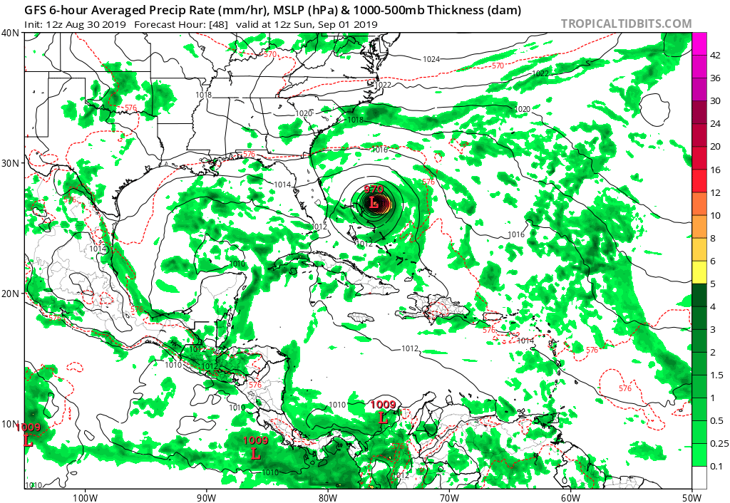
12z GFS almost identical to the 00z ECMWF. Should be a similar path.
0 likes
My posts are my own personal opinion, defer to the National Hurricane Center (NHC) and other NOAA products for decision making during hurricane season.
Who is online
Users browsing this forum: No registered users and 42 guests