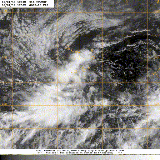
91L INVEST 190901 1200 14.3N 23.8W ATL 25 NA
ATL: GABRIELLE - Post-Tropical - Discussion
Moderator: S2k Moderators
-
Nancy Smar

- Category 5

- Posts: 1081
- Age: 25
- Joined: Wed Aug 16, 2017 10:03 pm
ATL: GABRIELLE - Post-Tropical - Discussion
Last edited by Nancy Smar on Fri Sep 06, 2019 9:49 am, edited 2 times in total.
1 likes

Re: ATL: INVEST 91L - Discussion
Ok 91L, I need you to behave like a good fish should....we have bigger fish to fry....
7 likes


-
Extratropical94

- Professional-Met

- Posts: 3545
- Age: 31
- Joined: Wed Oct 20, 2010 6:36 am
- Location: Hamburg, Germany
- Contact:
Re: ATL: INVEST 91L - Discussion
MetroMike wrote:Map of where this is?

3 likes
54° 11' 59'' N, 9° 9' 20'' E
Boomer Sooner!
Go Broncos! Go Cards!
Clinching counties, one at a time: https://mob-rule.com/user-gifs/USA/xtrp94.gif
- Daniel
Boomer Sooner!
Go Broncos! Go Cards!
Clinching counties, one at a time: https://mob-rule.com/user-gifs/USA/xtrp94.gif
- Daniel
Re: ATL: INVEST 91L - Discussion
Some people are saying this is a fish already.
It is common for theses to straighten up and move westward after a while.
I would not assume it will go poleward in the future.
It is common for theses to straighten up and move westward after a while.
I would not assume it will go poleward in the future.
4 likes

Re: ATL: INVEST 91L - Discussion
MetroMike wrote:Some people are saying this is a fish already.
It is common for theses to straighten up and move westward after a while.
I would not assume it will go poleward in the future.
It's fairly far north for this time of year and there's another system to the west that'll create a weakness if the upper flow doesn't. All indications are that the one behind this will be the one to watch more.
2 likes
The above post is not official and should not be used as such. It is the opinion of the poster and may or may not be backed by sound meteorological data. It is not endorsed by any professional institution or storm2k.org. For official information, please refer to the NHC and NWS products.
-
Sciencerocks
- Category 5
- Posts: 10194
- Age: 40
- Joined: Thu Jul 06, 2017 1:51 am

Re: ATL: INVEST 91L - Discussion
Hammy wrote:MetroMike wrote:Some people are saying this is a fish already.
It is common for theses to straighten up and move westward after a while.
I would not assume it will go poleward in the future.
It's fairly far north for this time of year and there's another system to the west that'll create a weakness if the upper flow doesn't. All indications are that the one behind this will be the one to watch more.
Do you reckon any of the AOIs will get named??
0 likes
blonde stacey (xe/xem/xir)

Re: ATL: INVEST 91L - Discussion
Euro shows this gaining latitude until around 40w when it starts heading west. It then recurves east of Bermuda. Reminds me a bit of Karl 2016.
0 likes
Igor 2010, Sandy 2012, Fay 2014, Gonzalo 2014, Joaquin 2015, Nicole 2016, Humberto 2019, Imelda 2025
I am only a tropical weather enthusiast. My predictions are not official and may or may not be backed by sound meteorological data. For official information, please refer to the NHC and NWS products.
I am only a tropical weather enthusiast. My predictions are not official and may or may not be backed by sound meteorological data. For official information, please refer to the NHC and NWS products.
Re: ATL: INVEST 91L - Discussion
Hammy wrote:MetroMike wrote:Some people are saying this is a fish already.
It is common for theses to straighten up and move westward after a while.
I would not assume it will go poleward in the future.
It's fairly far north for this time of year and there's another system to the west that'll create a weakness if the upper flow doesn't. All indications are that the one behind this will be the one to watch more.
Far north? Its right in the MDR.
0 likes
Re: ATL: INVEST 91L - Discussion
MetroMike wrote:Hammy wrote:MetroMike wrote:Some people are saying this is a fish already.
It is common for theses to straighten up and move westward after a while.
I would not assume it will go poleward in the future.
It's fairly far north for this time of year and there's another system to the west that'll create a weakness if the upper flow doesn't. All indications are that the one behind this will be the one to watch more.
Far north? Its right in the MDR.
Waves that pass over Cabo Verde (as opposed to passing south) and don't wait until the western Atlantic to develop don't make it very far west before turning. It's north for how far east it still is, about 15-16N.
0 likes
The above post is not official and should not be used as such. It is the opinion of the poster and may or may not be backed by sound meteorological data. It is not endorsed by any professional institution or storm2k.org. For official information, please refer to the NHC and NWS products.
Re: ATL: INVEST 91L - Discussion
Hammy wrote:MetroMike wrote:Hammy wrote:
It's fairly far north for this time of year and there's another system to the west that'll create a weakness if the upper flow doesn't. All indications are that the one behind this will be the one to watch more.
Far north? Its right in the MDR.
Waves that pass over Cabo Verde (as opposed to passing south) and don't wait until the western Atlantic to develop don't make it very far west before turning. It's north for how far east it still is, about 15-16N.
But do you think any of these aois will get named, and if so, in what order?
There is some huge wave behind this one. Imelda?
0 likes
blonde stacey (xe/xem/xir)
-
AnnularCane

- S2K Supporter

- Posts: 2965
- Joined: Thu Jun 08, 2006 9:18 am
- Location: Wytheville, VA
Re: ATL: INVEST 91L - Discussion
Hammy wrote:MetroMike wrote:Hammy wrote:
It's fairly far north for this time of year and there's another system to the west that'll create a weakness if the upper flow doesn't. All indications are that the one behind this will be the one to watch more.
Far north? Its right in the MDR.
Waves that pass over Cabo Verde (as opposed to passing south) and don't wait until the western Atlantic to develop don't make it very far west before turning. It's north for how far east it still is, about 15-16N.
That's usually the case, I think, but there are always exceptions.
0 likes
Re: ATL: INVEST 91L - Discussion
DioBrando wrote:Hammy wrote:MetroMike wrote:Far north? Its right in the MDR.
Waves that pass over Cabo Verde (as opposed to passing south) and don't wait until the western Atlantic to develop don't make it very far west before turning. It's north for how far east it still is, about 15-16N.
But do you think any of these aois will get named, and if so, in what order?
There is some huge wave behind this one. Imelda?
I think we're going to likely be at least to Gabrielle in about a week. We'd be to Imelda if the Gulf system and the one east of Dorian can also both manage to develop, but the latter seems unlikely.
2 likes
The above post is not official and should not be used as such. It is the opinion of the poster and may or may not be backed by sound meteorological data. It is not endorsed by any professional institution or storm2k.org. For official information, please refer to the NHC and NWS products.
Re: ATL: INVEST 91L - Discussion
Hammy wrote:DioBrando wrote:Hammy wrote:
Waves that pass over Cabo Verde (as opposed to passing south) and don't wait until the western Atlantic to develop don't make it very far west before turning. It's north for how far east it still is, about 15-16N.
But do you think any of these aois will get named, and if so, in what order?
There is some huge wave behind this one. Imelda?
I think we're going to likely be at least to Gabrielle in about a week. We'd be to Imelda if the Gulf system and the one east of Dorian can also both manage to develop, but the latter seems unlikely.
I really hope Humberto is a beautiful strong fish storm.
0 likes
blonde stacey (xe/xem/xir)
-
HurricaneEric
- Tropical Storm

- Posts: 146
- Age: 31
- Joined: Mon Sep 07, 2015 11:06 am
- Location: Miami, FL
Re: ATL: INVEST 91L - Discussion

1. Shower and thunderstorm activity associated with a low pressure
system located about 300 miles west of the Cabo Verde Islands
continues to show signs of organization. A tropical depression is
expected to form during the next day or so while the system moves
generally northwestward across the eastern tropical Atlantic Ocean.
Locally heavy rainfall will be possible over the Cabo Verde Islands
today.
* Formation chance through 48 hours...high...80 percent.
* Formation chance through 5 days...high...90 percent.
Sent from my iPhone using Tapatalk
0 likes
Irene '99, Katrina '05, Wilma '05, Irma '17 (storms I remember my area getting hurricane force winds/gusts).
The posts in this forum are NOT official forecast and shouldn't be used as such. They are just the opinion of the poster and may or may not be backed by sound meteorological data. For official information, please refer to the experts.
The posts in this forum are NOT official forecast and shouldn't be used as such. They are just the opinion of the poster and may or may not be backed by sound meteorological data. For official information, please refer to the experts.
-
Nancy Smar
- Category 5
- Posts: 1081
- Age: 25
- Joined: Wed Aug 16, 2017 10:03 pm
Re: ATL: INVEST 91L - Discussion
SUBJ/TROPICAL CYCLONE FORMATION ALERT//
WTNT22 KNGU 021300
RMKS/1. FORMATION OF A SIGNIFICANT TROPICAL CYCLONE IS POSSIBLE
WITHIN 100 NM EITHER SIDE OF A LINE FROM 15.1N 28.1W TO 16.1N 32.2W
WITHIN THE NEXT 24 HOURS. AVAILABLE DATA DOES NOT JUSTIFY
ISSUANCE OF NUMBERED TROPICAL CYCLONE WARNINGS AT THIS TIME.
WINDS IN THE AREA ARE ESTIMATED TO BE 25 TO 30 KNOTS. METSAT
IMAGERY AT 021200Z INDICATES THAT A CIRCULATION CENTER IS LOCATED
NEAR 15.2N 28.5W. THE SYSTEM IS MOVING WEST-NORTHWESTWARD AT 06
KNOTS.
2. THE POTENTIAL FOR THE DEVELOPMENT OF A SIGNIFICANT TROPICAL
CYCLONE WITHIN THE NEXT 24 HOURS IS HIGH. RECENT SATELLITE-DERIVED
SURFACE WIND DATA INDICATES THE LOW PRESSURE SYSTEM LOCATED ABOUT
150 MILES WEST-SOUTHWEST OF THE CABO VERDE ISLANDS HAS BECOME
BETTER DEFINED. SHOWER AND THUNDERSTORM ACTIVITY IS SHOWING SIGNS OF
ORGANIZATION, AND ENVIORNMENTAL CONDITIONS ARE CONDUCIVE FOR A
TROPICAL DEPRESSION TO FORM OVER THE NEXT 24 TO 48 HOURS WHILE THE
SYSTEM MOVES GENERALLY NORTHWESTWARD. HEAVY RAINFALL WILL BE
POSSIBLE OVER THE CABO VERDE ISLANDS THROUGH TUESDAY.
3. THIS ALERT WILL BE REISSUED, UPGRADED TO WARNING OR CANCELLED
BY 031300Z.//
0 likes
-
CyclonicFury

- Category 5
- Posts: 2040
- Age: 27
- Joined: Sun Jul 02, 2017 12:32 pm
- Location: NC
- Contact:
Re: ATL: INVEST 91L - Discussion
The environment for this one doesn't appear to be too great. Marginal SSTs, dry air, and increasing westerly shear in 3-5 days. That explains why both the statistical guidance and global models are bearish on this one.
For a long track hurricane, the wave behind this one might have a better chance at that.
For a long track hurricane, the wave behind this one might have a better chance at that.
4 likes
NCSU B.S. in Meteorology Class of 2021. Tropical weather blogger at http://www.cyclonicfury.com. My forecasts and thoughts are NOT official, for official forecasts please consult the National Hurricane Center.
-
cycloneye

- Admin

- Posts: 149843
- Age: 69
- Joined: Thu Oct 10, 2002 10:54 am
- Location: San Juan, Puerto Rico
Re: ATL: INVEST 91L - Discussion
Shower and thunderstorm activity associated with a low pressure
system located about 300 miles west of the Cabo Verde Islands
continues to show signs of organization. A tropical depression is
expected to form during the next day or so while the system moves
generally northwestward across the eastern tropical Atlantic Ocean.
Locally heavy rainfall will be possible over the Cabo Verde Islands
today.
* Formation chance through 48 hours...high...80 percent.
* Formation chance through 5 days...high...90 percent.
0 likes
Visit the Caribbean-Central America Weather Thread where you can find at first post web cams,radars
and observations from Caribbean basin members Click Here
and observations from Caribbean basin members Click Here

Re: ATL: INVEST 91L - Discussion
I wonder if we will get a potential tropical cyclone advisory/alert at 8PM (or 2 AM) or if they will just jump into advisories.
0 likes
Who is online
Users browsing this forum: No registered users and 34 guests