

Emmett_Brown wrote:chaser1 wrote:Emmett_Brown wrote:
This is a good point. The 12Z GFS shows a solid NW motion between 24 and 42 hours, as the first trough pulls out, and heights build to the east of the storm. If it fails to move enough today, and starts that NW motion from a lower latitude, could still get close the CFL coast. Lots of time left for things to happen.
Sounds like good news for the Jupiter inlet area north to about Vero. I'm not sure whether the ridge to the north is really going to build in all that much following this first trough lifting out. Seems to me that the weakness will have been established by and large. Perhaps a nudge slightly more back to the N.W.?? Then again, by this time the storm might well be far enough east of the Fla peninsula that a minimal or slight ridge enhanced push to the left might be too little - too late to bring the Dorian less then 40 miles from Titusville. Guess we'll have to wait and see whether a crawl to the N.W. or NNW has already commenced, or whether Dorian will be sitting and feasting on Bahamian Conch fritters for a while longer. Hope it's the former for the sake of those poor people getting raked for endless hours.
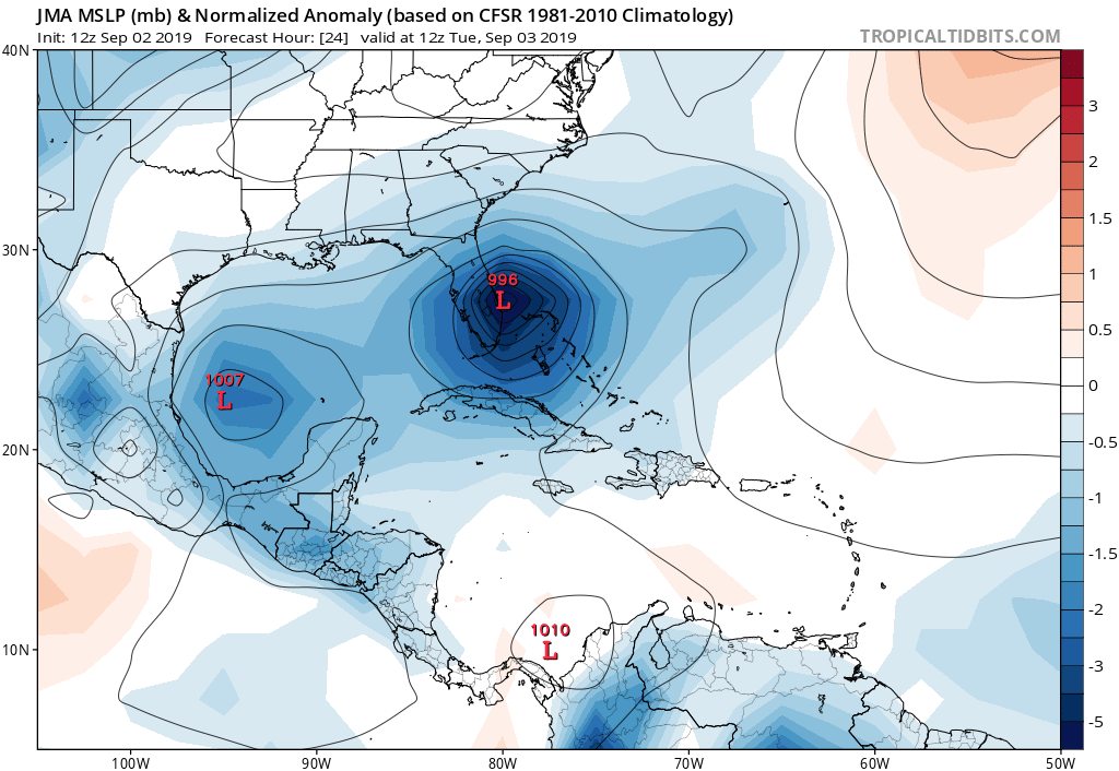
Yep, agreed. The ridge I am referring to, is actually to the E of the storm. This is the one that turns it N, but does so with a tilt to the NW for a bit. So it is more the shape of the ridge building from the E than ridging to the N of Dorian. Then, a new trough swoops down and turns it N, then NE. So the NW motion will be temporary, and is the only thing that might shove it back W for a bit. But I agree, looking a little better for FL EC.
Ahh, gotcha. Do you think it would be a matter of the ridge to the east "amplifying" or filling, or in fact moving westward all the while? On another note, thank heaven that this other weak but large disturbance around 27.5N and 65W isn't closer to Dorian then it is LOL. We don't need another player to enter the field adding any further "fuji" downward northerly influence that could result in Dorian to trek any more to the west


