It has a good deal of vorticity with it and convection should start to build under this sheared divergent flow aloft currently so chances will likely start going up from the NHC soon as it will be back in the 5 day range.

Moderator: S2k Moderators


northjaxpro wrote::uarrow: Shear will become much more conducive for development within the next couple of days.
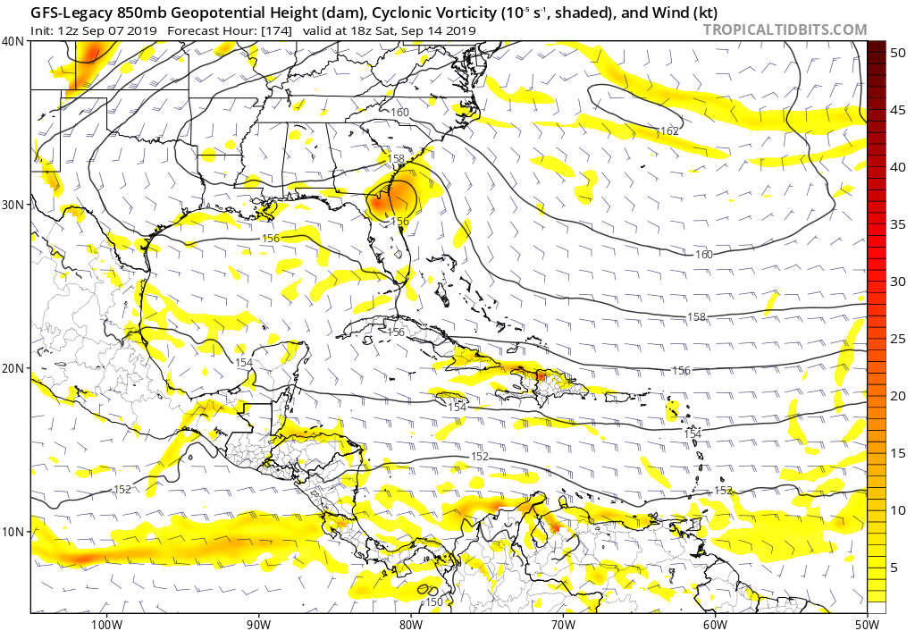
Latest 12Z GFS continues to show this developing.as it approaches the Bahamas late this week and then moving.across North Florida next weekend
This is not what we need to see to say the least, but EURO and GFS are in agreement of a potential TC.
We must stay closely monitored obviously to this!!

LarryWx wrote:northjaxpro wrote::uarrow: Shear will become much more conducive for development within the next couple of days.
Latest 12Z GFS continues to show this developing.as it approaches the Bahamas late this week and then moving.across North Florida next weekend
This is not what we need to see to say the least, but EURO and GFS are in agreement of a potential TC.
We must stay closely monitored obviously to this!!
I agree based on steering being favorable to bringing it into the SE. I admit that this caught me by surprise. However, the good news is that the Bahamas in 5-6 days are projected to have moderate SE to SSW shear then unlike the ideal conditions for Dorian. So, that hopefully would mean only slow development.
northjaxpro wrote:LarryWx wrote:northjaxpro wrote::uarrow: Shear will become much more conducive for development within the next couple of days.
Latest 12Z GFS continues to show this developing.as it approaches the Bahamas late this week and then moving.across North Florida next weekend
This is not what we need to see to say the least, but EURO and GFS are in agreement of a potential TC.
We must stay closely monitored obviously to this!!
I agree based on steering being favorable to bringing it into the SE. I admit that this caught me by surprise. However, the good news is that the Bahamas in 5-6 days are projected to have moderate SE to SSW shear then unlike the ideal conditions for Dorian. So, that hopefully would mean only slow development.
Let us hope you are right about that Larry.regarding shear increasing again by next weekend!!!!!
LarryWx wrote:northjaxpro wrote:LarryWx wrote:
I agree based on steering being favorable to bringing it into the SE. I admit that this caught me by surprise. However, the good news is that the Bahamas in 5-6 days are projected to have moderate SE to SSW shear then unlike the ideal conditions for Dorian. So, that hopefully would mean only slow development.
Let us hope you are right about that Larry.regarding shear increasing again by next weekend!!!!!
The 12Z ICON has this hitting far NE FL/SE GA as a weak low a week from tomorrow moving NW.

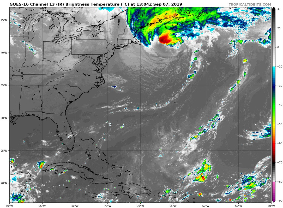
GCANE wrote:Something's here.
Shear-induced convection, but not washing out.
Can clearly see east and west LL winds converging on the southern end of the convection.
https://i.imgur.com/2xuB4uj.gif
GCANE wrote:Something's here.
Shear-induced convection, but not washing out.
Can clearly see east and west LL winds converging on the southern end of the convection.
https://i.imgur.com/2xuB4uj.gif


Aric Dunn wrote:Well this is interesting.. I was looking at the SAT loop and noticed the flow over the center and NE Islands and even eastern carrib has switched from easterly to west and SW. thats hard to do in this part of the atlantic.
must be a larger low pressure to the north than we see. elongated but there.
can any of the islanders confirm the odd wind direction ?
https://i.ibb.co/b2Kgbtf/Capture.png
notice the flow is west to east over the NE islands.
https://i.ibb.co/4N4p6Hr/10.gif
northjaxpro wrote:LarryWx wrote:northjaxpro wrote:
Let us hope you are right about that Larry.regarding shear increasing again by next weekend!!!!!
The 12Z ICON has this hitting far NE FL/SE GA as a weak low a week from tomorrow moving NW.
I awaiting the UKMET to see what it is showing. I am not real high on the ICON yet.
LarryWx wrote:northjaxpro wrote:LarryWx wrote:
The 12Z ICON has this hitting far NE FL/SE GA as a weak low a week from tomorrow moving NW.
I awaiting the UKMET to see what it is showing. I am not real high on the ICON yet.
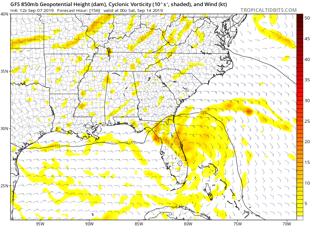
12Z UK has a weak low coming into Daytona day 7 with ~1-3" of rain for the NE FL/far SE GA coast. Also, although the 12Z Euro has no closed low and only a wave coming into FL Sat, the EPS has a few actual TCs, including one H, coming into about the same area day 7.
What all of this is telling me is that unlike for the very far out consensus for 94L and the subsequent wave, both of which MAY very well recurve safely OTS or threaten the NC to NE US/SE Canada corridor, there is a pretty high chance due to strong consensus for some tropical entity and maybe a TC originating from the wave now near the LAs to come into the FL-SC corridor moving WNW to NW, especially FL-SC, ~Saturday. Hopefully it would be fairly weak based on forecasted moderate shear nearby (in total contrast to the very light shear around Dorian), but that's not set in stone since SSTs are very warm, dewpoints are projected to be 72+ (so pretty moist), there's a pretty big high to the north inducing sfc convergence to its south, and shear is not projected to be strong W shear from westerlies dipping down but rather moderate S to SE shear in the Bahamas on its approach between an upper high to its E and an upper low in the GOM.


cycloneye wrote:The member who made this thread has the responsability to edit the title as the system in question moves.I edited the title with the correct location.
https://i.imgur.com/2zGAwnt.gif
Users browsing this forum: No registered users and 108 guests


