The usual "wait and see" approach is so much more valid in this particular case.
GFS is pretty much saying Jerry will exit quickly enough for the ridge to build in and capture Karen. But is not particularly bullish on developing karen at all. The Euro is similar but develops Karen significantly after barely giving enough space between the two systems for the ridge to capture her. And the UK is equally as stubborn in insisting the two systems will dance with each other
ATL: KAREN - Models
Moderator: S2k Moderators
-
Hurricaneman

- Category 5

- Posts: 7404
- Age: 45
- Joined: Tue Aug 31, 2004 3:24 pm
- Location: central florida
Re: ATL: KAREN - Models
gatorcane wrote:12Z GFS with an upper anticyclone at 120 hours yet no strengthening? Vibes of Humberto here...
I don’t think the GFS has a good grasp of Karen yet in terms of strength but the track is on line with the consensus of the models
0 likes
Re: ATL: KAREN - Models
12Z UKMET looks kind of like the 12Z ICON, which is heavily influenced by Jerry:
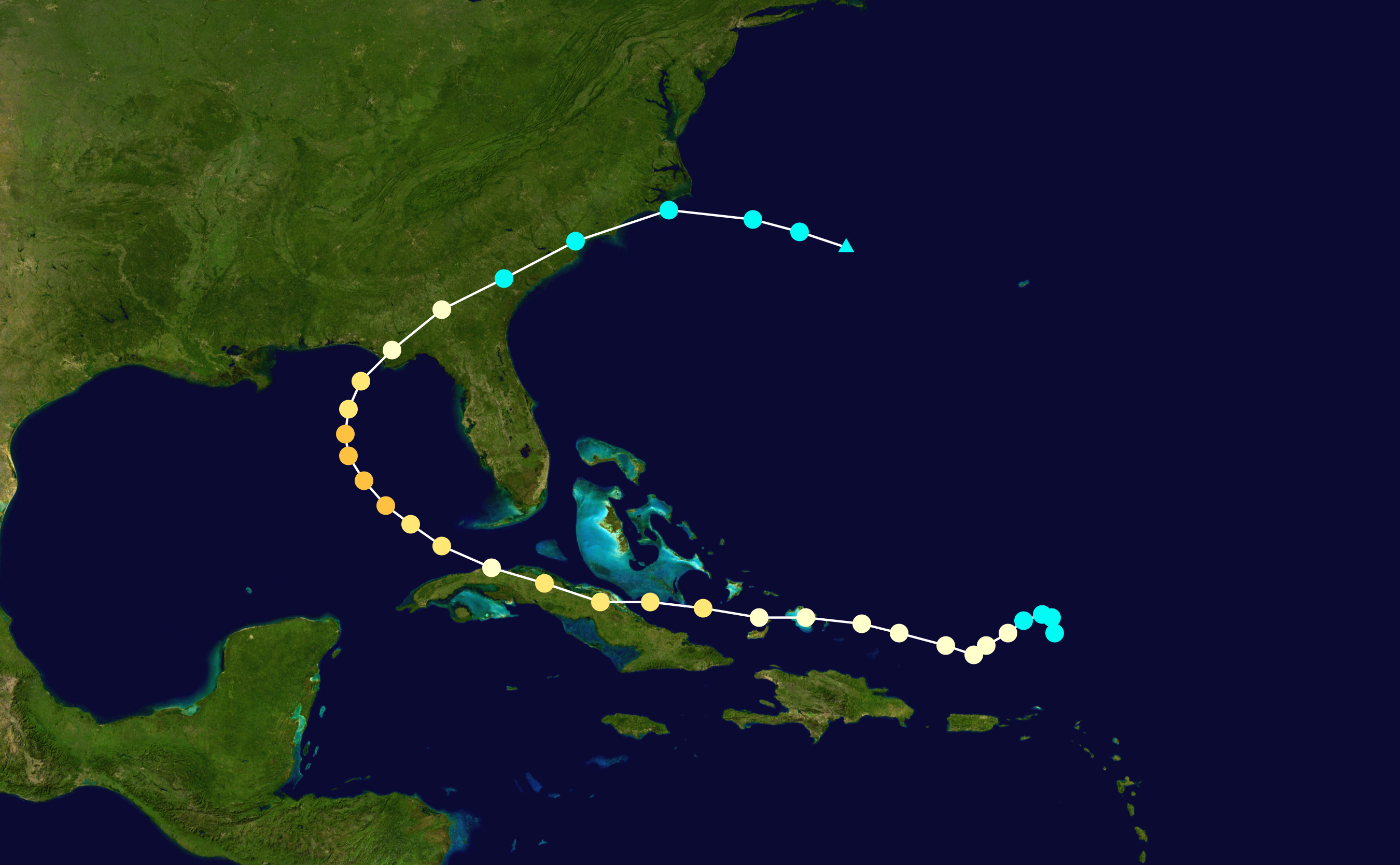
TROPICAL STORM KAREN ANALYSED POSITION : 14.2N 64.5W
ATCF IDENTIFIER : AL122019
LEAD CENTRAL MAXIMUM WIND
VERIFYING TIME TIME POSITION PRESSURE (MB) SPEED (KNOTS)
-------------- ---- -------- ------------- -------------
1200UTC 23.09.2019 0 14.2N 64.5W 1008 34
0000UTC 24.09.2019 12 15.8N 66.0W 1007 24
1200UTC 24.09.2019 24 17.1N 66.3W 1007 28
0000UTC 25.09.2019 36 19.4N 65.4W 1006 31
1200UTC 25.09.2019 48 22.2N 64.4W 1004 37
0000UTC 26.09.2019 60 25.3N 63.0W 1001 37
1200UTC 26.09.2019 72 28.1N 62.2W 999 43
0000UTC 27.09.2019 84 30.4N 61.5W 998 49
1200UTC 27.09.2019 96 32.0N 61.6W 1001 36
0000UTC 28.09.2019 108 32.8N 62.6W 1004 32
1200UTC 28.09.2019 120 33.2N 65.2W 1006 31
0000UTC 29.09.2019 132 33.6N 68.2W 1004 43
1200UTC 29.09.2019 144 33.0N 70.3W 1001 47
0 likes
Personal Forecast Disclaimer:
The posts in this forum are NOT official forecasts and should not be used as such. They are just the opinion of the poster and may or may not be backed by sound meteorological data. They are NOT endorsed by any professional institution or storm2k.org. For official information, please refer to the NHC and NWS products.
The posts in this forum are NOT official forecasts and should not be used as such. They are just the opinion of the poster and may or may not be backed by sound meteorological data. They are NOT endorsed by any professional institution or storm2k.org. For official information, please refer to the NHC and NWS products.
-
chris_fit

- Category 5
- Posts: 3261
- Age: 43
- Joined: Wed Sep 10, 2003 11:58 pm
- Location: Tampa Bay Area, FL
Re: ATL: KAREN - Models
I remember with Dorian there were many many runs where GFS lost it once it got north of PR... This gives me vibes of that
0 likes
Re: ATL: KAREN - Models
The hard left of yesterday is quickly being abandoned by most models - it just didn't seem logical from the start...
Not saying we're all-clear but definitely the Dorian/Humberto/Jerry trough is the more likely outcome...
We may have a fish sale with Jerry, Karen and Lorenzo all on the scales : )
Not saying we're all-clear but definitely the Dorian/Humberto/Jerry trough is the more likely outcome...
We may have a fish sale with Jerry, Karen and Lorenzo all on the scales : )
Last edited by Frank2 on Mon Sep 23, 2019 11:28 am, edited 1 time in total.
0 likes
-
toad strangler

- S2K Supporter

- Posts: 4546
- Joined: Sun Jul 28, 2013 3:09 pm
- Location: Earth
- Contact:
Re: ATL: KAREN - Models
Frank2 wrote:The hard left of yesterday is quickly being abandoned by most models - it just didn't seem logical from the start...
Not saying we're all-clear but definitely the Dorian/Humberto/Jerry trough is the more likely outcome...
Disagree, the 12z GFS still makes the hard left. But, its just a few clouds
The 0z Euro makes the hard left with a bit stronger of a system.
So, you can't say "most models are quickly abandoning" when the GFS and Euro still show it.
Last edited by toad strangler on Mon Sep 23, 2019 11:44 am, edited 1 time in total.
1 likes
My Weather Station
https://www.wunderground.com/dashboard/pws/KFLPORTS603
https://www.wunderground.com/dashboard/pws/KFLPORTS603
-
AJC3

- Admin

- Posts: 4153
- Age: 62
- Joined: Tue Aug 31, 2004 7:04 pm
- Location: Ballston Spa, New York
- Contact:
Re: ATL: KAREN - Models
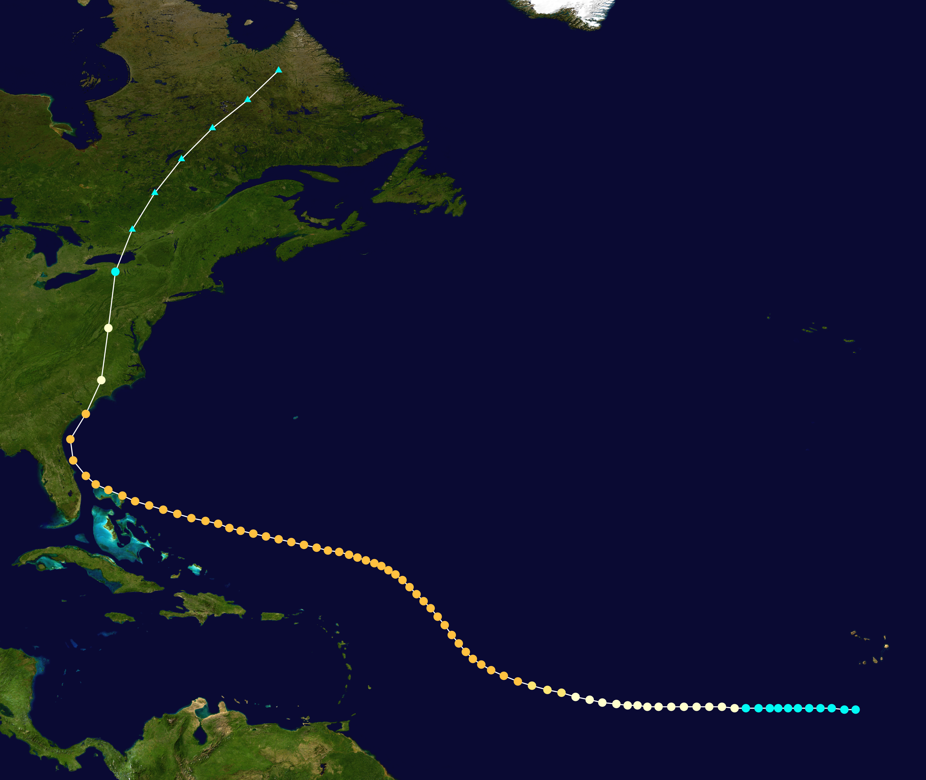
jconsor wrote:AJC3 wrote:If you expand the radius out to 120 miles, you get 2 more infamous semi-analogs: Betsy (1965) and Ike (2008). However, both were 2 (Ike) to 4 (Betsy) weeks earlier in the season. A 175 mile radius gives you the very infamous Kate (November 1985) as another semi-analog, as well as an unnamed hurricane in mid September 1947.
https://i.imgur.com/vEkAiaE.jpg
While such a prolonged westerly track from a relatively high latitude is rare in late Sep/early Oct, it's not unprecedented.
Here are four examples. Hurricane Kate (which you mentioned) in Nov 1985 moved west from the SE Bahamas into N Cuba, before recurving N and NE and hitting the FL panhandle as a Cat 2.
https://upload.wikimedia.org/wikipedia/ ... _track.png
A late Sep hurricane in 1941 developed NE of PR and moved W to WNW, hitting S FL as a Cat 2.
https://upload.wikimedia.org/wikipedia/ ... _track.png
An early Oct hurricane in 1929 developed N of PR and initially moved NW, then turned sharply SW toward the N Bahamas, hitting Nassau hard before striking extreme S FL as a Cat 3.
https://upload.wikimedia.org/wikipedia/ ... _track.png
A hurricane in 1893 developed in late Sep south of the Cape Verde Islands, then turned NW passing several hundred miles NE of the Leeward Islands. It then bent back to the WNW, passing across the far N Bahamas. Finally, it turned N, brushing the NE FL and GA coasts, then making a rare landfall in SC in mid-Oct as a Cat 3!
https://upload.wikimedia.org/wikipedia/ ... _track.png
For sure, all great analogs for a system to actually reach south FL and the GOMEX, but to be clear my post was with respect to the 00Z OP-ECM solution which actually threatened coastal TX.
0 likes
-
gatorcane

- S2K Supporter
- Posts: 23708
- Age: 48
- Joined: Sun Mar 13, 2005 3:54 pm
- Location: Boca Raton, FL
Re: ATL: KAREN - Models
CMC looks more realistic than the GFS on intensity through 72 hours
Last edited by gatorcane on Mon Sep 23, 2019 11:35 am, edited 1 time in total.
0 likes
-
AtlanticWind

- S2K Supporter
- Posts: 1898
- Age: 67
- Joined: Sun Aug 08, 2004 9:57 pm
- Location: Plantation,Fla
Re: ATL: KAREN - Models
Frank2 wrote:The hard left of yesterday is quickly being abandoned by most models - it just didn't seem logical from the start...
Not saying we're all-clear but definitely the Dorian/Humberto/Jerry trough is the more likely outcome...
We may have a fish sale with Jerry, Karen and Lorenzo all on the scales : )
The 2 most reliable models GFS and Euro make the hard left.
So to me that is what I would be expecting at this point, What Karen will be is the question.
1 likes
Re: ATL: KAREN - Models
Frank2 wrote:The hard left of yesterday is quickly being abandoned by most models - it just didn't seem logical from the start...
Not saying we're all-clear but definitely the Dorian/Humberto/Jerry trough is the more likely outcome...
We may have a fish sale with Jerry, Karen and Lorenzo all on the scales : )
Lol, ok Frank, whatever
You realize the 12z GFS tracks Karen (or what is left of her) into the western Gulf, right?
3 likes
-
toad strangler
- S2K Supporter
- Posts: 4546
- Joined: Sun Jul 28, 2013 3:09 pm
- Location: Earth
- Contact:
Re: ATL: KAREN - Models
gatorcane wrote:CMC looks more realistic than the GFS on intensity through 72 hours
CMC will send her away OTS again. A climo type recurve.
0 likes
My Weather Station
https://www.wunderground.com/dashboard/pws/KFLPORTS603
https://www.wunderground.com/dashboard/pws/KFLPORTS603
-
AxaltaRacing24
- Category 5
- Posts: 1774
- Age: 25
- Joined: Wed Jul 27, 2016 11:14 am
- Location: Jupiter, FL
Re: ATL: KAREN - Models
sma10 wrote:Frank2 wrote:The hard left of yesterday is quickly being abandoned by most models - it just didn't seem logical from the start...
Not saying we're all-clear but definitely the Dorian/Humberto/Jerry trough is the more likely outcome...
We may have a fish sale with Jerry, Karen and Lorenzo all on the scales : )
Lol, ok Frank, whatever
You realize the 12z GFS tracks Karen (or what is left of her) into the western Gulf, right?
exactly. it’s very hard to go against the euro AND gfs showing something. 3-4 days out
1 likes

Re: ATL: KAREN - Models
Frank2 wrote:The hard left of yesterday is quickly being abandoned by most models - it just didn't seem logical from the start...
Not saying we're all-clear but definitely the Dorian/Humberto/Jerry trough is the more likely outcome...
We may have a fish sale with Jerry, Karen and Lorenzo all on the scales : )
NHC has the hard turn left at 96-120 hours at 27.0
Seems like they are buying it and increasing strength from 60mph to 70mph
1 likes
Personal Forecast Disclaimer:
My posts are just my opinion and are most likely not backed by sound meteorological data. They are NOT endorsed by any professional institution or storm2k.org. For official information, please refer to the NHC and NWS products.
Bottom line is that I am just expressing my opinion!!!
My posts are just my opinion and are most likely not backed by sound meteorological data. They are NOT endorsed by any professional institution or storm2k.org. For official information, please refer to the NHC and NWS products.
Bottom line is that I am just expressing my opinion!!!
Re: ATL: KAREN - Models
Frank2 wrote:The hard left of yesterday is quickly being abandoned by most models - it just didn't seem logical from the start...
Not saying we're all-clear but definitely the Dorian/Humberto/Jerry trough is the more likely outcome...
We may have a fish sale with Jerry, Karen and Lorenzo all on the scales : )

What models are you looking at to come to this conclusion?
Last edited by Nuno on Mon Sep 23, 2019 12:03 pm, edited 1 time in total.
3 likes
Andrew (1992), Irene (1999), Frances (2004), Katrina (2005), Wilma (2005), Fay (2008), Irma (2017), Eta (2020), Ian (2022)
-
AtlanticWind
- S2K Supporter
- Posts: 1898
- Age: 67
- Joined: Sun Aug 08, 2004 9:57 pm
- Location: Plantation,Fla
Re: ATL: KAREN - Models
Frank2 wrote:The hard left of yesterday is quickly being abandoned by most models - it just didn't seem logical from the start...
Not saying we're all-clear but definitely the Dorian/Humberto/Jerry trough is the more likely outcome...
We may have a fish sale with Jerry, Karen and Lorenzo all on the scales : )
It is actually very "logical" if that what models are showing. Forecasting Hurricanes is now science.
Climatology is not used per se ,as any effects of seasonal changes would be reflected in the models.
I am not saying that Karen could not go out to sea, but I will go with the NHC forecasts which reflect
the best of meteorlogical science.
4 likes
-
Blown Away

- S2K Supporter
- Posts: 10253
- Joined: Wed May 26, 2004 6:17 am
Re: ATL: KAREN - Models
If this OTS talk after PR happens, would mean Euro has to swing from heading to Bay of Campeche to W Atlantic. I’ll do the trend post for that. 
1 likes
Hurricane Eye Experience: David 79, Irene 99, Frances 04, Jeanne 04, Wilma 05… Hurricane Brush Experience: Andrew 92, Erin 95, Floyd 99, Matthew 16, Irma 17, Ian 22, Nicole 22…
-
p1nheadlarry

- Category 2

- Posts: 672
- Age: 34
- Joined: Wed Jan 29, 2014 2:42 pm
- Location: SR County FL
Re: ATL: KAREN - Models
gatorcane wrote:12Z GFS with an upper anticyclone at 120 hours yet no strengthening? Vibes of Humberto here...
High midlevel shear
0 likes
--;->#GoNoles--;->.
-
toad strangler
- S2K Supporter
- Posts: 4546
- Joined: Sun Jul 28, 2013 3:09 pm
- Location: Earth
- Contact:
Re: ATL: KAREN - Models
12z GFS Legacy shows the same hard left as the 12z GFS and the 0z Euro but total poofs any hint of vorticity
0 likes
My Weather Station
https://www.wunderground.com/dashboard/pws/KFLPORTS603
https://www.wunderground.com/dashboard/pws/KFLPORTS603
Re: ATL: KAREN - Models
I just think the degree of difficulty on this particular one is a 10/10.
It's hard enough to predict how strong the ridge will be, when/if Karen is trapped, will she or won't she strengthen ..... but with Jerry added to the mix, the complexity is super high.
In the event the UK is right, for example, do we even know for certain how two tropical storms will interact with each other. Is it forecastable? The UK has insisted on a fujiwhara the last several runs but each time it happens the two systems end up in completely different places.
0 likes
-
StormLogic

- Tropical Storm

- Posts: 201
- Joined: Mon Jun 03, 2019 9:58 am
- Location: Beaumont
Re: ATL: KAREN - Models
IMO this will be a bigger threat next week. Till then the models are going to flip-pity flop. The high ridge will most likely build up sometime this week headed into next week. I will check back on Karen in a few days.
2 likes
Personal Forecast Disclaimer:
The posts in this forum are NOT official forecast and should not be used as such. They are just the opinion of the poster and may or may not be backed by sound meteorological data. They are NOT endorsed by any professional institution or storm2k.org. For official information, please refer to the NHC and NWS products.
The posts in this forum are NOT official forecast and should not be used as such. They are just the opinion of the poster and may or may not be backed by sound meteorological data. They are NOT endorsed by any professional institution or storm2k.org. For official information, please refer to the NHC and NWS products.
Who is online
Users browsing this forum: No registered users and 39 guests